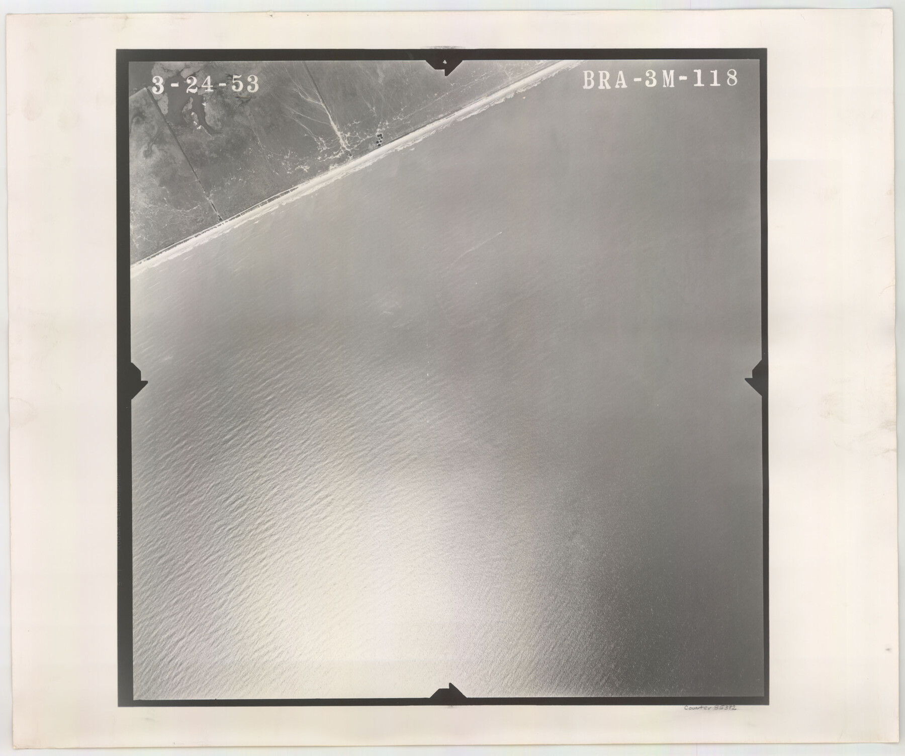
Flight Mission No. BRA-3M, Frame 118, Jefferson County
BRA-3M-118
-
Map/Doc
85392
-
Collection
General Map Collection
-
Object Dates
1953/3/24 (Creation Date)
-
People and Organizations
U. S. Department of Agriculture (Publisher)
-
Counties
Jefferson
-
Subjects
Aerial Photograph
-
Height x Width
18.6 x 22.3 inches
47.2 x 56.6 cm
-
Comments
Flown by Jack Ammann Photogrammetric Engineers of San Antonio, Texas.
Part of: General Map Collection
El Paso County Rolled Sketch 66

Print $20.00
- Digital $50.00
El Paso County Rolled Sketch 66
2014
Size 35.1 x 41.2 inches
Map/Doc 93712
Colorado County Sketch File 9

Print $3.00
- Digital $50.00
Colorado County Sketch File 9
Size 11.3 x 17.0 inches
Map/Doc 11134
Map of Hidalgo County

Print $20.00
- Digital $50.00
Map of Hidalgo County
1896
Size 44.9 x 25.5 inches
Map/Doc 4684
Maverick County Working Sketch 3

Print $20.00
- Digital $50.00
Maverick County Working Sketch 3
1939
Size 34.4 x 24.8 inches
Map/Doc 70895
Baylor County

Print $20.00
- Digital $50.00
Baylor County
1961
Size 43.0 x 35.2 inches
Map/Doc 95426
[Surveys in Austin's Colony along Hickory Creek, Hog Creek, and the Yegua River]
![195, [Surveys in Austin's Colony along Hickory Creek, Hog Creek, and the Yegua River], General Map Collection](https://historictexasmaps.com/wmedia_w700/maps/195.tif.jpg)
Print $20.00
- Digital $50.00
[Surveys in Austin's Colony along Hickory Creek, Hog Creek, and the Yegua River]
1831
Size 19.4 x 23.9 inches
Map/Doc 195
Culberson County Working Sketch 69
Print $40.00
- Digital $50.00
Culberson County Working Sketch 69
1975
Size 49.4 x 32.2 inches
Map/Doc 68523
Aransas Migratory Waterfowl Refuge in Aransas and Refugio Counties

Print $20.00
- Digital $50.00
Aransas Migratory Waterfowl Refuge in Aransas and Refugio Counties
1937
Size 40.3 x 31.0 inches
Map/Doc 2693
Eastland County Sketch File 9

Print $4.00
- Digital $50.00
Eastland County Sketch File 9
Size 10.5 x 8.2 inches
Map/Doc 21580
McCulloch County Working Sketch 2

Print $20.00
- Digital $50.00
McCulloch County Working Sketch 2
1947
Size 23.9 x 29.6 inches
Map/Doc 70677
Jack County Sketch File 15a

Print $6.00
- Digital $50.00
Jack County Sketch File 15a
1875
Size 14.7 x 10.2 inches
Map/Doc 27547
Map of the Western Part of Bexar District

Print $40.00
- Digital $50.00
Map of the Western Part of Bexar District
1849
Size 64.0 x 54.3 inches
Map/Doc 16944
You may also like
Parker County Working Sketch 13

Print $20.00
- Digital $50.00
Parker County Working Sketch 13
1978
Map/Doc 71463
Nueces County Working Sketch 12

Print $20.00
- Digital $50.00
Nueces County Working Sketch 12
2011
Size 22.0 x 42.3 inches
Map/Doc 90047
McMullen County Sketch File 37

Print $6.00
- Digital $50.00
McMullen County Sketch File 37
1937
Size 14.3 x 8.8 inches
Map/Doc 31410
[Plat and field notes of 3.107 acre tract for Clement Cove Harbor Company]

Print $2.00
- Digital $50.00
[Plat and field notes of 3.107 acre tract for Clement Cove Harbor Company]
1987
Size 13.7 x 8.5 inches
Map/Doc 60398
Gray County Sketch File B2

Print $20.00
- Digital $50.00
Gray County Sketch File B2
Size 22.8 x 17.3 inches
Map/Doc 11579
Eastland County Working Sketch 37

Print $20.00
- Digital $50.00
Eastland County Working Sketch 37
1967
Size 23.7 x 18.1 inches
Map/Doc 68818
Brazos River Conservation and Reclamation District Official Boundary Line Survey

Print $20.00
- Digital $50.00
Brazos River Conservation and Reclamation District Official Boundary Line Survey
Size 37.1 x 24.7 inches
Map/Doc 90127
University Lands Hudspeth County, Texas, Blocks A to N

Print $40.00
- Digital $50.00
University Lands Hudspeth County, Texas, Blocks A to N
1935
Size 38.6 x 55.4 inches
Map/Doc 2447
Brazoria County Rolled Sketch 19

Print $20.00
- Digital $50.00
Brazoria County Rolled Sketch 19
Size 16.9 x 19.0 inches
Map/Doc 5166
Coke County Sketch File 7

Print $20.00
- Digital $50.00
Coke County Sketch File 7
Size 18.9 x 22.4 inches
Map/Doc 11105
Upton County Rolled Sketch 24

Print $20.00
- Digital $50.00
Upton County Rolled Sketch 24
1886
Size 17.3 x 43.5 inches
Map/Doc 10043
Laguna Madre, Register No. 1476A

Print $40.00
- Digital $50.00
Laguna Madre, Register No. 1476A
1880
Size 31.3 x 53.3 inches
Map/Doc 73604