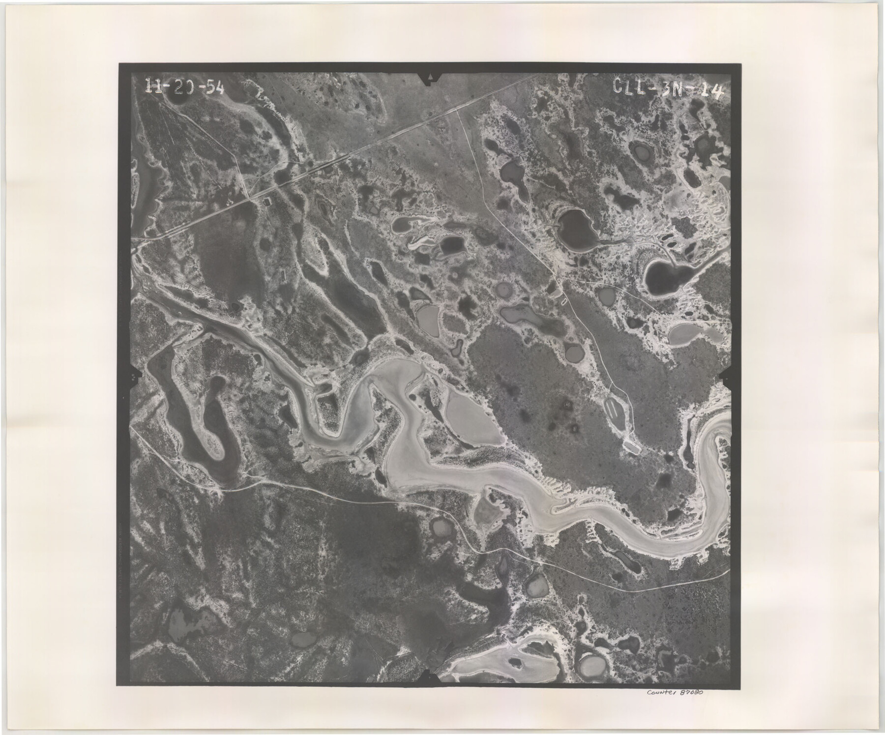
Flight Mission No. CLL-3N, Frame 14, Willacy County
CLL-3N-14
-
Map/Doc
87080
-
Collection
General Map Collection
-
Object Dates
1954/11/20 (Creation Date)
-
People and Organizations
U. S. Department of Agriculture (Publisher)
-
Counties
Willacy
-
Subjects
Aerial Photograph
-
Height x Width
18.4 x 22.2 inches
46.7 x 56.4 cm
-
Comments
Flown by Puckett Aerial Surveys, Inc. of Jackson, Mississippi.
Part of: General Map Collection
Flight Mission No. DCL-7C, Frame 141, Kenedy County

Print $20.00
- Digital $50.00
Flight Mission No. DCL-7C, Frame 141, Kenedy County
1943
Size 18.5 x 22.4 inches
Map/Doc 86098
Franklin County Working Sketch 4

Print $20.00
- Digital $50.00
Franklin County Working Sketch 4
1999
Size 19.2 x 16.6 inches
Map/Doc 69242
Kleberg County Rolled Sketch 6

Print $20.00
- Digital $50.00
Kleberg County Rolled Sketch 6
Size 11.1 x 13.0 inches
Map/Doc 9359
Denton County Rolled Sketch 3

Print $20.00
- Digital $50.00
Denton County Rolled Sketch 3
1959
Size 39.1 x 23.9 inches
Map/Doc 5700
Map of Kendall County

Print $20.00
- Digital $50.00
Map of Kendall County
1899
Size 36.8 x 34.2 inches
Map/Doc 66887
Dallam County Sketch File 9

Print $40.00
- Digital $50.00
Dallam County Sketch File 9
1914
Size 9.0 x 7.7 inches
Map/Doc 20357
San Patricio County NRC Article 33.136 Location Key Sheet

Print $20.00
- Digital $50.00
San Patricio County NRC Article 33.136 Location Key Sheet
1975
Size 27.0 x 23.0 inches
Map/Doc 77036
Red River County Working Sketch 24

Print $20.00
- Digital $50.00
Red River County Working Sketch 24
1958
Size 29.3 x 23.7 inches
Map/Doc 72007
Limestone County Sketch File B

Print $8.00
- Digital $50.00
Limestone County Sketch File B
1878
Size 8.2 x 7.3 inches
Map/Doc 30151
Leon County Rolled Sketch 7

Print $40.00
- Digital $50.00
Leon County Rolled Sketch 7
1954
Size 55.9 x 35.0 inches
Map/Doc 9428
Flight Mission No. DCL-5C, Frame 50, Kenedy County

Print $20.00
- Digital $50.00
Flight Mission No. DCL-5C, Frame 50, Kenedy County
1943
Size 18.6 x 22.4 inches
Map/Doc 85846
Hale County Boundary File 8

Print $60.00
- Digital $50.00
Hale County Boundary File 8
Size 11.8 x 9.0 inches
Map/Doc 54080
You may also like
Presidio County Sketch File 44

Print $15.00
- Digital $50.00
Presidio County Sketch File 44
1913
Size 11.1 x 9.5 inches
Map/Doc 34525
Map of Survey 8, Block 1, D.B. Gardner

Print $20.00
- Digital $50.00
Map of Survey 8, Block 1, D.B. Gardner
1915
Size 13.0 x 18.8 inches
Map/Doc 10763
United States Gulf Coast - from Galveston to the Rio Grande

Print $20.00
- Digital $50.00
United States Gulf Coast - from Galveston to the Rio Grande
1915
Size 26.4 x 18.2 inches
Map/Doc 72733
Terrell County Rolled Sketch 32

Print $20.00
- Digital $50.00
Terrell County Rolled Sketch 32
Size 20.6 x 25.4 inches
Map/Doc 7938
Map of Jack County

Print $20.00
- Digital $50.00
Map of Jack County
1896
Size 20.3 x 17.7 inches
Map/Doc 3699
Travis County State Real Property Sketch 6

Print $40.00
- Digital $50.00
Travis County State Real Property Sketch 6
1987
Size 30.2 x 41.4 inches
Map/Doc 61697
Brewster County Rolled Sketch 18B

Print $20.00
- Digital $50.00
Brewster County Rolled Sketch 18B
1906
Size 16.2 x 18.1 inches
Map/Doc 5197
Angelina County Sketch File 2

Print $2.00
- Digital $50.00
Angelina County Sketch File 2
Size 8.6 x 6.0 inches
Map/Doc 12921
Map of Val Verde County

Print $40.00
- Digital $50.00
Map of Val Verde County
1898
Size 80.4 x 70.4 inches
Map/Doc 82014
Martin County Boundary File 1

Print $10.00
- Digital $50.00
Martin County Boundary File 1
Size 11.2 x 8.7 inches
Map/Doc 56757
Goliad County Working Sketch 3

Print $40.00
- Digital $50.00
Goliad County Working Sketch 3
1916
Size 42.8 x 76.4 inches
Map/Doc 63193
The Judicial District/County of DeWitt. Created, February 2, 1842

Print $20.00
The Judicial District/County of DeWitt. Created, February 2, 1842
2020
Size 22.4 x 21.7 inches
Map/Doc 96325