[Worksheets related to the Wilson Strickland survey and vicinity]
170-14
-
Map/Doc
91349
-
Collection
Twichell Survey Records
-
Counties
Montgomery
-
Height x Width
22.9 x 13.8 inches
58.2 x 35.1 cm
-
Comments
One of 17 worksheets. To view all sheets, click here.
Related maps
[Worksheets related to the Wilson Strickland survey and vicinity]
![89714, [Vicinity and related to the Wilson Strickland Survey], Twichell Survey Records](https://historictexasmaps.com/wmedia_w700/maps/89714-1.tif.jpg)
![89714, [Vicinity and related to the Wilson Strickland Survey], Twichell Survey Records](https://historictexasmaps.com/wmedia_w700/maps/89714-1.tif.jpg)
Print $20.00
- Digital $50.00
[Worksheets related to the Wilson Strickland survey and vicinity]
Size 40.9 x 43.1 inches
Map/Doc 89714
[Worksheets related to the Wilson Strickland survey and vicinity]
![89715, [Vicinity and related to the Wilson Strickland Survey], Twichell Survey Records](https://historictexasmaps.com/wmedia_w700/maps/89715-1.tif.jpg)
![89715, [Vicinity and related to the Wilson Strickland Survey], Twichell Survey Records](https://historictexasmaps.com/wmedia_w700/maps/89715-1.tif.jpg)
Print $20.00
- Digital $50.00
[Worksheets related to the Wilson Strickland survey and vicinity]
Size 34.7 x 43.0 inches
Map/Doc 89715
[Worksheets related to the Wilson Strickland survey and vicinity]
![91265, [Vicinity and related to the Wilson Strickland Survey], Twichell Survey Records](https://historictexasmaps.com/wmedia_w700/maps/91265-1.tif.jpg)
![91265, [Vicinity and related to the Wilson Strickland Survey], Twichell Survey Records](https://historictexasmaps.com/wmedia_w700/maps/91265-1.tif.jpg)
Print $20.00
- Digital $50.00
[Worksheets related to the Wilson Strickland survey and vicinity]
Size 39.0 x 11.6 inches
Map/Doc 91265
[Worksheets related to the Wilson Strickland survey and vicinity]
![91266, [Vicinity and related to the Wilson Strickland Survey], Twichell Survey Records](https://historictexasmaps.com/wmedia_w700/maps/91266-1.tif.jpg)
![91266, [Vicinity and related to the Wilson Strickland Survey], Twichell Survey Records](https://historictexasmaps.com/wmedia_w700/maps/91266-1.tif.jpg)
Print $20.00
- Digital $50.00
[Worksheets related to the Wilson Strickland survey and vicinity]
Size 35.8 x 17.5 inches
Map/Doc 91266
[Worksheets related to the Wilson Strickland survey and vicinity]
![91267, [Vicinity and related to the Wilson Strickland Survey], Twichell Survey Records](https://historictexasmaps.com/wmedia_w700/maps/91267-1.tif.jpg)
![91267, [Vicinity and related to the Wilson Strickland Survey], Twichell Survey Records](https://historictexasmaps.com/wmedia_w700/maps/91267-1.tif.jpg)
Print $20.00
- Digital $50.00
[Worksheets related to the Wilson Strickland survey and vicinity]
Size 21.7 x 19.4 inches
Map/Doc 91267
[Worksheets related to the Wilson Strickland survey and vicinity]
![91268, [Vicinity and related to the Wilson Strickland Survey], Twichell Survey Records](https://historictexasmaps.com/wmedia_w700/maps/91268-1.tif.jpg)
![91268, [Vicinity and related to the Wilson Strickland Survey], Twichell Survey Records](https://historictexasmaps.com/wmedia_w700/maps/91268-1.tif.jpg)
Print $20.00
- Digital $50.00
[Worksheets related to the Wilson Strickland survey and vicinity]
Size 21.1 x 18.9 inches
Map/Doc 91268
[Worksheets related to the Wilson Strickland survey and vicinity]
![91269, [Worksheets related to the Wilson Strickland survey and vicinity], Twichell Survey Records](https://historictexasmaps.com/wmedia_w700/maps/91269.tif.jpg)
![91269, [Worksheets related to the Wilson Strickland survey and vicinity], Twichell Survey Records](https://historictexasmaps.com/wmedia_w700/maps/91269.tif.jpg)
Print $20.00
- Digital $50.00
[Worksheets related to the Wilson Strickland survey and vicinity]
Size 25.7 x 21.7 inches
Map/Doc 91269
[Worksheets related to the Wilson Strickland survey and vicinity]
![91281, [Worksheets related to the Wilson Strickland survey and vicinity], Twichell Survey Records](https://historictexasmaps.com/wmedia_w700/maps/91281-1.tif.jpg)
![91281, [Worksheets related to the Wilson Strickland survey and vicinity], Twichell Survey Records](https://historictexasmaps.com/wmedia_w700/maps/91281-1.tif.jpg)
Print $20.00
- Digital $50.00
[Worksheets related to the Wilson Strickland survey and vicinity]
Size 22.6 x 10.2 inches
Map/Doc 91281
[Worksheets related to the Wilson Strickland survey and vicinity]
![91282, [Worksheets related to the Wilson Strickland survey and vicinity], Twichell Survey Records](https://historictexasmaps.com/wmedia_w700/maps/91282-1.tif.jpg)
![91282, [Worksheets related to the Wilson Strickland survey and vicinity], Twichell Survey Records](https://historictexasmaps.com/wmedia_w700/maps/91282-1.tif.jpg)
Print $20.00
- Digital $50.00
[Worksheets related to the Wilson Strickland survey and vicinity]
Size 7.9 x 24.3 inches
Map/Doc 91282
[Worksheets related to the Wilson Strickland survey and vicinity]
![91283, [Worksheets related to the Wilson Strickland survey and vicinity], Twichell Survey Records](https://historictexasmaps.com/wmedia_w700/maps/91283-1.tif.jpg)
![91283, [Worksheets related to the Wilson Strickland survey and vicinity], Twichell Survey Records](https://historictexasmaps.com/wmedia_w700/maps/91283-1.tif.jpg)
Print $20.00
- Digital $50.00
[Worksheets related to the Wilson Strickland survey and vicinity]
Size 9.9 x 29.7 inches
Map/Doc 91283
[Worksheets related to the Wilson Strickland survey and vicinity]
![91302, [Worksheets related to the Wilson Strickland survey and vicinity], Twichell Survey Records](https://historictexasmaps.com/wmedia_w700/maps/91302-1.tif.jpg)
![91302, [Worksheets related to the Wilson Strickland survey and vicinity], Twichell Survey Records](https://historictexasmaps.com/wmedia_w700/maps/91302-1.tif.jpg)
Print $20.00
- Digital $50.00
[Worksheets related to the Wilson Strickland survey and vicinity]
Size 22.0 x 25.6 inches
Map/Doc 91302
[Worksheets related to the Wilson Strickland survey and vicinity]
![91350, [Worksheets related to the Wilson Strickland survey and vicinity], Twichell Survey Records](https://historictexasmaps.com/wmedia_w700/maps/91350-1.tif.jpg)
![91350, [Worksheets related to the Wilson Strickland survey and vicinity], Twichell Survey Records](https://historictexasmaps.com/wmedia_w700/maps/91350-1.tif.jpg)
Print $20.00
- Digital $50.00
[Worksheets related to the Wilson Strickland survey and vicinity]
Size 29.6 x 43.6 inches
Map/Doc 91350
[Worksheets related to the Wilson Strickland survey and vicinity]
![91381, [Worksheets related to the Wilson Strickland survey and vicinity], Twichell Survey Records](https://historictexasmaps.com/wmedia_w700/maps/91381-1.tif.jpg)
![91381, [Worksheets related to the Wilson Strickland survey and vicinity], Twichell Survey Records](https://historictexasmaps.com/wmedia_w700/maps/91381-1.tif.jpg)
Print $20.00
- Digital $50.00
[Worksheets related to the Wilson Strickland survey and vicinity]
Size 20.1 x 24.8 inches
Map/Doc 91381
[Worksheets related to the Wilson Strickland survey and vicinity]
![91383, [Worksheets related to the Wilson Strickland survey and vicinity], Twichell Survey Records](https://historictexasmaps.com/wmedia_w700/maps/91383-1.tif.jpg)
![91383, [Worksheets related to the Wilson Strickland survey and vicinity], Twichell Survey Records](https://historictexasmaps.com/wmedia_w700/maps/91383-1.tif.jpg)
Print $20.00
- Digital $50.00
[Worksheets related to the Wilson Strickland survey and vicinity]
Size 36.0 x 15.7 inches
Map/Doc 91383
[Worksheets related to the Wilson Strickland survey and vicinity]
![91384, [Worksheets related to the Wilson Strickland survey and vicinity], Twichell Survey Records](https://historictexasmaps.com/wmedia_w700/maps/91384-1.tif.jpg)
![91384, [Worksheets related to the Wilson Strickland survey and vicinity], Twichell Survey Records](https://historictexasmaps.com/wmedia_w700/maps/91384-1.tif.jpg)
Print $20.00
- Digital $50.00
[Worksheets related to the Wilson Strickland survey and vicinity]
Size 23.6 x 28.0 inches
Map/Doc 91384
[Worksheets related to the Wilson Strickland survey and vicinity]
![91391, [Worksheets related to the Wilson Strickland survey and vicinity], Twichell Survey Records](https://historictexasmaps.com/wmedia_w700/maps/91391-1.tif.jpg)
![91391, [Worksheets related to the Wilson Strickland survey and vicinity], Twichell Survey Records](https://historictexasmaps.com/wmedia_w700/maps/91391-1.tif.jpg)
Print $20.00
- Digital $50.00
[Worksheets related to the Wilson Strickland survey and vicinity]
Size 42.8 x 19.6 inches
Map/Doc 91391
Part of: Twichell Survey Records
[Sketch showing School Lands]
![90449, [Sketch showing School Lands], Twichell Survey Records](https://historictexasmaps.com/wmedia_w700/maps/90449-1.tif.jpg)
![90449, [Sketch showing School Lands], Twichell Survey Records](https://historictexasmaps.com/wmedia_w700/maps/90449-1.tif.jpg)
Print $20.00
- Digital $50.00
[Sketch showing School Lands]
Size 25.4 x 12.5 inches
Map/Doc 90449
Map of the Northeast Part of the Pitchfork Ranch


Print $20.00
- Digital $50.00
Map of the Northeast Part of the Pitchfork Ranch
1916
Size 23.4 x 23.4 inches
Map/Doc 90980
[Plat showing 1.0 acre of land out of the NE/4 of Section 2, Block E]
![92706, [Plat showing 1.0 acre of land out of the NE/4 of Section 2, Block E], Twichell Survey Records](https://historictexasmaps.com/wmedia_w700/maps/92706-1.tif.jpg)
![92706, [Plat showing 1.0 acre of land out of the NE/4 of Section 2, Block E], Twichell Survey Records](https://historictexasmaps.com/wmedia_w700/maps/92706-1.tif.jpg)
Print $3.00
- Digital $50.00
[Plat showing 1.0 acre of land out of the NE/4 of Section 2, Block E]
1954
Size 9.6 x 10.2 inches
Map/Doc 92706
[G. W. Carlisle Waco Manufacturing Co. Block 1]
![90669, [G. W. Carlisle Waco Manufacturing Co. Block 1], Twichell Survey Records](https://historictexasmaps.com/wmedia_w700/maps/90669-1.tif.jpg)
![90669, [G. W. Carlisle Waco Manufacturing Co. Block 1], Twichell Survey Records](https://historictexasmaps.com/wmedia_w700/maps/90669-1.tif.jpg)
Print $2.00
- Digital $50.00
[G. W. Carlisle Waco Manufacturing Co. Block 1]
Size 8.4 x 10.9 inches
Map/Doc 90669
[Texas Boundary Line]
![92081, [Texas Boundary Line], Twichell Survey Records](https://historictexasmaps.com/wmedia_w700/maps/92081-1.tif.jpg)
![92081, [Texas Boundary Line], Twichell Survey Records](https://historictexasmaps.com/wmedia_w700/maps/92081-1.tif.jpg)
Print $20.00
- Digital $50.00
[Texas Boundary Line]
Size 21.2 x 12.4 inches
Map/Doc 92081
[McLennan County School Land Leagues 3 and 4 and surrounding surveys/blocks]
![90434, [McLennan County School Land Leagues 3 and 4 and surrounding surveys/blocks], Twichell Survey Records](https://historictexasmaps.com/wmedia_w700/maps/90434-1.tif.jpg)
![90434, [McLennan County School Land Leagues 3 and 4 and surrounding surveys/blocks], Twichell Survey Records](https://historictexasmaps.com/wmedia_w700/maps/90434-1.tif.jpg)
Print $20.00
- Digital $50.00
[McLennan County School Land Leagues 3 and 4 and surrounding surveys/blocks]
Size 12.0 x 14.8 inches
Map/Doc 90434
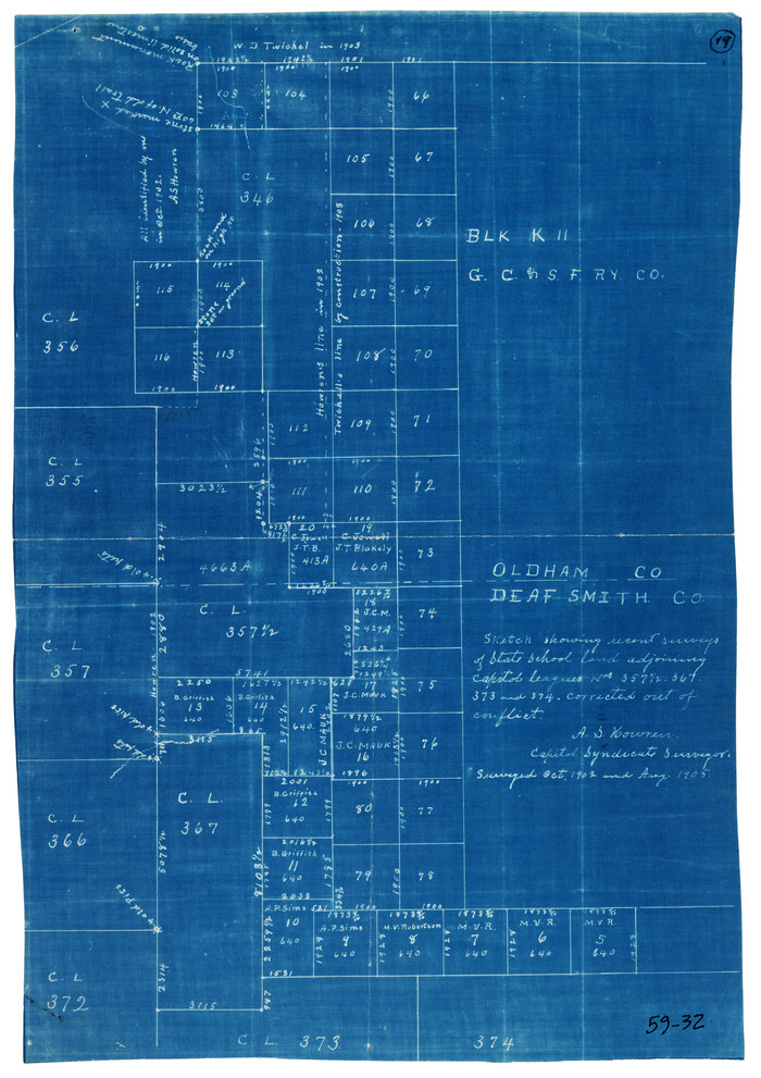
Sketch showing recent surveys of State School Land adjoining Capitol Leagues No. 357 1/2, 367, 373 and 374 corrected out of conflict

Print $2.00
- Digital $50.00
Sketch showing recent surveys of State School Land adjoining Capitol Leagues No. 357 1/2, 367, 373 and 374 corrected out of conflict
1905
Size 7.4 x 10.5 inches
Map/Doc 90533
[I. Killough and Hiram Cates surveys and vicinity]
![91851, [I. Killough and Hiram Cates surveys and vicinity], Twichell Survey Records](https://historictexasmaps.com/wmedia_w700/maps/91851-1.tif.jpg)
![91851, [I. Killough and Hiram Cates surveys and vicinity], Twichell Survey Records](https://historictexasmaps.com/wmedia_w700/maps/91851-1.tif.jpg)
Print $20.00
- Digital $50.00
[I. Killough and Hiram Cates surveys and vicinity]
Size 27.5 x 9.2 inches
Map/Doc 91851
[Blks. 8, 10, CC 41, and 32]
![90118, [Blks. 8, 10, CC 41, and 32], Twichell Survey Records](https://historictexasmaps.com/wmedia_w700/maps/90118-1.tif.jpg)
![90118, [Blks. 8, 10, CC 41, and 32], Twichell Survey Records](https://historictexasmaps.com/wmedia_w700/maps/90118-1.tif.jpg)
Print $20.00
- Digital $50.00
[Blks. 8, 10, CC 41, and 32]
Size 40.6 x 15.4 inches
Map/Doc 90118
[Sections 58-70, I. & G. N. Block 1, Runnels County School Land and part of Block 194]
![91632, [Sections 58-70, I. & G. N. Block 1, Runnels County School Land and part of Block 194], Twichell Survey Records](https://historictexasmaps.com/wmedia_w700/maps/91632-1.tif.jpg)
![91632, [Sections 58-70, I. & G. N. Block 1, Runnels County School Land and part of Block 194], Twichell Survey Records](https://historictexasmaps.com/wmedia_w700/maps/91632-1.tif.jpg)
Print $20.00
- Digital $50.00
[Sections 58-70, I. & G. N. Block 1, Runnels County School Land and part of Block 194]
Size 23.9 x 20.9 inches
Map/Doc 91632
[I. & G. N. RR. Co. Blk. 1]
![89805, [I. & G. N. RR. Co. Blk. 1], Twichell Survey Records](https://historictexasmaps.com/wmedia_w700/maps/89805-1.tif.jpg)
![89805, [I. & G. N. RR. Co. Blk. 1], Twichell Survey Records](https://historictexasmaps.com/wmedia_w700/maps/89805-1.tif.jpg)
Print $40.00
- Digital $50.00
[I. & G. N. RR. Co. Blk. 1]
Size 36.7 x 49.0 inches
Map/Doc 89805
[West Half of Potter County, South of River and West Half of Randall County]
![91828, [West Half of Potter County, South of River and West Half of Randall County], Twichell Survey Records](https://historictexasmaps.com/wmedia_w700/maps/91828.tif.jpg)
![91828, [West Half of Potter County, South of River and West Half of Randall County], Twichell Survey Records](https://historictexasmaps.com/wmedia_w700/maps/91828.tif.jpg)
Print $20.00
- Digital $50.00
[West Half of Potter County, South of River and West Half of Randall County]
Size 25.9 x 43.0 inches
Map/Doc 91828
You may also like
Midland County Rolled Sketch 4


Print $40.00
- Digital $50.00
Midland County Rolled Sketch 4
Size 43.5 x 85.6 inches
Map/Doc 10696
Llano County Working Sketch 12


Print $20.00
- Digital $50.00
Llano County Working Sketch 12
Size 18.8 x 12.5 inches
Map/Doc 70630
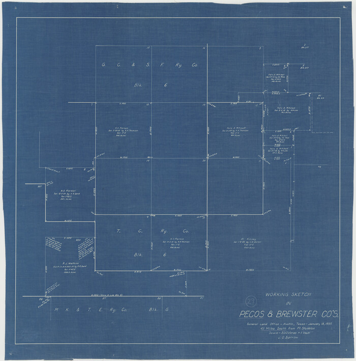
Pecos County Working Sketch 29

Print $20.00
- Digital $50.00
Pecos County Working Sketch 29
1935
Size 24.3 x 24.0 inches
Map/Doc 71501
Winkler County Rolled Sketch 14


Print $20.00
- Digital $50.00
Winkler County Rolled Sketch 14
Size 25.9 x 38.4 inches
Map/Doc 8275
County and Railroad Map of Texas


Print $20.00
- Digital $50.00
County and Railroad Map of Texas
1876
Size 17.0 x 16.0 inches
Map/Doc 93623
Culberson County Working Sketch 86


Print $40.00
- Digital $50.00
Culberson County Working Sketch 86
1981
Size 37.3 x 53.3 inches
Map/Doc 68540
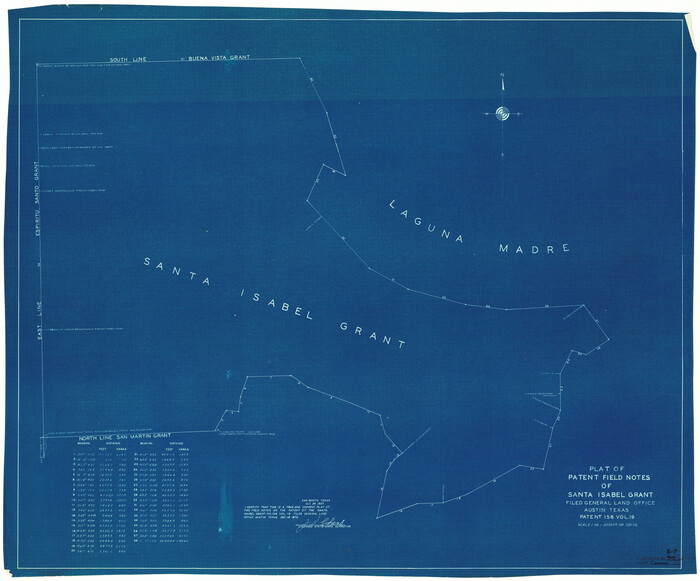
Cameron County Rolled Sketch Z7

Print $20.00
- Digital $50.00
Cameron County Rolled Sketch Z7
1937
Size 28.3 x 34.1 inches
Map/Doc 5405
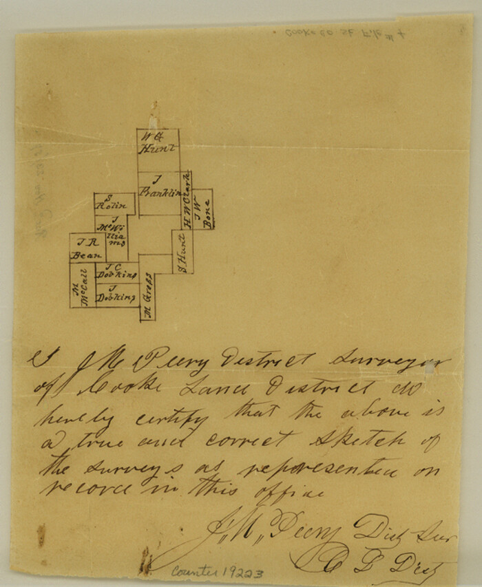
Cooke County Sketch File 4

Print $6.00
- Digital $50.00
Cooke County Sketch File 4
1856
Size 6.6 x 5.4 inches
Map/Doc 19223
Angelina County Sketch File 18b


Print $40.00
- Digital $50.00
Angelina County Sketch File 18b
Size 12.6 x 16.2 inches
Map/Doc 13032
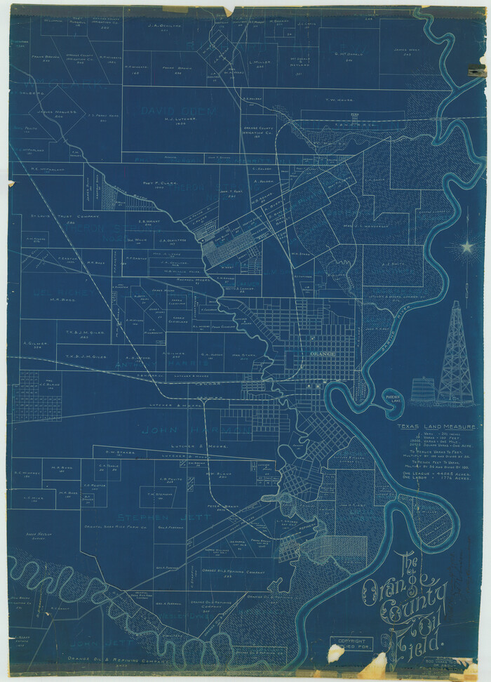
Orange County Rolled Sketch 16

Print $20.00
- Digital $50.00
Orange County Rolled Sketch 16
Size 42.2 x 30.4 inches
Map/Doc 41813
Sterling County Sketch File A


Print $20.00
- Digital $50.00
Sterling County Sketch File A
1906
Size 18.2 x 26.0 inches
Map/Doc 12362
Castro County Working Sketch 2


Print $20.00
- Digital $50.00
Castro County Working Sketch 2
Size 30.4 x 26.2 inches
Map/Doc 67897
![91349, [Worksheets related to the Wilson Strickland survey and vicinity], Twichell Survey Records](https://historictexasmaps.com/wmedia_w1800h1800/maps/91349-1.tif.jpg)