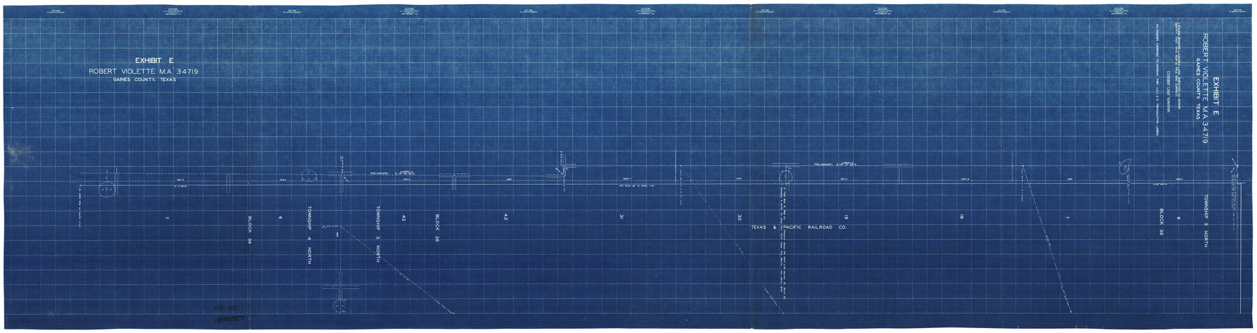
Exhibit E, Robert Violette M. A. 34719, Gaines County, Texas
58-50
-
Map/Doc
93134
-
Collection
Twichell Survey Records
-
People and Organizations
Sylvan Sanders (Surveyor/Engineer)
-
Counties
Dawson Gaines
-
Height x Width
85.9 x 24.3 inches
218.2 x 61.7 cm
Part of: Twichell Survey Records
[Plat showing Blocks Z, Q and D]
![90289, [Plat showing Blocks Z, Q and D], Twichell Survey Records](https://historictexasmaps.com/wmedia_w700/maps/90289-1.tif.jpg)
Print $20.00
- Digital $50.00
[Plat showing Blocks Z, Q and D]
Size 15.9 x 21.2 inches
Map/Doc 90289
King County Survey

Print $20.00
- Digital $50.00
King County Survey
1916
Size 25.6 x 30.5 inches
Map/Doc 91021

[West Central Portion of County]
![91257, [West Central Portion of County], Twichell Survey Records](https://historictexasmaps.com/wmedia_w700/maps/91257-1.tif.jpg)
Print $20.00
- Digital $50.00
[West Central Portion of County]
Size 19.5 x 9.8 inches
Map/Doc 91257
King County Survey made by A. C. Tackitt and W. D. Twichell

Print $20.00
- Digital $50.00
King County Survey made by A. C. Tackitt and W. D. Twichell
1916
Size 25.8 x 30.8 inches
Map/Doc 92147
[Texas and Pacific Railway Company, Block 44, Township One South]
![89845, [Texas and Pacific Railway Company, Block 44, Township One South], Twichell Survey Records](https://historictexasmaps.com/wmedia_w700/maps/89845-1.tif.jpg)
Print $40.00
- Digital $50.00
[Texas and Pacific Railway Company, Block 44, Township One South]
Size 42.0 x 59.2 inches
Map/Doc 89845
Sketch in Castro County

Print $2.00
- Digital $50.00
Sketch in Castro County
1888
Size 7.8 x 7.9 inches
Map/Doc 90388
[Block 6T, Portions of Blocks 44, 2T, and 3T, and vicinity]
![91526, [Block 6T, Portions of Blocks 44, 2T, and 3T, and vicinity], Twichell Survey Records](https://historictexasmaps.com/wmedia_w700/maps/91526-1.tif.jpg)
Print $20.00
- Digital $50.00
[Block 6T, Portions of Blocks 44, 2T, and 3T, and vicinity]
Size 14.2 x 15.9 inches
Map/Doc 91526
[Tie line from Northeast Block 36, Township 5N to Northwest corner Block M]
![90559, [Tie line from Northeast Block 36, Township 5N to Northwest corner Block M], Twichell Survey Records](https://historictexasmaps.com/wmedia_w700/maps/90559-1.tif.jpg)
Print $20.00
- Digital $50.00
[Tie line from Northeast Block 36, Township 5N to Northwest corner Block M]
Size 22.3 x 10.3 inches
Map/Doc 90559
[Capitol Leagues in Southwest Hartley and Northwest Oldham Counties]
![90727, [Capitol Leagues in Southwest Hartley and Northwest Oldham Counties], Twichell Survey Records](https://historictexasmaps.com/wmedia_w700/maps/90727-1.tif.jpg)
Print $20.00
- Digital $50.00
[Capitol Leagues in Southwest Hartley and Northwest Oldham Counties]
Size 14.6 x 20.4 inches
Map/Doc 90727
Map Showing North and West Boundaries of Gray County, Texas

Print $20.00
- Digital $50.00
Map Showing North and West Boundaries of Gray County, Texas
1906
Size 42.4 x 38.9 inches
Map/Doc 89942
[Sketch Showing South part of Capitol Lands]
![93086, [Sketch Showing South part of Capitol Lands], Twichell Survey Records](https://historictexasmaps.com/wmedia_w700/maps/93086-1.tif.jpg)
Print $20.00
- Digital $50.00
[Sketch Showing South part of Capitol Lands]
Size 47.3 x 17.7 inches
Map/Doc 93086
You may also like
Yates Pool, Pecos County, Texas

Print $20.00
- Digital $50.00
Yates Pool, Pecos County, Texas
1928
Size 21.3 x 18.3 inches
Map/Doc 91623
Houston Ship Channel, Alexander Island to Carpenter Bayou

Print $40.00
- Digital $50.00
Houston Ship Channel, Alexander Island to Carpenter Bayou
1982
Size 36.0 x 49.5 inches
Map/Doc 69913

Reeves County Working Sketch 51

Print $20.00
- Digital $50.00
Reeves County Working Sketch 51
1974
Size 45.4 x 34.6 inches
Map/Doc 63494
Flight Mission No. BRA-16M, Frame 173, Jefferson County

Print $20.00
- Digital $50.00
Flight Mission No. BRA-16M, Frame 173, Jefferson County
1953
Size 18.5 x 22.2 inches
Map/Doc 85771
Atascosa County Rolled Sketch 11

Print $20.00
- Digital $50.00
Atascosa County Rolled Sketch 11
1943
Size 22.8 x 38.0 inches
Map/Doc 5094
Harris County Historic Topographic 33

Print $20.00
- Digital $50.00
Harris County Historic Topographic 33
1916
Size 29.3 x 22.8 inches
Map/Doc 65844
Hamilton County Rolled Sketch 7

Print $20.00
- Digital $50.00
Hamilton County Rolled Sketch 7
1927
Size 32.2 x 38.4 inches
Map/Doc 6057
Gregg County Rolled Sketch 11

Print $20.00
- Digital $50.00
Gregg County Rolled Sketch 11
Size 32.7 x 30.5 inches
Map/Doc 6036
Jefferson County Sketch File 21

Print $10.00
- Digital $50.00
Jefferson County Sketch File 21
Size 8.6 x 6.6 inches
Map/Doc 28171
Crosby County Working Sketch 7

Print $20.00
- Digital $50.00
Crosby County Working Sketch 7
1938
Size 33.8 x 21.6 inches
Map/Doc 68441
1988 Land Use - El Paso, Ciudad Juarez and Vicinity

Print $20.00
- Digital $50.00
1988 Land Use - El Paso, Ciudad Juarez and Vicinity
1988
Size 34.2 x 25.1 inches
Map/Doc 87369