McCulloch County Rolled Sketch 8

Print $40.00
- Digital $50.00
McCulloch County Rolled Sketch 8
1982
Size: 51.3 x 31.4 inches
10292
McCulloch County Sketch File 6

Print $20.00
- Digital $50.00
McCulloch County Sketch File 6
1893
Size: 44.2 x 19.3 inches
10539
McCulloch County Sketch File 5A

Print $20.00
- Digital $50.00
McCulloch County Sketch File 5A
Size: 14.8 x 17.4 inches
12056
Menard County Sketch File 4

Print $20.00
- Digital $50.00
Menard County Sketch File 4
Size: 18.3 x 25.5 inches
12072
Menard County Sketch File 8

Print $20.00
- Digital $50.00
Menard County Sketch File 8
Size: 19.7 x 28.5 inches
12073
Map of Fisher and Miller's Colony made from the records in the Office of the District Surveyor of Bexar comprising also all the recent surveys

Print $20.00
- Digital $50.00
Map of Fisher and Miller's Colony made from the records in the Office of the District Surveyor of Bexar comprising also all the recent surveys
1855
Size: 23.7 x 35.2 inches
1971
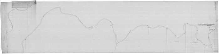
[Plat of Colorado River Survey, McCulloch County]
Print $40.00
- Digital $50.00
[Plat of Colorado River Survey, McCulloch County]
1918
Size: 40.3 x 159.2 inches
2462
Plat of South 1/2 of Colorado River Channel in McCulloch Co., Texas from Concho County line down river 34 mile 315 varas

Print $40.00
- Digital $50.00
Plat of South 1/2 of Colorado River Channel in McCulloch Co., Texas from Concho County line down river 34 mile 315 varas
1918
Size: 41.5 x 104.6 inches
2463
McCulloch County Sketch File 1

Print $4.00
- Digital $50.00
McCulloch County Sketch File 1
1854
Size: 8.7 x 6.8 inches
31165
McCulloch County Sketch File 2

Print $4.00
- Digital $50.00
McCulloch County Sketch File 2
1872
Size: 12.8 x 8.1 inches
31167
McCulloch County Sketch File 3

Print $12.00
- Digital $50.00
McCulloch County Sketch File 3
1893
Size: 11.1 x 8.5 inches
31169
McCulloch County Sketch File 4

Print $4.00
- Digital $50.00
McCulloch County Sketch File 4
1883
Size: 11.1 x 8.5 inches
31175
McCulloch County Sketch File 5

Print $11.00
- Digital $50.00
McCulloch County Sketch File 5
1899
Size: 17.5 x 9.2 inches
31177
McCulloch County Sketch File 8

Print $4.00
- Digital $50.00
McCulloch County Sketch File 8
1904
Size: 11.3 x 8.7 inches
31182
McCulloch County Sketch File 9

Print $6.00
- Digital $50.00
McCulloch County Sketch File 9
1883
Size: 7.3 x 8.7 inches
31184
McCulloch County Sketch File 10

Print $8.00
- Digital $50.00
McCulloch County Sketch File 10
1920
Size: 11.1 x 8.7 inches
31187
McCulloch County Sketch File 11

Print $14.00
- Digital $50.00
McCulloch County Sketch File 11
1929
Size: 11.2 x 8.8 inches
31191
McCulloch County Sketch File 12

Print $6.00
- Digital $50.00
McCulloch County Sketch File 12
1989
Size: 14.2 x 8.6 inches
31198
McCulloch County Sketch File 13

Print $4.00
- Digital $50.00
McCulloch County Sketch File 13
1982
Size: 3.4 x 7.8 inches
31201
McCulloch County Sketch File 14

Print $8.00
- Digital $50.00
McCulloch County Sketch File 14
1990
Size: 11.2 x 8.7 inches
31203
McCulloch County Sketch File 15, 15a, 15b

Print $34.00
- Digital $50.00
McCulloch County Sketch File 15, 15a, 15b
1993
Size: 11.2 x 8.8 inches
31207
Ownership Map of McCulloch County, Texas

Print $20.00
- Digital $50.00
Ownership Map of McCulloch County, Texas
1951
Size: 40.5 x 32.5 inches
3138
Pecos County Sketch File 67

Print $76.00
- Digital $50.00
Pecos County Sketch File 67
1919
Size: 14.1 x 8.8 inches
33828
Map of McCulloch County

Print $20.00
- Digital $50.00
Map of McCulloch County
1858
Size: 26.6 x 22.4 inches
3855
Map of McCulloch County

Print $20.00
- Digital $50.00
Map of McCulloch County
1874
Size: 26.7 x 20.7 inches
3857
McCulloch County Boundary File 1

Print $40.00
- Digital $50.00
McCulloch County Boundary File 1
Size: 9.2 x 33.6 inches
56906
McCulloch County Boundary File 2

Print $6.00
- Digital $50.00
McCulloch County Boundary File 2
Size: 12.9 x 8.3 inches
56908
McCulloch County Rolled Sketch 8
Print $40.00
- Digital $50.00
McCulloch County Rolled Sketch 8
1982
-
Size
51.3 x 31.4 inches
-
Map/Doc
10292
-
Creation Date
1982
McCulloch County Sketch File 6
Print $20.00
- Digital $50.00
McCulloch County Sketch File 6
1893
-
Size
44.2 x 19.3 inches
-
Map/Doc
10539
-
Creation Date
1893
McCulloch County Sketch File 5A
Print $20.00
- Digital $50.00
McCulloch County Sketch File 5A
-
Size
14.8 x 17.4 inches
-
Map/Doc
12056
Menard County Sketch File 4
Print $20.00
- Digital $50.00
Menard County Sketch File 4
-
Size
18.3 x 25.5 inches
-
Map/Doc
12072
Menard County Sketch File 8
Print $20.00
- Digital $50.00
Menard County Sketch File 8
-
Size
19.7 x 28.5 inches
-
Map/Doc
12073
Map of Fisher and Miller's Colony made from the records in the Office of the District Surveyor of Bexar comprising also all the recent surveys
Print $20.00
- Digital $50.00
Map of Fisher and Miller's Colony made from the records in the Office of the District Surveyor of Bexar comprising also all the recent surveys
1855
-
Size
23.7 x 35.2 inches
-
Map/Doc
1971
-
Creation Date
1855
[Plat of Colorado River Survey, McCulloch County]
Print $40.00
- Digital $50.00
[Plat of Colorado River Survey, McCulloch County]
1918
-
Size
40.3 x 159.2 inches
-
Map/Doc
2462
-
Creation Date
1918
Plat of South 1/2 of Colorado River Channel in McCulloch Co., Texas from Concho County line down river 34 mile 315 varas
Print $40.00
- Digital $50.00
Plat of South 1/2 of Colorado River Channel in McCulloch Co., Texas from Concho County line down river 34 mile 315 varas
1918
-
Size
41.5 x 104.6 inches
-
Map/Doc
2463
-
Creation Date
1918
McCulloch County Sketch File 1
Print $4.00
- Digital $50.00
McCulloch County Sketch File 1
1854
-
Size
8.7 x 6.8 inches
-
Map/Doc
31165
-
Creation Date
1854
McCulloch County Sketch File 2
Print $4.00
- Digital $50.00
McCulloch County Sketch File 2
1872
-
Size
12.8 x 8.1 inches
-
Map/Doc
31167
-
Creation Date
1872
McCulloch County Sketch File 3
Print $12.00
- Digital $50.00
McCulloch County Sketch File 3
1893
-
Size
11.1 x 8.5 inches
-
Map/Doc
31169
-
Creation Date
1893
McCulloch County Sketch File 4
Print $4.00
- Digital $50.00
McCulloch County Sketch File 4
1883
-
Size
11.1 x 8.5 inches
-
Map/Doc
31175
-
Creation Date
1883
McCulloch County Sketch File 5
Print $11.00
- Digital $50.00
McCulloch County Sketch File 5
1899
-
Size
17.5 x 9.2 inches
-
Map/Doc
31177
-
Creation Date
1899
McCulloch County Sketch File 8
Print $4.00
- Digital $50.00
McCulloch County Sketch File 8
1904
-
Size
11.3 x 8.7 inches
-
Map/Doc
31182
-
Creation Date
1904
McCulloch County Sketch File 9
Print $6.00
- Digital $50.00
McCulloch County Sketch File 9
1883
-
Size
7.3 x 8.7 inches
-
Map/Doc
31184
-
Creation Date
1883
McCulloch County Sketch File 10
Print $8.00
- Digital $50.00
McCulloch County Sketch File 10
1920
-
Size
11.1 x 8.7 inches
-
Map/Doc
31187
-
Creation Date
1920
McCulloch County Sketch File 11
Print $14.00
- Digital $50.00
McCulloch County Sketch File 11
1929
-
Size
11.2 x 8.8 inches
-
Map/Doc
31191
-
Creation Date
1929
McCulloch County Sketch File 12
Print $6.00
- Digital $50.00
McCulloch County Sketch File 12
1989
-
Size
14.2 x 8.6 inches
-
Map/Doc
31198
-
Creation Date
1989
McCulloch County Sketch File 13
Print $4.00
- Digital $50.00
McCulloch County Sketch File 13
1982
-
Size
3.4 x 7.8 inches
-
Map/Doc
31201
-
Creation Date
1982
McCulloch County Sketch File 14
Print $8.00
- Digital $50.00
McCulloch County Sketch File 14
1990
-
Size
11.2 x 8.7 inches
-
Map/Doc
31203
-
Creation Date
1990
McCulloch County Sketch File 15, 15a, 15b
Print $34.00
- Digital $50.00
McCulloch County Sketch File 15, 15a, 15b
1993
-
Size
11.2 x 8.8 inches
-
Map/Doc
31207
-
Creation Date
1993
Ownership Map of McCulloch County, Texas
Print $20.00
- Digital $50.00
Ownership Map of McCulloch County, Texas
1951
-
Size
40.5 x 32.5 inches
-
Map/Doc
3138
-
Creation Date
1951
Pecos County Sketch File 67
Print $76.00
- Digital $50.00
Pecos County Sketch File 67
1919
-
Size
14.1 x 8.8 inches
-
Map/Doc
33828
-
Creation Date
1919
McCulloch County

Print $20.00
- Digital $50.00
McCulloch County
1895
-
Size
23.3 x 18.7 inches
-
Map/Doc
3854
-
Creation Date
1895
Map of McCulloch County
Print $20.00
- Digital $50.00
Map of McCulloch County
1858
-
Size
26.6 x 22.4 inches
-
Map/Doc
3855
-
Creation Date
1858
McCulloch County

Print $20.00
- Digital $50.00
McCulloch County
1874
-
Size
21.9 x 16.8 inches
-
Map/Doc
3856
-
Creation Date
1874
Map of McCulloch County
Print $20.00
- Digital $50.00
Map of McCulloch County
1874
-
Size
26.7 x 20.7 inches
-
Map/Doc
3857
-
Creation Date
1874
McCulloch County
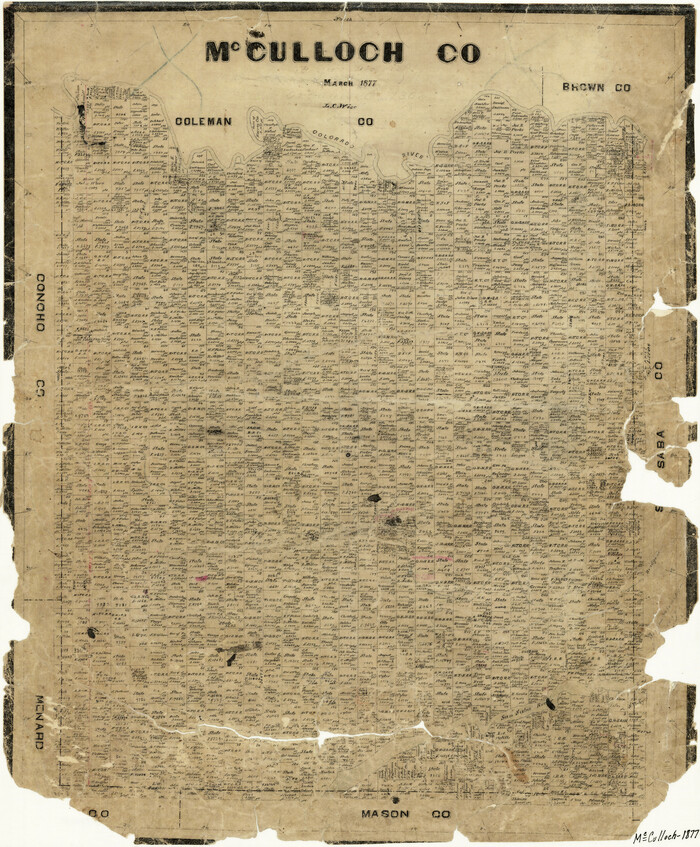
Print $20.00
- Digital $50.00
McCulloch County
1877
-
Size
21.3 x 17.9 inches
-
Map/Doc
3858
-
Creation Date
1877
McCulloch County Boundary File 1
Print $40.00
- Digital $50.00
McCulloch County Boundary File 1
-
Size
9.2 x 33.6 inches
-
Map/Doc
56906
McCulloch County Boundary File 2
Print $6.00
- Digital $50.00
McCulloch County Boundary File 2
-
Size
12.9 x 8.3 inches
-
Map/Doc
56908