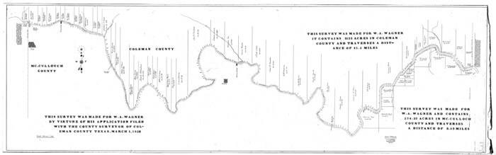
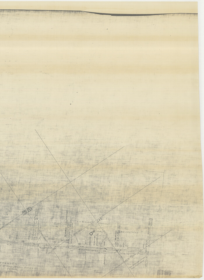
[Sketch for Mineral Application 31137 - Colorado River, W. A. Wagner]
Print $40.00
- Digital $50.00
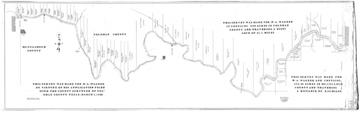
[Sketch for Mineral Application 31137 - Colorado River, W. A. Wagner]
1928
Size: 39.6 x 126.4 inches
65633
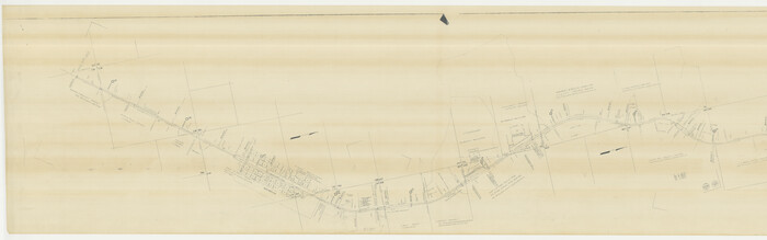
[Sketch for Mineral Application 31137 - Colorado River, W. A. Wagner]
Print $40.00
- Digital $50.00
[Sketch for Mineral Application 31137 - Colorado River, W. A. Wagner]
1928
Size: 39.6 x 126.2 inches
65634
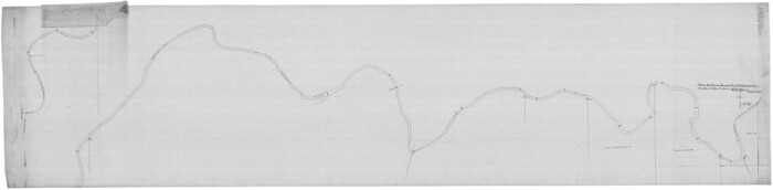
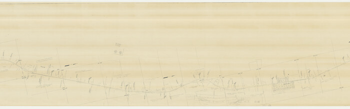
[Plat of Colorado River Survey, McCulloch County]
Print $40.00
- Digital $50.00
[Plat of Colorado River Survey, McCulloch County]
1918
Size: 40.3 x 159.2 inches
2462
[G. C. & S. F. Ry., San Saba Branch, Right of Way Map, Brady to Melvin]
Print $40.00
- Digital $50.00
[G. C. & S. F. Ry., San Saba Branch, Right of Way Map, Brady to Melvin]
1916
Size: 37.7 x 121.5 inches
61421
[FT. W. & R. G. Ry. Right of Way Map, Winchell to Brady, McCulloch County, Texas]
Print $20.00
- Digital $50.00
[FT. W. & R. G. Ry. Right of Way Map, Winchell to Brady, McCulloch County, Texas]
1918
Size: 37.0 x 26.9 inches
61411
[FT. W. & R. G. Ry. Right of Way Map, Winchell to Brady, McCulloch County, Texas]
Print $40.00
- Digital $50.00
[FT. W. & R. G. Ry. Right of Way Map, Winchell to Brady, McCulloch County, Texas]
1918
Size: 38.2 x 122.0 inches
61414
[FT. W. & R. G. Ry. Right of Way Map, Winchell to Brady, McCulloch County, Texas]
Print $40.00
- Digital $50.00
[FT. W. & R. G. Ry. Right of Way Map, Winchell to Brady, McCulloch County, Texas]
1918
Size: 38.2 x 122.0 inches
61415
[Coleman and McCullogh County Drilling Block]
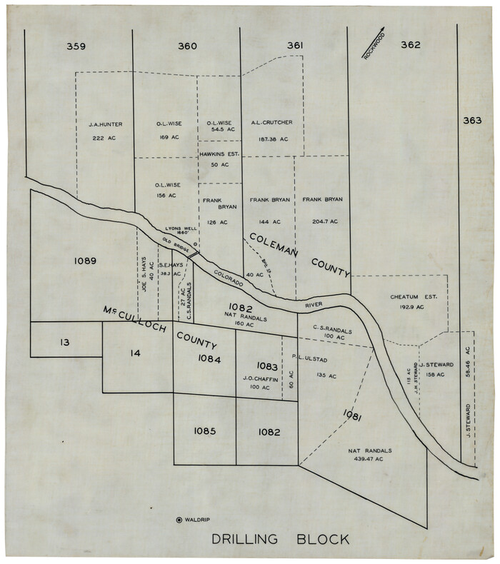
Print $20.00
- Digital $50.00
[Coleman and McCullogh County Drilling Block]
Size: 16.6 x 18.6 inches
92968
Water-Shed of the Colorado River

Print $40.00
- Digital $50.00
Water-Shed of the Colorado River
1925
Size: 37.1 x 79.8 inches
65261
San Saba County Working Sketch 9

Print $20.00
- Digital $50.00
San Saba County Working Sketch 9
1983
Size: 33.8 x 42.8 inches
63797
San Saba County Working Sketch 5

Print $20.00
- Digital $50.00
San Saba County Working Sketch 5
1945
Size: 30.5 x 22.9 inches
63793
San Saba County Working Sketch 1

Print $20.00
- Digital $50.00
San Saba County Working Sketch 1
1919
Size: 15.3 x 15.3 inches
63789
San Saba County Rolled Sketch 3

Print $20.00
- Digital $50.00
San Saba County Rolled Sketch 3
Size: 31.9 x 43.3 inches
7744
San Saba County Rolled Sketch 2

Print $20.00
- Digital $50.00
San Saba County Rolled Sketch 2
Size: 38.9 x 20.7 inches
7743
Plat of South 1/2 of Colorado River Channel in McCulloch Co., Texas from Concho County line down river 34 mile 315 varas

Print $40.00
- Digital $50.00
Plat of South 1/2 of Colorado River Channel in McCulloch Co., Texas from Concho County line down river 34 mile 315 varas
1918
Size: 41.5 x 104.6 inches
2463
Plat of South 1/2 of Colorado River Channel in McCulloch Co., Texas from Concho County line down river 34 mile 315 varas

Print $40.00
- Digital $50.00
Plat of South 1/2 of Colorado River Channel in McCulloch Co., Texas from Concho County line down river 34 mile 315 varas
1918
Size: 41.1 x 144.3 inches
76044
Pecos County Sketch File 67

Print $76.00
- Digital $50.00
Pecos County Sketch File 67
1919
Size: 14.1 x 8.8 inches
33828
Ownership Map of McCulloch County, Texas

Print $20.00
- Digital $50.00
Ownership Map of McCulloch County, Texas
1951
Size: 40.5 x 32.5 inches
3138
Menard County Working Sketch 7

Print $20.00
- Digital $50.00
Menard County Working Sketch 7
1926
Size: 25.6 x 41.2 inches
70954
Menard County Working Sketch 26

Print $20.00
- Digital $50.00
Menard County Working Sketch 26
1961
Size: 28.6 x 36.1 inches
70973
Menard County Sketch File 8

Print $20.00
- Digital $50.00
Menard County Sketch File 8
Size: 19.7 x 28.5 inches
12073
Menard County Sketch File 4

Print $20.00
- Digital $50.00
Menard County Sketch File 4
Size: 18.3 x 25.5 inches
12072
McCulloch County, Texas

Print $20.00
- Digital $50.00
McCulloch County, Texas
1879
Size: 24.6 x 18.0 inches
573
McCulloch County Working Sketch Graphic Index

Print $20.00
- Digital $50.00
McCulloch County Working Sketch Graphic Index
1949
Size: 47.3 x 37.4 inches
76636
McCulloch County Working Sketch 9

Print $20.00
- Digital $50.00
McCulloch County Working Sketch 9
1978
Size: 35.6 x 32.7 inches
70684
McCulloch County Working Sketch 8

Print $20.00
- Digital $50.00
McCulloch County Working Sketch 8
1977
Size: 22.5 x 19.8 inches
70683
McCulloch County Working Sketch 7

Print $20.00
- Digital $50.00
McCulloch County Working Sketch 7
1976
Size: 35.9 x 30.4 inches
70682
McCulloch County Working Sketch 6

Print $20.00
- Digital $50.00
McCulloch County Working Sketch 6
1961
Size: 15.2 x 23.9 inches
70681
McCulloch County Working Sketch 5

Print $20.00
- Digital $50.00
McCulloch County Working Sketch 5
1961
Size: 21.3 x 19.2 inches
70680
McCulloch County Working Sketch 4

Print $20.00
- Digital $50.00
McCulloch County Working Sketch 4
1956
Size: 25.3 x 22.8 inches
70679
[Sketch for Mineral Application 31137 - Colorado River, W. A. Wagner]
Print $40.00
- Digital $50.00
[Sketch for Mineral Application 31137 - Colorado River, W. A. Wagner]
1928
-
Size
39.6 x 126.4 inches
-
Map/Doc
65633
-
Creation Date
1928
[Sketch for Mineral Application 31137 - Colorado River, W. A. Wagner]
Print $40.00
- Digital $50.00
[Sketch for Mineral Application 31137 - Colorado River, W. A. Wagner]
1928
-
Size
39.6 x 126.2 inches
-
Map/Doc
65634
-
Creation Date
1928
[Plat of Colorado River Survey, McCulloch County]
Print $40.00
- Digital $50.00
[Plat of Colorado River Survey, McCulloch County]
1918
-
Size
40.3 x 159.2 inches
-
Map/Doc
2462
-
Creation Date
1918
[G. C. & S. F. Ry., San Saba Branch, Right of Way Map, Brady to Melvin]
Print $40.00
- Digital $50.00
[G. C. & S. F. Ry., San Saba Branch, Right of Way Map, Brady to Melvin]
1916
-
Size
37.7 x 121.5 inches
-
Map/Doc
61421
-
Creation Date
1916
[FT. W. & R. G. Ry. Right of Way Map, Winchell to Brady, McCulloch County, Texas]
Print $20.00
- Digital $50.00
[FT. W. & R. G. Ry. Right of Way Map, Winchell to Brady, McCulloch County, Texas]
1918
-
Size
37.0 x 26.9 inches
-
Map/Doc
61411
-
Creation Date
1918
[FT. W. & R. G. Ry. Right of Way Map, Winchell to Brady, McCulloch County, Texas]
Print $40.00
- Digital $50.00
[FT. W. & R. G. Ry. Right of Way Map, Winchell to Brady, McCulloch County, Texas]
1918
-
Size
38.2 x 122.0 inches
-
Map/Doc
61414
-
Creation Date
1918
[FT. W. & R. G. Ry. Right of Way Map, Winchell to Brady, McCulloch County, Texas]
Print $40.00
- Digital $50.00
[FT. W. & R. G. Ry. Right of Way Map, Winchell to Brady, McCulloch County, Texas]
1918
-
Size
38.2 x 122.0 inches
-
Map/Doc
61415
-
Creation Date
1918
[Coleman and McCullogh County Drilling Block]
Print $20.00
- Digital $50.00
[Coleman and McCullogh County Drilling Block]
-
Size
16.6 x 18.6 inches
-
Map/Doc
92968
Water-Shed of the Colorado River
Print $40.00
- Digital $50.00
Water-Shed of the Colorado River
1925
-
Size
37.1 x 79.8 inches
-
Map/Doc
65261
-
Creation Date
1925
San Saba County Working Sketch 9
Print $20.00
- Digital $50.00
San Saba County Working Sketch 9
1983
-
Size
33.8 x 42.8 inches
-
Map/Doc
63797
-
Creation Date
1983
San Saba County Working Sketch 5
Print $20.00
- Digital $50.00
San Saba County Working Sketch 5
1945
-
Size
30.5 x 22.9 inches
-
Map/Doc
63793
-
Creation Date
1945
San Saba County Working Sketch 1
Print $20.00
- Digital $50.00
San Saba County Working Sketch 1
1919
-
Size
15.3 x 15.3 inches
-
Map/Doc
63789
-
Creation Date
1919
San Saba County Rolled Sketch 3
Print $20.00
- Digital $50.00
San Saba County Rolled Sketch 3
-
Size
31.9 x 43.3 inches
-
Map/Doc
7744
San Saba County Rolled Sketch 2
Print $20.00
- Digital $50.00
San Saba County Rolled Sketch 2
-
Size
38.9 x 20.7 inches
-
Map/Doc
7743
Plat of South 1/2 of Colorado River Channel in McCulloch Co., Texas from Concho County line down river 34 mile 315 varas
Print $40.00
- Digital $50.00
Plat of South 1/2 of Colorado River Channel in McCulloch Co., Texas from Concho County line down river 34 mile 315 varas
1918
-
Size
41.5 x 104.6 inches
-
Map/Doc
2463
-
Creation Date
1918
Plat of South 1/2 of Colorado River Channel in McCulloch Co., Texas from Concho County line down river 34 mile 315 varas
Print $40.00
- Digital $50.00
Plat of South 1/2 of Colorado River Channel in McCulloch Co., Texas from Concho County line down river 34 mile 315 varas
1918
-
Size
41.1 x 144.3 inches
-
Map/Doc
76044
-
Creation Date
1918
Pecos County Sketch File 67
Print $76.00
- Digital $50.00
Pecos County Sketch File 67
1919
-
Size
14.1 x 8.8 inches
-
Map/Doc
33828
-
Creation Date
1919
Ownership Map of McCulloch County, Texas
Print $20.00
- Digital $50.00
Ownership Map of McCulloch County, Texas
1951
-
Size
40.5 x 32.5 inches
-
Map/Doc
3138
-
Creation Date
1951
Menard County Working Sketch 7
Print $20.00
- Digital $50.00
Menard County Working Sketch 7
1926
-
Size
25.6 x 41.2 inches
-
Map/Doc
70954
-
Creation Date
1926
Menard County Working Sketch 26
Print $20.00
- Digital $50.00
Menard County Working Sketch 26
1961
-
Size
28.6 x 36.1 inches
-
Map/Doc
70973
-
Creation Date
1961
Menard County Sketch File 8
Print $20.00
- Digital $50.00
Menard County Sketch File 8
-
Size
19.7 x 28.5 inches
-
Map/Doc
12073
Menard County Sketch File 4
Print $20.00
- Digital $50.00
Menard County Sketch File 4
-
Size
18.3 x 25.5 inches
-
Map/Doc
12072
McCulloch County, Texas
Print $20.00
- Digital $50.00
McCulloch County, Texas
1879
-
Size
24.6 x 18.0 inches
-
Map/Doc
573
-
Creation Date
1879
McCulloch County Working Sketch Graphic Index
Print $20.00
- Digital $50.00
McCulloch County Working Sketch Graphic Index
1949
-
Size
47.3 x 37.4 inches
-
Map/Doc
76636
-
Creation Date
1949
McCulloch County Working Sketch 9
Print $20.00
- Digital $50.00
McCulloch County Working Sketch 9
1978
-
Size
35.6 x 32.7 inches
-
Map/Doc
70684
-
Creation Date
1978
McCulloch County Working Sketch 8
Print $20.00
- Digital $50.00
McCulloch County Working Sketch 8
1977
-
Size
22.5 x 19.8 inches
-
Map/Doc
70683
-
Creation Date
1977
McCulloch County Working Sketch 7
Print $20.00
- Digital $50.00
McCulloch County Working Sketch 7
1976
-
Size
35.9 x 30.4 inches
-
Map/Doc
70682
-
Creation Date
1976
McCulloch County Working Sketch 6
Print $20.00
- Digital $50.00
McCulloch County Working Sketch 6
1961
-
Size
15.2 x 23.9 inches
-
Map/Doc
70681
-
Creation Date
1961
McCulloch County Working Sketch 5
Print $20.00
- Digital $50.00
McCulloch County Working Sketch 5
1961
-
Size
21.3 x 19.2 inches
-
Map/Doc
70680
-
Creation Date
1961
McCulloch County Working Sketch 4
Print $20.00
- Digital $50.00
McCulloch County Working Sketch 4
1956
-
Size
25.3 x 22.8 inches
-
Map/Doc
70679
-
Creation Date
1956