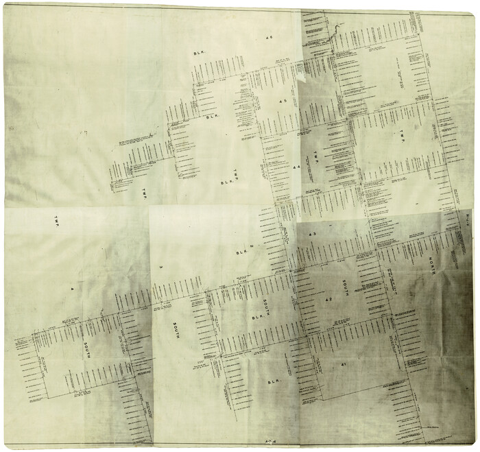
Upton County Rolled Sketch 10

Print $20.00
- Digital $50.00
Upton County Rolled Sketch 10
1911
Size: 41.2 x 43.0 inches
10035
Upton County Rolled Sketch 34

Print $20.00
- Digital $50.00
Upton County Rolled Sketch 34
1951
Size: 34.4 x 34.3 inches
10050
Upton County Rolled Sketch 36

Print $40.00
- Digital $50.00
Upton County Rolled Sketch 36
1952
Size: 42.9 x 64.2 inches
10051
Upton County Rolled Sketch 36A

Print $40.00
- Digital $50.00
Upton County Rolled Sketch 36A
1952
Size: 43.5 x 65.8 inches
10661
Midland County Rolled Sketch 5

Print $20.00
- Digital $50.00
Midland County Rolled Sketch 5
Size: 35.3 x 44.8 inches
10695
Midland County Rolled Sketch 4

Print $40.00
- Digital $50.00
Midland County Rolled Sketch 4
Size: 43.5 x 85.6 inches
10696
Midland County Rolled Sketch 4B

Print $40.00
- Digital $50.00
Midland County Rolled Sketch 4B
1951
Size: 77.5 x 25.1 inches
10725
Ector County Sketch File 1

Print $20.00
- Digital $50.00
Ector County Sketch File 1
1931
Size: 17.1 x 18.0 inches
11415
Glasscock County Sketch File 2

Print $20.00
- Digital $50.00
Glasscock County Sketch File 2
1931
Size: 35.1 x 16.2 inches
11559
Midland County Sketch File 1

Print $20.00
- Digital $50.00
Midland County Sketch File 1
1886
Size: 25.7 x 16.1 inches
12079
Midland County Sketch File 2

Print $20.00
- Digital $50.00
Midland County Sketch File 2
1886
Size: 16.3 x 17.6 inches
12080
Midland County Sketch File 3

Print $20.00
- Digital $50.00
Midland County Sketch File 3
1886
Size: 18.3 x 25.2 inches
12081
Midland County Sketch File 4

Print $20.00
- Digital $50.00
Midland County Sketch File 4
1886
Size: 16.3 x 18.9 inches
12082
Midland County Sketch File 7

Print $20.00
- Digital $50.00
Midland County Sketch File 7
1930
Size: 33.1 x 23.7 inches
12083
Midland County Sketch File 8

Print $20.00
- Digital $50.00
Midland County Sketch File 8
1933
Size: 17.5 x 21.6 inches
12084
Midland County Sketch File 9

Print $20.00
- Digital $50.00
Midland County Sketch File 9
Size: 19.7 x 29.2 inches
12085
Midland County Sketch File 11

Print $20.00
- Digital $50.00
Midland County Sketch File 11
1936
Size: 21.6 x 17.5 inches
12086
Midland County Sketch File 12

Print $20.00
- Digital $50.00
Midland County Sketch File 12
1939
Size: 25.4 x 18.6 inches
12087
Midland County Sketch File D

Print $42.00
- Digital $50.00
Midland County Sketch File D
1901
Size: 32.6 x 18.4 inches
12089
Midland County Sketch File M

Print $20.00
- Digital $50.00
Midland County Sketch File M
Size: 18.5 x 14.9 inches
12090
Dawson County Sketch File C

Print $50.00
- Digital $50.00
Dawson County Sketch File C
1917
Size: 14.3 x 8.8 inches
20470
[Plat of Texas and Pacific Railroad Company Block Lines, 80 Mile Reserve]
Print $40.00
- Digital $50.00
[Plat of Texas and Pacific Railroad Company Block Lines, 80 Mile Reserve]
1876
Size: 43.5 x 46.3 inches
3124
Midland County Sketch File 5

Print $2.00
- Digital $50.00
Midland County Sketch File 5
Size: 8.4 x 3.5 inches
31575
Midland County Sketch File 13

Print $4.00
- Digital $50.00
Midland County Sketch File 13
1940
Size: 11.2 x 8.7 inches
31576
Midland County Sketch File 14

Print $8.00
- Digital $50.00
Midland County Sketch File 14
1951
Size: 10.9 x 8.7 inches
31578
Midland County Sketch File 17

Print $26.00
- Digital $50.00
Midland County Sketch File 17
1955
Size: 11.2 x 8.7 inches
31582
Midland County Sketch File 18

Print $4.00
- Digital $50.00
Midland County Sketch File 18
Size: 14.7 x 8.1 inches
31585
Midland County Sketch File 19

Print $74.00
- Digital $50.00
Midland County Sketch File 19
1952
Size: 11.1 x 8.7 inches
31587
Upton County Rolled Sketch 10
Print $20.00
- Digital $50.00
Upton County Rolled Sketch 10
1911
-
Size
41.2 x 43.0 inches
-
Map/Doc
10035
-
Creation Date
1911
Upton County Rolled Sketch 34
Print $20.00
- Digital $50.00
Upton County Rolled Sketch 34
1951
-
Size
34.4 x 34.3 inches
-
Map/Doc
10050
-
Creation Date
1951
Upton County Rolled Sketch 36
Print $40.00
- Digital $50.00
Upton County Rolled Sketch 36
1952
-
Size
42.9 x 64.2 inches
-
Map/Doc
10051
-
Creation Date
1952
Upton County Rolled Sketch 36A
Print $40.00
- Digital $50.00
Upton County Rolled Sketch 36A
1952
-
Size
43.5 x 65.8 inches
-
Map/Doc
10661
-
Creation Date
1952
Midland County Rolled Sketch 5
Print $20.00
- Digital $50.00
Midland County Rolled Sketch 5
-
Size
35.3 x 44.8 inches
-
Map/Doc
10695
Midland County Rolled Sketch 4
Print $40.00
- Digital $50.00
Midland County Rolled Sketch 4
-
Size
43.5 x 85.6 inches
-
Map/Doc
10696
Midland County Rolled Sketch 4B
Print $40.00
- Digital $50.00
Midland County Rolled Sketch 4B
1951
-
Size
77.5 x 25.1 inches
-
Map/Doc
10725
-
Creation Date
1951
Ector County Sketch File 1
Print $20.00
- Digital $50.00
Ector County Sketch File 1
1931
-
Size
17.1 x 18.0 inches
-
Map/Doc
11415
-
Creation Date
1931
Glasscock County Sketch File 2
Print $20.00
- Digital $50.00
Glasscock County Sketch File 2
1931
-
Size
35.1 x 16.2 inches
-
Map/Doc
11559
-
Creation Date
1931
Martin County Sketch File 9

Print $20.00
Martin County Sketch File 9
-
Size
19.7 x 27.4 inches
-
Map/Doc
12029
Midland County Sketch File 1
Print $20.00
- Digital $50.00
Midland County Sketch File 1
1886
-
Size
25.7 x 16.1 inches
-
Map/Doc
12079
-
Creation Date
1886
Midland County Sketch File 2
Print $20.00
- Digital $50.00
Midland County Sketch File 2
1886
-
Size
16.3 x 17.6 inches
-
Map/Doc
12080
-
Creation Date
1886
Midland County Sketch File 3
Print $20.00
- Digital $50.00
Midland County Sketch File 3
1886
-
Size
18.3 x 25.2 inches
-
Map/Doc
12081
-
Creation Date
1886
Midland County Sketch File 4
Print $20.00
- Digital $50.00
Midland County Sketch File 4
1886
-
Size
16.3 x 18.9 inches
-
Map/Doc
12082
-
Creation Date
1886
Midland County Sketch File 7
Print $20.00
- Digital $50.00
Midland County Sketch File 7
1930
-
Size
33.1 x 23.7 inches
-
Map/Doc
12083
-
Creation Date
1930
Midland County Sketch File 8
Print $20.00
- Digital $50.00
Midland County Sketch File 8
1933
-
Size
17.5 x 21.6 inches
-
Map/Doc
12084
-
Creation Date
1933
Midland County Sketch File 9
Print $20.00
- Digital $50.00
Midland County Sketch File 9
-
Size
19.7 x 29.2 inches
-
Map/Doc
12085
Midland County Sketch File 11
Print $20.00
- Digital $50.00
Midland County Sketch File 11
1936
-
Size
21.6 x 17.5 inches
-
Map/Doc
12086
-
Creation Date
1936
Midland County Sketch File 12
Print $20.00
- Digital $50.00
Midland County Sketch File 12
1939
-
Size
25.4 x 18.6 inches
-
Map/Doc
12087
-
Creation Date
1939
Midland County Sketch File D
Print $42.00
- Digital $50.00
Midland County Sketch File D
1901
-
Size
32.6 x 18.4 inches
-
Map/Doc
12089
-
Creation Date
1901
Midland County Sketch File M
Print $20.00
- Digital $50.00
Midland County Sketch File M
-
Size
18.5 x 14.9 inches
-
Map/Doc
12090
Dawson County Sketch File C
Print $50.00
- Digital $50.00
Dawson County Sketch File C
1917
-
Size
14.3 x 8.8 inches
-
Map/Doc
20470
-
Creation Date
1917
[Plat of Texas and Pacific Railroad Company Block Lines, 80 Mile Reserve]
Print $40.00
- Digital $50.00
[Plat of Texas and Pacific Railroad Company Block Lines, 80 Mile Reserve]
1876
-
Size
43.5 x 46.3 inches
-
Map/Doc
3124
-
Creation Date
1876
Midland County Sketch File 5
Print $2.00
- Digital $50.00
Midland County Sketch File 5
-
Size
8.4 x 3.5 inches
-
Map/Doc
31575
Midland County Sketch File 13
Print $4.00
- Digital $50.00
Midland County Sketch File 13
1940
-
Size
11.2 x 8.7 inches
-
Map/Doc
31576
-
Creation Date
1940
Midland County Sketch File 14
Print $8.00
- Digital $50.00
Midland County Sketch File 14
1951
-
Size
10.9 x 8.7 inches
-
Map/Doc
31578
-
Creation Date
1951
Midland County Sketch File 17
Print $26.00
- Digital $50.00
Midland County Sketch File 17
1955
-
Size
11.2 x 8.7 inches
-
Map/Doc
31582
-
Creation Date
1955
Midland County Sketch File 18
Print $4.00
- Digital $50.00
Midland County Sketch File 18
-
Size
14.7 x 8.1 inches
-
Map/Doc
31585
Midland County Sketch File 19
Print $74.00
- Digital $50.00
Midland County Sketch File 19
1952
-
Size
11.1 x 8.7 inches
-
Map/Doc
31587
-
Creation Date
1952
Midland County

Print $20.00
- Digital $50.00
Midland County
1896
-
Size
21.5 x 20.0 inches
-
Map/Doc
3877
-
Creation Date
1896