[Township 5-S, Blocks 36, 37 & 38]
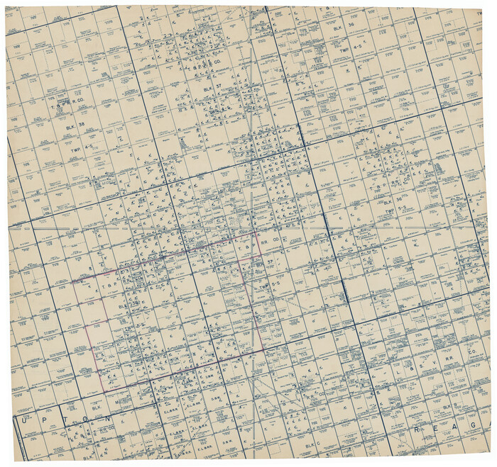
Print $20.00
- Digital $50.00
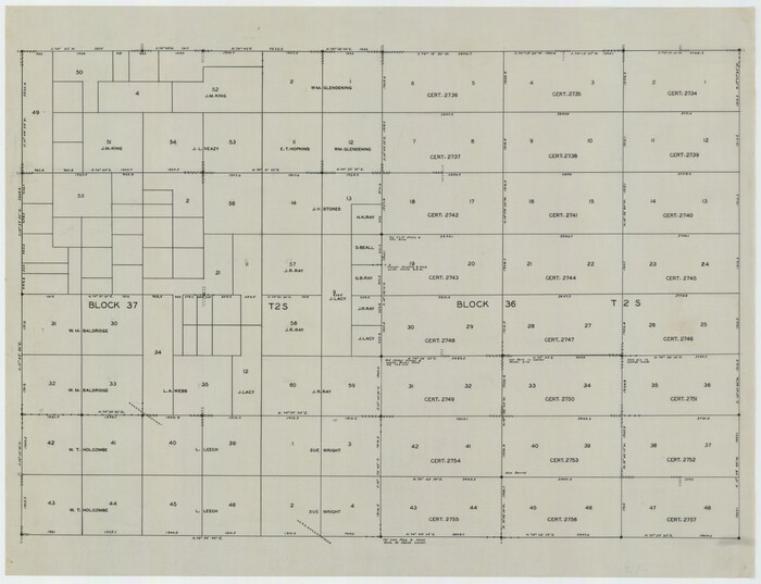
[Township 5-S, Blocks 36, 37 & 38]
1952
Size: 27.6 x 26.5 inches
92291
[Township 5-S, Blocks 36, 37 & 38]
Print $20.00
- Digital $50.00
[Township 5-S, Blocks 36, 37 & 38]
1952
Size: 27.7 x 26.6 inches
92292
[Plat of Texas and Pacific Railroad Company Block Lines, 80 Mile Reserve]
Print $40.00
- Digital $50.00
[Plat of Texas and Pacific Railroad Company Block Lines, 80 Mile Reserve]
1876
Size: 43.5 x 46.3 inches
3124
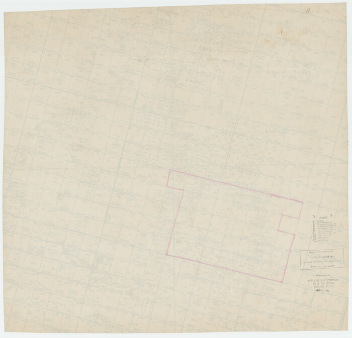
[Blocks 36, 37 Township 2 South]
Print $20.00
- Digital $50.00
[Blocks 36, 37 Township 2 South]
Size: 24.6 x 18.9 inches
92320
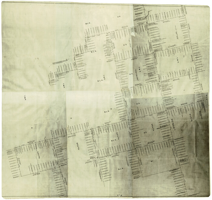
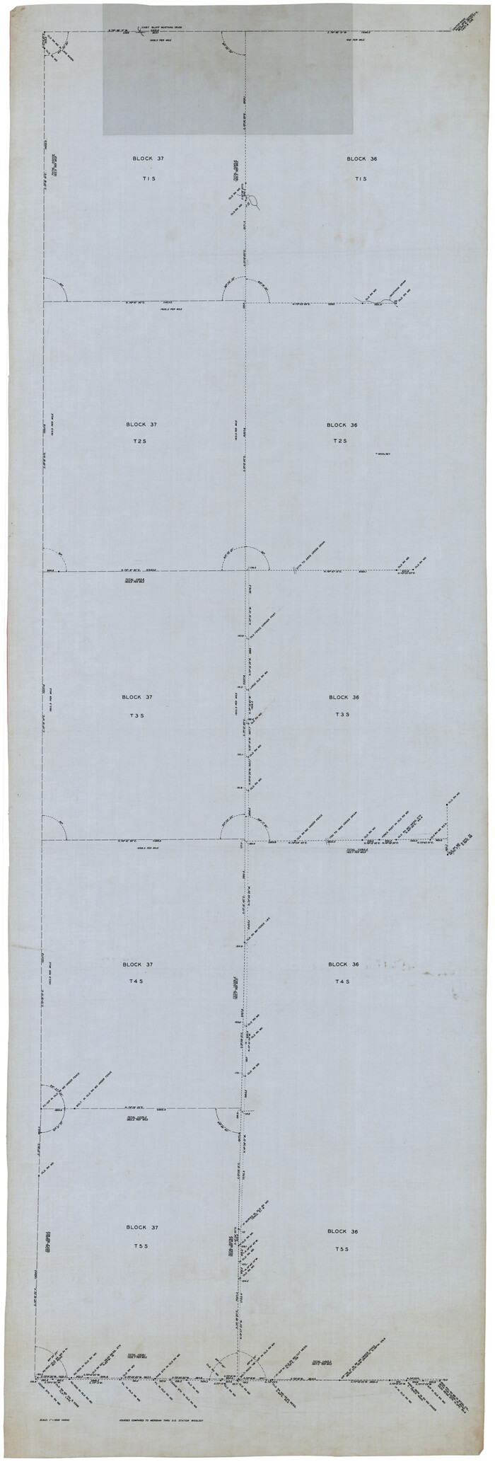
[Blocks 36 and 37, Townships 1S-5S]
Print $40.00
- Digital $50.00
[Blocks 36 and 37, Townships 1S-5S]
Size: 28.9 x 83.7 inches
93213
Water-Shed of the Colorado River

Print $40.00
- Digital $50.00
Water-Shed of the Colorado River
1925
Size: 37.1 x 79.8 inches
65261
Upton County Working Sketch 47

Print $20.00
- Digital $50.00
Upton County Working Sketch 47
1973
Size: 24.8 x 26.7 inches
69543
Upton County Working Sketch 36

Print $40.00
- Digital $50.00
Upton County Working Sketch 36
1957
Size: 43.5 x 57.3 inches
69532
Upton County Sketch File 36

Print $14.00
- Digital $50.00
Upton County Sketch File 36
1952
Size: 11.3 x 8.8 inches
38893
Upton County Rolled Sketch 38

Print $20.00
- Digital $50.00
Upton County Rolled Sketch 38
1953
Size: 21.1 x 28.0 inches
8078
Upton County Rolled Sketch 36A

Print $40.00
- Digital $50.00
Upton County Rolled Sketch 36A
1952
Size: 43.5 x 65.8 inches
10661
Upton County Rolled Sketch 36

Print $40.00
- Digital $50.00
Upton County Rolled Sketch 36
1952
Size: 42.9 x 64.2 inches
10051
Upton County Rolled Sketch 34

Print $20.00
- Digital $50.00
Upton County Rolled Sketch 34
1951
Size: 34.4 x 34.3 inches
10050
Upton County Rolled Sketch 10

Print $20.00
- Digital $50.00
Upton County Rolled Sketch 10
1911
Size: 41.2 x 43.0 inches
10035
Sectional Map No. 2 of the lands and the line of the Texas & Pacific Ry. Co. in Howard, Martin, Andrews, Midland and Tom Green Counties

Print $20.00
- Digital $50.00
Sectional Map No. 2 of the lands and the line of the Texas & Pacific Ry. Co. in Howard, Martin, Andrews, Midland and Tom Green Counties
1885
Size: 18.9 x 23.4 inches
4859
Sectional Map No. 2 of the lands and the line of the Texas & Pacific Ry. Co. in Howard, Martin, Andrews, Midland and Tom Green Counties

Print $20.00
- Digital $50.00
Sectional Map No. 2 of the lands and the line of the Texas & Pacific Ry. Co. in Howard, Martin, Andrews, Midland and Tom Green Counties
1885
Size: 19.1 x 23.2 inches
4860
Sectional Map No. 2 of the lands and the line of the Texas & Pacific Ry. Co. in Howard, Martin, Andrews, Midland and Tom Green Counties

Print $20.00
- Digital $50.00
Sectional Map No. 2 of the lands and the line of the Texas & Pacific Ry. Co. in Howard, Martin, Andrews, Midland and Tom Green Counties
1885
Size: 18.9 x 23.2 inches
4861
Sectional Map No. 2 of the lands and the line of the Texas & Pacific Ry. Co. in Howard, Martin, Andrews, Midland and Tom Green Counties

Print $20.00
- Digital $50.00
Sectional Map No. 2 of the lands and the line of the Texas & Pacific Ry. Co. in Howard, Martin, Andrews, Midland and Tom Green Counties
1885
Size: 19.1 x 23.3 inches
4862
Revised Sectional Map Number 2, Showing Surveys in Howard, Martin, Andrews, Glasscock, Midland, Ector

Print $20.00
- Digital $50.00
Revised Sectional Map Number 2, Showing Surveys in Howard, Martin, Andrews, Glasscock, Midland, Ector
1908
Size: 24.7 x 19.6 inches
91367
Revised Sectional Map Number 2, Lands in Texas and Pacific Railway Reservation From Westbrook Station in Mitchell County to Metz Station in Ector County

Print $20.00
- Digital $50.00
Revised Sectional Map Number 2, Lands in Texas and Pacific Railway Reservation From Westbrook Station in Mitchell County to Metz Station in Ector County
Size: 25.1 x 19.6 inches
91366
Revised Sectional Map Number 2, Showing Lands in Howard, Martin, Andrews, Glasscock, Midland, Ector, and Portions of Borden, Dawson, Irion, Reagan, Upton, Crane, Ward, and Winkler Counties

Print $20.00
- Digital $50.00
Revised Sectional Map Number 2, Showing Lands in Howard, Martin, Andrews, Glasscock, Midland, Ector, and Portions of Borden, Dawson, Irion, Reagan, Upton, Crane, Ward, and Winkler Counties
1908
Size: 16.6 x 13.3 inches
91113
Ownership Map Midland Co., Texas

Ownership Map Midland Co., Texas
1951
Size: 43.2 x 45.3 inches
89914
Midland County, Texas

Print $20.00
- Digital $50.00
Midland County, Texas
1880
Size: 20.8 x 17.7 inches
437
Midland County, Texas

Print $20.00
- Digital $50.00
Midland County, Texas
1888
Size: 22.4 x 17.5 inches
653
Midland County, Texas

Print $20.00
- Digital $50.00
Midland County, Texas
1880
Size: 25.5 x 21.5 inches
740
Midland County Working Sketch Graphic Index

Print $20.00
- Digital $50.00
Midland County Working Sketch Graphic Index
1930
Size: 43.3 x 35.3 inches
76641
Midland County Working Sketch 9

Print $20.00
- Digital $50.00
Midland County Working Sketch 9
1951
Size: 42.6 x 35.9 inches
70989
Midland County Working Sketch 8

Print $20.00
- Digital $50.00
Midland County Working Sketch 8
1950
Size: 41.4 x 32.9 inches
70988
Midland County Working Sketch 7

Print $20.00
- Digital $50.00
Midland County Working Sketch 7
1950
Size: 34.6 x 28.3 inches
70987
Midland County Working Sketch 6

Print $20.00
- Digital $50.00
Midland County Working Sketch 6
1950
Size: 41.2 x 30.9 inches
70986
[Township 5-S, Blocks 36, 37 & 38]
Print $20.00
- Digital $50.00
[Township 5-S, Blocks 36, 37 & 38]
1952
-
Size
27.6 x 26.5 inches
-
Map/Doc
92291
-
Creation Date
1952
[Township 5-S, Blocks 36, 37 & 38]
Print $20.00
- Digital $50.00
[Township 5-S, Blocks 36, 37 & 38]
1952
-
Size
27.7 x 26.6 inches
-
Map/Doc
92292
-
Creation Date
1952
[Plat of Texas and Pacific Railroad Company Block Lines, 80 Mile Reserve]
Print $40.00
- Digital $50.00
[Plat of Texas and Pacific Railroad Company Block Lines, 80 Mile Reserve]
1876
-
Size
43.5 x 46.3 inches
-
Map/Doc
3124
-
Creation Date
1876
[Blocks 36, 37 Township 2 South]
Print $20.00
- Digital $50.00
[Blocks 36, 37 Township 2 South]
-
Size
24.6 x 18.9 inches
-
Map/Doc
92320
[Blocks 36 and 37, Townships 1S-5S]
Print $40.00
- Digital $50.00
[Blocks 36 and 37, Townships 1S-5S]
-
Size
28.9 x 83.7 inches
-
Map/Doc
93213
Water-Shed of the Colorado River
Print $40.00
- Digital $50.00
Water-Shed of the Colorado River
1925
-
Size
37.1 x 79.8 inches
-
Map/Doc
65261
-
Creation Date
1925
Upton County Working Sketch 47
Print $20.00
- Digital $50.00
Upton County Working Sketch 47
1973
-
Size
24.8 x 26.7 inches
-
Map/Doc
69543
-
Creation Date
1973
Upton County Working Sketch 36
Print $40.00
- Digital $50.00
Upton County Working Sketch 36
1957
-
Size
43.5 x 57.3 inches
-
Map/Doc
69532
-
Creation Date
1957
Upton County Sketch File 36
Print $14.00
- Digital $50.00
Upton County Sketch File 36
1952
-
Size
11.3 x 8.8 inches
-
Map/Doc
38893
-
Creation Date
1952
Upton County Rolled Sketch 38
Print $20.00
- Digital $50.00
Upton County Rolled Sketch 38
1953
-
Size
21.1 x 28.0 inches
-
Map/Doc
8078
-
Creation Date
1953
Upton County Rolled Sketch 36A
Print $40.00
- Digital $50.00
Upton County Rolled Sketch 36A
1952
-
Size
43.5 x 65.8 inches
-
Map/Doc
10661
-
Creation Date
1952
Upton County Rolled Sketch 36
Print $40.00
- Digital $50.00
Upton County Rolled Sketch 36
1952
-
Size
42.9 x 64.2 inches
-
Map/Doc
10051
-
Creation Date
1952
Upton County Rolled Sketch 34
Print $20.00
- Digital $50.00
Upton County Rolled Sketch 34
1951
-
Size
34.4 x 34.3 inches
-
Map/Doc
10050
-
Creation Date
1951
Upton County Rolled Sketch 10
Print $20.00
- Digital $50.00
Upton County Rolled Sketch 10
1911
-
Size
41.2 x 43.0 inches
-
Map/Doc
10035
-
Creation Date
1911
Sectional Map No. 2 of the lands and the line of the Texas & Pacific Ry. Co. in Howard, Martin, Andrews, Midland and Tom Green Counties
Print $20.00
- Digital $50.00
Sectional Map No. 2 of the lands and the line of the Texas & Pacific Ry. Co. in Howard, Martin, Andrews, Midland and Tom Green Counties
1885
-
Size
18.9 x 23.4 inches
-
Map/Doc
4859
-
Creation Date
1885
Sectional Map No. 2 of the lands and the line of the Texas & Pacific Ry. Co. in Howard, Martin, Andrews, Midland and Tom Green Counties
Print $20.00
- Digital $50.00
Sectional Map No. 2 of the lands and the line of the Texas & Pacific Ry. Co. in Howard, Martin, Andrews, Midland and Tom Green Counties
1885
-
Size
19.1 x 23.2 inches
-
Map/Doc
4860
-
Creation Date
1885
Sectional Map No. 2 of the lands and the line of the Texas & Pacific Ry. Co. in Howard, Martin, Andrews, Midland and Tom Green Counties
Print $20.00
- Digital $50.00
Sectional Map No. 2 of the lands and the line of the Texas & Pacific Ry. Co. in Howard, Martin, Andrews, Midland and Tom Green Counties
1885
-
Size
18.9 x 23.2 inches
-
Map/Doc
4861
-
Creation Date
1885
Sectional Map No. 2 of the lands and the line of the Texas & Pacific Ry. Co. in Howard, Martin, Andrews, Midland and Tom Green Counties
Print $20.00
- Digital $50.00
Sectional Map No. 2 of the lands and the line of the Texas & Pacific Ry. Co. in Howard, Martin, Andrews, Midland and Tom Green Counties
1885
-
Size
19.1 x 23.3 inches
-
Map/Doc
4862
-
Creation Date
1885
Revised Sectional Map Number 2, Showing Surveys in Howard, Martin, Andrews, Glasscock, Midland, Ector
Print $20.00
- Digital $50.00
Revised Sectional Map Number 2, Showing Surveys in Howard, Martin, Andrews, Glasscock, Midland, Ector
1908
-
Size
24.7 x 19.6 inches
-
Map/Doc
91367
-
Creation Date
1908
Revised Sectional Map Number 2, Lands in Texas and Pacific Railway Reservation From Westbrook Station in Mitchell County to Metz Station in Ector County
Print $20.00
- Digital $50.00
Revised Sectional Map Number 2, Lands in Texas and Pacific Railway Reservation From Westbrook Station in Mitchell County to Metz Station in Ector County
-
Size
25.1 x 19.6 inches
-
Map/Doc
91366
Revised Sectional Map Number 2, Showing Lands in Howard, Martin, Andrews, Glasscock, Midland, Ector, and Portions of Borden, Dawson, Irion, Reagan, Upton, Crane, Ward, and Winkler Counties
Print $20.00
- Digital $50.00
Revised Sectional Map Number 2, Showing Lands in Howard, Martin, Andrews, Glasscock, Midland, Ector, and Portions of Borden, Dawson, Irion, Reagan, Upton, Crane, Ward, and Winkler Counties
1908
-
Size
16.6 x 13.3 inches
-
Map/Doc
91113
-
Creation Date
1908
Ownership Map Midland Co., Texas
Ownership Map Midland Co., Texas
1951
-
Size
43.2 x 45.3 inches
-
Map/Doc
89914
-
Creation Date
1951
Midland County, Texas
Print $20.00
- Digital $50.00
Midland County, Texas
1880
-
Size
20.8 x 17.7 inches
-
Map/Doc
437
-
Creation Date
1880
Midland County, Texas
Print $20.00
- Digital $50.00
Midland County, Texas
1888
-
Size
22.4 x 17.5 inches
-
Map/Doc
653
-
Creation Date
1888
Midland County, Texas
Print $20.00
- Digital $50.00
Midland County, Texas
1880
-
Size
25.5 x 21.5 inches
-
Map/Doc
740
-
Creation Date
1880
Midland County Working Sketch Graphic Index
Print $20.00
- Digital $50.00
Midland County Working Sketch Graphic Index
1930
-
Size
43.3 x 35.3 inches
-
Map/Doc
76641
-
Creation Date
1930
Midland County Working Sketch 9
Print $20.00
- Digital $50.00
Midland County Working Sketch 9
1951
-
Size
42.6 x 35.9 inches
-
Map/Doc
70989
-
Creation Date
1951
Midland County Working Sketch 8
Print $20.00
- Digital $50.00
Midland County Working Sketch 8
1950
-
Size
41.4 x 32.9 inches
-
Map/Doc
70988
-
Creation Date
1950
Midland County Working Sketch 7
Print $20.00
- Digital $50.00
Midland County Working Sketch 7
1950
-
Size
34.6 x 28.3 inches
-
Map/Doc
70987
-
Creation Date
1950
Midland County Working Sketch 6
Print $20.00
- Digital $50.00
Midland County Working Sketch 6
1950
-
Size
41.2 x 30.9 inches
-
Map/Doc
70986
-
Creation Date
1950