Austin County Sketch File 3

Print $40.00
- Digital $50.00
Austin County Sketch File 3
Size: 17.1 x 13.6 inches
10870
Austin County Sketch File 12

Print $40.00
- Digital $50.00
Austin County Sketch File 12
Size: 22.5 x 18.0 inches
10876
Austin County Sketch File 13

Print $40.00
- Digital $50.00
Austin County Sketch File 13
Size: 13.9 x 13.2 inches
10877
Austin County Sketch File 1

Print $4.00
- Digital $50.00
Austin County Sketch File 1
Size: 8.0 x 6.5 inches
13853
Austin County Sketch File 2

Print $4.00
- Digital $50.00
Austin County Sketch File 2
Size: 8.2 x 6.3 inches
13855
Austin County Sketch File 14

Print $40.00
- Digital $50.00
Austin County Sketch File 14
Size: 18.8 x 8.8 inches
13880
Austin County Sketch File 15

Print $12.00
- Digital $50.00
Austin County Sketch File 15
Size: 9.5 x 8.2 inches
13882
Austin County Sketch File 16

Print $74.00
- Digital $50.00
Austin County Sketch File 16
Size: 14.3 x 8.8 inches
13888
Austin County Sketch File 18

Print $14.00
- Digital $50.00
Austin County Sketch File 18
Size: 12.8 x 8.2 inches
13927
Colorado County Sketch File 11

Print $6.00
- Digital $50.00
Colorado County Sketch File 11
Size: 12.7 x 11.0 inches
18935
Colorado County Sketch File 15

Print $4.00
- Digital $50.00
Colorado County Sketch File 15
Size: 13.0 x 8.1 inches
18943
Austin County Boundary File 1

Print $44.00
- Digital $50.00
Austin County Boundary File 1
Size: 7.0 x 8.2 inches
50223
Austin County Boundary File 2

Print $32.00
- Digital $50.00
Austin County Boundary File 2
Size: 22.4 x 30.7 inches
50236
Austin County Boundary File 3

Print $2.00
- Digital $50.00
Austin County Boundary File 3
Size: 14.3 x 8.6 inches
50243
Austin County Boundary File 4

Print $10.00
- Digital $50.00
Austin County Boundary File 4
Size: 14.1 x 8.6 inches
50244
Austin County Boundary File 5

Print $6.00
- Digital $50.00
Austin County Boundary File 5
Size: 14.3 x 8.5 inches
50249
Austin County Boundary File 5a

Print $6.00
- Digital $50.00
Austin County Boundary File 5a
Size: 14.1 x 8.7 inches
50252
Austin County Boundary File 6

Print $16.00
- Digital $50.00
Austin County Boundary File 6
Size: 11.1 x 8.4 inches
50255
Austin County Rolled Sketch 5B

Print $40.00
- Digital $50.00
Austin County Rolled Sketch 5B
Size: 23.7 x 51.5 inches
5107
Map of the 1st, 2nd and 3rd Sections of Houston & Texas Central Railroad

Print $40.00
- Digital $50.00
Map of the 1st, 2nd and 3rd Sections of Houston & Texas Central Railroad
Size: 30.7 x 64.6 inches
64478
Map of Taylor, Bastrop & Houston Railroad in Austin County

Print $20.00
- Digital $50.00
Map of Taylor, Bastrop & Houston Railroad in Austin County
Size: 14.6 x 25.1 inches
64480
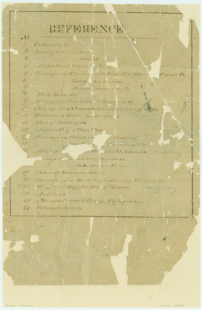
[Atlas C, Table of Contents]
Print $3.00
- Digital $50.00
[Atlas C, Table of Contents]
Size: 14.7 x 9.6 inches
78353
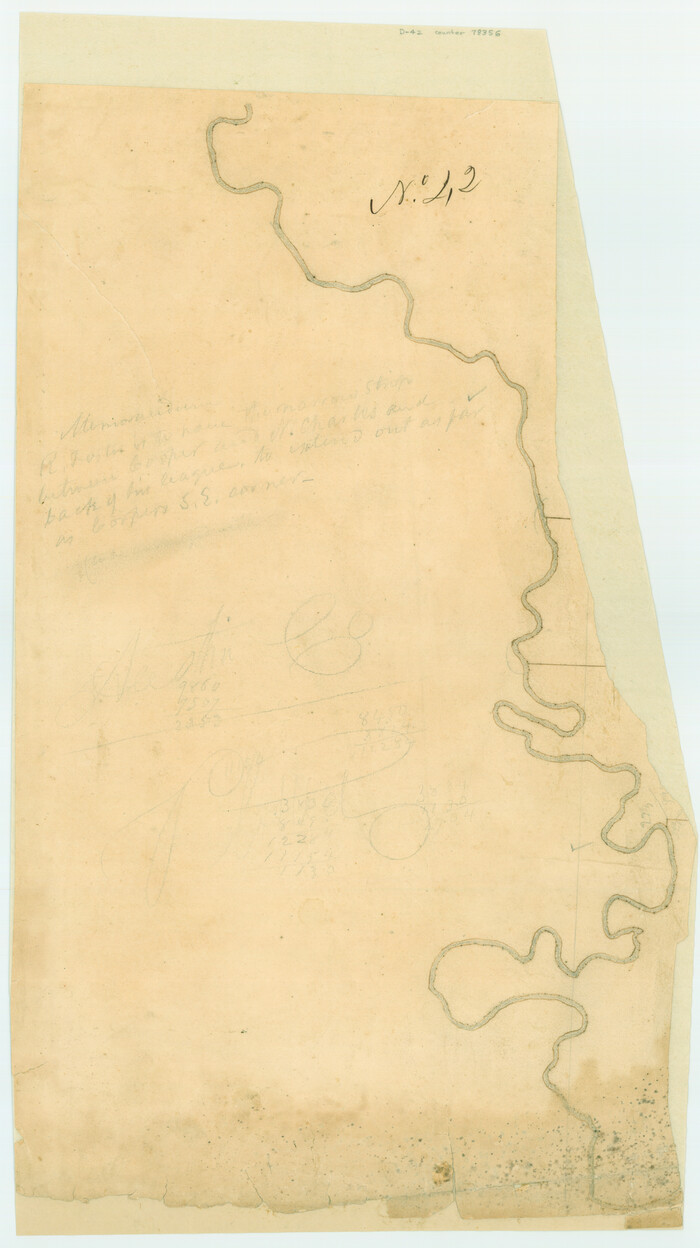
[Surveys possibly in Austin County]
Print $3.00
- Digital $50.00
[Surveys possibly in Austin County]
Size: 17.0 x 9.6 inches
78356
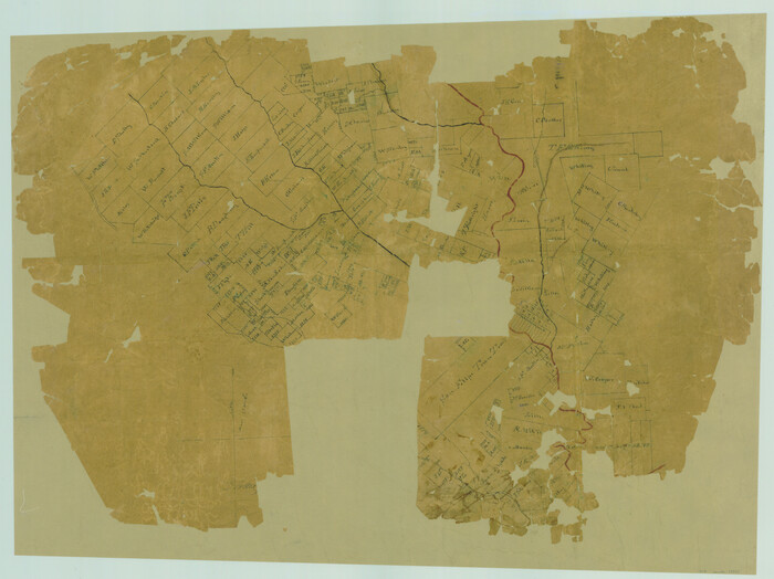
[Surveys in Waller County]
Print $20.00
- Digital $50.00
[Surveys in Waller County]
Size: 21.5 x 28.7 inches
78367
San Felipe Town Tract & Adjoining Survey for S. F. Austin and A. Lester

Print $2.00
- Digital $50.00
San Felipe Town Tract & Adjoining Survey for S. F. Austin and A. Lester
Size: 9.9 x 8.1 inches
78368
Austin County Rolled Sketch 4

Print $20.00
- Digital $50.00
Austin County Rolled Sketch 4
Size: 30.8 x 44.8 inches
8435
Austin County Rolled Sketch 5A

Print $40.00
- Digital $50.00
Austin County Rolled Sketch 5A
Size: 54.2 x 44.1 inches
8437
Plan of the town of Austin

Print $20.00
- Digital $50.00
Plan of the town of Austin
Size: 18.4 x 13.0 inches
94117
A Map of Austin's Colony and adjacent country in Texas drawn principally from actual survey by Stephen F. Austin

A Map of Austin's Colony and adjacent country in Texas drawn principally from actual survey by Stephen F. Austin
1820
Size: 13.8 x 17.0 inches
93353
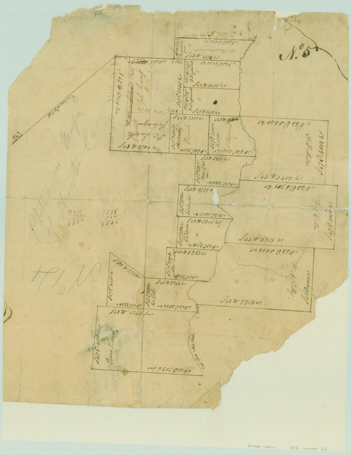
[Surveys in Austin's Colony along the east bank of Mill Creek]
Print $3.00
- Digital $50.00
[Surveys in Austin's Colony along the east bank of Mill Creek]
1827
Size: 14.4 x 11.1 inches
216
Austin County Sketch File 3
Print $40.00
- Digital $50.00
Austin County Sketch File 3
-
Size
17.1 x 13.6 inches
-
Map/Doc
10870
Austin County Sketch File 12
Print $40.00
- Digital $50.00
Austin County Sketch File 12
-
Size
22.5 x 18.0 inches
-
Map/Doc
10876
Austin County Sketch File 13
Print $40.00
- Digital $50.00
Austin County Sketch File 13
-
Size
13.9 x 13.2 inches
-
Map/Doc
10877
Austin County Sketch File 1
Print $4.00
- Digital $50.00
Austin County Sketch File 1
-
Size
8.0 x 6.5 inches
-
Map/Doc
13853
Austin County Sketch File 2
Print $4.00
- Digital $50.00
Austin County Sketch File 2
-
Size
8.2 x 6.3 inches
-
Map/Doc
13855
Austin County Sketch File 14
Print $40.00
- Digital $50.00
Austin County Sketch File 14
-
Size
18.8 x 8.8 inches
-
Map/Doc
13880
Austin County Sketch File 15
Print $12.00
- Digital $50.00
Austin County Sketch File 15
-
Size
9.5 x 8.2 inches
-
Map/Doc
13882
Austin County Sketch File 16
Print $74.00
- Digital $50.00
Austin County Sketch File 16
-
Size
14.3 x 8.8 inches
-
Map/Doc
13888
Austin County Sketch File 18
Print $14.00
- Digital $50.00
Austin County Sketch File 18
-
Size
12.8 x 8.2 inches
-
Map/Doc
13927
Colorado County Sketch File 11
Print $6.00
- Digital $50.00
Colorado County Sketch File 11
-
Size
12.7 x 11.0 inches
-
Map/Doc
18935
Colorado County Sketch File 15
Print $4.00
- Digital $50.00
Colorado County Sketch File 15
-
Size
13.0 x 8.1 inches
-
Map/Doc
18943
Austin County Boundary File 1
Print $44.00
- Digital $50.00
Austin County Boundary File 1
-
Size
7.0 x 8.2 inches
-
Map/Doc
50223
Austin County Boundary File 2
Print $32.00
- Digital $50.00
Austin County Boundary File 2
-
Size
22.4 x 30.7 inches
-
Map/Doc
50236
Austin County Boundary File 3
Print $2.00
- Digital $50.00
Austin County Boundary File 3
-
Size
14.3 x 8.6 inches
-
Map/Doc
50243
Austin County Boundary File 4
Print $10.00
- Digital $50.00
Austin County Boundary File 4
-
Size
14.1 x 8.6 inches
-
Map/Doc
50244
Austin County Boundary File 5
Print $6.00
- Digital $50.00
Austin County Boundary File 5
-
Size
14.3 x 8.5 inches
-
Map/Doc
50249
Austin County Boundary File 5a
Print $6.00
- Digital $50.00
Austin County Boundary File 5a
-
Size
14.1 x 8.7 inches
-
Map/Doc
50252
Austin County Boundary File 6
Print $16.00
- Digital $50.00
Austin County Boundary File 6
-
Size
11.1 x 8.4 inches
-
Map/Doc
50255
Austin County Rolled Sketch 5B
Print $40.00
- Digital $50.00
Austin County Rolled Sketch 5B
-
Size
23.7 x 51.5 inches
-
Map/Doc
5107
Map of the 1st, 2nd and 3rd Sections of Houston & Texas Central Railroad
Print $40.00
- Digital $50.00
Map of the 1st, 2nd and 3rd Sections of Houston & Texas Central Railroad
-
Size
30.7 x 64.6 inches
-
Map/Doc
64478
Map of Taylor, Bastrop & Houston Railroad in Austin County
Print $20.00
- Digital $50.00
Map of Taylor, Bastrop & Houston Railroad in Austin County
-
Size
14.6 x 25.1 inches
-
Map/Doc
64480
[Atlas C, Table of Contents]
Print $3.00
- Digital $50.00
[Atlas C, Table of Contents]
-
Size
14.7 x 9.6 inches
-
Map/Doc
78353
[Surveys possibly in Austin County]
Print $3.00
- Digital $50.00
[Surveys possibly in Austin County]
-
Size
17.0 x 9.6 inches
-
Map/Doc
78356
[Surveys in Waller County]
Print $20.00
- Digital $50.00
[Surveys in Waller County]
-
Size
21.5 x 28.7 inches
-
Map/Doc
78367
San Felipe Town Tract & Adjoining Survey for S. F. Austin and A. Lester
Print $2.00
- Digital $50.00
San Felipe Town Tract & Adjoining Survey for S. F. Austin and A. Lester
-
Size
9.9 x 8.1 inches
-
Map/Doc
78368
Austin County Rolled Sketch 4
Print $20.00
- Digital $50.00
Austin County Rolled Sketch 4
-
Size
30.8 x 44.8 inches
-
Map/Doc
8435
Austin County Rolled Sketch 5A
Print $40.00
- Digital $50.00
Austin County Rolled Sketch 5A
-
Size
54.2 x 44.1 inches
-
Map/Doc
8437
Plan of the town of Austin
Print $20.00
- Digital $50.00
Plan of the town of Austin
-
Size
18.4 x 13.0 inches
-
Map/Doc
94117
A Map of Austin's Colony and adjacent country in Texas drawn principally from actual survey by Stephen F. Austin
A Map of Austin's Colony and adjacent country in Texas drawn principally from actual survey by Stephen F. Austin
1820
-
Size
13.8 x 17.0 inches
-
Map/Doc
93353
-
Creation Date
1820
[Surveys in Austin's Colony along the east bank of Mill Creek]
Print $3.00
- Digital $50.00
[Surveys in Austin's Colony along the east bank of Mill Creek]
1827
-
Size
14.4 x 11.1 inches
-
Map/Doc
216
-
Creation Date
1827