The Republic County of Austin. Proposed, Late Fall 1837

Print $20.00
The Republic County of Austin. Proposed, Late Fall 1837
2020
Size: 14.8 x 21.7 inches
96080
The Republic County of Austin. Proposed, Fall 1837-May 23, 1838

Print $20.00
The Republic County of Austin. Proposed, Fall 1837-May 23, 1838
2020
Size: 14.8 x 21.7 inches
96081
The Republic County of Austin. Defined, May 24, 1838

Print $20.00
The Republic County of Austin. Defined, May 24, 1838
2020
Size: 14.7 x 21.6 inches
96082
The Republic County of Austin. January 10, 1839

Print $20.00
The Republic County of Austin. January 10, 1839
2020
Size: 7.0 x 22.0 inches
96083
The Republic County of Austin. February 5, 1840

Print $20.00
The Republic County of Austin. February 5, 1840
2020
Size: 14.7 x 21.7 inches
96084
The Republic County of Austin. January 28, 1841

Print $20.00
The Republic County of Austin. January 28, 1841
2020
Size: 14.7 x 21.7 inches
96085
The Republic County of Austin. January 29, 1842

Print $20.00
The Republic County of Austin. January 29, 1842
2020
Size: 14.7 x 21.7 inches
96086
The Republic County of Austin. February 1, 1844

Print $20.00
The Republic County of Austin. February 1, 1844
2020
Size: 14.7 x 21.7 inches
96087
The Republic County of Austin. December 29, 1845

Print $20.00
The Republic County of Austin. December 29, 1845
2020
Size: 14.7 x 21.6 inches
96088
Austin County Working Sketch 9

Print $20.00
- Digital $50.00
Austin County Working Sketch 9
1996
Size: 34.4 x 32.0 inches
67250
Austin County Working Sketch 7

Print $40.00
- Digital $50.00
Austin County Working Sketch 7
1992
Size: 30.9 x 48.8 inches
67248
Austin County Working Sketch 8

Print $20.00
- Digital $50.00
Austin County Working Sketch 8
1992
Size: 28.7 x 31.6 inches
67249
Austin County Working Sketch 6

Print $20.00
- Digital $50.00
Austin County Working Sketch 6
1985
Size: 30.3 x 28.5 inches
67247
Austin County Rolled Sketch 7

Print $47.00
- Digital $50.00
Austin County Rolled Sketch 7
1974
Size: 10.4 x 15.3 inches
42340
Austin County Working Sketch 5

Print $20.00
- Digital $50.00
Austin County Working Sketch 5
1965
Size: 23.4 x 27.8 inches
67246
General Highway Map, Austin County, Texas

Print $20.00
General Highway Map, Austin County, Texas
1961
Size: 18.1 x 25.1 inches
79357
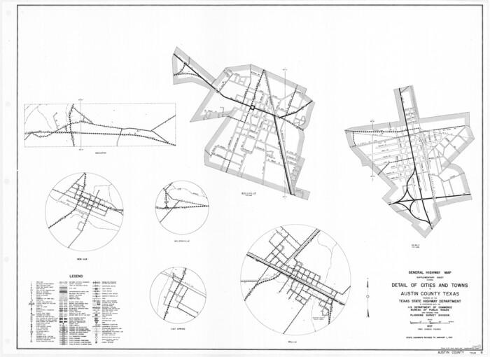
General Highway Map. Detail of Cities and Towns in Austin County, Texas [Sealy and Bellville, etc.]
Print $20.00
General Highway Map. Detail of Cities and Towns in Austin County, Texas [Sealy and Bellville, etc.]
1961
Size: 18.2 x 25.0 inches
79358
Austin County Working Sketch 4

Print $20.00
- Digital $50.00
Austin County Working Sketch 4
1959
Size: 29.8 x 34.8 inches
67245
Austin County Rolled Sketch 6

Print $20.00
- Digital $50.00
Austin County Rolled Sketch 6
1951
Size: 25.5 x 34.0 inches
5108
Austin County Working Sketch 3

Print $20.00
- Digital $50.00
Austin County Working Sketch 3
1950
Size: 33.3 x 40.1 inches
67244
Stephen F. Austin Park

Print $20.00
- Digital $50.00
Stephen F. Austin Park
1950
Size: 24.7 x 36.9 inches
73568
Austin County Working Sketch 2

Print $20.00
- Digital $50.00
Austin County Working Sketch 2
1944
Size: 23.3 x 27.0 inches
67243
Austin County Working Sketch Graphic Index

Print $20.00
- Digital $50.00
Austin County Working Sketch Graphic Index
1943
Size: 38.6 x 41.1 inches
76459
Austin County Rolled Sketch 5B

Print $40.00
- Digital $50.00
Austin County Rolled Sketch 5B
1942
Size: 22.5 x 50.8 inches
5106
Austin County Working Sketch 1

Print $20.00
- Digital $50.00
Austin County Working Sketch 1
1941
Size: 27.7 x 30.1 inches
67242
General Highway Map, Austin County, Texas

Print $20.00
General Highway Map, Austin County, Texas
1939
Size: 18.4 x 25.0 inches
79009
The Republic County of Austin. Proposed, Late Fall 1837
Print $20.00
The Republic County of Austin. Proposed, Late Fall 1837
2020
-
Size
14.8 x 21.7 inches
-
Map/Doc
96080
-
Creation Date
2020
The Republic County of Austin. Proposed, Fall 1837-May 23, 1838
Print $20.00
The Republic County of Austin. Proposed, Fall 1837-May 23, 1838
2020
-
Size
14.8 x 21.7 inches
-
Map/Doc
96081
-
Creation Date
2020
The Republic County of Austin. Defined, May 24, 1838
Print $20.00
The Republic County of Austin. Defined, May 24, 1838
2020
-
Size
14.7 x 21.6 inches
-
Map/Doc
96082
-
Creation Date
2020
The Republic County of Austin. January 10, 1839
Print $20.00
The Republic County of Austin. January 10, 1839
2020
-
Size
7.0 x 22.0 inches
-
Map/Doc
96083
-
Creation Date
2020
The Republic County of Austin. February 5, 1840
Print $20.00
The Republic County of Austin. February 5, 1840
2020
-
Size
14.7 x 21.7 inches
-
Map/Doc
96084
-
Creation Date
2020
The Republic County of Austin. January 28, 1841
Print $20.00
The Republic County of Austin. January 28, 1841
2020
-
Size
14.7 x 21.7 inches
-
Map/Doc
96085
-
Creation Date
2020
The Republic County of Austin. January 29, 1842
Print $20.00
The Republic County of Austin. January 29, 1842
2020
-
Size
14.7 x 21.7 inches
-
Map/Doc
96086
-
Creation Date
2020
The Republic County of Austin. February 1, 1844
Print $20.00
The Republic County of Austin. February 1, 1844
2020
-
Size
14.7 x 21.7 inches
-
Map/Doc
96087
-
Creation Date
2020
The Republic County of Austin. December 29, 1845
Print $20.00
The Republic County of Austin. December 29, 1845
2020
-
Size
14.7 x 21.6 inches
-
Map/Doc
96088
-
Creation Date
2020
Austin County Working Sketch 9
Print $20.00
- Digital $50.00
Austin County Working Sketch 9
1996
-
Size
34.4 x 32.0 inches
-
Map/Doc
67250
-
Creation Date
1996
Austin County Working Sketch 7
Print $40.00
- Digital $50.00
Austin County Working Sketch 7
1992
-
Size
30.9 x 48.8 inches
-
Map/Doc
67248
-
Creation Date
1992
Austin County Working Sketch 8
Print $20.00
- Digital $50.00
Austin County Working Sketch 8
1992
-
Size
28.7 x 31.6 inches
-
Map/Doc
67249
-
Creation Date
1992
Austin County Working Sketch 6
Print $20.00
- Digital $50.00
Austin County Working Sketch 6
1985
-
Size
30.3 x 28.5 inches
-
Map/Doc
67247
-
Creation Date
1985
Austin County Rolled Sketch 7
Print $47.00
- Digital $50.00
Austin County Rolled Sketch 7
1974
-
Size
10.4 x 15.3 inches
-
Map/Doc
42340
-
Creation Date
1974
Austin County Working Sketch 5
Print $20.00
- Digital $50.00
Austin County Working Sketch 5
1965
-
Size
23.4 x 27.8 inches
-
Map/Doc
67246
-
Creation Date
1965
General Highway Map, Austin County, Texas
Print $20.00
General Highway Map, Austin County, Texas
1961
-
Size
18.1 x 25.1 inches
-
Map/Doc
79357
-
Creation Date
1961
General Highway Map. Detail of Cities and Towns in Austin County, Texas [Sealy and Bellville, etc.]
Print $20.00
General Highway Map. Detail of Cities and Towns in Austin County, Texas [Sealy and Bellville, etc.]
1961
-
Size
18.2 x 25.0 inches
-
Map/Doc
79358
-
Creation Date
1961
Austin County Working Sketch 4
Print $20.00
- Digital $50.00
Austin County Working Sketch 4
1959
-
Size
29.8 x 34.8 inches
-
Map/Doc
67245
-
Creation Date
1959
Austin County Rolled Sketch 6
Print $20.00
- Digital $50.00
Austin County Rolled Sketch 6
1951
-
Size
25.5 x 34.0 inches
-
Map/Doc
5108
-
Creation Date
1951
Austin County Working Sketch 3
Print $20.00
- Digital $50.00
Austin County Working Sketch 3
1950
-
Size
33.3 x 40.1 inches
-
Map/Doc
67244
-
Creation Date
1950
Stephen F. Austin Park
Print $20.00
- Digital $50.00
Stephen F. Austin Park
1950
-
Size
24.7 x 36.9 inches
-
Map/Doc
73568
-
Creation Date
1950
Austin County Working Sketch 2
Print $20.00
- Digital $50.00
Austin County Working Sketch 2
1944
-
Size
23.3 x 27.0 inches
-
Map/Doc
67243
-
Creation Date
1944
Austin County

Print $20.00
- Digital $50.00
Austin County
1943
-
Size
39.4 x 43.0 inches
-
Map/Doc
1775
-
Creation Date
1943
Austin County

Print $20.00
- Digital $50.00
Austin County
1943
-
Size
40.1 x 42.5 inches
-
Map/Doc
73073
-
Creation Date
1943
Austin County Working Sketch Graphic Index
Print $20.00
- Digital $50.00
Austin County Working Sketch Graphic Index
1943
-
Size
38.6 x 41.1 inches
-
Map/Doc
76459
-
Creation Date
1943
Austin County

Print $20.00
- Digital $50.00
Austin County
1943
-
Size
38.5 x 41.3 inches
-
Map/Doc
77205
-
Creation Date
1943
Austin County

Print $20.00
- Digital $50.00
Austin County
1943
-
Size
40.2 x 43.0 inches
-
Map/Doc
95422
-
Creation Date
1943
Austin County Rolled Sketch 5B
Print $40.00
- Digital $50.00
Austin County Rolled Sketch 5B
1942
-
Size
22.5 x 50.8 inches
-
Map/Doc
5106
-
Creation Date
1942
Austin County Working Sketch 1
Print $20.00
- Digital $50.00
Austin County Working Sketch 1
1941
-
Size
27.7 x 30.1 inches
-
Map/Doc
67242
-
Creation Date
1941
General Highway Map, Austin County, Texas
Print $20.00
General Highway Map, Austin County, Texas
1939
-
Size
18.4 x 25.0 inches
-
Map/Doc
79009
-
Creation Date
1939