Calhoun County Sketch File 1

Print $7.00
- Digital $50.00
Calhoun County Sketch File 1
1855
Size: 17.1 x 11.0 inches
11031
Calhoun County Sketch File 2

Print $40.00
- Digital $50.00
Calhoun County Sketch File 2
1856
Size: 20.2 x 15.8 inches
11032
Calhoun County Sketch File 12

Print $120.00
- Digital $50.00
Calhoun County Sketch File 12
Size: 23.0 x 36.9 inches
11033
Calhoun County Sketch File 15

Print $40.00
- Digital $50.00
Calhoun County Sketch File 15
1929
Size: 36.8 x 25.4 inches
11036
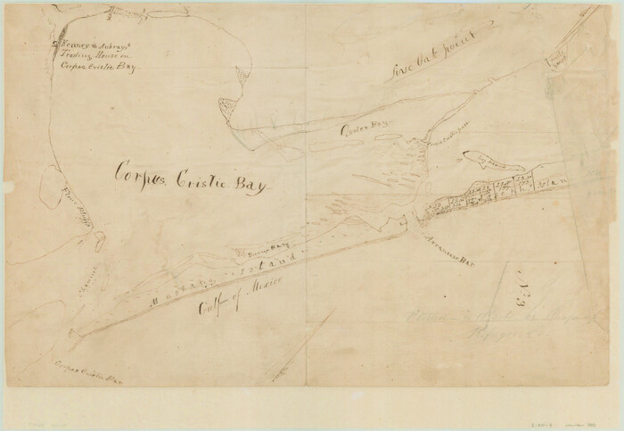
[Aransas and Corpus Christi Bays]
Print $3.00
- Digital $50.00
[Aransas and Corpus Christi Bays]
1839
Size: 11.4 x 16.5 inches
140
San Antonio Bay and Vicinity in Aransas and Calhoun Counties, showing Subdivsion for Mineral Development

Print $40.00
- Digital $50.00
San Antonio Bay and Vicinity in Aransas and Calhoun Counties, showing Subdivsion for Mineral Development
1948
Size: 37.0 x 74.5 inches
1912
Texas Gulf Coast, from the Sabine River to the Rio Grande as Subdivided for Mineral Development; Matagorda, Calhoun and Aransas Counties

Print $40.00
- Digital $50.00
Texas Gulf Coast, from the Sabine River to the Rio Grande as Subdivided for Mineral Development; Matagorda, Calhoun and Aransas Counties
1976
Size: 43.0 x 90.9 inches
1939
Connected Map of the County of Victoria

Print $40.00
- Digital $50.00
Connected Map of the County of Victoria
1838
Size: 79.7 x 49.0 inches
1946
Plan of the City of Calhoun

Print $40.00
- Digital $50.00
Plan of the City of Calhoun
1839
Size: 49.7 x 58.9 inches
2175
Karte von Indian Point od Indianola / Karte der Stadt Neu Braunfels / Karte der Stadt Friedrichsburg / Hafen von Indian Point oder Indianola

Print $20.00
- Digital $50.00
Karte von Indian Point od Indianola / Karte der Stadt Neu Braunfels / Karte der Stadt Friedrichsburg / Hafen von Indian Point oder Indianola
1850
Size: 13.6 x 19.4 inches
2182
Map of Matagorda & Carancahua Bays in Jackson, Calhoun & Matagorda Cos. showing subdivision thereof for mineral development

Print $20.00
- Digital $50.00
Map of Matagorda & Carancahua Bays in Jackson, Calhoun & Matagorda Cos. showing subdivision thereof for mineral development
1937
Size: 26.4 x 37.1 inches
2255
Map No. 8-A, Calhoun Co. - Revision of the East portion of Espiritu Santo Bay Tracts

Print $5.00
- Digital $50.00
Map No. 8-A, Calhoun Co. - Revision of the East portion of Espiritu Santo Bay Tracts
1978
Size: 21.2 x 28.0 inches
2498
Map of Espiritu Santo Bay in Calhoun County showing subdivision therof for mineral development

Print $20.00
- Digital $50.00
Map of Espiritu Santo Bay in Calhoun County showing subdivision therof for mineral development
1938
Size: 38.6 x 42.9 inches
2499
Jackson County Sketch File 28

Print $38.00
- Digital $50.00
Jackson County Sketch File 28
1945
Size: 14.2 x 8.7 inches
27706
Texas Gulf Coast Map from the Sabine River to the Rio Grande as subdivided for mineral development

Print $40.00
- Digital $50.00
Texas Gulf Coast Map from the Sabine River to the Rio Grande as subdivided for mineral development
Size: 46.0 x 91.3 inches
2901
Map of San Antonio Bay and Vicinity in Aransas and Calhoun Counties showing subdivision for mineral development

Print $40.00
- Digital $50.00
Map of San Antonio Bay and Vicinity in Aransas and Calhoun Counties showing subdivision for mineral development
1939
Size: 40.4 x 62.8 inches
2925
Map of Matagorda Bay & Vicinity in Matagorda & Calhoun Counties Showing Subdivision for Mineral Development

Print $40.00
- Digital $50.00
Map of Matagorda Bay & Vicinity in Matagorda & Calhoun Counties Showing Subdivision for Mineral Development
1939
Size: 46.1 x 55.5 inches
2927
Revised Map of Matagorda Bay and Vicinity in Matagorda and Calhoun Counties showing subdivision for mineral development

Print $40.00
- Digital $50.00
Revised Map of Matagorda Bay and Vicinity in Matagorda and Calhoun Counties showing subdivision for mineral development
1941
Size: 44.3 x 60.0 inches
2933
Matagorda Bay Oil Area, Matagorda, Calhoun & Jackson Cos.

Print $40.00
- Digital $50.00
Matagorda Bay Oil Area, Matagorda, Calhoun & Jackson Cos.
1927
Size: 34.9 x 66.8 inches
2934
Portion of States submerged area in Lavaca Bay, Calhoun County, Texas

Print $20.00
- Digital $50.00
Portion of States submerged area in Lavaca Bay, Calhoun County, Texas
1921
Size: 23.0 x 27.0 inches
2940
Permanent Lakes and Marshes in Calhoun, Victoria and Jackson Cos. for Mineral Development

Print $20.00
- Digital $50.00
Permanent Lakes and Marshes in Calhoun, Victoria and Jackson Cos. for Mineral Development
1937
Size: 36.9 x 38.9 inches
2973
Map of Permanent Lakes & Marshes in Calhoun, Victoria & Jackson Counties for Mineral Development

Print $20.00
- Digital $50.00
Map of Permanent Lakes & Marshes in Calhoun, Victoria & Jackson Counties for Mineral Development
1937
Size: 31.3 x 37.2 inches
3021
Proposed bombing and machine gun restricted areas along Gulf of Mexico from San Luis Pass to Aransas Pass

Print $20.00
- Digital $50.00
Proposed bombing and machine gun restricted areas along Gulf of Mexico from San Luis Pass to Aransas Pass
1941
Size: 11.1 x 24.1 inches
3024
Revised map of Matagorda Bay and vicinity in Matagorda and Calhoun Counties showing subdivision for mineral development

Print $40.00
- Digital $50.00
Revised map of Matagorda Bay and vicinity in Matagorda and Calhoun Counties showing subdivision for mineral development
1941
Size: 43.4 x 56.6 inches
3098
Calhoun County Sketch File 3

Print $4.00
- Digital $50.00
Calhoun County Sketch File 3
Size: 8.0 x 12.0 inches
35899
Calhoun County Sketch File 4

Print $14.00
- Digital $50.00
Calhoun County Sketch File 4
1908
Size: 11.0 x 6.9 inches
35901
Calhoun County Sketch File 1
Print $7.00
- Digital $50.00
Calhoun County Sketch File 1
1855
-
Size
17.1 x 11.0 inches
-
Map/Doc
11031
-
Creation Date
1855
Calhoun County Sketch File 2
Print $40.00
- Digital $50.00
Calhoun County Sketch File 2
1856
-
Size
20.2 x 15.8 inches
-
Map/Doc
11032
-
Creation Date
1856
Calhoun County Sketch File 12
Print $120.00
- Digital $50.00
Calhoun County Sketch File 12
-
Size
23.0 x 36.9 inches
-
Map/Doc
11033
Calhoun County Sketch File 15
Print $40.00
- Digital $50.00
Calhoun County Sketch File 15
1929
-
Size
36.8 x 25.4 inches
-
Map/Doc
11036
-
Creation Date
1929
[Aransas and Corpus Christi Bays]
Print $3.00
- Digital $50.00
[Aransas and Corpus Christi Bays]
1839
-
Size
11.4 x 16.5 inches
-
Map/Doc
140
-
Creation Date
1839
Plan of Calhoun

Print $20.00
- Digital $50.00
Plan of Calhoun
1839
-
Size
18.6 x 22.7 inches
-
Map/Doc
176
-
Creation Date
1839
Calhoun Co.

Print $40.00
- Digital $50.00
Calhoun Co.
1948
-
Size
49.7 x 40.9 inches
-
Map/Doc
1792
-
Creation Date
1948
San Antonio Bay and Vicinity in Aransas and Calhoun Counties, showing Subdivsion for Mineral Development
Print $40.00
- Digital $50.00
San Antonio Bay and Vicinity in Aransas and Calhoun Counties, showing Subdivsion for Mineral Development
1948
-
Size
37.0 x 74.5 inches
-
Map/Doc
1912
-
Creation Date
1948
Texas Gulf Coast, from the Sabine River to the Rio Grande as Subdivided for Mineral Development; Matagorda, Calhoun and Aransas Counties
Print $40.00
- Digital $50.00
Texas Gulf Coast, from the Sabine River to the Rio Grande as Subdivided for Mineral Development; Matagorda, Calhoun and Aransas Counties
1976
-
Size
43.0 x 90.9 inches
-
Map/Doc
1939
-
Creation Date
1976
[Victoria District]
![1945, [Victoria District], General Map Collection](https://historictexasmaps.com/wmedia_w700/maps/1945.tif.jpg)
Print $20.00
- Digital $50.00
[Victoria District]
-
Size
34.8 x 25.6 inches
-
Map/Doc
1945
Connected Map of the County of Victoria
Print $40.00
- Digital $50.00
Connected Map of the County of Victoria
1838
-
Size
79.7 x 49.0 inches
-
Map/Doc
1946
-
Creation Date
1838
Plan of the City of Calhoun
Print $40.00
- Digital $50.00
Plan of the City of Calhoun
1839
-
Size
49.7 x 58.9 inches
-
Map/Doc
2175
-
Creation Date
1839
Karte von Indian Point od Indianola / Karte der Stadt Neu Braunfels / Karte der Stadt Friedrichsburg / Hafen von Indian Point oder Indianola
Print $20.00
- Digital $50.00
Karte von Indian Point od Indianola / Karte der Stadt Neu Braunfels / Karte der Stadt Friedrichsburg / Hafen von Indian Point oder Indianola
1850
-
Size
13.6 x 19.4 inches
-
Map/Doc
2182
-
Creation Date
1850
Map of Matagorda & Carancahua Bays in Jackson, Calhoun & Matagorda Cos. showing subdivision thereof for mineral development
Print $20.00
- Digital $50.00
Map of Matagorda & Carancahua Bays in Jackson, Calhoun & Matagorda Cos. showing subdivision thereof for mineral development
1937
-
Size
26.4 x 37.1 inches
-
Map/Doc
2255
-
Creation Date
1937
Map No. 8-A, Calhoun Co. - Revision of the East portion of Espiritu Santo Bay Tracts
Print $5.00
- Digital $50.00
Map No. 8-A, Calhoun Co. - Revision of the East portion of Espiritu Santo Bay Tracts
1978
-
Size
21.2 x 28.0 inches
-
Map/Doc
2498
-
Creation Date
1978
Map of Espiritu Santo Bay in Calhoun County showing subdivision therof for mineral development
Print $20.00
- Digital $50.00
Map of Espiritu Santo Bay in Calhoun County showing subdivision therof for mineral development
1938
-
Size
38.6 x 42.9 inches
-
Map/Doc
2499
-
Creation Date
1938
Jackson County Sketch File 28
Print $38.00
- Digital $50.00
Jackson County Sketch File 28
1945
-
Size
14.2 x 8.7 inches
-
Map/Doc
27706
-
Creation Date
1945
Texas Gulf Coast Map from the Sabine River to the Rio Grande as subdivided for mineral development
Print $40.00
- Digital $50.00
Texas Gulf Coast Map from the Sabine River to the Rio Grande as subdivided for mineral development
-
Size
46.0 x 91.3 inches
-
Map/Doc
2901
Map of San Antonio Bay and Vicinity in Aransas and Calhoun Counties showing subdivision for mineral development
Print $40.00
- Digital $50.00
Map of San Antonio Bay and Vicinity in Aransas and Calhoun Counties showing subdivision for mineral development
1939
-
Size
40.4 x 62.8 inches
-
Map/Doc
2925
-
Creation Date
1939
Map of Matagorda Bay & Vicinity in Matagorda & Calhoun Counties Showing Subdivision for Mineral Development
Print $40.00
- Digital $50.00
Map of Matagorda Bay & Vicinity in Matagorda & Calhoun Counties Showing Subdivision for Mineral Development
1939
-
Size
46.1 x 55.5 inches
-
Map/Doc
2927
-
Creation Date
1939
Revised Map of Matagorda Bay and Vicinity in Matagorda and Calhoun Counties showing subdivision for mineral development
Print $40.00
- Digital $50.00
Revised Map of Matagorda Bay and Vicinity in Matagorda and Calhoun Counties showing subdivision for mineral development
1941
-
Size
44.3 x 60.0 inches
-
Map/Doc
2933
-
Creation Date
1941
Matagorda Bay Oil Area, Matagorda, Calhoun & Jackson Cos.
Print $40.00
- Digital $50.00
Matagorda Bay Oil Area, Matagorda, Calhoun & Jackson Cos.
1927
-
Size
34.9 x 66.8 inches
-
Map/Doc
2934
-
Creation Date
1927
Portion of States submerged area in Lavaca Bay, Calhoun County, Texas
Print $20.00
- Digital $50.00
Portion of States submerged area in Lavaca Bay, Calhoun County, Texas
1921
-
Size
23.0 x 27.0 inches
-
Map/Doc
2940
-
Creation Date
1921
Permanent Lakes and Marshes in Calhoun, Victoria and Jackson Cos. for Mineral Development
Print $20.00
- Digital $50.00
Permanent Lakes and Marshes in Calhoun, Victoria and Jackson Cos. for Mineral Development
1937
-
Size
36.9 x 38.9 inches
-
Map/Doc
2973
-
Creation Date
1937
Map of Permanent Lakes & Marshes in Calhoun, Victoria & Jackson Counties for Mineral Development
Print $20.00
- Digital $50.00
Map of Permanent Lakes & Marshes in Calhoun, Victoria & Jackson Counties for Mineral Development
1937
-
Size
31.3 x 37.2 inches
-
Map/Doc
3021
-
Creation Date
1937
Proposed bombing and machine gun restricted areas along Gulf of Mexico from San Luis Pass to Aransas Pass
Print $20.00
- Digital $50.00
Proposed bombing and machine gun restricted areas along Gulf of Mexico from San Luis Pass to Aransas Pass
1941
-
Size
11.1 x 24.1 inches
-
Map/Doc
3024
-
Creation Date
1941
Revised map of Matagorda Bay and vicinity in Matagorda and Calhoun Counties showing subdivision for mineral development
Print $40.00
- Digital $50.00
Revised map of Matagorda Bay and vicinity in Matagorda and Calhoun Counties showing subdivision for mineral development
1941
-
Size
43.4 x 56.6 inches
-
Map/Doc
3098
-
Creation Date
1941
Calhoun County

Print $20.00
- Digital $50.00
Calhoun County
1882
-
Size
22.7 x 18.7 inches
-
Map/Doc
3359
-
Creation Date
1882
Calhoun County Sketch File 3
Print $4.00
- Digital $50.00
Calhoun County Sketch File 3
-
Size
8.0 x 12.0 inches
-
Map/Doc
35899
Calhoun County Sketch File 4
Print $14.00
- Digital $50.00
Calhoun County Sketch File 4
1908
-
Size
11.0 x 6.9 inches
-
Map/Doc
35901
-
Creation Date
1908