2nd Chain to Long Reef, Texas

Print $40.00
- Digital $50.00
2nd Chain to Long Reef, Texas
1860
Size: 30.9 x 52.6 inches
69984
A Map of Matagorda Bay and County With the Adjacent County

Print $20.00
- Digital $50.00
A Map of Matagorda Bay and County With the Adjacent County
1839
Size: 33.9 x 43.1 inches
4855
A Map of Part of Matagorda Peninsula, State of Texas

Print $40.00
- Digital $50.00
A Map of Part of Matagorda Peninsula, State of Texas
1856
Size: 34.4 x 54.2 inches
69980
Aransas County NRC Article 33.136 Sketch 17

Print $206.00
- Digital $50.00
Aransas County NRC Article 33.136 Sketch 17
2019
Size: 22.4 x 35.8 inches
96475
Aransas County NRC Article 33.136 Sketch 21

Print $138.00
Aransas County NRC Article 33.136 Sketch 21
2024
97269
Calhoun County Aerial Photograph Index Sheet 1

Print $20.00
- Digital $50.00
Calhoun County Aerial Photograph Index Sheet 1
1953
Size: 23.7 x 19.7 inches
83670
Calhoun County Aerial Photograph Index Sheet 2

Print $20.00
- Digital $50.00
Calhoun County Aerial Photograph Index Sheet 2
1953
Size: 24.1 x 19.8 inches
83671
Calhoun County Aerial Photograph Index Sheet 3

Print $20.00
- Digital $50.00
Calhoun County Aerial Photograph Index Sheet 3
1953
Size: 23.8 x 19.8 inches
83672
Calhoun County Aerial Photograph Index Sheet 4

Print $20.00
- Digital $50.00
Calhoun County Aerial Photograph Index Sheet 4
1953
Size: 24.2 x 19.7 inches
87211
Calhoun County Aerial Photograph Index Sheet 5

Print $20.00
- Digital $50.00
Calhoun County Aerial Photograph Index Sheet 5
1953
Size: 24.0 x 19.5 inches
83673
Calhoun County Aerial Photograph Index Sheet 6

Print $20.00
- Digital $50.00
Calhoun County Aerial Photograph Index Sheet 6
1953
Size: 24.0 x 19.3 inches
83674
Calhoun County Boundary File 14

Print $58.00
- Digital $50.00
Calhoun County Boundary File 14
Size: 11.2 x 8.8 inches
51014
Calhoun County Boundary File 2

Print $50.00
- Digital $50.00
Calhoun County Boundary File 2
Size: 9.1 x 7.7 inches
50968
Calhoun County Boundary File 3

Print $8.00
- Digital $50.00
Calhoun County Boundary File 3
Size: 11.3 x 8.7 inches
50975
Calhoun County Boundary File 4

Print $96.00
- Digital $50.00
Calhoun County Boundary File 4
Size: 14.3 x 8.7 inches
50979
Calhoun County Boundary File 5

Print $10.00
- Digital $50.00
Calhoun County Boundary File 5
Size: 14.2 x 8.8 inches
51009
Calhoun County NRC Article 33.136 Location Key Sheet

Print $20.00
- Digital $50.00
Calhoun County NRC Article 33.136 Location Key Sheet
1973
Size: 27.0 x 22.0 inches
77010
Calhoun County NRC Article 33.136 Location Key Sheet

Print $20.00
- Digital $50.00
Calhoun County NRC Article 33.136 Location Key Sheet
1995
Size: 27.0 x 22.0 inches
77011
Calhoun County NRC Article 33.136 Location Key Sheet

Print $20.00
- Digital $50.00
Calhoun County NRC Article 33.136 Location Key Sheet
1973
Size: 27.0 x 23.0 inches
87906
Calhoun County NRC Article 33.136 Location Key Sheet

Print $20.00
- Digital $50.00
Calhoun County NRC Article 33.136 Location Key Sheet
1973
Size: 27.0 x 23.0 inches
87907
2nd Chain to Long Reef, Texas
Print $40.00
- Digital $50.00
2nd Chain to Long Reef, Texas
1860
-
Size
30.9 x 52.6 inches
-
Map/Doc
69984
-
Creation Date
1860
A Map of Matagorda Bay and County With the Adjacent County
Print $20.00
- Digital $50.00
A Map of Matagorda Bay and County With the Adjacent County
1839
-
Size
33.9 x 43.1 inches
-
Map/Doc
4855
-
Creation Date
1839
A Map of Part of Matagorda Peninsula, State of Texas
Print $40.00
- Digital $50.00
A Map of Part of Matagorda Peninsula, State of Texas
1856
-
Size
34.4 x 54.2 inches
-
Map/Doc
69980
-
Creation Date
1856
Aransas County NRC Article 33.136 Sketch 17
Print $206.00
- Digital $50.00
Aransas County NRC Article 33.136 Sketch 17
2019
-
Size
22.4 x 35.8 inches
-
Map/Doc
96475
-
Creation Date
2019
Aransas County NRC Article 33.136 Sketch 21
Print $138.00
Aransas County NRC Article 33.136 Sketch 21
2024
-
Map/Doc
97269
-
Creation Date
2024
Calhoun Co.

Print $40.00
- Digital $50.00
Calhoun Co.
1948
-
Size
49.7 x 40.9 inches
-
Map/Doc
1792
-
Creation Date
1948
Calhoun Co.

Print $40.00
- Digital $50.00
Calhoun Co.
1919
-
Size
48.7 x 40.1 inches
-
Map/Doc
4788
-
Creation Date
1919
Calhoun Co.

Print $40.00
- Digital $50.00
Calhoun Co.
1919
-
Size
48.7 x 41.1 inches
-
Map/Doc
4899
-
Creation Date
1919
Calhoun Co.

Print $40.00
- Digital $50.00
Calhoun Co.
1919
-
Size
49.0 x 41.0 inches
-
Map/Doc
66742
-
Creation Date
1919
Calhoun Co.

Print $40.00
- Digital $50.00
Calhoun Co.
1948
-
Size
49.5 x 41.0 inches
-
Map/Doc
73096
-
Creation Date
1948
Calhoun Co.

Print $20.00
- Digital $50.00
Calhoun Co.
1948
-
Size
41.1 x 33.6 inches
-
Map/Doc
77228
-
Creation Date
1948
Calhoun Co.

Print $40.00
- Digital $50.00
Calhoun Co.
1948
-
Size
50.2 x 41.9 inches
-
Map/Doc
95445
-
Creation Date
1948
Calhoun County

Print $20.00
- Digital $50.00
Calhoun County
1882
-
Size
22.7 x 18.7 inches
-
Map/Doc
3359
-
Creation Date
1882
Calhoun County

Print $20.00
- Digital $50.00
Calhoun County
1883
-
Size
22.9 x 19.1 inches
-
Map/Doc
66741
-
Creation Date
1883
Calhoun County
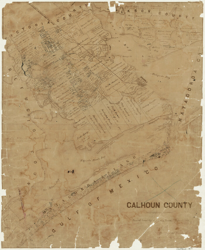
Print $20.00
- Digital $50.00
Calhoun County
1871
-
Size
22.4 x 18.3 inches
-
Map/Doc
888
-
Creation Date
1871
Calhoun County Aerial Photograph Index Sheet 1
Print $20.00
- Digital $50.00
Calhoun County Aerial Photograph Index Sheet 1
1953
-
Size
23.7 x 19.7 inches
-
Map/Doc
83670
-
Creation Date
1953
Calhoun County Aerial Photograph Index Sheet 2
Print $20.00
- Digital $50.00
Calhoun County Aerial Photograph Index Sheet 2
1953
-
Size
24.1 x 19.8 inches
-
Map/Doc
83671
-
Creation Date
1953
Calhoun County Aerial Photograph Index Sheet 3
Print $20.00
- Digital $50.00
Calhoun County Aerial Photograph Index Sheet 3
1953
-
Size
23.8 x 19.8 inches
-
Map/Doc
83672
-
Creation Date
1953
Calhoun County Aerial Photograph Index Sheet 4
Print $20.00
- Digital $50.00
Calhoun County Aerial Photograph Index Sheet 4
1953
-
Size
24.2 x 19.7 inches
-
Map/Doc
87211
-
Creation Date
1953
Calhoun County Aerial Photograph Index Sheet 5
Print $20.00
- Digital $50.00
Calhoun County Aerial Photograph Index Sheet 5
1953
-
Size
24.0 x 19.5 inches
-
Map/Doc
83673
-
Creation Date
1953
Calhoun County Aerial Photograph Index Sheet 6
Print $20.00
- Digital $50.00
Calhoun County Aerial Photograph Index Sheet 6
1953
-
Size
24.0 x 19.3 inches
-
Map/Doc
83674
-
Creation Date
1953
Calhoun County Boundary File 14
Print $58.00
- Digital $50.00
Calhoun County Boundary File 14
-
Size
11.2 x 8.8 inches
-
Map/Doc
51014
Calhoun County Boundary File 2
Print $50.00
- Digital $50.00
Calhoun County Boundary File 2
-
Size
9.1 x 7.7 inches
-
Map/Doc
50968
Calhoun County Boundary File 3
Print $8.00
- Digital $50.00
Calhoun County Boundary File 3
-
Size
11.3 x 8.7 inches
-
Map/Doc
50975
Calhoun County Boundary File 4
Print $96.00
- Digital $50.00
Calhoun County Boundary File 4
-
Size
14.3 x 8.7 inches
-
Map/Doc
50979
Calhoun County Boundary File 5
Print $10.00
- Digital $50.00
Calhoun County Boundary File 5
-
Size
14.2 x 8.8 inches
-
Map/Doc
51009
Calhoun County NRC Article 33.136 Location Key Sheet
Print $20.00
- Digital $50.00
Calhoun County NRC Article 33.136 Location Key Sheet
1973
-
Size
27.0 x 22.0 inches
-
Map/Doc
77010
-
Creation Date
1973
Calhoun County NRC Article 33.136 Location Key Sheet
Print $20.00
- Digital $50.00
Calhoun County NRC Article 33.136 Location Key Sheet
1995
-
Size
27.0 x 22.0 inches
-
Map/Doc
77011
-
Creation Date
1995
Calhoun County NRC Article 33.136 Location Key Sheet
Print $20.00
- Digital $50.00
Calhoun County NRC Article 33.136 Location Key Sheet
1973
-
Size
27.0 x 23.0 inches
-
Map/Doc
87906
-
Creation Date
1973
Calhoun County NRC Article 33.136 Location Key Sheet
Print $20.00
- Digital $50.00
Calhoun County NRC Article 33.136 Location Key Sheet
1973
-
Size
27.0 x 23.0 inches
-
Map/Doc
87907
-
Creation Date
1973