Dallam County Sketch File 16

Print $28.00
- Digital $50.00
Dallam County Sketch File 16
1993
Size: 11.5 x 8.7 inches
20390
Dallam County Working Sketch 1

Print $20.00
- Digital $50.00
Dallam County Working Sketch 1
1905
Size: 15.9 x 13.6 inches
68586
Dallam County Sketch File 15

Print $18.00
- Digital $50.00
Dallam County Sketch File 15
1990
Size: 14.4 x 9.0 inches
20381
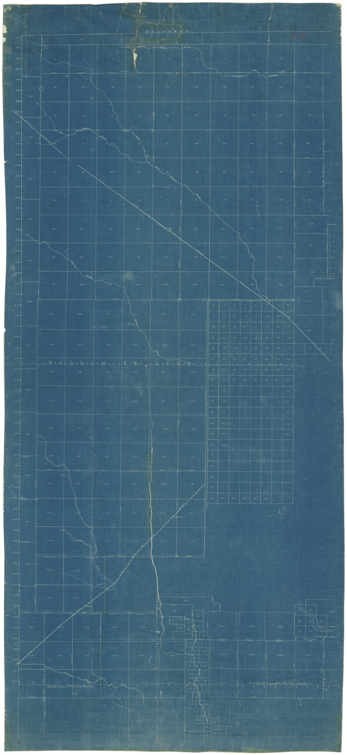
Dallam County Working Sketch 5

Print $20.00
- Digital $50.00
Dallam County Working Sketch 5
1990
Size: 39.0 x 33.1 inches
68590
Dallam County Working Sketch 4

Print $20.00
- Digital $50.00
Dallam County Working Sketch 4
1974
Size: 31.2 x 32.0 inches
68589
General Highway Map, Dallam County, Texas

Print $20.00
General Highway Map, Dallam County, Texas
1961
Size: 24.6 x 18.3 inches
79428
General Highway Map, Dallam County, Texas

Print $20.00
General Highway Map, Dallam County, Texas
1961
Size: 24.7 x 18.2 inches
79429
Dallam County Working Sketch 3

Print $20.00
- Digital $50.00
Dallam County Working Sketch 3
1960
Size: 13.8 x 30.5 inches
68588
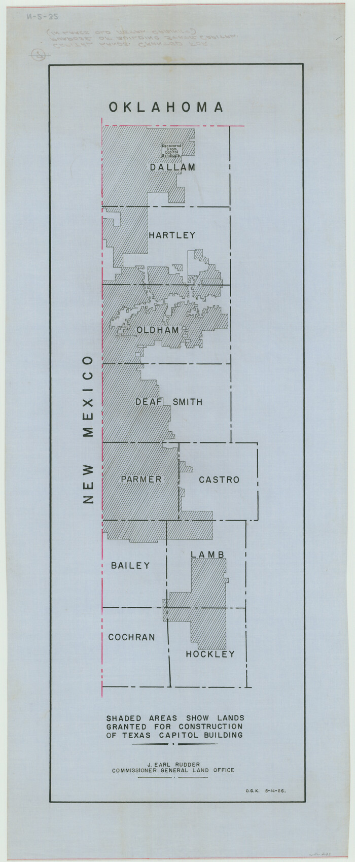
[Capitol lands granted for purpose of building State Capitol]
Print $20.00
- Digital $50.00
[Capitol lands granted for purpose of building State Capitol]
1956
Size: 31.5 x 13.0 inches
2073
Dallam County Sketch File 14

Print $4.00
- Digital $50.00
Dallam County Sketch File 14
1949
Size: 11.3 x 8.8 inches
20379
Dallam County Rolled Sketch 8

Print $20.00
- Digital $50.00
Dallam County Rolled Sketch 8
1949
Size: 37.7 x 26.3 inches
5686
General Highway Map, Dallam County, Hartley County, Texas

Print $20.00
General Highway Map, Dallam County, Hartley County, Texas
1940
Size: 18.3 x 25.1 inches
79065
Dallam County Sketch File 11

Print $4.00
- Digital $50.00
Dallam County Sketch File 11
1935
Size: 11.8 x 7.2 inches
20377
Dallam County Working Sketch Graphic Index

Print $40.00
- Digital $50.00
Dallam County Working Sketch Graphic Index
1926
Size: 41.3 x 50.9 inches
76516
Dallam County Sketch File 10

Print $20.00
- Digital $50.00
Dallam County Sketch File 10
1925
Size: 7.2 x 8.6 inches
20367
Sherman County Sketch File 3

Print $26.00
- Digital $50.00
Sherman County Sketch File 3
1925
Size: 7.7 x 8.9 inches
36675
Hartley County Sketch File 13

Print $80.00
- Digital $50.00
Hartley County Sketch File 13
1924
Size: 18.3 x 12.5 inches
26106
Chicago, Rock Island, Texas & Mexico

Print $40.00
- Digital $50.00
Chicago, Rock Island, Texas & Mexico
1920
Size: 24.8 x 122.0 inches
64421
Chicago, Rock Island, Texas & Mexico

Print $40.00
- Digital $50.00
Chicago, Rock Island, Texas & Mexico
1920
Size: 25.9 x 120.3 inches
64422
[Map showing resurvey of Capitol Leagues in Hartley & Dallam Counties, Texas]
Print $40.00
- Digital $50.00
[Map showing resurvey of Capitol Leagues in Hartley & Dallam Counties, Texas]
1918
Size: 66.9 x 31.0 inches
1753
Texas State Capitol Land

Print $40.00
- Digital $50.00
Texas State Capitol Land
1915
Size: 76.5 x 55.6 inches
93155
Dallam County Sketch File 9

Print $40.00
- Digital $50.00
Dallam County Sketch File 9
1914
Size: 9.0 x 7.7 inches
20357
[Washington County RR. Co. Block 1 and Cherokee Iron Furnace Co. Block 1]
Print $20.00
- Digital $50.00
[Washington County RR. Co. Block 1 and Cherokee Iron Furnace Co. Block 1]
1911
Size: 22.4 x 25.4 inches
92065
[Map of Surveys in Dallam, Texas]
Print $20.00
- Digital $50.00
[Map of Surveys in Dallam, Texas]
1910
Size: 19.5 x 27.8 inches
1768
Capitol Syndicate Subdivision of Capitol Land Reservation Leagues

Print $20.00
- Digital $50.00
Capitol Syndicate Subdivision of Capitol Land Reservation Leagues
1908
Size: 25.6 x 31.5 inches
92584
Hartley County Sketch File 12

Print $20.00
- Digital $50.00
Hartley County Sketch File 12
1906
Size: 16.3 x 12.4 inches
11736
Dallam County Sketch File 16
Print $28.00
- Digital $50.00
Dallam County Sketch File 16
1993
-
Size
11.5 x 8.7 inches
-
Map/Doc
20390
-
Creation Date
1993
Dallam County Working Sketch 1
Print $20.00
- Digital $50.00
Dallam County Working Sketch 1
1905
-
Size
15.9 x 13.6 inches
-
Map/Doc
68586
-
Creation Date
1905
Dallam County Sketch File 15
Print $18.00
- Digital $50.00
Dallam County Sketch File 15
1990
-
Size
14.4 x 9.0 inches
-
Map/Doc
20381
-
Creation Date
1990
Dallam County Working Sketch 5
Print $20.00
- Digital $50.00
Dallam County Working Sketch 5
1990
-
Size
39.0 x 33.1 inches
-
Map/Doc
68590
-
Creation Date
1990
Dallam County Working Sketch 4
Print $20.00
- Digital $50.00
Dallam County Working Sketch 4
1974
-
Size
31.2 x 32.0 inches
-
Map/Doc
68589
-
Creation Date
1974
General Highway Map, Dallam County, Texas
Print $20.00
General Highway Map, Dallam County, Texas
1961
-
Size
24.6 x 18.3 inches
-
Map/Doc
79428
-
Creation Date
1961
General Highway Map, Dallam County, Texas
Print $20.00
General Highway Map, Dallam County, Texas
1961
-
Size
24.7 x 18.2 inches
-
Map/Doc
79429
-
Creation Date
1961
Dallam County Working Sketch 3
Print $20.00
- Digital $50.00
Dallam County Working Sketch 3
1960
-
Size
13.8 x 30.5 inches
-
Map/Doc
68588
-
Creation Date
1960
[Capitol lands granted for purpose of building State Capitol]
Print $20.00
- Digital $50.00
[Capitol lands granted for purpose of building State Capitol]
1956
-
Size
31.5 x 13.0 inches
-
Map/Doc
2073
-
Creation Date
1956
Dallam County Sketch File 14
Print $4.00
- Digital $50.00
Dallam County Sketch File 14
1949
-
Size
11.3 x 8.8 inches
-
Map/Doc
20379
-
Creation Date
1949
Dallam County Rolled Sketch 8
Print $20.00
- Digital $50.00
Dallam County Rolled Sketch 8
1949
-
Size
37.7 x 26.3 inches
-
Map/Doc
5686
-
Creation Date
1949
General Highway Map, Dallam County, Hartley County, Texas
Print $20.00
General Highway Map, Dallam County, Hartley County, Texas
1940
-
Size
18.3 x 25.1 inches
-
Map/Doc
79065
-
Creation Date
1940
Dallam County Sketch File 11
Print $4.00
- Digital $50.00
Dallam County Sketch File 11
1935
-
Size
11.8 x 7.2 inches
-
Map/Doc
20377
-
Creation Date
1935
Dallam County

Print $40.00
- Digital $50.00
Dallam County
1926
-
Size
40.1 x 48.6 inches
-
Map/Doc
73125
-
Creation Date
1926
Dallam County

Print $20.00
- Digital $50.00
Dallam County
1926
-
Size
34.0 x 41.0 inches
-
Map/Doc
77257
-
Creation Date
1926
Dallam County Working Sketch Graphic Index
Print $40.00
- Digital $50.00
Dallam County Working Sketch Graphic Index
1926
-
Size
41.3 x 50.9 inches
-
Map/Doc
76516
-
Creation Date
1926
Northern Texas Panhandle

Northern Texas Panhandle
1926
-
Size
71.6 x 43.0 inches
-
Map/Doc
89915
-
Creation Date
1926
Dallam County

Print $40.00
- Digital $50.00
Dallam County
1926
-
Size
39.9 x 48.6 inches
-
Map/Doc
95474
-
Creation Date
1926
Dallam County Sketch File 10
Print $20.00
- Digital $50.00
Dallam County Sketch File 10
1925
-
Size
7.2 x 8.6 inches
-
Map/Doc
20367
-
Creation Date
1925
Sherman County Sketch File 3
Print $26.00
- Digital $50.00
Sherman County Sketch File 3
1925
-
Size
7.7 x 8.9 inches
-
Map/Doc
36675
-
Creation Date
1925
Hartley County Sketch File 13
Print $80.00
- Digital $50.00
Hartley County Sketch File 13
1924
-
Size
18.3 x 12.5 inches
-
Map/Doc
26106
-
Creation Date
1924
Chicago, Rock Island, Texas & Mexico
Print $40.00
- Digital $50.00
Chicago, Rock Island, Texas & Mexico
1920
-
Size
24.8 x 122.0 inches
-
Map/Doc
64421
-
Creation Date
1920
Chicago, Rock Island, Texas & Mexico
Print $40.00
- Digital $50.00
Chicago, Rock Island, Texas & Mexico
1920
-
Size
25.9 x 120.3 inches
-
Map/Doc
64422
-
Creation Date
1920
[Map showing resurvey of Capitol Leagues in Hartley & Dallam Counties, Texas]
Print $40.00
- Digital $50.00
[Map showing resurvey of Capitol Leagues in Hartley & Dallam Counties, Texas]
1918
-
Size
66.9 x 31.0 inches
-
Map/Doc
1753
-
Creation Date
1918
Texas State Capitol Land
Print $40.00
- Digital $50.00
Texas State Capitol Land
1915
-
Size
76.5 x 55.6 inches
-
Map/Doc
93155
-
Creation Date
1915
Dallam County Sketch File 9
Print $40.00
- Digital $50.00
Dallam County Sketch File 9
1914
-
Size
9.0 x 7.7 inches
-
Map/Doc
20357
-
Creation Date
1914
[Washington County RR. Co. Block 1 and Cherokee Iron Furnace Co. Block 1]
Print $20.00
- Digital $50.00
[Washington County RR. Co. Block 1 and Cherokee Iron Furnace Co. Block 1]
1911
-
Size
22.4 x 25.4 inches
-
Map/Doc
92065
-
Creation Date
1911
[Map of Surveys in Dallam, Texas]
Print $20.00
- Digital $50.00
[Map of Surveys in Dallam, Texas]
1910
-
Size
19.5 x 27.8 inches
-
Map/Doc
1768
-
Creation Date
1910
Capitol Syndicate Subdivision of Capitol Land Reservation Leagues
Print $20.00
- Digital $50.00
Capitol Syndicate Subdivision of Capitol Land Reservation Leagues
1908
-
Size
25.6 x 31.5 inches
-
Map/Doc
92584
-
Creation Date
1908
Hartley County Sketch File 12
Print $20.00
- Digital $50.00
Hartley County Sketch File 12
1906
-
Size
16.3 x 12.4 inches
-
Map/Doc
11736
-
Creation Date
1906