Cooke County Sketch File 40

Print $20.00
- Digital $50.00
Cooke County Sketch File 40
Size: 36.3 x 34.0 inches
10341
Tarrant County Sketch File 31

Print $20.00
- Digital $50.00
Tarrant County Sketch File 31
Size: 27.2 x 39.3 inches
10380
Cooke County Sketch File 3a

Print $20.00
- Digital $50.00
Cooke County Sketch File 3a
Size: 18.8 x 10.4 inches
11170
Denton County Sketch File 1

Print $2.00
- Digital $50.00
Denton County Sketch File 1
Size: 8.4 x 10.6 inches
20681
Denton County Sketch File 7

Print $8.00
- Digital $50.00
Denton County Sketch File 7
Size: 13.7 x 7.9 inches
20698
Denton County Sketch File 19

Print $10.00
- Digital $50.00
Denton County Sketch File 19
Size: 10.0 x 7.3 inches
20733
Denton County Sketch File 28

Print $4.00
- Digital $50.00
Denton County Sketch File 28
Size: 14.4 x 8.9 inches
20756
Denton County Sketch File 29 1/2

Print $4.00
- Digital $50.00
Denton County Sketch File 29 1/2
Size: 14.8 x 9.1 inches
20758
Denton County Sketch File 33

Print $4.00
- Digital $50.00
Denton County Sketch File 33
Size: 8.2 x 12.4 inches
20760
Denton County Sketch File 33a

Print $4.00
- Digital $50.00
Denton County Sketch File 33a
Size: 8.0 x 13.1 inches
20762
Denton County Boundary File 1

Print $14.00
- Digital $50.00
Denton County Boundary File 1
Size: 8.7 x 3.5 inches
52394
Denton County Boundary File 1a

Print $24.00
- Digital $50.00
Denton County Boundary File 1a
Size: 12.4 x 8.1 inches
52401
Denton County Boundary File 2

Print $22.00
- Digital $50.00
Denton County Boundary File 2
Size: 14.1 x 8.5 inches
52413
Denton County Boundary File 3

Print $34.00
- Digital $50.00
Denton County Boundary File 3
Size: 6.1 x 3.9 inches
52424
Denton County Boundary File 4 and 4a and 4b and 4c

Print $14.00
- Digital $50.00
Denton County Boundary File 4 and 4a and 4b and 4c
Size: 11.2 x 8.5 inches
52441
Denton County Boundary File 4 and 4a and 4b and 4c

Print $168.00
- Digital $50.00
Denton County Boundary File 4 and 4a and 4b and 4c
Size: 11.1 x 8.6 inches
52448
Denton County Boundary File 4 and 4a and 4b and 4c

Print $2.00
- Digital $50.00
Denton County Boundary File 4 and 4a and 4b and 4c
Size: 11.0 x 8.7 inches
52470
[Map of Located Land of Gulf, Colorado & Santa Fe Ry. Co. through Denton]
Print $40.00
- Digital $50.00
[Map of Located Land of Gulf, Colorado & Santa Fe Ry. Co. through Denton]
Size: 122.8 x 28.3 inches
64340
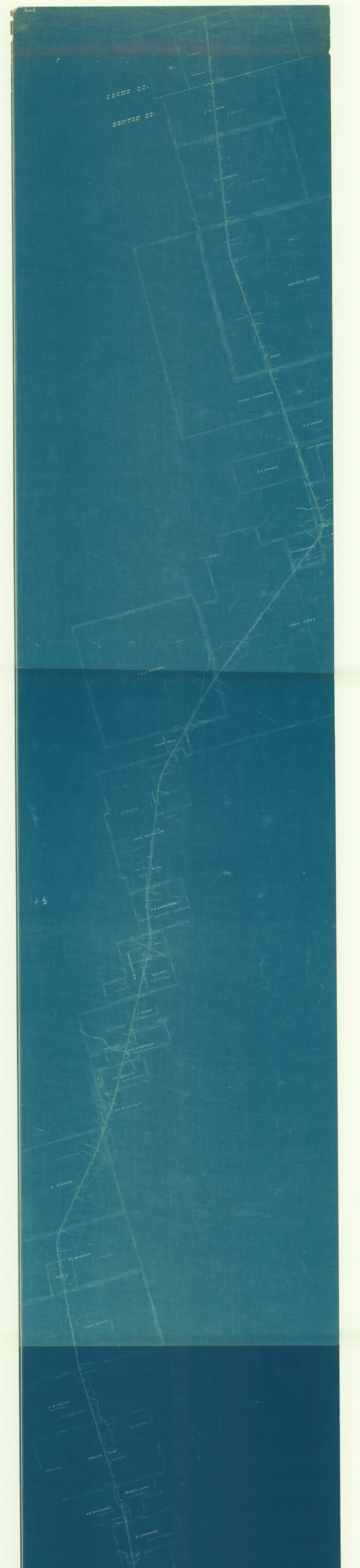
Map of Located Land of Gulf, Colorado & Santa Fe Ry. Co. through Denton

Print $40.00
- Digital $50.00
Map of Located Land of Gulf, Colorado & Santa Fe Ry. Co. through Denton
Size: 55.5 x 25.8 inches
64341
Map of the Recognised Line, M. El. P. & P. RR. from Texas & Arkansas State Line to Milam & Bexar Land District Line

Print $40.00
- Digital $50.00
Map of the Recognised Line, M. El. P. & P. RR. from Texas & Arkansas State Line to Milam & Bexar Land District Line
Size: 15.3 x 89.4 inches
64638
[Unidentified Railroad through Denton and Dallas County]

Print $40.00
- Digital $50.00
[Unidentified Railroad through Denton and Dallas County]
Size: 6.8 x 121.3 inches
64774
[Unidentified Railroad through Denton and Dallas County]

Print $40.00
- Digital $50.00
[Unidentified Railroad through Denton and Dallas County]
Size: 6.8 x 73.3 inches
64775
Denton County Working Sketch 2

Print $20.00
- Digital $50.00
Denton County Working Sketch 2
Size: 21.2 x 17.7 inches
68607
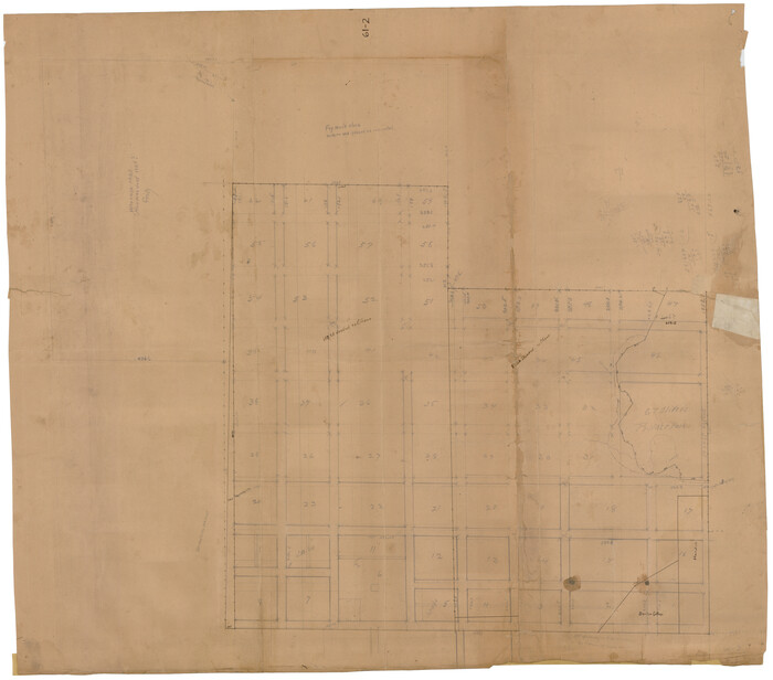
Denton County Working Sketch 32

Print $20.00
- Digital $50.00
Denton County Working Sketch 32
Size: 35.1 x 32.0 inches
68637
Map of Denton County, Texas

Print $20.00
- Digital $50.00
Map of Denton County, Texas
Size: 22.8 x 19.4 inches
711
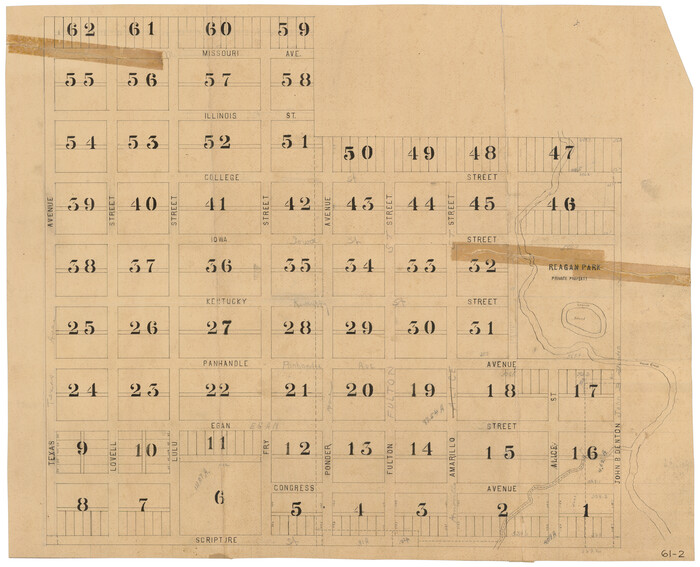
[Scripture Addition to the City of Denton]
Print $20.00
- Digital $50.00
[Scripture Addition to the City of Denton]
Size: 35.4 x 31.4 inches
90586
[Scripture Addition to the City of Denton]
Print $20.00
- Digital $50.00
[Scripture Addition to the City of Denton]
Size: 27.3 x 22.0 inches
90587
Map of the Scripture Addition to the City of Denton

Print $20.00
- Digital $50.00
Map of the Scripture Addition to the City of Denton
Size: 31.5 x 27.8 inches
90589
[Surveys along Trinity River]
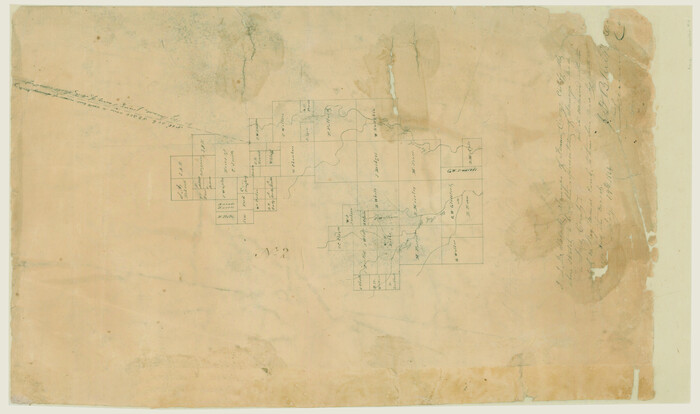
Print $20.00
- Digital $50.00
[Surveys along Trinity River]
1844
Size: 21.4 x 12.6 inches
7
Map of Fannin County

Print $20.00
- Digital $50.00
Map of Fannin County
1845
Size: 34.7 x 47.0 inches
87153
Cooke County Sketch File 40
Print $20.00
- Digital $50.00
Cooke County Sketch File 40
-
Size
36.3 x 34.0 inches
-
Map/Doc
10341
Tarrant County Sketch File 31
Print $20.00
- Digital $50.00
Tarrant County Sketch File 31
-
Size
27.2 x 39.3 inches
-
Map/Doc
10380
Cooke County Sketch File 3a
Print $20.00
- Digital $50.00
Cooke County Sketch File 3a
-
Size
18.8 x 10.4 inches
-
Map/Doc
11170
Denton County Sketch File 1
Print $2.00
- Digital $50.00
Denton County Sketch File 1
-
Size
8.4 x 10.6 inches
-
Map/Doc
20681
Denton County Sketch File 7
Print $8.00
- Digital $50.00
Denton County Sketch File 7
-
Size
13.7 x 7.9 inches
-
Map/Doc
20698
Denton County Sketch File 19
Print $10.00
- Digital $50.00
Denton County Sketch File 19
-
Size
10.0 x 7.3 inches
-
Map/Doc
20733
Denton County Sketch File 28
Print $4.00
- Digital $50.00
Denton County Sketch File 28
-
Size
14.4 x 8.9 inches
-
Map/Doc
20756
Denton County Sketch File 29 1/2
Print $4.00
- Digital $50.00
Denton County Sketch File 29 1/2
-
Size
14.8 x 9.1 inches
-
Map/Doc
20758
Denton County Sketch File 33
Print $4.00
- Digital $50.00
Denton County Sketch File 33
-
Size
8.2 x 12.4 inches
-
Map/Doc
20760
Denton County Sketch File 33a
Print $4.00
- Digital $50.00
Denton County Sketch File 33a
-
Size
8.0 x 13.1 inches
-
Map/Doc
20762
Denton County Boundary File 1
Print $14.00
- Digital $50.00
Denton County Boundary File 1
-
Size
8.7 x 3.5 inches
-
Map/Doc
52394
Denton County Boundary File 1a
Print $24.00
- Digital $50.00
Denton County Boundary File 1a
-
Size
12.4 x 8.1 inches
-
Map/Doc
52401
Denton County Boundary File 2
Print $22.00
- Digital $50.00
Denton County Boundary File 2
-
Size
14.1 x 8.5 inches
-
Map/Doc
52413
Denton County Boundary File 3
Print $34.00
- Digital $50.00
Denton County Boundary File 3
-
Size
6.1 x 3.9 inches
-
Map/Doc
52424
Denton County Boundary File 4 and 4a and 4b and 4c
Print $14.00
- Digital $50.00
Denton County Boundary File 4 and 4a and 4b and 4c
-
Size
11.2 x 8.5 inches
-
Map/Doc
52441
Denton County Boundary File 4 and 4a and 4b and 4c
Print $168.00
- Digital $50.00
Denton County Boundary File 4 and 4a and 4b and 4c
-
Size
11.1 x 8.6 inches
-
Map/Doc
52448
Denton County Boundary File 4 and 4a and 4b and 4c
Print $2.00
- Digital $50.00
Denton County Boundary File 4 and 4a and 4b and 4c
-
Size
11.0 x 8.7 inches
-
Map/Doc
52470
[Map of Located Land of Gulf, Colorado & Santa Fe Ry. Co. through Denton]
Print $40.00
- Digital $50.00
[Map of Located Land of Gulf, Colorado & Santa Fe Ry. Co. through Denton]
-
Size
122.8 x 28.3 inches
-
Map/Doc
64340
Map of Located Land of Gulf, Colorado & Santa Fe Ry. Co. through Denton
Print $40.00
- Digital $50.00
Map of Located Land of Gulf, Colorado & Santa Fe Ry. Co. through Denton
-
Size
55.5 x 25.8 inches
-
Map/Doc
64341
Map of the Recognised Line, M. El. P. & P. RR. from Texas & Arkansas State Line to Milam & Bexar Land District Line
Print $40.00
- Digital $50.00
Map of the Recognised Line, M. El. P. & P. RR. from Texas & Arkansas State Line to Milam & Bexar Land District Line
-
Size
15.3 x 89.4 inches
-
Map/Doc
64638
[Unidentified Railroad through Denton and Dallas County]
Print $40.00
- Digital $50.00
[Unidentified Railroad through Denton and Dallas County]
-
Size
6.8 x 121.3 inches
-
Map/Doc
64774
[Unidentified Railroad through Denton and Dallas County]
Print $40.00
- Digital $50.00
[Unidentified Railroad through Denton and Dallas County]
-
Size
6.8 x 73.3 inches
-
Map/Doc
64775
Denton County Working Sketch 2
Print $20.00
- Digital $50.00
Denton County Working Sketch 2
-
Size
21.2 x 17.7 inches
-
Map/Doc
68607
Denton County Working Sketch 32
Print $20.00
- Digital $50.00
Denton County Working Sketch 32
-
Size
35.1 x 32.0 inches
-
Map/Doc
68637
Map of Denton County, Texas
Print $20.00
- Digital $50.00
Map of Denton County, Texas
-
Size
22.8 x 19.4 inches
-
Map/Doc
711
[Scripture Addition to the City of Denton]
Print $20.00
- Digital $50.00
[Scripture Addition to the City of Denton]
-
Size
35.4 x 31.4 inches
-
Map/Doc
90586
[Scripture Addition to the City of Denton]
Print $20.00
- Digital $50.00
[Scripture Addition to the City of Denton]
-
Size
27.3 x 22.0 inches
-
Map/Doc
90587
Map of the Scripture Addition to the City of Denton
Print $20.00
- Digital $50.00
Map of the Scripture Addition to the City of Denton
-
Size
31.5 x 27.8 inches
-
Map/Doc
90589
[Surveys along Trinity River]
Print $20.00
- Digital $50.00
[Surveys along Trinity River]
1844
-
Size
21.4 x 12.6 inches
-
Map/Doc
7
-
Creation Date
1844
Map of Fannin County
Print $20.00
- Digital $50.00
Map of Fannin County
1845
-
Size
34.7 x 47.0 inches
-
Map/Doc
87153
-
Creation Date
1845