Ward County Rolled Sketch A

Print $40.00
- Digital $50.00
Ward County Rolled Sketch A
Size: 42.6 x 56.3 inches
10099
Ward County Rolled Sketch 4

Print $20.00
- Digital $50.00
Ward County Rolled Sketch 4
Size: 39.3 x 47.2 inches
10102
Midland County Sketch File M

Print $20.00
- Digital $50.00
Midland County Sketch File M
Size: 18.5 x 14.9 inches
12090
Crane County Sketch File 27

Print $6.00
- Digital $50.00
Crane County Sketch File 27
Size: 11.5 x 9.3 inches
19603
Ector County Sketch File 11

Print $4.00
- Digital $50.00
Ector County Sketch File 11
Size: 11.3 x 9.0 inches
21643

Ector County Rolled Sketch 12

Print $38.00
- Digital $50.00
Ector County Rolled Sketch 12
Size: 10.1 x 15.4 inches
44314
Ector County Boundary File 1

Print $10.00
- Digital $50.00
Ector County Boundary File 1
Size: 13.3 x 8.4 inches
52829
Ector County Boundary File 2

Print $4.00
- Digital $50.00
Ector County Boundary File 2
Size: 13.2 x 8.2 inches
52834
Ector County Boundary File 3

Print $18.00
- Digital $50.00
Ector County Boundary File 3
Size: 9.0 x 4.4 inches
52836
Ector County Boundary File 4

Print $4.00
- Digital $50.00
Ector County Boundary File 4
Size: 13.3 x 8.2 inches
52845
Ector County Boundary File 5

Print $12.00
- Digital $50.00
Ector County Boundary File 5
Size: 14.3 x 8.8 inches
52847
Ector County Rolled Sketch WA

Print $20.00
- Digital $50.00
Ector County Rolled Sketch WA
Size: 26.2 x 30.0 inches
5780
Midland County Rolled Sketch 11

Print $20.00
- Digital $50.00
Midland County Rolled Sketch 11
Size: 45.7 x 26.2 inches
6767
Ector County Working Sketch 21

Print $40.00
- Digital $50.00
Ector County Working Sketch 21
Size: 41.3 x 117.7 inches
68864
Ector County Working Sketch 27

Print $20.00
- Digital $50.00
Ector County Working Sketch 27
Size: 28.0 x 32.7 inches
68870
Map of lands owned by R.E. Montgomery in Martin and Andrews County, Texas

Print $20.00
- Digital $50.00
Map of lands owned by R.E. Montgomery in Martin and Andrews County, Texas
Size: 20.0 x 24.5 inches
75764
Lands of Gunter & Munson and Maddox Bros. & Anderson, Tom Green Co. Tex.

Print $20.00
- Digital $50.00
Lands of Gunter & Munson and Maddox Bros. & Anderson, Tom Green Co. Tex.
Size: 20.4 x 30.7 inches
75787
Andrews County Rolled Sketch 42

Print $20.00
- Digital $50.00
Andrews County Rolled Sketch 42
Size: 27.3 x 36.0 inches
77182
PSL Field Notes for Blocks B14 and B16 in Crane and Ector Counties, Blocks B18 and B20 in Crane and Ward Counties, and Blocks B17, B21, B22, B23, B24, B25, and B26 in Crane County

PSL Field Notes for Blocks B14 and B16 in Crane and Ector Counties, Blocks B18 and B20 in Crane and Ward Counties, and Blocks B17, B21, B22, B23, B24, B25, and B26 in Crane County
81646
PSL Field Notes for Block B13 in Crane, Ector, Ward, and Winkler Counties, Blocks B14 and B16 in Crane and Ector Counties, Blocks B7 and B8 in Ector and Winkler Counties and Block B15 in Ector County

PSL Field Notes for Block B13 in Crane, Ector, Ward, and Winkler Counties, Blocks B14 and B16 in Crane and Ector Counties, Blocks B7 and B8 in Ector and Winkler Counties and Block B15 in Ector County
81651
State University and PSL Blocks 1 through 77 in Andrews, Culberson, Crane, Ector, El Paso, Gaines, Loving, Martin, Reeves, Tom Green, Ward County, and Winkler Counties

State University and PSL Blocks 1 through 77 in Andrews, Culberson, Crane, Ector, El Paso, Gaines, Loving, Martin, Reeves, Tom Green, Ward County, and Winkler Counties
81652
PSL Field Notes for Block B9 in Ector and Winkler Counties, Block B13 in Ector, Ward, and Winkler Counties, and Blocks A55, A56, A57, B1, B2, B3, B5, B6, B7, B10, B11, and B12 in Winkler County

PSL Field Notes for Block B9 in Ector and Winkler Counties, Block B13 in Ector, Ward, and Winkler Counties, and Blocks A55, A56, A57, B1, B2, B3, B5, B6, B7, B10, B11, and B12 in Winkler County
81676
University Land Field Notes for Block 35 in Crane and Ector Counties

University Land Field Notes for Block 35 in Crane and Ector Counties
81714
Winkler County Rolled Sketch 14

Print $20.00
- Digital $50.00
Winkler County Rolled Sketch 14
Size: 25.9 x 38.4 inches
8275
[Sketch showing Blocks B17-B29 and vicinity]
Print $40.00
- Digital $50.00
[Sketch showing Blocks B17-B29 and vicinity]
Size: 61.8 x 28.6 inches
89732
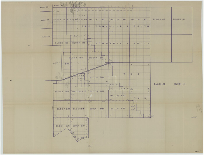
[T. & P. "B" Blocks, Tsp. 1S, Tsp. 2S, Tsp. 3S. And Tsp. 4S]
Print $40.00
- Digital $50.00
[T. & P. "B" Blocks, Tsp. 1S, Tsp. 2S, Tsp. 3S. And Tsp. 4S]
Size: 56.1 x 43.3 inches
89774
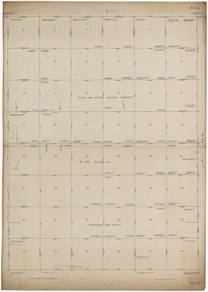
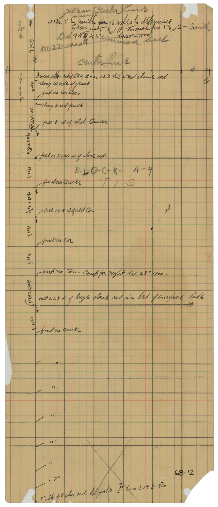
[Texas and Pacific Railway Company, Block 44, Township One South]
Print $40.00
- Digital $50.00
[Texas and Pacific Railway Company, Block 44, Township One South]
Size: 42.0 x 59.2 inches
89845
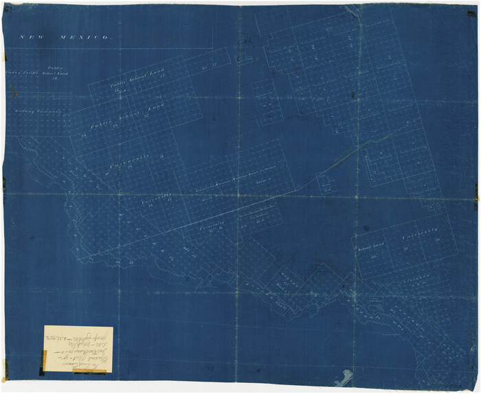
[Sketch showing unsurveyed land in West Texas as of 1902]
Print $20.00
- Digital $50.00
[Sketch showing unsurveyed land in West Texas as of 1902]
Size: 42.0 x 34.0 inches
89937
[T. & P. Block 44, Township 1S]
Print $20.00
- Digital $50.00
[T. & P. Block 44, Township 1S]
Size: 10.4 x 23.2 inches
90814
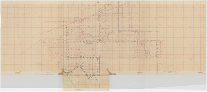
Ward County Rolled Sketch A
Print $40.00
- Digital $50.00
Ward County Rolled Sketch A
-
Size
42.6 x 56.3 inches
-
Map/Doc
10099
Ward County Rolled Sketch 4
Print $20.00
- Digital $50.00
Ward County Rolled Sketch 4
-
Size
39.3 x 47.2 inches
-
Map/Doc
10102
Midland County Sketch File M
Print $20.00
- Digital $50.00
Midland County Sketch File M
-
Size
18.5 x 14.9 inches
-
Map/Doc
12090
Crane County Sketch File 27
Print $6.00
- Digital $50.00
Crane County Sketch File 27
-
Size
11.5 x 9.3 inches
-
Map/Doc
19603
Ector County Sketch File 11
Print $4.00
- Digital $50.00
Ector County Sketch File 11
-
Size
11.3 x 9.0 inches
-
Map/Doc
21643
Ector County Rolled Sketch 12
Print $38.00
- Digital $50.00
Ector County Rolled Sketch 12
-
Size
10.1 x 15.4 inches
-
Map/Doc
44314
Ector County Boundary File 1
Print $10.00
- Digital $50.00
Ector County Boundary File 1
-
Size
13.3 x 8.4 inches
-
Map/Doc
52829
Ector County Boundary File 2
Print $4.00
- Digital $50.00
Ector County Boundary File 2
-
Size
13.2 x 8.2 inches
-
Map/Doc
52834
Ector County Boundary File 3
Print $18.00
- Digital $50.00
Ector County Boundary File 3
-
Size
9.0 x 4.4 inches
-
Map/Doc
52836
Ector County Boundary File 4
Print $4.00
- Digital $50.00
Ector County Boundary File 4
-
Size
13.3 x 8.2 inches
-
Map/Doc
52845
Ector County Boundary File 5
Print $12.00
- Digital $50.00
Ector County Boundary File 5
-
Size
14.3 x 8.8 inches
-
Map/Doc
52847
Ector County Rolled Sketch WA
Print $20.00
- Digital $50.00
Ector County Rolled Sketch WA
-
Size
26.2 x 30.0 inches
-
Map/Doc
5780
Midland County Rolled Sketch 11
Print $20.00
- Digital $50.00
Midland County Rolled Sketch 11
-
Size
45.7 x 26.2 inches
-
Map/Doc
6767
Ector County Working Sketch 21
Print $40.00
- Digital $50.00
Ector County Working Sketch 21
-
Size
41.3 x 117.7 inches
-
Map/Doc
68864
Ector County Working Sketch 27
Print $20.00
- Digital $50.00
Ector County Working Sketch 27
-
Size
28.0 x 32.7 inches
-
Map/Doc
68870
Map of lands owned by R.E. Montgomery in Martin and Andrews County, Texas
Print $20.00
- Digital $50.00
Map of lands owned by R.E. Montgomery in Martin and Andrews County, Texas
-
Size
20.0 x 24.5 inches
-
Map/Doc
75764
Lands of Gunter & Munson and Maddox Bros. & Anderson, Tom Green Co. Tex.
Print $20.00
- Digital $50.00
Lands of Gunter & Munson and Maddox Bros. & Anderson, Tom Green Co. Tex.
-
Size
20.4 x 30.7 inches
-
Map/Doc
75787
Andrews County Rolled Sketch 42
Print $20.00
- Digital $50.00
Andrews County Rolled Sketch 42
-
Size
27.3 x 36.0 inches
-
Map/Doc
77182
PSL Field Notes for Blocks B14 and B16 in Crane and Ector Counties, Blocks B18 and B20 in Crane and Ward Counties, and Blocks B17, B21, B22, B23, B24, B25, and B26 in Crane County
PSL Field Notes for Blocks B14 and B16 in Crane and Ector Counties, Blocks B18 and B20 in Crane and Ward Counties, and Blocks B17, B21, B22, B23, B24, B25, and B26 in Crane County
-
Map/Doc
81646
PSL Field Notes for Block B13 in Crane, Ector, Ward, and Winkler Counties, Blocks B14 and B16 in Crane and Ector Counties, Blocks B7 and B8 in Ector and Winkler Counties and Block B15 in Ector County
PSL Field Notes for Block B13 in Crane, Ector, Ward, and Winkler Counties, Blocks B14 and B16 in Crane and Ector Counties, Blocks B7 and B8 in Ector and Winkler Counties and Block B15 in Ector County
-
Map/Doc
81651
State University and PSL Blocks 1 through 77 in Andrews, Culberson, Crane, Ector, El Paso, Gaines, Loving, Martin, Reeves, Tom Green, Ward County, and Winkler Counties
State University and PSL Blocks 1 through 77 in Andrews, Culberson, Crane, Ector, El Paso, Gaines, Loving, Martin, Reeves, Tom Green, Ward County, and Winkler Counties
-
Map/Doc
81652
PSL Field Notes for Block B9 in Ector and Winkler Counties, Block B13 in Ector, Ward, and Winkler Counties, and Blocks A55, A56, A57, B1, B2, B3, B5, B6, B7, B10, B11, and B12 in Winkler County
PSL Field Notes for Block B9 in Ector and Winkler Counties, Block B13 in Ector, Ward, and Winkler Counties, and Blocks A55, A56, A57, B1, B2, B3, B5, B6, B7, B10, B11, and B12 in Winkler County
-
Map/Doc
81676
University Land Field Notes for Block 35 in Crane and Ector Counties
University Land Field Notes for Block 35 in Crane and Ector Counties
-
Map/Doc
81714
Winkler County Rolled Sketch 14
Print $20.00
- Digital $50.00
Winkler County Rolled Sketch 14
-
Size
25.9 x 38.4 inches
-
Map/Doc
8275
[Sketch showing Blocks B17-B29 and vicinity]
Print $40.00
- Digital $50.00
[Sketch showing Blocks B17-B29 and vicinity]
-
Size
61.8 x 28.6 inches
-
Map/Doc
89732
[T. & P. "B" Blocks, Tsp. 1S, Tsp. 2S, Tsp. 3S. And Tsp. 4S]
Print $40.00
- Digital $50.00
[T. & P. "B" Blocks, Tsp. 1S, Tsp. 2S, Tsp. 3S. And Tsp. 4S]
-
Size
56.1 x 43.3 inches
-
Map/Doc
89774
[Texas and Pacific Railway Company, Block 44, Township One South]
Print $40.00
- Digital $50.00
[Texas and Pacific Railway Company, Block 44, Township One South]
-
Size
42.0 x 59.2 inches
-
Map/Doc
89845
[Sketch showing unsurveyed land in West Texas as of 1902]
Print $20.00
- Digital $50.00
[Sketch showing unsurveyed land in West Texas as of 1902]
-
Size
42.0 x 34.0 inches
-
Map/Doc
89937
[T. & P. Block 44, Township 1S]
Print $20.00
- Digital $50.00
[T. & P. Block 44, Township 1S]
-
Size
10.4 x 23.2 inches
-
Map/Doc
90814