Galveston County Rolled Sketch 27

Print $20.00
- Digital $50.00
Galveston County Rolled Sketch 27
1978
Size: 29.6 x 33.3 inches
10301
Galveston County Sketch File 29

Print $40.00
- Digital $50.00
Galveston County Sketch File 29
Size: 35.1 x 29.3 inches
10454
Galveston County Sketch File 30

Print $20.00
- Digital $50.00
Galveston County Sketch File 30
1915
Size: 43.0 x 30.7 inches
10455
Galveston County Sketch File 44

Print $20.00
- Digital $50.00
Galveston County Sketch File 44
1959
Size: 25.2 x 38.8 inches
10456
Galveston County Sketch File 51

Print $20.00
- Digital $50.00
Galveston County Sketch File 51
1895
Size: 25.7 x 40.2 inches
10457
Galveston County Sketch File 58

Print $20.00
- Digital $50.00
Galveston County Sketch File 58
1984
Size: 47.1 x 38.3 inches
10458
Galveston County Sketch File 73f

Print $20.00
- Digital $50.00
Galveston County Sketch File 73f
Size: 33.1 x 40.3 inches
10459
Galveston County Sketch File 73g

Print $20.00
- Digital $50.00
Galveston County Sketch File 73g
Size: 32.1 x 41.2 inches
10460
Galveston County Sketch File 73h

Print $20.00
- Digital $50.00
Galveston County Sketch File 73h
Size: 29.4 x 36.8 inches
10461
Harris County Sketch File 92

Print $20.00
- Digital $50.00
Harris County Sketch File 92
1932
Size: 37.9 x 35.0 inches
10483
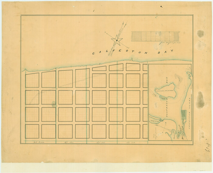
[Town lots on Galveston Island]
Print $20.00
- Digital $50.00
[Town lots on Galveston Island]
1839
Size: 18.8 x 23.0 inches
11
Chambers County Sketch File 24

Print $20.00
- Digital $50.00
Chambers County Sketch File 24
1909
Size: 34.1 x 14.5 inches
11065
Galveston County Sketch File 13

Print $20.00
- Digital $50.00
Galveston County Sketch File 13
Size: 16.2 x 12.5 inches
11530
Galveston County Sketch File 24

Print $20.00
- Digital $50.00
Galveston County Sketch File 24
Size: 15.8 x 18.1 inches
11531
Galveston County Sketch File 27

Print $20.00
- Digital $50.00
Galveston County Sketch File 27
Size: 18.3 x 30.0 inches
11532
Galveston County Sketch File 31

Print $20.00
- Digital $50.00
Galveston County Sketch File 31
1916
Size: 23.7 x 13.6 inches
11534
Galveston County Sketch File 32

Print $20.00
- Digital $50.00
Galveston County Sketch File 32
1916
Size: 15.2 x 34.3 inches
11535
Galveston County Sketch File 34

Print $20.00
- Digital $50.00
Galveston County Sketch File 34
1934
Size: 11.5 x 20.1 inches
11536
Galveston County Sketch File 34a

Print $20.00
- Digital $50.00
Galveston County Sketch File 34a
Size: 11.4 x 20.3 inches
11537
Galveston County Sketch File 42

Print $20.00
- Digital $50.00
Galveston County Sketch File 42
1899
Size: 23.9 x 23.7 inches
11538
Galveston County Sketch File 43

Print $40.00
- Digital $50.00
Galveston County Sketch File 43
1915
Size: 19.4 x 15.1 inches
11539
Galveston County Sketch File 45

Print $20.00
- Digital $50.00
Galveston County Sketch File 45
1930
Size: 19.5 x 23.2 inches
11540
Galveston County Sketch File 46

Print $20.00
- Digital $50.00
Galveston County Sketch File 46
1912
Size: 14.0 x 34.1 inches
11541
Galveston County Sketch File 64

Print $44.00
- Digital $50.00
Galveston County Sketch File 64
1984
Size: 31.5 x 25.5 inches
11542
Galveston County Sketch File 73I

Print $20.00
- Digital $50.00
Galveston County Sketch File 73I
Size: 31.5 x 26.0 inches
11543
Brazoria County Sketch File 1a

Print $6.00
- Digital $50.00
Brazoria County Sketch File 1a
1861
Size: 12.5 x 11.5 inches
14918
Brazoria County Sketch File 6

Print $42.00
- Digital $50.00
Brazoria County Sketch File 6
Size: 9.0 x 7.1 inches
14931
Brazoria County Sketch File 10

Print $40.00
- Digital $50.00
Brazoria County Sketch File 10
Size: 16.4 x 12.7 inches
14938
Brazoria County Sketch File 23

Print $40.00
- Digital $50.00
Brazoria County Sketch File 23
Size: 12.7 x 12.2 inches
15020
Brazoria County Sketch File 24

Print $6.00
- Digital $50.00
Brazoria County Sketch File 24
1868
Size: 11.3 x 10.4 inches
15022
Galveston County Rolled Sketch 27
Print $20.00
- Digital $50.00
Galveston County Rolled Sketch 27
1978
-
Size
29.6 x 33.3 inches
-
Map/Doc
10301
-
Creation Date
1978
Galveston County Sketch File 29
Print $40.00
- Digital $50.00
Galveston County Sketch File 29
-
Size
35.1 x 29.3 inches
-
Map/Doc
10454
Galveston County Sketch File 30
Print $20.00
- Digital $50.00
Galveston County Sketch File 30
1915
-
Size
43.0 x 30.7 inches
-
Map/Doc
10455
-
Creation Date
1915
Galveston County Sketch File 44
Print $20.00
- Digital $50.00
Galveston County Sketch File 44
1959
-
Size
25.2 x 38.8 inches
-
Map/Doc
10456
-
Creation Date
1959
Galveston County Sketch File 51
Print $20.00
- Digital $50.00
Galveston County Sketch File 51
1895
-
Size
25.7 x 40.2 inches
-
Map/Doc
10457
-
Creation Date
1895
Galveston County Sketch File 58
Print $20.00
- Digital $50.00
Galveston County Sketch File 58
1984
-
Size
47.1 x 38.3 inches
-
Map/Doc
10458
-
Creation Date
1984
Galveston County Sketch File 73f
Print $20.00
- Digital $50.00
Galveston County Sketch File 73f
-
Size
33.1 x 40.3 inches
-
Map/Doc
10459
Galveston County Sketch File 73g
Print $20.00
- Digital $50.00
Galveston County Sketch File 73g
-
Size
32.1 x 41.2 inches
-
Map/Doc
10460
Galveston County Sketch File 73h
Print $20.00
- Digital $50.00
Galveston County Sketch File 73h
-
Size
29.4 x 36.8 inches
-
Map/Doc
10461
Harris County Sketch File 92
Print $20.00
- Digital $50.00
Harris County Sketch File 92
1932
-
Size
37.9 x 35.0 inches
-
Map/Doc
10483
-
Creation Date
1932
[Town lots on Galveston Island]
Print $20.00
- Digital $50.00
[Town lots on Galveston Island]
1839
-
Size
18.8 x 23.0 inches
-
Map/Doc
11
-
Creation Date
1839
Chambers County Sketch File 24
Print $20.00
- Digital $50.00
Chambers County Sketch File 24
1909
-
Size
34.1 x 14.5 inches
-
Map/Doc
11065
-
Creation Date
1909
Galveston County Sketch File 13
Print $20.00
- Digital $50.00
Galveston County Sketch File 13
-
Size
16.2 x 12.5 inches
-
Map/Doc
11530
Galveston County Sketch File 24
Print $20.00
- Digital $50.00
Galveston County Sketch File 24
-
Size
15.8 x 18.1 inches
-
Map/Doc
11531
Galveston County Sketch File 27
Print $20.00
- Digital $50.00
Galveston County Sketch File 27
-
Size
18.3 x 30.0 inches
-
Map/Doc
11532
Galveston County Sketch File 31
Print $20.00
- Digital $50.00
Galveston County Sketch File 31
1916
-
Size
23.7 x 13.6 inches
-
Map/Doc
11534
-
Creation Date
1916
Galveston County Sketch File 32
Print $20.00
- Digital $50.00
Galveston County Sketch File 32
1916
-
Size
15.2 x 34.3 inches
-
Map/Doc
11535
-
Creation Date
1916
Galveston County Sketch File 34
Print $20.00
- Digital $50.00
Galveston County Sketch File 34
1934
-
Size
11.5 x 20.1 inches
-
Map/Doc
11536
-
Creation Date
1934
Galveston County Sketch File 34a
Print $20.00
- Digital $50.00
Galveston County Sketch File 34a
-
Size
11.4 x 20.3 inches
-
Map/Doc
11537
Galveston County Sketch File 42
Print $20.00
- Digital $50.00
Galveston County Sketch File 42
1899
-
Size
23.9 x 23.7 inches
-
Map/Doc
11538
-
Creation Date
1899
Galveston County Sketch File 43
Print $40.00
- Digital $50.00
Galveston County Sketch File 43
1915
-
Size
19.4 x 15.1 inches
-
Map/Doc
11539
-
Creation Date
1915
Galveston County Sketch File 45
Print $20.00
- Digital $50.00
Galveston County Sketch File 45
1930
-
Size
19.5 x 23.2 inches
-
Map/Doc
11540
-
Creation Date
1930
Galveston County Sketch File 46
Print $20.00
- Digital $50.00
Galveston County Sketch File 46
1912
-
Size
14.0 x 34.1 inches
-
Map/Doc
11541
-
Creation Date
1912
Galveston County Sketch File 64
Print $44.00
- Digital $50.00
Galveston County Sketch File 64
1984
-
Size
31.5 x 25.5 inches
-
Map/Doc
11542
-
Creation Date
1984
Galveston County Sketch File 73I
Print $20.00
- Digital $50.00
Galveston County Sketch File 73I
-
Size
31.5 x 26.0 inches
-
Map/Doc
11543
Brazoria County Sketch File 1a
Print $6.00
- Digital $50.00
Brazoria County Sketch File 1a
1861
-
Size
12.5 x 11.5 inches
-
Map/Doc
14918
-
Creation Date
1861
Brazoria County Sketch File 6
Print $42.00
- Digital $50.00
Brazoria County Sketch File 6
-
Size
9.0 x 7.1 inches
-
Map/Doc
14931
Brazoria County Sketch File 10
Print $40.00
- Digital $50.00
Brazoria County Sketch File 10
-
Size
16.4 x 12.7 inches
-
Map/Doc
14938
Brazoria County Sketch File 23
Print $40.00
- Digital $50.00
Brazoria County Sketch File 23
-
Size
12.7 x 12.2 inches
-
Map/Doc
15020
Brazoria County Sketch File 24
Print $6.00
- Digital $50.00
Brazoria County Sketch File 24
1868
-
Size
11.3 x 10.4 inches
-
Map/Doc
15022
-
Creation Date
1868