Surveys on the Coleto Creek, Goliad County

Print $20.00
- Digital $50.00
Surveys on the Coleto Creek, Goliad County
1841
Size: 13.8 x 14.9 inches
10
Goliad County Sketch File A

Print $20.00
- Digital $50.00
Goliad County Sketch File A
1897
Size: 30.6 x 32.9 inches
10465
Goliad County Sketch File 27

Print $20.00
- Digital $50.00
Goliad County Sketch File 27
Size: 19.0 x 24.4 inches
11568
Goliad County Sketch File 28

Print $20.00
- Digital $50.00
Goliad County Sketch File 28
Size: 18.9 x 15.5 inches
11569
Goliad County Sketch File 35

Print $20.00
- Digital $50.00
Goliad County Sketch File 35
1924
Size: 22.8 x 27.6 inches
11570
Goliad County Sketch File 36

Print $20.00
- Digital $50.00
Goliad County Sketch File 36
1925
Size: 17.1 x 14.1 inches
11571
Goliad County Sketch File 40

Print $20.00
- Digital $50.00
Goliad County Sketch File 40
1949
Size: 23.9 x 36.0 inches
11572
Goliad County Sketch File 41

Print $20.00
- Digital $50.00
Goliad County Sketch File 41
1958
Size: 25.2 x 35.3 inches
11573
Goliad County Sketch File Y

Print $20.00
- Digital $50.00
Goliad County Sketch File Y
1894
Size: 14.1 x 12.1 inches
11574
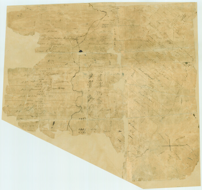
[Surveys in Power and Hewetson's Colony]
Print $20.00
- Digital $50.00
[Surveys in Power and Hewetson's Colony]
1830
Size: 21.3 x 22.5 inches
2
DeWitt County Sketch File 1

Print $11.00
- Digital $50.00
DeWitt County Sketch File 1
1851
Size: 8.4 x 8.2 inches
20794
Goliad County Sketch File 1

Print $24.00
- Digital $50.00
Goliad County Sketch File 1
1857
Size: 12.5 x 7.5 inches
24211
Goliad County Sketch File 3

Print $4.00
- Digital $50.00
Goliad County Sketch File 3
1852
Size: 12.4 x 8.2 inches
24214
Goliad County Sketch File 4

Print $6.00
- Digital $50.00
Goliad County Sketch File 4
1857
Size: 7.7 x 12.3 inches
24216
Goliad County Sketch File 5

Print $6.00
- Digital $50.00
Goliad County Sketch File 5
Size: 15.9 x 10.2 inches
24218
Goliad County Sketch File 6

Print $2.00
- Digital $50.00
Goliad County Sketch File 6
1857
Size: 8.8 x 4.9 inches
24220
Goliad County Sketch File 8

Print $4.00
- Digital $50.00
Goliad County Sketch File 8
1848
Size: 9.0 x 11.1 inches
24221
Goliad County Sketch File 9

Print $6.00
- Digital $50.00
Goliad County Sketch File 9
1849
Size: 8.1 x 10.1 inches
24223
Goliad County Sketch File 10

Print $4.00
- Digital $50.00
Goliad County Sketch File 10
1859
Size: 9.3 x 8.1 inches
24226
Goliad County Sketch File 11

Print $40.00
- Digital $50.00
Goliad County Sketch File 11
Size: 13.4 x 12.5 inches
24228
Goliad County Sketch File 12

Print $18.00
- Digital $50.00
Goliad County Sketch File 12
1857
Size: 12.9 x 7.9 inches
24230
Goliad County Sketch File 13

Print $8.00
- Digital $50.00
Goliad County Sketch File 13
1856
Size: 12.4 x 8.0 inches
24239
Goliad County Sketch File 14

Print $4.00
- Digital $50.00
Goliad County Sketch File 14
1878
Size: 8.6 x 11.4 inches
24243
Goliad County Sketch File 15

Print $4.00
- Digital $50.00
Goliad County Sketch File 15
1879
Size: 8.1 x 14.9 inches
24245
Goliad County Sketch File 16

Print $40.00
- Digital $50.00
Goliad County Sketch File 16
Size: 13.4 x 15.8 inches
24247
Goliad County Sketch File 17

Print $12.00
- Digital $50.00
Goliad County Sketch File 17
1851
Size: 12.4 x 8.2 inches
24249
Goliad County Sketch File 18

Print $100.00
- Digital $50.00
Goliad County Sketch File 18
1854
Size: 12.8 x 15.5 inches
24255
Surveys on the Coleto Creek, Goliad County
Print $20.00
- Digital $50.00
Surveys on the Coleto Creek, Goliad County
1841
-
Size
13.8 x 14.9 inches
-
Map/Doc
10
-
Creation Date
1841
Goliad County Sketch File A
Print $20.00
- Digital $50.00
Goliad County Sketch File A
1897
-
Size
30.6 x 32.9 inches
-
Map/Doc
10465
-
Creation Date
1897
Goliad County Sketch File 27
Print $20.00
- Digital $50.00
Goliad County Sketch File 27
-
Size
19.0 x 24.4 inches
-
Map/Doc
11568
Goliad County Sketch File 28
Print $20.00
- Digital $50.00
Goliad County Sketch File 28
-
Size
18.9 x 15.5 inches
-
Map/Doc
11569
Goliad County Sketch File 35
Print $20.00
- Digital $50.00
Goliad County Sketch File 35
1924
-
Size
22.8 x 27.6 inches
-
Map/Doc
11570
-
Creation Date
1924
Goliad County Sketch File 36
Print $20.00
- Digital $50.00
Goliad County Sketch File 36
1925
-
Size
17.1 x 14.1 inches
-
Map/Doc
11571
-
Creation Date
1925
Goliad County Sketch File 40
Print $20.00
- Digital $50.00
Goliad County Sketch File 40
1949
-
Size
23.9 x 36.0 inches
-
Map/Doc
11572
-
Creation Date
1949
Goliad County Sketch File 41
Print $20.00
- Digital $50.00
Goliad County Sketch File 41
1958
-
Size
25.2 x 35.3 inches
-
Map/Doc
11573
-
Creation Date
1958
Goliad County Sketch File Y
Print $20.00
- Digital $50.00
Goliad County Sketch File Y
1894
-
Size
14.1 x 12.1 inches
-
Map/Doc
11574
-
Creation Date
1894
Goliad Co.

Print $20.00
- Digital $50.00
Goliad Co.
1896
-
Size
44.3 x 45.2 inches
-
Map/Doc
16836
-
Creation Date
1896
Goliad County

Print $20.00
- Digital $50.00
Goliad County
1946
-
Size
42.3 x 44.7 inches
-
Map/Doc
1840
-
Creation Date
1946
[Surveys in Power and Hewetson's Colony]
Print $20.00
- Digital $50.00
[Surveys in Power and Hewetson's Colony]
1830
-
Size
21.3 x 22.5 inches
-
Map/Doc
2
-
Creation Date
1830
DeWitt County Sketch File 1
Print $11.00
- Digital $50.00
DeWitt County Sketch File 1
1851
-
Size
8.4 x 8.2 inches
-
Map/Doc
20794
-
Creation Date
1851
Map of Goliad

Print $20.00
- Digital $50.00
Map of Goliad
1929
-
Size
15.4 x 19.0 inches
-
Map/Doc
2205
-
Creation Date
1929
Goliad County Sketch File 1
Print $24.00
- Digital $50.00
Goliad County Sketch File 1
1857
-
Size
12.5 x 7.5 inches
-
Map/Doc
24211
-
Creation Date
1857
Goliad County Sketch File 3
Print $4.00
- Digital $50.00
Goliad County Sketch File 3
1852
-
Size
12.4 x 8.2 inches
-
Map/Doc
24214
-
Creation Date
1852
Goliad County Sketch File 4
Print $6.00
- Digital $50.00
Goliad County Sketch File 4
1857
-
Size
7.7 x 12.3 inches
-
Map/Doc
24216
-
Creation Date
1857
Goliad County Sketch File 5
Print $6.00
- Digital $50.00
Goliad County Sketch File 5
-
Size
15.9 x 10.2 inches
-
Map/Doc
24218
Goliad County Sketch File 6
Print $2.00
- Digital $50.00
Goliad County Sketch File 6
1857
-
Size
8.8 x 4.9 inches
-
Map/Doc
24220
-
Creation Date
1857
Goliad County Sketch File 8
Print $4.00
- Digital $50.00
Goliad County Sketch File 8
1848
-
Size
9.0 x 11.1 inches
-
Map/Doc
24221
-
Creation Date
1848
Goliad County Sketch File 9
Print $6.00
- Digital $50.00
Goliad County Sketch File 9
1849
-
Size
8.1 x 10.1 inches
-
Map/Doc
24223
-
Creation Date
1849
Goliad County Sketch File 10
Print $4.00
- Digital $50.00
Goliad County Sketch File 10
1859
-
Size
9.3 x 8.1 inches
-
Map/Doc
24226
-
Creation Date
1859
Goliad County Sketch File 11
Print $40.00
- Digital $50.00
Goliad County Sketch File 11
-
Size
13.4 x 12.5 inches
-
Map/Doc
24228
Goliad County Sketch File 12
Print $18.00
- Digital $50.00
Goliad County Sketch File 12
1857
-
Size
12.9 x 7.9 inches
-
Map/Doc
24230
-
Creation Date
1857
Goliad County Sketch File 13
Print $8.00
- Digital $50.00
Goliad County Sketch File 13
1856
-
Size
12.4 x 8.0 inches
-
Map/Doc
24239
-
Creation Date
1856
Goliad County Sketch File 14
Print $4.00
- Digital $50.00
Goliad County Sketch File 14
1878
-
Size
8.6 x 11.4 inches
-
Map/Doc
24243
-
Creation Date
1878
Goliad County Sketch File 15
Print $4.00
- Digital $50.00
Goliad County Sketch File 15
1879
-
Size
8.1 x 14.9 inches
-
Map/Doc
24245
-
Creation Date
1879
Goliad County Sketch File 16
Print $40.00
- Digital $50.00
Goliad County Sketch File 16
-
Size
13.4 x 15.8 inches
-
Map/Doc
24247
Goliad County Sketch File 17
Print $12.00
- Digital $50.00
Goliad County Sketch File 17
1851
-
Size
12.4 x 8.2 inches
-
Map/Doc
24249
-
Creation Date
1851
Goliad County Sketch File 18
Print $100.00
- Digital $50.00
Goliad County Sketch File 18
1854
-
Size
12.8 x 15.5 inches
-
Map/Doc
24255
-
Creation Date
1854