Bexar County Sketch File 60

Print $4.00
- Digital $50.00
Bexar County Sketch File 60
2009
Size: 11.0 x 8.5 inches
93669
DeWitt County Sketch File 1

Print $11.00
- Digital $50.00
DeWitt County Sketch File 1
1851
Size: 8.4 x 8.2 inches
20794
DeWitt County Working Sketch 16

Print $20.00
- Digital $50.00
DeWitt County Working Sketch 16
1920
Size: 23.0 x 25.1 inches
69016
Exhibit A to the Surveyors Report, R.W. Lillard vs J.M. Taylor, et al

Print $20.00
- Digital $50.00
Exhibit A to the Surveyors Report, R.W. Lillard vs J.M. Taylor, et al
1881
Size: 12.4 x 12.9 inches
683
General Highway Map, Goliad County, Texas

Print $20.00
General Highway Map, Goliad County, Texas
1940
Size: 18.7 x 25.1 inches
79101
General Highway Map, Goliad County, Texas

Print $20.00
General Highway Map, Goliad County, Texas
1961
Size: 18.2 x 24.7 inches
79481

Goliad County Boundary File 33

Print $12.00
- Digital $50.00
Goliad County Boundary File 33
Size: 9.4 x 4.2 inches
53797
Goliad County Rolled Sketch 1

Print $20.00
- Digital $50.00
Goliad County Rolled Sketch 1
1941
Size: 31.4 x 38.5 inches
6023
Goliad County Rolled Sketch 2

Print $20.00
- Digital $50.00
Goliad County Rolled Sketch 2
1944
Size: 33.1 x 34.6 inches
9010
Goliad County Rolled Sketch 3

Print $4.00
- Digital $50.00
Goliad County Rolled Sketch 3
1945
Size: 24.2 x 26.9 inches
6024
Goliad County Rolled Sketch 5

Print $20.00
- Digital $50.00
Goliad County Rolled Sketch 5
1956
Size: 26.5 x 29.5 inches
6025
Goliad County Rolled Sketch 6

Print $20.00
- Digital $50.00
Goliad County Rolled Sketch 6
1999
Size: 23.4 x 34.5 inches
6026
Goliad County Rolled Sketch 7

Print $69.00
- Digital $50.00
Goliad County Rolled Sketch 7
1849
Size: 10.6 x 16.1 inches
45254
Goliad County Sketch File 1

Print $24.00
- Digital $50.00
Goliad County Sketch File 1
1857
Size: 12.5 x 7.5 inches
24211
Goliad County Sketch File 10

Print $4.00
- Digital $50.00
Goliad County Sketch File 10
1859
Size: 9.3 x 8.1 inches
24226
Goliad County Sketch File 11

Print $40.00
- Digital $50.00
Goliad County Sketch File 11
Size: 13.4 x 12.5 inches
24228
Goliad County Sketch File 12

Print $18.00
- Digital $50.00
Goliad County Sketch File 12
1857
Size: 12.9 x 7.9 inches
24230
Bexar County Sketch File 60
Print $4.00
- Digital $50.00
Bexar County Sketch File 60
2009
-
Size
11.0 x 8.5 inches
-
Map/Doc
93669
-
Creation Date
2009
DeWitt County Sketch File 1
Print $11.00
- Digital $50.00
DeWitt County Sketch File 1
1851
-
Size
8.4 x 8.2 inches
-
Map/Doc
20794
-
Creation Date
1851
DeWitt County Working Sketch 16
Print $20.00
- Digital $50.00
DeWitt County Working Sketch 16
1920
-
Size
23.0 x 25.1 inches
-
Map/Doc
69016
-
Creation Date
1920
Exhibit A to the Surveyors Report, R.W. Lillard vs J.M. Taylor, et al
Print $20.00
- Digital $50.00
Exhibit A to the Surveyors Report, R.W. Lillard vs J.M. Taylor, et al
1881
-
Size
12.4 x 12.9 inches
-
Map/Doc
683
-
Creation Date
1881
General Highway Map, Goliad County, Texas
Print $20.00
General Highway Map, Goliad County, Texas
1940
-
Size
18.7 x 25.1 inches
-
Map/Doc
79101
-
Creation Date
1940
General Highway Map, Goliad County, Texas
Print $20.00
General Highway Map, Goliad County, Texas
1961
-
Size
18.2 x 24.7 inches
-
Map/Doc
79481
-
Creation Date
1961
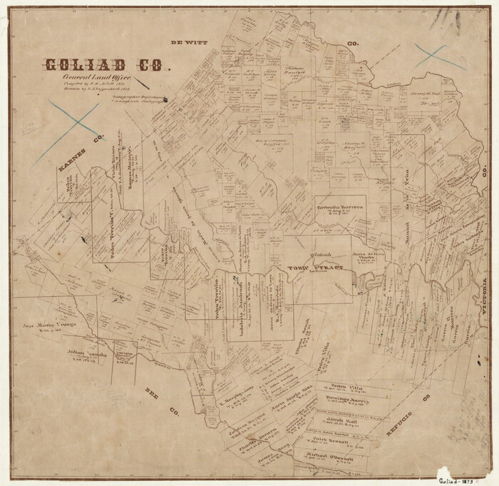
Goliad Co.

Print $20.00
- Digital $50.00
Goliad Co.
1896
-
Size
44.3 x 45.2 inches
-
Map/Doc
16836
-
Creation Date
1896
Goliad Co.

Print $20.00
- Digital $50.00
Goliad Co.
1896
-
Size
42.3 x 45.1 inches
-
Map/Doc
4958
-
Creation Date
1896
Goliad Co.

Print $20.00
- Digital $50.00
Goliad Co.
1896
-
Size
43.2 x 45.9 inches
-
Map/Doc
66839
-
Creation Date
1896
Goliad Co. Sketch

Print $3.00
- Digital $50.00
Goliad Co. Sketch
1900
-
Size
15.6 x 11.3 inches
-
Map/Doc
417
-
Creation Date
1900
Goliad County

Print $20.00
- Digital $50.00
Goliad County
1946
-
Size
42.3 x 44.7 inches
-
Map/Doc
1840
-
Creation Date
1946
Goliad County

Print $20.00
- Digital $50.00
Goliad County
1885
-
Size
20.0 x 23.1 inches
-
Map/Doc
3587
-
Creation Date
1885
Goliad County

Print $20.00
- Digital $50.00
Goliad County
1871
-
Size
22.5 x 23.4 inches
-
Map/Doc
3588
-
Creation Date
1871
Goliad County

Print $20.00
- Digital $50.00
Goliad County
1873
-
Size
18.1 x 18.4 inches
-
Map/Doc
3590
-
Creation Date
1873
Goliad County
Print $20.00
- Digital $50.00
Goliad County
1873
-
Size
17.8 x 18.3 inches
-
Map/Doc
4546
-
Creation Date
1873
Goliad County

Print $20.00
- Digital $50.00
Goliad County
1946
-
Size
42.8 x 45.0 inches
-
Map/Doc
73159
-
Creation Date
1946
Goliad County

Print $20.00
- Digital $50.00
Goliad County
1946
-
Size
40.9 x 43.6 inches
-
Map/Doc
77291
-
Creation Date
1946
Goliad County

Print $20.00
- Digital $50.00
Goliad County
1946
-
Size
44.0 x 46.1 inches
-
Map/Doc
95509
-
Creation Date
1946
Goliad County Boundary File 33
Print $12.00
- Digital $50.00
Goliad County Boundary File 33
-
Size
9.4 x 4.2 inches
-
Map/Doc
53797
Goliad County Rolled Sketch 1
Print $20.00
- Digital $50.00
Goliad County Rolled Sketch 1
1941
-
Size
31.4 x 38.5 inches
-
Map/Doc
6023
-
Creation Date
1941
Goliad County Rolled Sketch 2
Print $20.00
- Digital $50.00
Goliad County Rolled Sketch 2
1944
-
Size
33.1 x 34.6 inches
-
Map/Doc
9010
-
Creation Date
1944
Goliad County Rolled Sketch 3
Print $4.00
- Digital $50.00
Goliad County Rolled Sketch 3
1945
-
Size
24.2 x 26.9 inches
-
Map/Doc
6024
-
Creation Date
1945
Goliad County Rolled Sketch 5
Print $20.00
- Digital $50.00
Goliad County Rolled Sketch 5
1956
-
Size
26.5 x 29.5 inches
-
Map/Doc
6025
-
Creation Date
1956
Goliad County Rolled Sketch 6
Print $20.00
- Digital $50.00
Goliad County Rolled Sketch 6
1999
-
Size
23.4 x 34.5 inches
-
Map/Doc
6026
-
Creation Date
1999
Goliad County Rolled Sketch 7
Print $69.00
- Digital $50.00
Goliad County Rolled Sketch 7
1849
-
Size
10.6 x 16.1 inches
-
Map/Doc
45254
-
Creation Date
1849
Goliad County Sketch File 1
Print $24.00
- Digital $50.00
Goliad County Sketch File 1
1857
-
Size
12.5 x 7.5 inches
-
Map/Doc
24211
-
Creation Date
1857
Goliad County Sketch File 10
Print $4.00
- Digital $50.00
Goliad County Sketch File 10
1859
-
Size
9.3 x 8.1 inches
-
Map/Doc
24226
-
Creation Date
1859
Goliad County Sketch File 11
Print $40.00
- Digital $50.00
Goliad County Sketch File 11
-
Size
13.4 x 12.5 inches
-
Map/Doc
24228
Goliad County Sketch File 12
Print $18.00
- Digital $50.00
Goliad County Sketch File 12
1857
-
Size
12.9 x 7.9 inches
-
Map/Doc
24230
-
Creation Date
1857