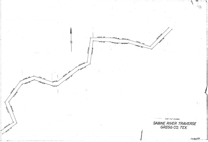
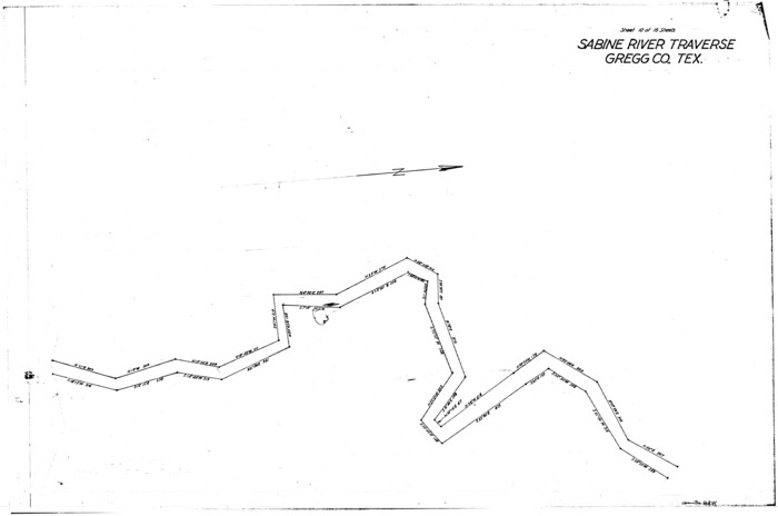
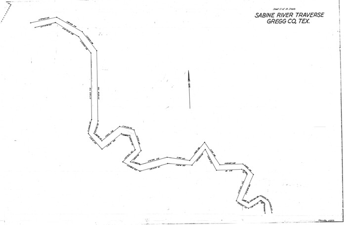
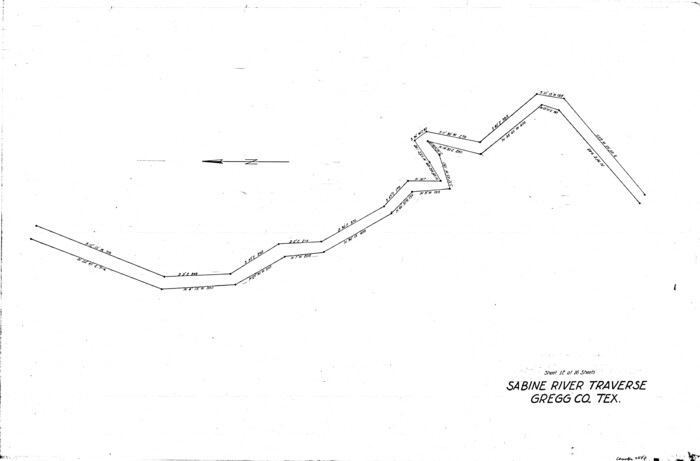
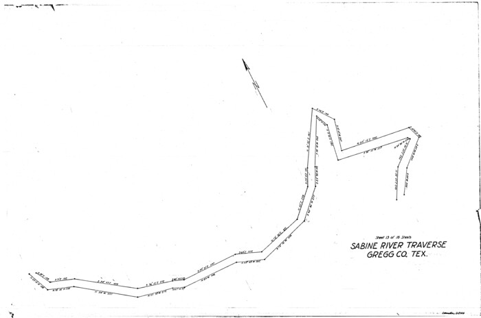
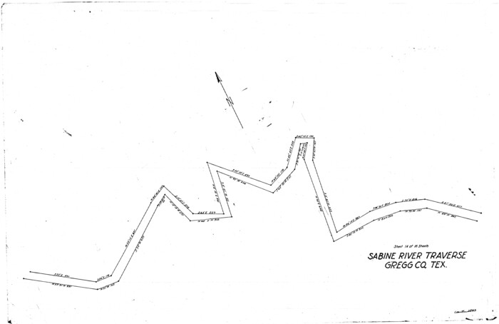
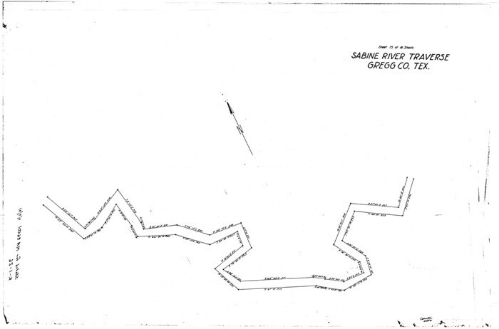
[Surveys along the Sabine River made under G.W. Smyth, Commissioner]
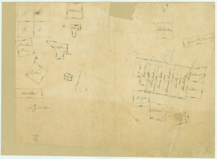
Print $20.00
- Digital $50.00
[Surveys along the Sabine River made under G.W. Smyth, Commissioner]
Size: 12.6 x 17.1 inches
89
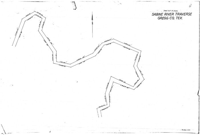
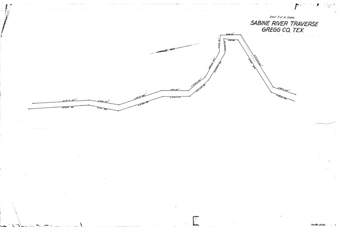
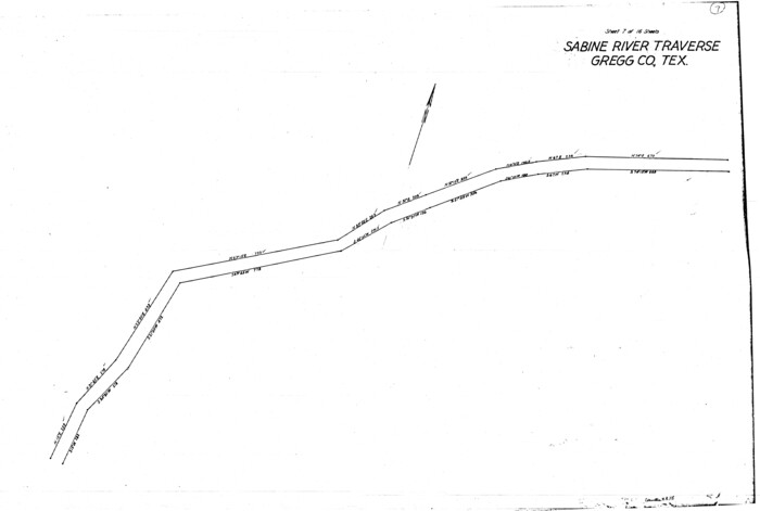
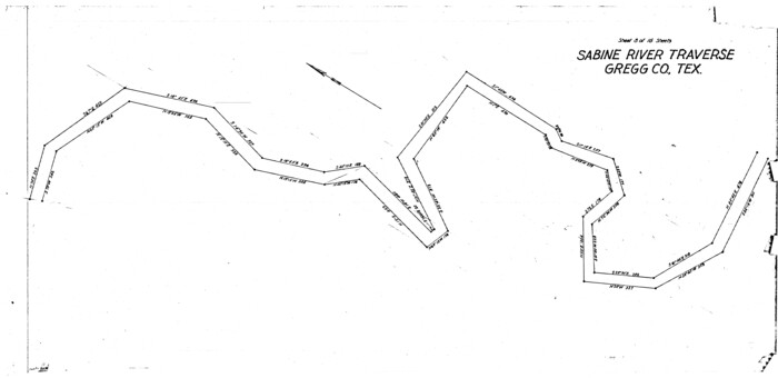
[Sketch for Mineral Application 26649-26650 - Sabine River, Harry A. Wolan]
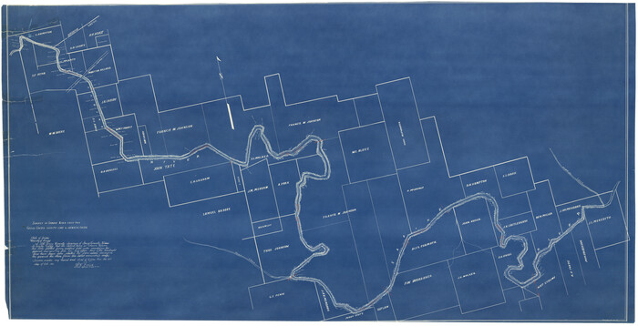
Print $40.00
- Digital $50.00
[Sketch for Mineral Application 26649-26650 - Sabine River, Harry A. Wolan]
1931
Size: 36.9 x 72.2 inches
2852
[Sketch for Mineral Application 26546 - Sabine River between Hawkins Creek and east boundary line of BBB&C RR Co. Surveys, R. S. Rathke]
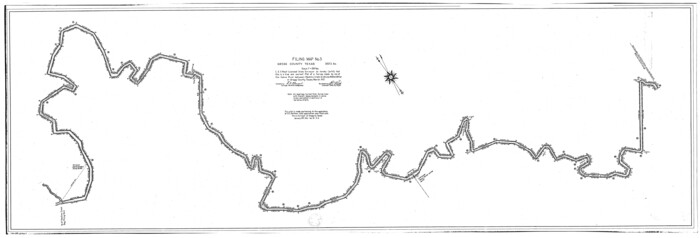
Print $40.00
- Digital $50.00
[Sketch for Mineral Application 26546 - Sabine River between Hawkins Creek and east boundary line of BBB&C RR Co. Surveys, R. S. Rathke]
1931
Size: 25.5 x 75.1 inches
65665
[Sketch for Mineral Application 26546 - Sabine River between Hawkins Creek and east boundary line of BBB&C RR Co. Surveys, R. S. Rathke]
Print $40.00
- Digital $50.00
[Sketch for Mineral Application 26546 - Sabine River between Hawkins Creek and east boundary line of BBB&C RR Co. Surveys, R. S. Rathke]
1931
Size: 74.9 x 26.3 inches
65666
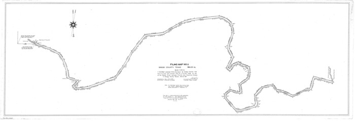
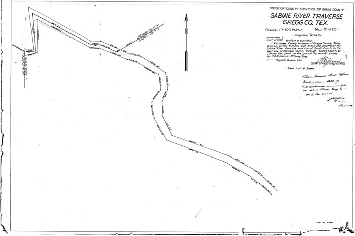
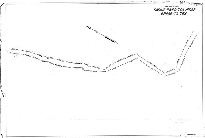
[Sketch for Mineral Application 26542 - Sabine River between Prairie and Hawkins Creek, F. B. Jackson, Jr.]
Print $40.00
- Digital $50.00
[Sketch for Mineral Application 26542 - Sabine River between Prairie and Hawkins Creek, F. B. Jackson, Jr.]
1931
Size: 22.0 x 64.0 inches
65669
[Sketch for Mineral Application 26542 - Sabine River between Prairie and Hawkins Creek, F. B. Jackson, Jr.]
Print $40.00
- Digital $50.00
[Sketch for Mineral Application 26542 - Sabine River between Prairie and Hawkins Creek, F. B. Jackson, Jr.]
1931
Size: 64.4 x 21.0 inches
65670
[Sketch for Mineral Application 26501 - Sabine River, T. A. Oldhausen]
Print $20.00
- Digital $50.00
[Sketch for Mineral Application 26501 - Sabine River, T. A. Oldhausen]
1931
Size: 24.0 x 36.0 inches
2832
[Sketch for Mineral Application 26501 - Sabine River, T. A. Oldhausen]
Print $20.00
- Digital $50.00
[Sketch for Mineral Application 26501 - Sabine River, T. A. Oldhausen]
1931
Size: 24.4 x 36.3 inches
2833
[Sketch for Mineral Application 26501 - Sabine River, T. A. Oldhausen]

Print $20.00
- Digital $50.00
[Sketch for Mineral Application 26501 - Sabine River, T. A. Oldhausen]
1931
Size: 23.9 x 36.0 inches
2834
[Sketch for Mineral Application 26501 - Sabine River, T. A. Oldhausen]
Print $20.00
- Digital $50.00
[Sketch for Mineral Application 26501 - Sabine River, T. A. Oldhausen]
1931
Size: 24.6 x 36.6 inches
2835
[Sketch for Mineral Application 26501 - Sabine River, T. A. Oldhausen]
Print $20.00
- Digital $50.00
[Sketch for Mineral Application 26501 - Sabine River, T. A. Oldhausen]
1931
Size: 24.4 x 36.5 inches
2836
[Sketch for Mineral Application 26501 - Sabine River, T. A. Oldhausen]

Print $20.00
- Digital $50.00
[Sketch for Mineral Application 26501 - Sabine River, T. A. Oldhausen]
1931
Size: 24.1 x 36.0 inches
2837
[Sketch for Mineral Application 26501 - Sabine River, T. A. Oldhausen]
Print $20.00
- Digital $50.00
[Sketch for Mineral Application 26501 - Sabine River, T. A. Oldhausen]
1931
Size: 24.3 x 36.1 inches
2838
[Sketch for Mineral Application 26501 - Sabine River, T. A. Oldhausen]
Print $20.00
- Digital $50.00
[Sketch for Mineral Application 26501 - Sabine River, T. A. Oldhausen]
1931
Size: 17.7 x 36.4 inches
2839
[Sketch for Mineral Application 26501 - Sabine River, T. A. Oldhausen]
Print $20.00
- Digital $50.00
[Sketch for Mineral Application 26501 - Sabine River, T. A. Oldhausen]
1931
Size: 24.3 x 35.5 inches
2840
[Sketch for Mineral Application 26501 - Sabine River, T. A. Oldhausen]
Print $20.00
- Digital $50.00
[Sketch for Mineral Application 26501 - Sabine River, T. A. Oldhausen]
1931
Size: 24.4 x 36.8 inches
2841
[Sketch for Mineral Application 26501 - Sabine River, T. A. Oldhausen]
Print $20.00
- Digital $50.00
[Sketch for Mineral Application 26501 - Sabine River, T. A. Oldhausen]
1931
Size: 24.0 x 36.9 inches
2842
[Sketch for Mineral Application 26501 - Sabine River, T. A. Oldhausen]
Print $20.00
- Digital $50.00
[Sketch for Mineral Application 26501 - Sabine River, T. A. Oldhausen]
1931
Size: 23.8 x 36.2 inches
2843
[Sketch for Mineral Application 26501 - Sabine River, T. A. Oldhausen]
Print $20.00
- Digital $50.00
[Sketch for Mineral Application 26501 - Sabine River, T. A. Oldhausen]
1931
Size: 24.4 x 36.8 inches
2844
[Sketch for Mineral Application 26501 - Sabine River, T. A. Oldhausen]
Print $20.00
- Digital $50.00
[Sketch for Mineral Application 26501 - Sabine River, T. A. Oldhausen]
1931
Size: 24.0 x 36.9 inches
2845
[Sketch for Mineral Application 26501 - Sabine River, T. A. Oldhausen]
Print $20.00
- Digital $50.00
[Sketch for Mineral Application 26501 - Sabine River, T. A. Oldhausen]
1931
Size: 24.4 x 37.0 inches
2846
[Sketch for Mineral Application 26501 - Sabine River, T. A. Oldhausen]

Print $20.00
- Digital $50.00
[Sketch for Mineral Application 26501 - Sabine River, T. A. Oldhausen]
1931
Size: 24.7 x 37.1 inches
2847
Upshur County Working Sketch 4

Print $20.00
- Digital $50.00
Upshur County Working Sketch 4
1939
Size: 21.6 x 15.3 inches
69560
Upshur County Working Sketch 15b

Print $20.00
- Digital $50.00
Upshur County Working Sketch 15b
1996
Size: 36.7 x 29.4 inches
69572
Upshur County Working Sketch 15a

Print $20.00
- Digital $50.00
Upshur County Working Sketch 15a
1996
Size: 42.6 x 34.7 inches
69573
Upshur County Working Sketch 15, revised

Print $20.00
- Digital $50.00
Upshur County Working Sketch 15, revised
1996
Size: 43.3 x 37.4 inches
78217
Upshur County Working Sketch 12

Print $20.00
- Digital $50.00
Upshur County Working Sketch 12
1984
Size: 31.9 x 29.6 inches
69569
Upshur County Sketch File 2

Print $4.00
- Digital $50.00
Upshur County Sketch File 2
1848
Size: 8.5 x 11.0 inches
38732
Upshur County Sketch File 19

Print $40.00
- Digital $50.00
Upshur County Sketch File 19
Size: 17.9 x 22.2 inches
12507
Upshur County Sketch File 15

Print $20.00
- Digital $50.00
Upshur County Sketch File 15
1934
Size: 20.7 x 31.2 inches
12505
[Surveys along the Sabine River made under G.W. Smyth, Commissioner]
Print $20.00
- Digital $50.00
[Surveys along the Sabine River made under G.W. Smyth, Commissioner]
-
Size
12.6 x 17.1 inches
-
Map/Doc
89
[Sketch for Mineral Application 26649-26650 - Sabine River, Harry A. Wolan]
Print $40.00
- Digital $50.00
[Sketch for Mineral Application 26649-26650 - Sabine River, Harry A. Wolan]
1931
-
Size
36.9 x 72.2 inches
-
Map/Doc
2852
-
Creation Date
1931
[Sketch for Mineral Application 26546 - Sabine River between Hawkins Creek and east boundary line of BBB&C RR Co. Surveys, R. S. Rathke]
Print $40.00
- Digital $50.00
[Sketch for Mineral Application 26546 - Sabine River between Hawkins Creek and east boundary line of BBB&C RR Co. Surveys, R. S. Rathke]
1931
-
Size
25.5 x 75.1 inches
-
Map/Doc
65665
-
Creation Date
1931
[Sketch for Mineral Application 26546 - Sabine River between Hawkins Creek and east boundary line of BBB&C RR Co. Surveys, R. S. Rathke]
Print $40.00
- Digital $50.00
[Sketch for Mineral Application 26546 - Sabine River between Hawkins Creek and east boundary line of BBB&C RR Co. Surveys, R. S. Rathke]
1931
-
Size
74.9 x 26.3 inches
-
Map/Doc
65666
-
Creation Date
1931
[Sketch for Mineral Application 26542 - Sabine River between Prairie and Hawkins Creek, F. B. Jackson, Jr.]
Print $40.00
- Digital $50.00
[Sketch for Mineral Application 26542 - Sabine River between Prairie and Hawkins Creek, F. B. Jackson, Jr.]
1931
-
Size
22.0 x 64.0 inches
-
Map/Doc
65669
-
Creation Date
1931
[Sketch for Mineral Application 26542 - Sabine River between Prairie and Hawkins Creek, F. B. Jackson, Jr.]
Print $40.00
- Digital $50.00
[Sketch for Mineral Application 26542 - Sabine River between Prairie and Hawkins Creek, F. B. Jackson, Jr.]
1931
-
Size
64.4 x 21.0 inches
-
Map/Doc
65670
-
Creation Date
1931
[Sketch for Mineral Application 26501 - Sabine River, T. A. Oldhausen]
Print $20.00
- Digital $50.00
[Sketch for Mineral Application 26501 - Sabine River, T. A. Oldhausen]
1931
-
Size
24.0 x 36.0 inches
-
Map/Doc
2832
-
Creation Date
1931
[Sketch for Mineral Application 26501 - Sabine River, T. A. Oldhausen]
Print $20.00
- Digital $50.00
[Sketch for Mineral Application 26501 - Sabine River, T. A. Oldhausen]
1931
-
Size
24.4 x 36.3 inches
-
Map/Doc
2833
-
Creation Date
1931
[Sketch for Mineral Application 26501 - Sabine River, T. A. Oldhausen]
Print $20.00
- Digital $50.00
[Sketch for Mineral Application 26501 - Sabine River, T. A. Oldhausen]
1931
-
Size
23.9 x 36.0 inches
-
Map/Doc
2834
-
Creation Date
1931
[Sketch for Mineral Application 26501 - Sabine River, T. A. Oldhausen]
Print $20.00
- Digital $50.00
[Sketch for Mineral Application 26501 - Sabine River, T. A. Oldhausen]
1931
-
Size
24.6 x 36.6 inches
-
Map/Doc
2835
-
Creation Date
1931
[Sketch for Mineral Application 26501 - Sabine River, T. A. Oldhausen]
Print $20.00
- Digital $50.00
[Sketch for Mineral Application 26501 - Sabine River, T. A. Oldhausen]
1931
-
Size
24.4 x 36.5 inches
-
Map/Doc
2836
-
Creation Date
1931
[Sketch for Mineral Application 26501 - Sabine River, T. A. Oldhausen]
Print $20.00
- Digital $50.00
[Sketch for Mineral Application 26501 - Sabine River, T. A. Oldhausen]
1931
-
Size
24.1 x 36.0 inches
-
Map/Doc
2837
-
Creation Date
1931
[Sketch for Mineral Application 26501 - Sabine River, T. A. Oldhausen]
Print $20.00
- Digital $50.00
[Sketch for Mineral Application 26501 - Sabine River, T. A. Oldhausen]
1931
-
Size
24.3 x 36.1 inches
-
Map/Doc
2838
-
Creation Date
1931
[Sketch for Mineral Application 26501 - Sabine River, T. A. Oldhausen]
Print $20.00
- Digital $50.00
[Sketch for Mineral Application 26501 - Sabine River, T. A. Oldhausen]
1931
-
Size
17.7 x 36.4 inches
-
Map/Doc
2839
-
Creation Date
1931
[Sketch for Mineral Application 26501 - Sabine River, T. A. Oldhausen]
Print $20.00
- Digital $50.00
[Sketch for Mineral Application 26501 - Sabine River, T. A. Oldhausen]
1931
-
Size
24.3 x 35.5 inches
-
Map/Doc
2840
-
Creation Date
1931
[Sketch for Mineral Application 26501 - Sabine River, T. A. Oldhausen]
Print $20.00
- Digital $50.00
[Sketch for Mineral Application 26501 - Sabine River, T. A. Oldhausen]
1931
-
Size
24.4 x 36.8 inches
-
Map/Doc
2841
-
Creation Date
1931
[Sketch for Mineral Application 26501 - Sabine River, T. A. Oldhausen]
Print $20.00
- Digital $50.00
[Sketch for Mineral Application 26501 - Sabine River, T. A. Oldhausen]
1931
-
Size
24.0 x 36.9 inches
-
Map/Doc
2842
-
Creation Date
1931
[Sketch for Mineral Application 26501 - Sabine River, T. A. Oldhausen]
Print $20.00
- Digital $50.00
[Sketch for Mineral Application 26501 - Sabine River, T. A. Oldhausen]
1931
-
Size
23.8 x 36.2 inches
-
Map/Doc
2843
-
Creation Date
1931
[Sketch for Mineral Application 26501 - Sabine River, T. A. Oldhausen]
Print $20.00
- Digital $50.00
[Sketch for Mineral Application 26501 - Sabine River, T. A. Oldhausen]
1931
-
Size
24.4 x 36.8 inches
-
Map/Doc
2844
-
Creation Date
1931
[Sketch for Mineral Application 26501 - Sabine River, T. A. Oldhausen]
Print $20.00
- Digital $50.00
[Sketch for Mineral Application 26501 - Sabine River, T. A. Oldhausen]
1931
-
Size
24.0 x 36.9 inches
-
Map/Doc
2845
-
Creation Date
1931
[Sketch for Mineral Application 26501 - Sabine River, T. A. Oldhausen]
Print $20.00
- Digital $50.00
[Sketch for Mineral Application 26501 - Sabine River, T. A. Oldhausen]
1931
-
Size
24.4 x 37.0 inches
-
Map/Doc
2846
-
Creation Date
1931
[Sketch for Mineral Application 26501 - Sabine River, T. A. Oldhausen]
Print $20.00
- Digital $50.00
[Sketch for Mineral Application 26501 - Sabine River, T. A. Oldhausen]
1931
-
Size
24.7 x 37.1 inches
-
Map/Doc
2847
-
Creation Date
1931
Upshur County Working Sketch 4
Print $20.00
- Digital $50.00
Upshur County Working Sketch 4
1939
-
Size
21.6 x 15.3 inches
-
Map/Doc
69560
-
Creation Date
1939
Upshur County Working Sketch 15b
Print $20.00
- Digital $50.00
Upshur County Working Sketch 15b
1996
-
Size
36.7 x 29.4 inches
-
Map/Doc
69572
-
Creation Date
1996
Upshur County Working Sketch 15a
Print $20.00
- Digital $50.00
Upshur County Working Sketch 15a
1996
-
Size
42.6 x 34.7 inches
-
Map/Doc
69573
-
Creation Date
1996
Upshur County Working Sketch 15, revised
Print $20.00
- Digital $50.00
Upshur County Working Sketch 15, revised
1996
-
Size
43.3 x 37.4 inches
-
Map/Doc
78217
-
Creation Date
1996
Upshur County Working Sketch 12
Print $20.00
- Digital $50.00
Upshur County Working Sketch 12
1984
-
Size
31.9 x 29.6 inches
-
Map/Doc
69569
-
Creation Date
1984
Upshur County Sketch File 2
Print $4.00
- Digital $50.00
Upshur County Sketch File 2
1848
-
Size
8.5 x 11.0 inches
-
Map/Doc
38732
-
Creation Date
1848
Upshur County Sketch File 19
Print $40.00
- Digital $50.00
Upshur County Sketch File 19
-
Size
17.9 x 22.2 inches
-
Map/Doc
12507
Upshur County Sketch File 15
Print $20.00
- Digital $50.00
Upshur County Sketch File 15
1934
-
Size
20.7 x 31.2 inches
-
Map/Doc
12505
-
Creation Date
1934