A Map of Gonzales County

Print $20.00
- Digital $50.00
A Map of Gonzales County
1838
Size: 34.7 x 39.2 inches
16838
Bexar County Rolled Sketch 16
Print $20.00
- Digital $50.00
Bexar County Rolled Sketch 16
1847
Size: 21.1 x 14.8 inches
5141
Caldwell County Sketch File 6

Print $8.00
- Digital $50.00
Caldwell County Sketch File 6
1922
Size: 14.1 x 8.1 inches
35847
Comal County Sketch File 9

Print $4.00
- Digital $50.00
Comal County Sketch File 9
1859
Size: 13.6 x 8.5 inches
19016
Comal County Sketch File 9 1/2

Print $6.00
- Digital $50.00
Comal County Sketch File 9 1/2
Size: 12.9 x 8.4 inches
19018
Comal County Working Sketch 14

Print $40.00
- Digital $50.00
Comal County Working Sketch 14
1992
Size: 25.4 x 49.9 inches
68180
Comal County Working Sketch 15

Print $20.00
- Digital $50.00
Comal County Working Sketch 15
1994
Size: 44.6 x 31.0 inches
68181
Connected Map of DeWitt's Colony compiled from the surveys of Byrd Lockhart

Print $40.00
- Digital $50.00
Connected Map of DeWitt's Colony compiled from the surveys of Byrd Lockhart
1831
Size: 39.2 x 54.0 inches
1942
English Field Notes of the Spanish Archives - Book Lockhart

English Field Notes of the Spanish Archives - Book Lockhart
1832
96539
General Highway Map, Guadalupe County, Texas

Print $20.00
General Highway Map, Guadalupe County, Texas
1940
Size: 18.6 x 25.1 inches
79107
General Highway Map, Guadalupe County, Texas

Print $20.00
General Highway Map, Guadalupe County, Texas
1961
Size: 18.1 x 24.6 inches
79492
Gonzales County Rolled Sketch 1

Print $20.00
- Digital $50.00
Gonzales County Rolled Sketch 1
1917
Size: 21.9 x 23.9 inches
6027
Gonzales County Rolled Sketch 1

Print $20.00
- Digital $50.00
Gonzales County Rolled Sketch 1
1917
Size: 22.1 x 24.0 inches
6028
Guadalupe County Rolled Sketch 1

Print $20.00
- Digital $50.00
Guadalupe County Rolled Sketch 1
1954
Size: 33.1 x 38.8 inches
6044
Guadalupe County Sketch File 1

Print $4.00
- Digital $50.00
Guadalupe County Sketch File 1
1857
Size: 8.9 x 13.4 inches
24644
Guadalupe County Sketch File 10

Print $4.00
- Digital $50.00
Guadalupe County Sketch File 10
1862
Size: 8.7 x 14.5 inches
24679
Guadalupe County Sketch File 11

Print $4.00
- Digital $50.00
Guadalupe County Sketch File 11
Size: 8.0 x 12.8 inches
24681
Guadalupe County Sketch File 12

Print $8.00
- Digital $50.00
Guadalupe County Sketch File 12
1869
Size: 12.9 x 8.2 inches
24683
Guadalupe County Sketch File 15a

Print $9.00
- Digital $50.00
Guadalupe County Sketch File 15a
Size: 10.3 x 8.2 inches
24687
Guadalupe County Sketch File 15b

Print $4.00
- Digital $50.00
Guadalupe County Sketch File 15b
1873
Size: 10.3 x 8.4 inches
24691
A Map of Gonzales County
Print $20.00
- Digital $50.00
A Map of Gonzales County
1838
-
Size
34.7 x 39.2 inches
-
Map/Doc
16838
-
Creation Date
1838
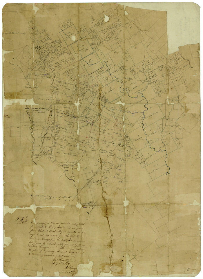
Bexar County Rolled Sketch 16
Print $20.00
- Digital $50.00
Bexar County Rolled Sketch 16
1847
-
Size
21.1 x 14.8 inches
-
Map/Doc
5141
-
Creation Date
1847
Caldwell County Sketch File 6
Print $8.00
- Digital $50.00
Caldwell County Sketch File 6
1922
-
Size
14.1 x 8.1 inches
-
Map/Doc
35847
-
Creation Date
1922
Comal County Sketch File 9
Print $4.00
- Digital $50.00
Comal County Sketch File 9
1859
-
Size
13.6 x 8.5 inches
-
Map/Doc
19016
-
Creation Date
1859
Comal County Sketch File 9 1/2
Print $6.00
- Digital $50.00
Comal County Sketch File 9 1/2
-
Size
12.9 x 8.4 inches
-
Map/Doc
19018
Comal County Working Sketch 14
Print $40.00
- Digital $50.00
Comal County Working Sketch 14
1992
-
Size
25.4 x 49.9 inches
-
Map/Doc
68180
-
Creation Date
1992
Comal County Working Sketch 15
Print $20.00
- Digital $50.00
Comal County Working Sketch 15
1994
-
Size
44.6 x 31.0 inches
-
Map/Doc
68181
-
Creation Date
1994
Connected Map of DeWitt's Colony compiled from the surveys of Byrd Lockhart
Print $40.00
- Digital $50.00
Connected Map of DeWitt's Colony compiled from the surveys of Byrd Lockhart
1831
-
Size
39.2 x 54.0 inches
-
Map/Doc
1942
-
Creation Date
1831
English Field Notes of the Spanish Archives - Book Lockhart
English Field Notes of the Spanish Archives - Book Lockhart
1832
-
Map/Doc
96539
-
Creation Date
1832
General Highway Map, Guadalupe County, Texas
Print $20.00
General Highway Map, Guadalupe County, Texas
1940
-
Size
18.6 x 25.1 inches
-
Map/Doc
79107
-
Creation Date
1940
General Highway Map, Guadalupe County, Texas
Print $20.00
General Highway Map, Guadalupe County, Texas
1961
-
Size
18.1 x 24.6 inches
-
Map/Doc
79492
-
Creation Date
1961
Gonzales County Rolled Sketch 1
Print $20.00
- Digital $50.00
Gonzales County Rolled Sketch 1
1917
-
Size
21.9 x 23.9 inches
-
Map/Doc
6027
-
Creation Date
1917
Gonzales County Rolled Sketch 1
Print $20.00
- Digital $50.00
Gonzales County Rolled Sketch 1
1917
-
Size
22.1 x 24.0 inches
-
Map/Doc
6028
-
Creation Date
1917
Guadalupe Co.

Print $20.00
- Digital $50.00
Guadalupe Co.
1919
-
Size
39.8 x 45.4 inches
-
Map/Doc
4692
-
Creation Date
1919
Guadalupe Co.

Print $20.00
- Digital $50.00
Guadalupe Co.
1919
-
Size
39.6 x 44.7 inches
-
Map/Doc
4965
-
Creation Date
1919
Guadalupe County

Print $20.00
- Digital $50.00
Guadalupe County
1869
-
Size
27.7 x 22.3 inches
-
Map/Doc
3607
-
Creation Date
1869
Guadalupe County

Print $20.00
- Digital $50.00
Guadalupe County
1877
-
Size
21.5 x 21.4 inches
-
Map/Doc
3608
-
Creation Date
1877
Guadalupe County

Print $20.00
- Digital $50.00
Guadalupe County
1854
-
Size
25.0 x 21.1 inches
-
Map/Doc
3609
-
Creation Date
1854
Guadalupe County

Print $20.00
- Digital $50.00
Guadalupe County
1872
-
Size
24.6 x 23.7 inches
-
Map/Doc
3610
-
Creation Date
1872
Guadalupe County

Print $20.00
- Digital $50.00
Guadalupe County
1880
-
Size
24.9 x 22.6 inches
-
Map/Doc
4553
-
Creation Date
1880
Guadalupe County

Print $20.00
- Digital $50.00
Guadalupe County
1977
-
Size
35.9 x 46.4 inches
-
Map/Doc
73165
-
Creation Date
1977
Guadalupe County

Print $20.00
- Digital $50.00
Guadalupe County
1977
-
Size
35.0 x 45.9 inches
-
Map/Doc
77297
-
Creation Date
1977
Guadalupe County

Print $20.00
- Digital $50.00
Guadalupe County
1977
-
Size
36.5 x 47.8 inches
-
Map/Doc
95515
-
Creation Date
1977
Guadalupe County Rolled Sketch 1
Print $20.00
- Digital $50.00
Guadalupe County Rolled Sketch 1
1954
-
Size
33.1 x 38.8 inches
-
Map/Doc
6044
-
Creation Date
1954
Guadalupe County Sketch File 1
Print $4.00
- Digital $50.00
Guadalupe County Sketch File 1
1857
-
Size
8.9 x 13.4 inches
-
Map/Doc
24644
-
Creation Date
1857
Guadalupe County Sketch File 10
Print $4.00
- Digital $50.00
Guadalupe County Sketch File 10
1862
-
Size
8.7 x 14.5 inches
-
Map/Doc
24679
-
Creation Date
1862
Guadalupe County Sketch File 11
Print $4.00
- Digital $50.00
Guadalupe County Sketch File 11
-
Size
8.0 x 12.8 inches
-
Map/Doc
24681
Guadalupe County Sketch File 12
Print $8.00
- Digital $50.00
Guadalupe County Sketch File 12
1869
-
Size
12.9 x 8.2 inches
-
Map/Doc
24683
-
Creation Date
1869
Guadalupe County Sketch File 15a
Print $9.00
- Digital $50.00
Guadalupe County Sketch File 15a
-
Size
10.3 x 8.2 inches
-
Map/Doc
24687
Guadalupe County Sketch File 15b
Print $4.00
- Digital $50.00
Guadalupe County Sketch File 15b
1873
-
Size
10.3 x 8.4 inches
-
Map/Doc
24691
-
Creation Date
1873