Hardin County Working Sketch 43

Print $20.00
- Digital $50.00
Hardin County Working Sketch 43
2001
Size: 45.4 x 37.4 inches
83572
Hardin County Rolled Sketch 24

Print $20.00
- Digital $50.00
Hardin County Rolled Sketch 24
1998
Size: 27.2 x 38.6 inches
6092
Hardin County Sketch File 71f

Print $20.00
- Digital $50.00
Hardin County Sketch File 71f
1997
Size: 25.2 x 36.7 inches
11643
Hardin County Sketch File 71

Print $94.00
- Digital $50.00
Hardin County Sketch File 71
1997
Size: 11.4 x 8.8 inches
25259
Tyler County Working Sketch 24

Print $20.00
- Digital $50.00
Tyler County Working Sketch 24
1989
Size: 34.8 x 40.6 inches
69494
Hardin County Working Sketch 40

Print $20.00
- Digital $50.00
Hardin County Working Sketch 40
1988
Size: 23.0 x 14.4 inches
63439
Hardin County Working Sketch 39, part 1

Print $20.00
- Digital $50.00
Hardin County Working Sketch 39, part 1
1985
Size: 34.4 x 47.1 inches
63437
Hardin County Working Sketch 39, part 2

Print $40.00
- Digital $50.00
Hardin County Working Sketch 39, part 2
1985
Size: 36.0 x 48.5 inches
63438
Hardin County Rolled Sketch 23

Print $20.00
- Digital $50.00
Hardin County Rolled Sketch 23
1982
Size: 28.5 x 45.2 inches
6091
Hardin County Working Sketch 38

Print $20.00
- Digital $50.00
Hardin County Working Sketch 38
1981
Size: 37.2 x 19.4 inches
63436
Jefferson County Working Sketch 34

Print $20.00
- Digital $50.00
Jefferson County Working Sketch 34
1981
Size: 33.4 x 18.8 inches
66578
Hardin County Working Sketch 37

Print $40.00
- Digital $50.00
Hardin County Working Sketch 37
1981
Size: 68.5 x 37.4 inches
63435
Jefferson County Working Sketch 32

Print $40.00
- Digital $50.00
Jefferson County Working Sketch 32
1981
Size: 68.9 x 36.0 inches
66576
Liberty County Working Sketch 83

Print $40.00
- Digital $50.00
Liberty County Working Sketch 83
1981
Size: 68.4 x 37.8 inches
70543
Hardin County Working Sketch 36

Print $40.00
- Digital $50.00
Hardin County Working Sketch 36
1981
Size: 76.8 x 37.5 inches
63434
Liberty County Working Sketch 82

Print $40.00
- Digital $50.00
Liberty County Working Sketch 82
1981
Size: 76.9 x 36.8 inches
70542
Hardin County Working Sketch 35

Print $20.00
- Digital $50.00
Hardin County Working Sketch 35
1981
Size: 17.2 x 14.6 inches
63433
Hardin County Working Sketch 34

Print $20.00
- Digital $50.00
Hardin County Working Sketch 34
1980
Size: 15.7 x 12.1 inches
63432
Hardin County Working Sketch 33

Print $20.00
- Digital $50.00
Hardin County Working Sketch 33
1979
Size: 36.0 x 43.6 inches
63431
Hardin County Working Sketch 32

Print $20.00
- Digital $50.00
Hardin County Working Sketch 32
1978
Size: 41.7 x 38.0 inches
63430
Hardin County Rolled Sketch 22

Print $20.00
- Digital $50.00
Hardin County Rolled Sketch 22
1977
Size: 32.0 x 44.4 inches
9110
Liberty County Working Sketch 69

Print $20.00
- Digital $50.00
Liberty County Working Sketch 69
1972
Size: 29.8 x 41.8 inches
70529
Hardin County Working Sketch 31

Print $20.00
- Digital $50.00
Hardin County Working Sketch 31
1971
Size: 43.0 x 33.2 inches
63429
Hardin County Working Sketch 30

Print $20.00
- Digital $50.00
Hardin County Working Sketch 30
1967
Size: 24.6 x 20.3 inches
63428
Hardin County Rolled Sketch 21

Print $20.00
- Digital $50.00
Hardin County Rolled Sketch 21
1966
Size: 18.8 x 22.7 inches
6090
General Highway Map, Hardin County, Texas

Print $20.00
General Highway Map, Hardin County, Texas
1961
Size: 18.1 x 24.9 inches
79499
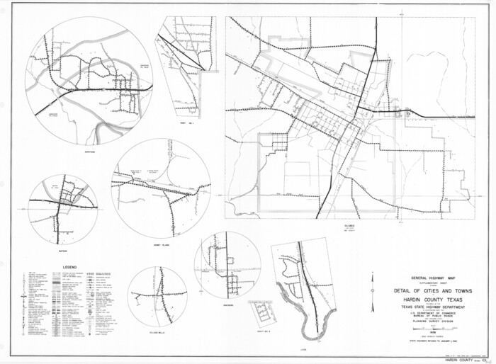
General Highway Map. Detail of Cities and Towns in Hardin County, Texas [Silsbee and vicinity]
Print $20.00
General Highway Map. Detail of Cities and Towns in Hardin County, Texas [Silsbee and vicinity]
1961
Size: 18.1 x 24.7 inches
79500
Hardin County Rolled Sketch 20

Print $20.00
- Digital $50.00
Hardin County Rolled Sketch 20
1960
Size: 27.7 x 35.9 inches
6089
Hardin County Working Sketch 29

Print $20.00
- Digital $50.00
Hardin County Working Sketch 29
1958
Size: 36.7 x 22.1 inches
63427
Jefferson County Sketch File 43

Print $20.00
- Digital $50.00
Jefferson County Sketch File 43
1957
Size: 26.6 x 19.6 inches
11877
Hardin County Working Sketch 43
Print $20.00
- Digital $50.00
Hardin County Working Sketch 43
2001
-
Size
45.4 x 37.4 inches
-
Map/Doc
83572
-
Creation Date
2001
Hardin County Rolled Sketch 24
Print $20.00
- Digital $50.00
Hardin County Rolled Sketch 24
1998
-
Size
27.2 x 38.6 inches
-
Map/Doc
6092
-
Creation Date
1998
Hardin County Sketch File 71f
Print $20.00
- Digital $50.00
Hardin County Sketch File 71f
1997
-
Size
25.2 x 36.7 inches
-
Map/Doc
11643
-
Creation Date
1997
Hardin County Sketch File 71
Print $94.00
- Digital $50.00
Hardin County Sketch File 71
1997
-
Size
11.4 x 8.8 inches
-
Map/Doc
25259
-
Creation Date
1997
Tyler County Working Sketch 24
Print $20.00
- Digital $50.00
Tyler County Working Sketch 24
1989
-
Size
34.8 x 40.6 inches
-
Map/Doc
69494
-
Creation Date
1989
Hardin County Working Sketch 40
Print $20.00
- Digital $50.00
Hardin County Working Sketch 40
1988
-
Size
23.0 x 14.4 inches
-
Map/Doc
63439
-
Creation Date
1988
Hardin County Working Sketch 39, part 1
Print $20.00
- Digital $50.00
Hardin County Working Sketch 39, part 1
1985
-
Size
34.4 x 47.1 inches
-
Map/Doc
63437
-
Creation Date
1985
Hardin County Working Sketch 39, part 2
Print $40.00
- Digital $50.00
Hardin County Working Sketch 39, part 2
1985
-
Size
36.0 x 48.5 inches
-
Map/Doc
63438
-
Creation Date
1985
Hardin County Rolled Sketch 23
Print $20.00
- Digital $50.00
Hardin County Rolled Sketch 23
1982
-
Size
28.5 x 45.2 inches
-
Map/Doc
6091
-
Creation Date
1982
Hardin County Working Sketch 38
Print $20.00
- Digital $50.00
Hardin County Working Sketch 38
1981
-
Size
37.2 x 19.4 inches
-
Map/Doc
63436
-
Creation Date
1981
Jefferson County Working Sketch 34
Print $20.00
- Digital $50.00
Jefferson County Working Sketch 34
1981
-
Size
33.4 x 18.8 inches
-
Map/Doc
66578
-
Creation Date
1981
Hardin County Working Sketch 37
Print $40.00
- Digital $50.00
Hardin County Working Sketch 37
1981
-
Size
68.5 x 37.4 inches
-
Map/Doc
63435
-
Creation Date
1981
Jefferson County Working Sketch 32
Print $40.00
- Digital $50.00
Jefferson County Working Sketch 32
1981
-
Size
68.9 x 36.0 inches
-
Map/Doc
66576
-
Creation Date
1981
Liberty County Working Sketch 83
Print $40.00
- Digital $50.00
Liberty County Working Sketch 83
1981
-
Size
68.4 x 37.8 inches
-
Map/Doc
70543
-
Creation Date
1981
Hardin County Working Sketch 36
Print $40.00
- Digital $50.00
Hardin County Working Sketch 36
1981
-
Size
76.8 x 37.5 inches
-
Map/Doc
63434
-
Creation Date
1981
Liberty County Working Sketch 82
Print $40.00
- Digital $50.00
Liberty County Working Sketch 82
1981
-
Size
76.9 x 36.8 inches
-
Map/Doc
70542
-
Creation Date
1981
Hardin County Working Sketch 35
Print $20.00
- Digital $50.00
Hardin County Working Sketch 35
1981
-
Size
17.2 x 14.6 inches
-
Map/Doc
63433
-
Creation Date
1981
Hardin County Working Sketch 34
Print $20.00
- Digital $50.00
Hardin County Working Sketch 34
1980
-
Size
15.7 x 12.1 inches
-
Map/Doc
63432
-
Creation Date
1980
Hardin County Working Sketch 33
Print $20.00
- Digital $50.00
Hardin County Working Sketch 33
1979
-
Size
36.0 x 43.6 inches
-
Map/Doc
63431
-
Creation Date
1979
Hardin County Working Sketch 32
Print $20.00
- Digital $50.00
Hardin County Working Sketch 32
1978
-
Size
41.7 x 38.0 inches
-
Map/Doc
63430
-
Creation Date
1978
Hardin County Rolled Sketch 22
Print $20.00
- Digital $50.00
Hardin County Rolled Sketch 22
1977
-
Size
32.0 x 44.4 inches
-
Map/Doc
9110
-
Creation Date
1977
Liberty County Working Sketch 69
Print $20.00
- Digital $50.00
Liberty County Working Sketch 69
1972
-
Size
29.8 x 41.8 inches
-
Map/Doc
70529
-
Creation Date
1972
Hardin County Working Sketch 31
Print $20.00
- Digital $50.00
Hardin County Working Sketch 31
1971
-
Size
43.0 x 33.2 inches
-
Map/Doc
63429
-
Creation Date
1971
Hardin County Working Sketch 30
Print $20.00
- Digital $50.00
Hardin County Working Sketch 30
1967
-
Size
24.6 x 20.3 inches
-
Map/Doc
63428
-
Creation Date
1967
Hardin County Rolled Sketch 21
Print $20.00
- Digital $50.00
Hardin County Rolled Sketch 21
1966
-
Size
18.8 x 22.7 inches
-
Map/Doc
6090
-
Creation Date
1966
General Highway Map, Hardin County, Texas
Print $20.00
General Highway Map, Hardin County, Texas
1961
-
Size
18.1 x 24.9 inches
-
Map/Doc
79499
-
Creation Date
1961
General Highway Map. Detail of Cities and Towns in Hardin County, Texas [Silsbee and vicinity]
Print $20.00
General Highway Map. Detail of Cities and Towns in Hardin County, Texas [Silsbee and vicinity]
1961
-
Size
18.1 x 24.7 inches
-
Map/Doc
79500
-
Creation Date
1961
Hardin County Rolled Sketch 20
Print $20.00
- Digital $50.00
Hardin County Rolled Sketch 20
1960
-
Size
27.7 x 35.9 inches
-
Map/Doc
6089
-
Creation Date
1960
Hardin County Working Sketch 29
Print $20.00
- Digital $50.00
Hardin County Working Sketch 29
1958
-
Size
36.7 x 22.1 inches
-
Map/Doc
63427
-
Creation Date
1958
Jefferson County Sketch File 43
Print $20.00
- Digital $50.00
Jefferson County Sketch File 43
1957
-
Size
26.6 x 19.6 inches
-
Map/Doc
11877
-
Creation Date
1957