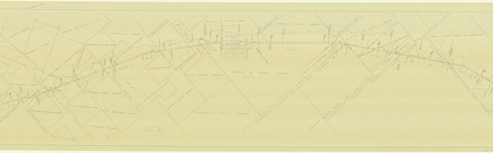
[G. C. & S. F. Ry. Northern-Division, Alignment and Right of Way Map, Weatherford Branch, Johnson and Hood Counties, Texas]
Print $40.00
- Digital $50.00
[G. C. & S. F. Ry. Northern-Division, Alignment and Right of Way Map, Weatherford Branch, Johnson and Hood Counties, Texas]
1935
Size: 37.4 x 120.9 inches
64648
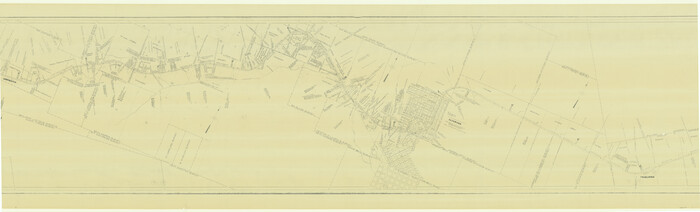
[G. C. & S. F. Ry. Alinement (sic) and Right of Way Map of Dallas Branch, Johnson County, Texas]
Print $40.00
- Digital $50.00
[G. C. & S. F. Ry. Alinement (sic) and Right of Way Map of Dallas Branch, Johnson County, Texas]
1926
Size: 37.6 x 124.3 inches
64651
Tarrant County Sketch File 24

Print $6.00
- Digital $50.00
Tarrant County Sketch File 24
Size: 15.3 x 10.0 inches
37735
Tarrant County Sketch File 1a

Print $4.00
- Digital $50.00
Tarrant County Sketch File 1a
1851
Size: 10.2 x 7.8 inches
37670
Tarrant County Sketch File 11

Print $11.00
- Digital $50.00
Tarrant County Sketch File 11
1859
Size: 7.5 x 6.2 inches
37698
Right of Way and Track Map, Houston & Texas Central R.R. operated by the T. and N. O. R.R., Fort Worth Branch

Print $40.00
- Digital $50.00
Right of Way and Track Map, Houston & Texas Central R.R. operated by the T. and N. O. R.R., Fort Worth Branch
1918
Size: 31.8 x 57.1 inches
64781
Map of the Recognised Line, M. El. P. & P. RR. from Texas & Arkansas State Line to Milam & Bexar Land District Line

Print $40.00
- Digital $50.00
Map of the Recognised Line, M. El. P. & P. RR. from Texas & Arkansas State Line to Milam & Bexar Land District Line
Size: 15.3 x 89.4 inches
64638
Map of Johnson County & Hood County

Print $20.00
- Digital $50.00
Map of Johnson County & Hood County
1863
Size: 19.3 x 28.3 inches
3735
Johnson County, Texas

Print $20.00
- Digital $50.00
Johnson County, Texas
1871
Size: 18.2 x 23.3 inches
734
Johnson County Working Sketch Graphic Index

Print $20.00
- Digital $50.00
Johnson County Working Sketch Graphic Index
1943
Size: 40.7 x 38.3 inches
76598
Johnson County Working Sketch 9

Print $20.00
- Digital $50.00
Johnson County Working Sketch 9
1953
Size: 20.4 x 15.2 inches
66622
Johnson County Working Sketch 8

Print $20.00
- Digital $50.00
Johnson County Working Sketch 8
1952
Size: 20.0 x 17.3 inches
66621
Johnson County Working Sketch 7

Print $20.00
- Digital $50.00
Johnson County Working Sketch 7
1951
Size: 23.0 x 21.3 inches
66620
Johnson County Working Sketch 6

Print $20.00
- Digital $50.00
Johnson County Working Sketch 6
1951
Size: 30.6 x 32.6 inches
66619
Johnson County Working Sketch 5

Print $20.00
- Digital $50.00
Johnson County Working Sketch 5
1950
Size: 25.8 x 22.3 inches
66618
Johnson County Working Sketch 4

Print $20.00
- Digital $50.00
Johnson County Working Sketch 4
1948
Size: 26.5 x 24.6 inches
66617
Johnson County Working Sketch 36

Print $20.00
- Digital $50.00
Johnson County Working Sketch 36
2016
Size: 24.1 x 36.1 inches
94088
Johnson County Working Sketch 35

Print $20.00
- Digital $50.00
Johnson County Working Sketch 35
2009
Size: 23.2 x 28.6 inches
89043
Johnson County Working Sketch 34

Print $20.00
- Digital $50.00
Johnson County Working Sketch 34
2008
Size: 20.0 x 21.2 inches
88890
Johnson County Working Sketch 32

Print $20.00
- Digital $50.00
Johnson County Working Sketch 32
2008
Size: 29.2 x 27.4 inches
88817
Johnson County Working Sketch 31

Print $20.00
- Digital $50.00
Johnson County Working Sketch 31
2007
Size: 21.2 x 22.0 inches
87499
Johnson County Working Sketch 30

Print $20.00
- Digital $50.00
Johnson County Working Sketch 30
2007
Size: 40.9 x 42.0 inches
83807
Johnson County Working Sketch 3

Print $20.00
- Digital $50.00
Johnson County Working Sketch 3
1948
Size: 29.1 x 24.2 inches
66616
Johnson County Working Sketch 29

Print $20.00
- Digital $50.00
Johnson County Working Sketch 29
2006
Size: 26.4 x 37.5 inches
83060
Johnson County Working Sketch 28

Print $20.00
- Digital $50.00
Johnson County Working Sketch 28
2005
Size: 24.0 x 26.0 inches
84700
Johnson County Working Sketch 27

Print $20.00
- Digital $50.00
Johnson County Working Sketch 27
2006
Size: 37.3 x 44.0 inches
83651
Johnson County Working Sketch 26

Print $20.00
- Digital $50.00
Johnson County Working Sketch 26
2005
Size: 22.3 x 41.8 inches
83574
Johnson County Working Sketch 25

Print $20.00
- Digital $50.00
Johnson County Working Sketch 25
1998
Size: 13.3 x 25.4 inches
66638
Johnson County Working Sketch 24

Print $20.00
- Digital $50.00
Johnson County Working Sketch 24
1996
Size: 47.5 x 34.5 inches
66637
Johnson County Working Sketch 23

Print $20.00
- Digital $50.00
Johnson County Working Sketch 23
1997
Size: 25.3 x 22.8 inches
66636
[G. C. & S. F. Ry. Northern-Division, Alignment and Right of Way Map, Weatherford Branch, Johnson and Hood Counties, Texas]
Print $40.00
- Digital $50.00
[G. C. & S. F. Ry. Northern-Division, Alignment and Right of Way Map, Weatherford Branch, Johnson and Hood Counties, Texas]
1935
-
Size
37.4 x 120.9 inches
-
Map/Doc
64648
-
Creation Date
1935
[G. C. & S. F. Ry. Alinement (sic) and Right of Way Map of Dallas Branch, Johnson County, Texas]
Print $40.00
- Digital $50.00
[G. C. & S. F. Ry. Alinement (sic) and Right of Way Map of Dallas Branch, Johnson County, Texas]
1926
-
Size
37.6 x 124.3 inches
-
Map/Doc
64651
-
Creation Date
1926
Tarrant County Sketch File 24
Print $6.00
- Digital $50.00
Tarrant County Sketch File 24
-
Size
15.3 x 10.0 inches
-
Map/Doc
37735
Tarrant County Sketch File 1a
Print $4.00
- Digital $50.00
Tarrant County Sketch File 1a
1851
-
Size
10.2 x 7.8 inches
-
Map/Doc
37670
-
Creation Date
1851
Tarrant County Sketch File 11
Print $11.00
- Digital $50.00
Tarrant County Sketch File 11
1859
-
Size
7.5 x 6.2 inches
-
Map/Doc
37698
-
Creation Date
1859
Right of Way and Track Map, Houston & Texas Central R.R. operated by the T. and N. O. R.R., Fort Worth Branch
Print $40.00
- Digital $50.00
Right of Way and Track Map, Houston & Texas Central R.R. operated by the T. and N. O. R.R., Fort Worth Branch
1918
-
Size
31.8 x 57.1 inches
-
Map/Doc
64781
-
Creation Date
1918
Map of the Recognised Line, M. El. P. & P. RR. from Texas & Arkansas State Line to Milam & Bexar Land District Line
Print $40.00
- Digital $50.00
Map of the Recognised Line, M. El. P. & P. RR. from Texas & Arkansas State Line to Milam & Bexar Land District Line
-
Size
15.3 x 89.4 inches
-
Map/Doc
64638
Map of Johnson County & Hood County
Print $20.00
- Digital $50.00
Map of Johnson County & Hood County
1863
-
Size
19.3 x 28.3 inches
-
Map/Doc
3735
-
Creation Date
1863
Johnson County, Texas
Print $20.00
- Digital $50.00
Johnson County, Texas
1871
-
Size
18.2 x 23.3 inches
-
Map/Doc
734
-
Creation Date
1871
Johnson County Working Sketch Graphic Index
Print $20.00
- Digital $50.00
Johnson County Working Sketch Graphic Index
1943
-
Size
40.7 x 38.3 inches
-
Map/Doc
76598
-
Creation Date
1943
Johnson County Working Sketch 9
Print $20.00
- Digital $50.00
Johnson County Working Sketch 9
1953
-
Size
20.4 x 15.2 inches
-
Map/Doc
66622
-
Creation Date
1953
Johnson County Working Sketch 8
Print $20.00
- Digital $50.00
Johnson County Working Sketch 8
1952
-
Size
20.0 x 17.3 inches
-
Map/Doc
66621
-
Creation Date
1952
Johnson County Working Sketch 7
Print $20.00
- Digital $50.00
Johnson County Working Sketch 7
1951
-
Size
23.0 x 21.3 inches
-
Map/Doc
66620
-
Creation Date
1951
Johnson County Working Sketch 6
Print $20.00
- Digital $50.00
Johnson County Working Sketch 6
1951
-
Size
30.6 x 32.6 inches
-
Map/Doc
66619
-
Creation Date
1951
Johnson County Working Sketch 5
Print $20.00
- Digital $50.00
Johnson County Working Sketch 5
1950
-
Size
25.8 x 22.3 inches
-
Map/Doc
66618
-
Creation Date
1950
Johnson County Working Sketch 4
Print $20.00
- Digital $50.00
Johnson County Working Sketch 4
1948
-
Size
26.5 x 24.6 inches
-
Map/Doc
66617
-
Creation Date
1948
Johnson County Working Sketch 36
Print $20.00
- Digital $50.00
Johnson County Working Sketch 36
2016
-
Size
24.1 x 36.1 inches
-
Map/Doc
94088
-
Creation Date
2016
Johnson County Working Sketch 35
Print $20.00
- Digital $50.00
Johnson County Working Sketch 35
2009
-
Size
23.2 x 28.6 inches
-
Map/Doc
89043
-
Creation Date
2009
Johnson County Working Sketch 34
Print $20.00
- Digital $50.00
Johnson County Working Sketch 34
2008
-
Size
20.0 x 21.2 inches
-
Map/Doc
88890
-
Creation Date
2008
Johnson County Working Sketch 32
Print $20.00
- Digital $50.00
Johnson County Working Sketch 32
2008
-
Size
29.2 x 27.4 inches
-
Map/Doc
88817
-
Creation Date
2008
Johnson County Working Sketch 31
Print $20.00
- Digital $50.00
Johnson County Working Sketch 31
2007
-
Size
21.2 x 22.0 inches
-
Map/Doc
87499
-
Creation Date
2007
Johnson County Working Sketch 30
Print $20.00
- Digital $50.00
Johnson County Working Sketch 30
2007
-
Size
40.9 x 42.0 inches
-
Map/Doc
83807
-
Creation Date
2007
Johnson County Working Sketch 3
Print $20.00
- Digital $50.00
Johnson County Working Sketch 3
1948
-
Size
29.1 x 24.2 inches
-
Map/Doc
66616
-
Creation Date
1948
Johnson County Working Sketch 29
Print $20.00
- Digital $50.00
Johnson County Working Sketch 29
2006
-
Size
26.4 x 37.5 inches
-
Map/Doc
83060
-
Creation Date
2006
Johnson County Working Sketch 28
Print $20.00
- Digital $50.00
Johnson County Working Sketch 28
2005
-
Size
24.0 x 26.0 inches
-
Map/Doc
84700
-
Creation Date
2005
Johnson County Working Sketch 27
Print $20.00
- Digital $50.00
Johnson County Working Sketch 27
2006
-
Size
37.3 x 44.0 inches
-
Map/Doc
83651
-
Creation Date
2006
Johnson County Working Sketch 26
Print $20.00
- Digital $50.00
Johnson County Working Sketch 26
2005
-
Size
22.3 x 41.8 inches
-
Map/Doc
83574
-
Creation Date
2005
Johnson County Working Sketch 25
Print $20.00
- Digital $50.00
Johnson County Working Sketch 25
1998
-
Size
13.3 x 25.4 inches
-
Map/Doc
66638
-
Creation Date
1998
Johnson County Working Sketch 24
Print $20.00
- Digital $50.00
Johnson County Working Sketch 24
1996
-
Size
47.5 x 34.5 inches
-
Map/Doc
66637
-
Creation Date
1996
Johnson County Working Sketch 23
Print $20.00
- Digital $50.00
Johnson County Working Sketch 23
1997
-
Size
25.3 x 22.8 inches
-
Map/Doc
66636
-
Creation Date
1997