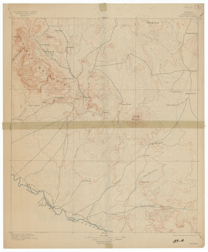
[USGS Topo Quad map of Shafter Sheet, Presidio County]
Print $20.00
- Digital $50.00
[USGS Topo Quad map of Shafter Sheet, Presidio County]
1895
Size: 16.9 x 20.5 inches
91754
[Sketch showing Jeff Davis County, Blocks 1, 2, 3, 4, 360, 363 and JG1]
Print $20.00
- Digital $50.00
[Sketch showing Jeff Davis County, Blocks 1, 2, 3, 4, 360, 363 and JG1]
Size: 20.5 x 13.7 inches
91776
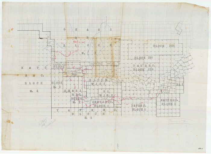
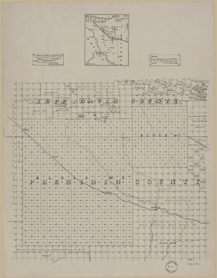
[Sketch of part of county with G.H. & S.A. Blk. 3 on North, H. & T.C. Blk. 4 on West, T. & P. Blk. 1 on South, T. & S. Blks. 224 & 301 on East]
Print $40.00
- Digital $50.00
[Sketch of part of county with G.H. & S.A. Blk. 3 on North, H. & T.C. Blk. 4 on West, T. & P. Blk. 1 on South, T. & S. Blks. 224 & 301 on East]
Size: 51.9 x 37.9 inches
89958
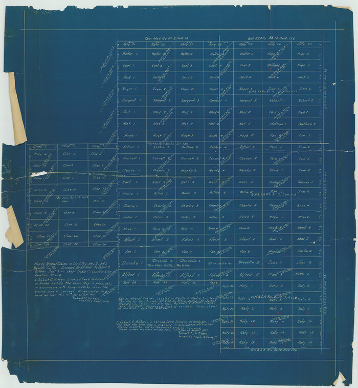
[Sketch for M-12871 to M-13240 - Presidio County]
Print $20.00
- Digital $50.00
[Sketch for M-12871 to M-13240 - Presidio County]
1927
Size: 33.0 x 30.5 inches
65649
[Sketch for M-12871 to M-13240 - Presidio County]
Print $20.00
- Digital $50.00
[Sketch for M-12871 to M-13240 - Presidio County]
1927
Size: 30.6 x 33.0 inches
65650
[Map of T&P Blocks 1 and 2 in Jeff Davis and Presidio Counties]
Print $20.00
[Map of T&P Blocks 1 and 2 in Jeff Davis and Presidio Counties]
Size: 22.2 x 17.3 inches
88959
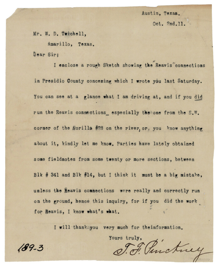
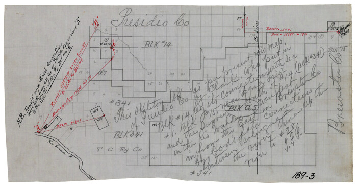
[Letter from T. F. Pinckney to W. D. Twichell accompanying sketch showing Blocks 14, 341, and G5]
Print $2.00
- Digital $50.00
[Letter from T. F. Pinckney to W. D. Twichell accompanying sketch showing Blocks 14, 341, and G5]
1911
Size: 8.0 x 9.5 inches
93110
[Letter from T. F. Pinckney to W. D. Twichell accompanying sketch showing Blocks 14, 341, and G5]
Print $2.00
- Digital $50.00
[Letter from T. F. Pinckney to W. D. Twichell accompanying sketch showing Blocks 14, 341, and G5]
Size: 15.1 x 7.9 inches
93111
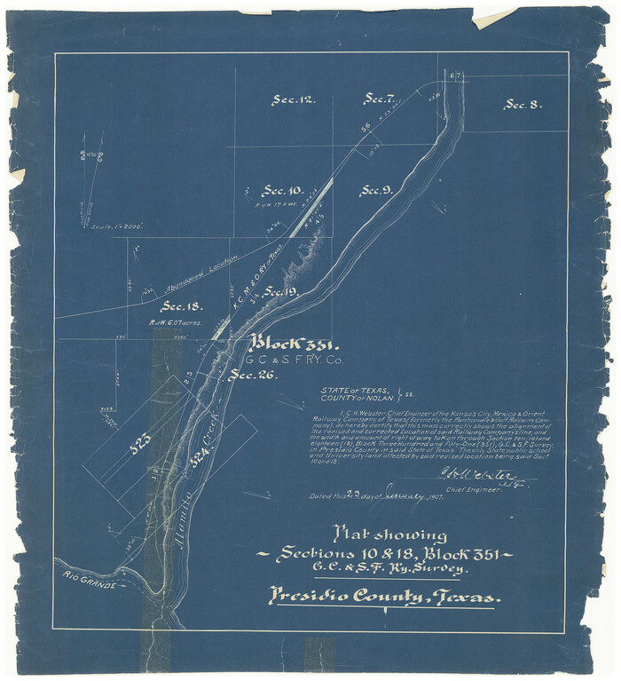
[Kansas City, Mexico & Orient] Plat Showing Sections 10 & 17, Block 351, GC & SF Ry. Survey, Presidio County, Texas
Print $20.00
- Digital $50.00
[Kansas City, Mexico & Orient] Plat Showing Sections 10 & 17, Block 351, GC & SF Ry. Survey, Presidio County, Texas
Size: 17.6 x 16.0 inches
64270
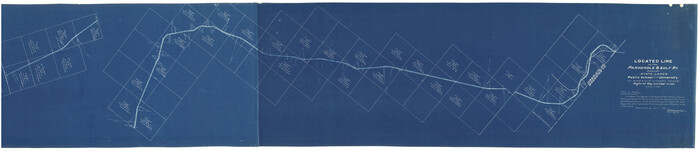
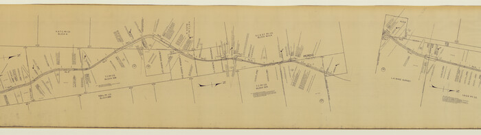
[Kansas City, Mexico & Orient] Located Line of the Panhandle and Gulf RY. Through Stand Lands, Public School and University, In Presidio County Texas, Right of Way 200 feet Wide
Print $40.00
- Digital $50.00
[Kansas City, Mexico & Orient] Located Line of the Panhandle and Gulf RY. Through Stand Lands, Public School and University, In Presidio County Texas, Right of Way 200 feet Wide
1904
Size: 15.6 x 70.3 inches
64269
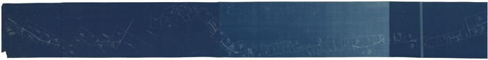
[Kansas City, Mexico & Orient]
Print $40.00
- Digital $50.00
[Kansas City, Mexico & Orient]
1904
Size: 16.2 x 123.7 inches
64268
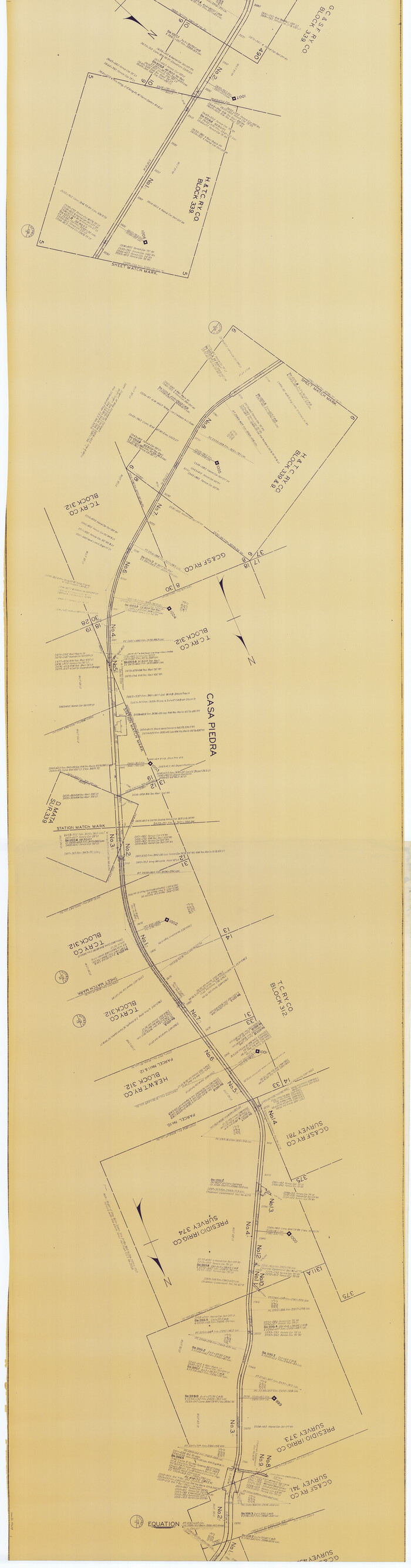
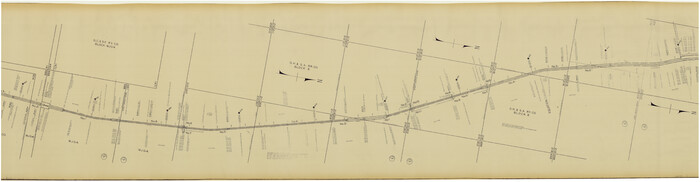
[Gulf Colorado & Santa Fe from 2178+36.0 to 3901+06.2]
Print $40.00
- Digital $50.00
[Gulf Colorado & Santa Fe from 2178+36.0 to 3901+06.2]
Size: 33.6 x 120.7 inches
64695
[Gulf Colorado & Santa Fe from 2178+36.0 to 3901+06.2]
Print $40.00
- Digital $50.00
[Gulf Colorado & Santa Fe from 2178+36.0 to 3901+06.2]
Size: 32.0 x 120.5 inches
64696
[Gulf Colorado & Santa Fe from 2178+36.0 to 3901+06.2]
Print $40.00
- Digital $50.00
[Gulf Colorado & Santa Fe from 2178+36.0 to 3901+06.2]
Size: 33.2 x 121.6 inches
64697
[Gulf Colorado & Santa Fe from 2178+36.0 to 3901+06.2]
Print $40.00
- Digital $50.00
[Gulf Colorado & Santa Fe from 2178+36.0 to 3901+06.2]
Size: 123.0 x 32.2 inches
64698
[Gulf Colorado & Santa Fe from 2178+36.0 to 3901+06.2]
Print $40.00
- Digital $50.00
[Gulf Colorado & Santa Fe from 2178+36.0 to 3901+06.2]
Size: 31.9 x 58.9 inches
64699
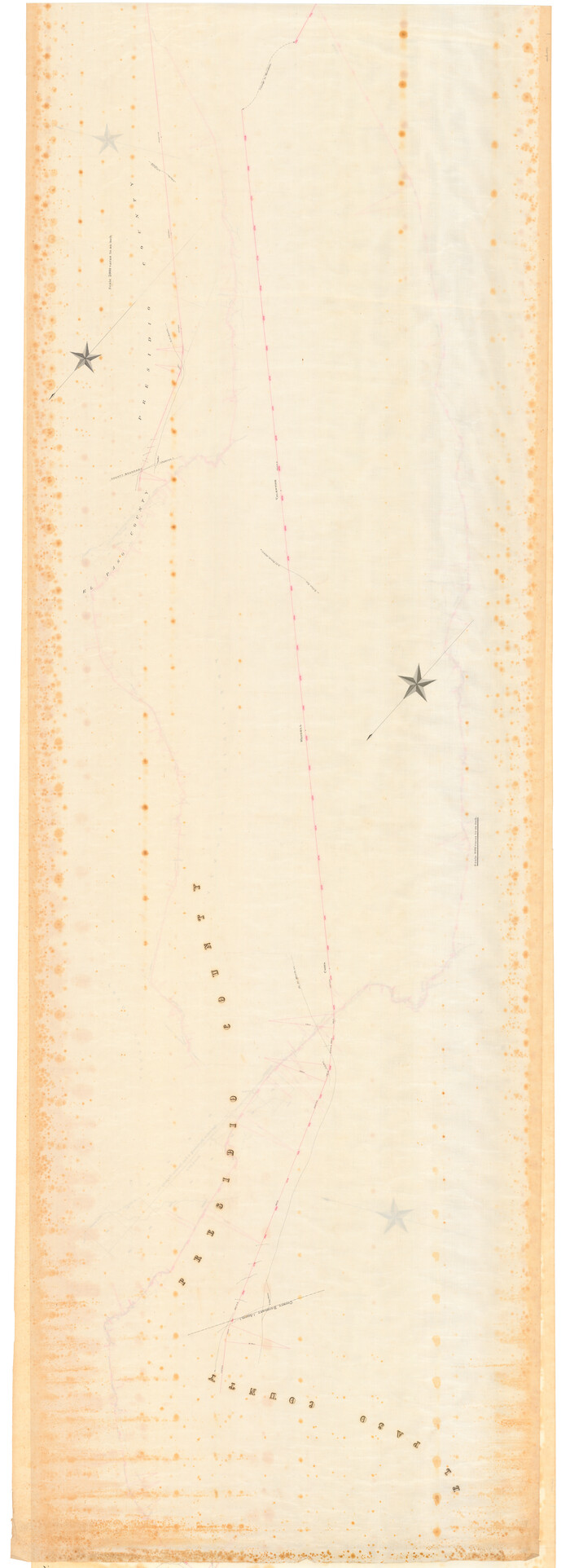
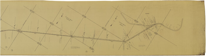
[Galveston, Harrisburg & San Antonio from El Paso-Presidio county boundary to Presidio-Pecos county boundary]
Print $40.00
- Digital $50.00
[Galveston, Harrisburg & San Antonio from El Paso-Presidio county boundary to Presidio-Pecos county boundary]
Size: 124.4 x 45.3 inches
64716
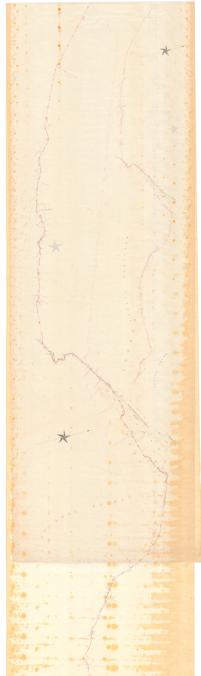
[Galveston, Harrisburg & San Antonio from El Paso-Presidio county boundary to Presidio-Pecos county boundary]
Print $40.00
- Digital $50.00
[Galveston, Harrisburg & San Antonio from El Paso-Presidio county boundary to Presidio-Pecos county boundary]
Size: 149.3 x 44.4 inches
64717
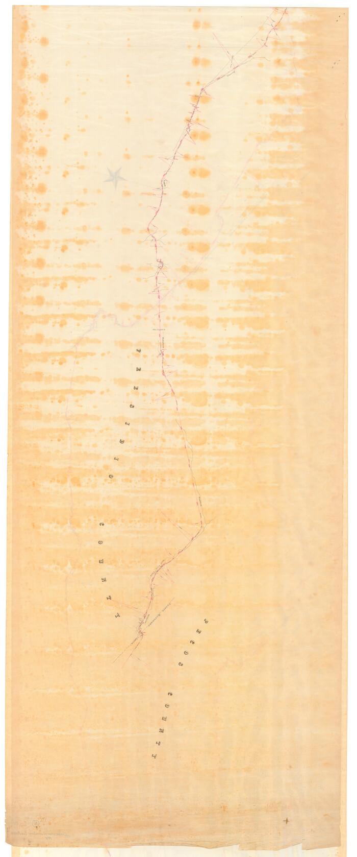
[Galveston, Harrisburg & San Antonio from El Paso-Presidio county boundary to Presidio-Pecos county boundary]
Print $40.00
- Digital $50.00
[Galveston, Harrisburg & San Antonio from El Paso-Presidio county boundary to Presidio-Pecos county boundary]
Size: 106.1 x 44.3 inches
64718
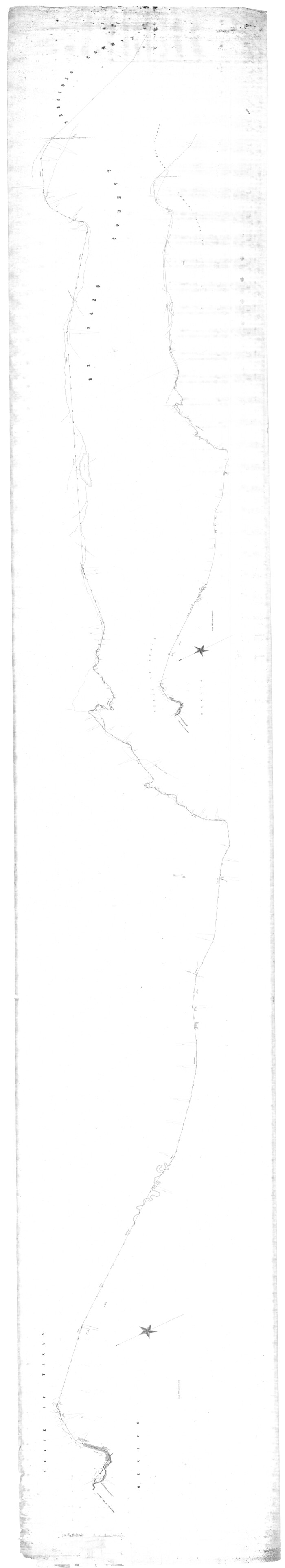
[Galveston, Harrisburg & San Antonio from El Paso to El Paso-Presidio county boundary]
Print $40.00
- Digital $50.00
[Galveston, Harrisburg & San Antonio from El Paso to El Paso-Presidio county boundary]
Size: 150.0 x 27.3 inches
64719
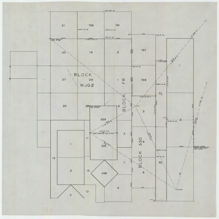
[Blocks WJG2, FR, 330]
Print $20.00
- Digital $50.00
[Blocks WJG2, FR, 330]
Size: 25.8 x 25.8 inches
92330
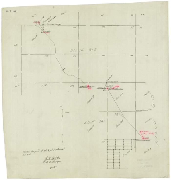
[Blocks 341, G-5, G-12, TCRRCo.]
Print $20.00
- Digital $50.00
[Blocks 341, G-5, G-12, TCRRCo.]
1954
Size: 23.7 x 22.7 inches
2069
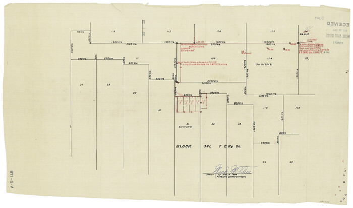
[Blocks 341, G-5, G-12, TCRRCo.]
Print $20.00
- Digital $50.00
[Blocks 341, G-5, G-12, TCRRCo.]
1954
Size: 15.1 x 26.1 inches
60298
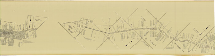
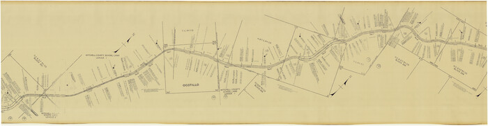
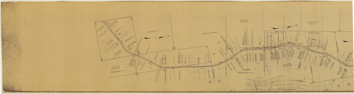
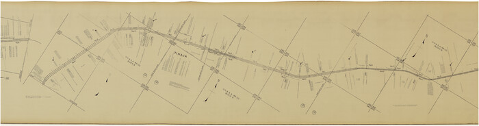
[Atchison, Topeka & Santa Fe from Paisano to south of Plata]
Print $40.00
- Digital $50.00
[Atchison, Topeka & Santa Fe from Paisano to south of Plata]
Size: 32.3 x 120.8 inches
64709
[Atchison, Topeka & Santa Fe from Paisano to south of Plata]
Print $40.00
- Digital $50.00
[Atchison, Topeka & Santa Fe from Paisano to south of Plata]
Size: 34.2 x 121.7 inches
64710
[Atchison, Topeka & Santa Fe from Paisano to south of Plata]
Print $40.00
- Digital $50.00
[Atchison, Topeka & Santa Fe from Paisano to south of Plata]
Size: 34.8 x 123.1 inches
64711
[Atchison, Topeka & Santa Fe from Paisano to south of Plata]
Print $40.00
- Digital $50.00
[Atchison, Topeka & Santa Fe from Paisano to south of Plata]
Size: 32.3 x 121.5 inches
64712
[Atchison, Topeka & Santa Fe from Paisano to south of Plata]
Print $40.00
- Digital $50.00
[Atchison, Topeka & Santa Fe from Paisano to south of Plata]
Size: 32.2 x 116.3 inches
64713
Working Sketch of Surveys in Presidio County in the area east of Shafter, Texas

Print $20.00
- Digital $50.00
Working Sketch of Surveys in Presidio County in the area east of Shafter, Texas
1947
Size: 37.5 x 40.1 inches
89889
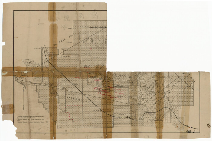
West Part Presidio Co.

Print $20.00
- Digital $50.00
West Part Presidio Co.
1974
Size: 42.1 x 33.3 inches
73267
[USGS Topo Quad map of Shafter Sheet, Presidio County]
Print $20.00
- Digital $50.00
[USGS Topo Quad map of Shafter Sheet, Presidio County]
1895
-
Size
16.9 x 20.5 inches
-
Map/Doc
91754
-
Creation Date
1895
[Sketch showing Jeff Davis County, Blocks 1, 2, 3, 4, 360, 363 and JG1]
Print $20.00
- Digital $50.00
[Sketch showing Jeff Davis County, Blocks 1, 2, 3, 4, 360, 363 and JG1]
-
Size
20.5 x 13.7 inches
-
Map/Doc
91776
[Sketch of part of county with G.H. & S.A. Blk. 3 on North, H. & T.C. Blk. 4 on West, T. & P. Blk. 1 on South, T. & S. Blks. 224 & 301 on East]
Print $40.00
- Digital $50.00
[Sketch of part of county with G.H. & S.A. Blk. 3 on North, H. & T.C. Blk. 4 on West, T. & P. Blk. 1 on South, T. & S. Blks. 224 & 301 on East]
-
Size
51.9 x 37.9 inches
-
Map/Doc
89958
[Sketch for M-12871 to M-13240 - Presidio County]
Print $20.00
- Digital $50.00
[Sketch for M-12871 to M-13240 - Presidio County]
1927
-
Size
33.0 x 30.5 inches
-
Map/Doc
65649
-
Creation Date
1927
[Sketch for M-12871 to M-13240 - Presidio County]
Print $20.00
- Digital $50.00
[Sketch for M-12871 to M-13240 - Presidio County]
1927
-
Size
30.6 x 33.0 inches
-
Map/Doc
65650
-
Creation Date
1927
[Map of T&P Blocks 1 and 2 in Jeff Davis and Presidio Counties]
Print $20.00
[Map of T&P Blocks 1 and 2 in Jeff Davis and Presidio Counties]
-
Size
22.2 x 17.3 inches
-
Map/Doc
88959
[Letter from T. F. Pinckney to W. D. Twichell accompanying sketch showing Blocks 14, 341, and G5]
Print $2.00
- Digital $50.00
[Letter from T. F. Pinckney to W. D. Twichell accompanying sketch showing Blocks 14, 341, and G5]
1911
-
Size
8.0 x 9.5 inches
-
Map/Doc
93110
-
Creation Date
1911
[Letter from T. F. Pinckney to W. D. Twichell accompanying sketch showing Blocks 14, 341, and G5]
Print $2.00
- Digital $50.00
[Letter from T. F. Pinckney to W. D. Twichell accompanying sketch showing Blocks 14, 341, and G5]
-
Size
15.1 x 7.9 inches
-
Map/Doc
93111
[Kansas City, Mexico & Orient] Plat Showing Sections 10 & 17, Block 351, GC & SF Ry. Survey, Presidio County, Texas
Print $20.00
- Digital $50.00
[Kansas City, Mexico & Orient] Plat Showing Sections 10 & 17, Block 351, GC & SF Ry. Survey, Presidio County, Texas
-
Size
17.6 x 16.0 inches
-
Map/Doc
64270
[Kansas City, Mexico & Orient] Located Line of the Panhandle and Gulf RY. Through Stand Lands, Public School and University, In Presidio County Texas, Right of Way 200 feet Wide
Print $40.00
- Digital $50.00
[Kansas City, Mexico & Orient] Located Line of the Panhandle and Gulf RY. Through Stand Lands, Public School and University, In Presidio County Texas, Right of Way 200 feet Wide
1904
-
Size
15.6 x 70.3 inches
-
Map/Doc
64269
-
Creation Date
1904
[Kansas City, Mexico & Orient]
Print $40.00
- Digital $50.00
[Kansas City, Mexico & Orient]
1904
-
Size
16.2 x 123.7 inches
-
Map/Doc
64268
-
Creation Date
1904
[Gulf Colorado & Santa Fe from 2178+36.0 to 3901+06.2]
Print $40.00
- Digital $50.00
[Gulf Colorado & Santa Fe from 2178+36.0 to 3901+06.2]
-
Size
33.6 x 120.7 inches
-
Map/Doc
64695
[Gulf Colorado & Santa Fe from 2178+36.0 to 3901+06.2]
Print $40.00
- Digital $50.00
[Gulf Colorado & Santa Fe from 2178+36.0 to 3901+06.2]
-
Size
32.0 x 120.5 inches
-
Map/Doc
64696
[Gulf Colorado & Santa Fe from 2178+36.0 to 3901+06.2]
Print $40.00
- Digital $50.00
[Gulf Colorado & Santa Fe from 2178+36.0 to 3901+06.2]
-
Size
33.2 x 121.6 inches
-
Map/Doc
64697
[Gulf Colorado & Santa Fe from 2178+36.0 to 3901+06.2]
Print $40.00
- Digital $50.00
[Gulf Colorado & Santa Fe from 2178+36.0 to 3901+06.2]
-
Size
123.0 x 32.2 inches
-
Map/Doc
64698
[Gulf Colorado & Santa Fe from 2178+36.0 to 3901+06.2]
Print $40.00
- Digital $50.00
[Gulf Colorado & Santa Fe from 2178+36.0 to 3901+06.2]
-
Size
31.9 x 58.9 inches
-
Map/Doc
64699
[Galveston, Harrisburg & San Antonio from El Paso-Presidio county boundary to Presidio-Pecos county boundary]
Print $40.00
- Digital $50.00
[Galveston, Harrisburg & San Antonio from El Paso-Presidio county boundary to Presidio-Pecos county boundary]
-
Size
124.4 x 45.3 inches
-
Map/Doc
64716
[Galveston, Harrisburg & San Antonio from El Paso-Presidio county boundary to Presidio-Pecos county boundary]
Print $40.00
- Digital $50.00
[Galveston, Harrisburg & San Antonio from El Paso-Presidio county boundary to Presidio-Pecos county boundary]
-
Size
149.3 x 44.4 inches
-
Map/Doc
64717
[Galveston, Harrisburg & San Antonio from El Paso-Presidio county boundary to Presidio-Pecos county boundary]
Print $40.00
- Digital $50.00
[Galveston, Harrisburg & San Antonio from El Paso-Presidio county boundary to Presidio-Pecos county boundary]
-
Size
106.1 x 44.3 inches
-
Map/Doc
64718
[Galveston, Harrisburg & San Antonio from El Paso to El Paso-Presidio county boundary]
Print $40.00
- Digital $50.00
[Galveston, Harrisburg & San Antonio from El Paso to El Paso-Presidio county boundary]
-
Size
150.0 x 27.3 inches
-
Map/Doc
64719
[Blocks WJG2, FR, 330]
Print $20.00
- Digital $50.00
[Blocks WJG2, FR, 330]
-
Size
25.8 x 25.8 inches
-
Map/Doc
92330
[Blocks 341, G-5, G-12, TCRRCo.]
Print $20.00
- Digital $50.00
[Blocks 341, G-5, G-12, TCRRCo.]
1954
-
Size
23.7 x 22.7 inches
-
Map/Doc
2069
-
Creation Date
1954
[Blocks 341, G-5, G-12, TCRRCo.]
Print $20.00
- Digital $50.00
[Blocks 341, G-5, G-12, TCRRCo.]
1954
-
Size
15.1 x 26.1 inches
-
Map/Doc
60298
-
Creation Date
1954
[Atchison, Topeka & Santa Fe from Paisano to south of Plata]
Print $40.00
- Digital $50.00
[Atchison, Topeka & Santa Fe from Paisano to south of Plata]
-
Size
32.3 x 120.8 inches
-
Map/Doc
64709
[Atchison, Topeka & Santa Fe from Paisano to south of Plata]
Print $40.00
- Digital $50.00
[Atchison, Topeka & Santa Fe from Paisano to south of Plata]
-
Size
34.2 x 121.7 inches
-
Map/Doc
64710
[Atchison, Topeka & Santa Fe from Paisano to south of Plata]
Print $40.00
- Digital $50.00
[Atchison, Topeka & Santa Fe from Paisano to south of Plata]
-
Size
34.8 x 123.1 inches
-
Map/Doc
64711
[Atchison, Topeka & Santa Fe from Paisano to south of Plata]
Print $40.00
- Digital $50.00
[Atchison, Topeka & Santa Fe from Paisano to south of Plata]
-
Size
32.3 x 121.5 inches
-
Map/Doc
64712
[Atchison, Topeka & Santa Fe from Paisano to south of Plata]
Print $40.00
- Digital $50.00
[Atchison, Topeka & Santa Fe from Paisano to south of Plata]
-
Size
32.2 x 116.3 inches
-
Map/Doc
64713
Working Sketch of Surveys in Presidio County in the area east of Shafter, Texas
Print $20.00
- Digital $50.00
Working Sketch of Surveys in Presidio County in the area east of Shafter, Texas
1947
-
Size
37.5 x 40.1 inches
-
Map/Doc
89889
-
Creation Date
1947
West Part Presidio Co.
Print $20.00
- Digital $50.00
West Part Presidio Co.
1974
-
Size
42.1 x 33.3 inches
-
Map/Doc
73267
-
Creation Date
1974