[T. & G. Ry. Main Line, Texas, Right of Way Map, Center to Gary]
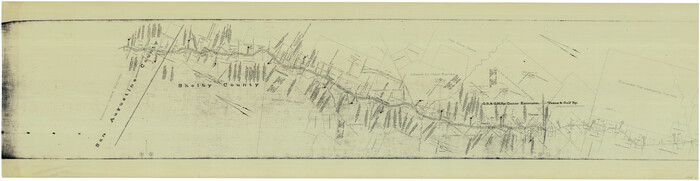
Print $40.00
- Digital $50.00
[T. & G. Ry. Main Line, Texas, Right of Way Map, Center to Gary]
1917
Size: 31.0 x 121.2 inches
64568
[T. & G. Ry. Main Line, Texas, Right of Way Map, Center to Gary]
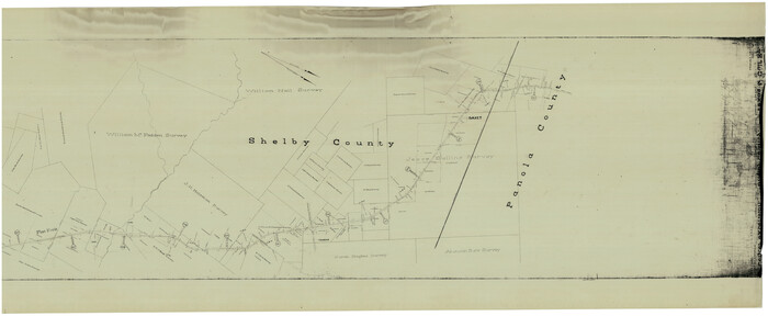
Print $40.00
- Digital $50.00
[T. & G. Ry. Main Line, Texas, Right of Way Map, Center to Gary]
1917
Size: 31.5 x 76.7 inches
64569
[T. & G. Ry. Main Line, Texas, Right of Way Map, Center to Gary]
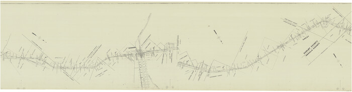
Print $40.00
- Digital $50.00
[T. & G. Ry. Main Line, Texas, Right of Way Map, Center to Gary]
1917
Size: 31.9 x 121.1 inches
64571
[T. & G. Ry. Main Line, Texas, Right of Way Map, Center to Gary]
Print $40.00
- Digital $50.00
[T. & G. Ry. Main Line, Texas, Right of Way Map, Center to Gary]
1917
Size: 31.9 x 104.6 inches
64572
The Republic County of San Augustine. December 29, 1845

Print $20.00
The Republic County of San Augustine. December 29, 1845
2020
Size: 18.8 x 21.7 inches
96272
The Republic County of San Augustine. Boundaries Defined, December 14, 1837

Print $20.00
The Republic County of San Augustine. Boundaries Defined, December 14, 1837
2020
Size: 18.8 x 21.7 inches
96271
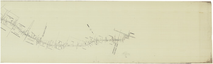
T. & G. Ry. Main Line, Texas, Right of Way Map, Center to Gary

Print $40.00
- Digital $50.00
T. & G. Ry. Main Line, Texas, Right of Way Map, Center to Gary
1917
Size: 32.4 x 122.8 inches
64570
Shelby County Working Sketch 36

Print $20.00
- Digital $50.00
Shelby County Working Sketch 36
2011
Size: 35.0 x 36.0 inches
90093
Shelby County Sketch File 23

Print $5.00
- Digital $50.00
Shelby County Sketch File 23
Size: 16.2 x 7.3 inches
36645
Shelby County Sketch File 20 1/2

Print $4.00
- Digital $50.00
Shelby County Sketch File 20 1/2
1890
Size: 6.6 x 8.4 inches
36640
Shelby County Rolled Sketch 2

Print $20.00
- Digital $50.00
Shelby County Rolled Sketch 2
Size: 20.3 x 30.7 inches
7775
San Augustine and Sabine Counties

Print $20.00
- Digital $50.00
San Augustine and Sabine Counties
1881
Size: 23.7 x 26.3 inches
4012
San Augustine County, Texas

Print $20.00
- Digital $50.00
San Augustine County, Texas
1879
Size: 22.7 x 17.5 inches
752
San Augustine County Working Sketch Graphic Index

Print $20.00
- Digital $50.00
San Augustine County Working Sketch Graphic Index
1949
Size: 47.4 x 29.6 inches
76690
San Augustine County Working Sketch 9

Print $20.00
- Digital $50.00
San Augustine County Working Sketch 9
1935
Size: 41.2 x 39.7 inches
63696
San Augustine County Working Sketch 8

Print $20.00
- Digital $50.00
San Augustine County Working Sketch 8
1935
Size: 24.8 x 35.0 inches
63695
San Augustine County Working Sketch 7

Print $20.00
- Digital $50.00
San Augustine County Working Sketch 7
1935
Size: 24.7 x 34.8 inches
63694
San Augustine County Working Sketch 6

Print $20.00
- Digital $50.00
San Augustine County Working Sketch 6
1935
Size: 22.2 x 37.9 inches
63693
San Augustine County Working Sketch 5

Print $20.00
- Digital $50.00
San Augustine County Working Sketch 5
1935
Size: 39.0 x 37.4 inches
63692
San Augustine County Working Sketch 4

Print $20.00
- Digital $50.00
San Augustine County Working Sketch 4
1934
Size: 24.4 x 27.7 inches
63691
San Augustine County Working Sketch 3

Print $20.00
- Digital $50.00
San Augustine County Working Sketch 3
1934
Size: 22.9 x 13.6 inches
63690
San Augustine County Working Sketch 28

Print $20.00
- Digital $50.00
San Augustine County Working Sketch 28
2011
Size: 23.4 x 36.7 inches
90091
San Augustine County Working Sketch 27

Print $20.00
- Digital $50.00
San Augustine County Working Sketch 27
2009
Size: 30.4 x 31.3 inches
89020
San Augustine County Working Sketch 26

Print $40.00
- Digital $50.00
San Augustine County Working Sketch 26
2008
Size: 63.9 x 33.5 inches
88823
San Augustine County Working Sketch 25

Print $20.00
- Digital $50.00
San Augustine County Working Sketch 25
1976
Size: 28.0 x 36.6 inches
63713
San Augustine County Working Sketch 24

Print $20.00
- Digital $50.00
San Augustine County Working Sketch 24
1975
Size: 27.8 x 39.1 inches
63712
San Augustine County Working Sketch 23

Print $20.00
- Digital $50.00
San Augustine County Working Sketch 23
1974
Size: 23.6 x 36.4 inches
63711
San Augustine County Working Sketch 22

Print $20.00
- Digital $50.00
San Augustine County Working Sketch 22
1974
Size: 16.1 x 29.0 inches
63710
San Augustine County Working Sketch 21

Print $40.00
- Digital $50.00
San Augustine County Working Sketch 21
1973
Size: 56.1 x 47.4 inches
63709
San Augustine County Working Sketch 20

Print $20.00
- Digital $50.00
San Augustine County Working Sketch 20
1969
Size: 15.1 x 24.0 inches
63708
[T. & G. Ry. Main Line, Texas, Right of Way Map, Center to Gary]
Print $40.00
- Digital $50.00
[T. & G. Ry. Main Line, Texas, Right of Way Map, Center to Gary]
1917
-
Size
31.0 x 121.2 inches
-
Map/Doc
64568
-
Creation Date
1917
[T. & G. Ry. Main Line, Texas, Right of Way Map, Center to Gary]
Print $40.00
- Digital $50.00
[T. & G. Ry. Main Line, Texas, Right of Way Map, Center to Gary]
1917
-
Size
31.5 x 76.7 inches
-
Map/Doc
64569
-
Creation Date
1917
[T. & G. Ry. Main Line, Texas, Right of Way Map, Center to Gary]
Print $40.00
- Digital $50.00
[T. & G. Ry. Main Line, Texas, Right of Way Map, Center to Gary]
1917
-
Size
31.9 x 121.1 inches
-
Map/Doc
64571
-
Creation Date
1917
[T. & G. Ry. Main Line, Texas, Right of Way Map, Center to Gary]
Print $40.00
- Digital $50.00
[T. & G. Ry. Main Line, Texas, Right of Way Map, Center to Gary]
1917
-
Size
31.9 x 104.6 inches
-
Map/Doc
64572
-
Creation Date
1917
The Republic County of San Augustine. December 29, 1845
Print $20.00
The Republic County of San Augustine. December 29, 1845
2020
-
Size
18.8 x 21.7 inches
-
Map/Doc
96272
-
Creation Date
2020
The Republic County of San Augustine. Boundaries Defined, December 14, 1837
Print $20.00
The Republic County of San Augustine. Boundaries Defined, December 14, 1837
2020
-
Size
18.8 x 21.7 inches
-
Map/Doc
96271
-
Creation Date
2020
T. & G. Ry. Main Line, Texas, Right of Way Map, Center to Gary
Print $40.00
- Digital $50.00
T. & G. Ry. Main Line, Texas, Right of Way Map, Center to Gary
1917
-
Size
32.4 x 122.8 inches
-
Map/Doc
64570
-
Creation Date
1917
Shelby County Working Sketch 36
Print $20.00
- Digital $50.00
Shelby County Working Sketch 36
2011
-
Size
35.0 x 36.0 inches
-
Map/Doc
90093
-
Creation Date
2011
Shelby County Sketch File 23
Print $5.00
- Digital $50.00
Shelby County Sketch File 23
-
Size
16.2 x 7.3 inches
-
Map/Doc
36645
Shelby County Sketch File 20 1/2
Print $4.00
- Digital $50.00
Shelby County Sketch File 20 1/2
1890
-
Size
6.6 x 8.4 inches
-
Map/Doc
36640
-
Creation Date
1890
Shelby County Rolled Sketch 2
Print $20.00
- Digital $50.00
Shelby County Rolled Sketch 2
-
Size
20.3 x 30.7 inches
-
Map/Doc
7775
San Augustine and Sabine Counties
Print $20.00
- Digital $50.00
San Augustine and Sabine Counties
1881
-
Size
23.7 x 26.3 inches
-
Map/Doc
4012
-
Creation Date
1881
San Augustine County, Texas
Print $20.00
- Digital $50.00
San Augustine County, Texas
1879
-
Size
22.7 x 17.5 inches
-
Map/Doc
752
-
Creation Date
1879
San Augustine County Working Sketch Graphic Index
Print $20.00
- Digital $50.00
San Augustine County Working Sketch Graphic Index
1949
-
Size
47.4 x 29.6 inches
-
Map/Doc
76690
-
Creation Date
1949
San Augustine County Working Sketch 9
Print $20.00
- Digital $50.00
San Augustine County Working Sketch 9
1935
-
Size
41.2 x 39.7 inches
-
Map/Doc
63696
-
Creation Date
1935
San Augustine County Working Sketch 8
Print $20.00
- Digital $50.00
San Augustine County Working Sketch 8
1935
-
Size
24.8 x 35.0 inches
-
Map/Doc
63695
-
Creation Date
1935
San Augustine County Working Sketch 7
Print $20.00
- Digital $50.00
San Augustine County Working Sketch 7
1935
-
Size
24.7 x 34.8 inches
-
Map/Doc
63694
-
Creation Date
1935
San Augustine County Working Sketch 6
Print $20.00
- Digital $50.00
San Augustine County Working Sketch 6
1935
-
Size
22.2 x 37.9 inches
-
Map/Doc
63693
-
Creation Date
1935
San Augustine County Working Sketch 5
Print $20.00
- Digital $50.00
San Augustine County Working Sketch 5
1935
-
Size
39.0 x 37.4 inches
-
Map/Doc
63692
-
Creation Date
1935
San Augustine County Working Sketch 4
Print $20.00
- Digital $50.00
San Augustine County Working Sketch 4
1934
-
Size
24.4 x 27.7 inches
-
Map/Doc
63691
-
Creation Date
1934
San Augustine County Working Sketch 3
Print $20.00
- Digital $50.00
San Augustine County Working Sketch 3
1934
-
Size
22.9 x 13.6 inches
-
Map/Doc
63690
-
Creation Date
1934
San Augustine County Working Sketch 28
Print $20.00
- Digital $50.00
San Augustine County Working Sketch 28
2011
-
Size
23.4 x 36.7 inches
-
Map/Doc
90091
-
Creation Date
2011
San Augustine County Working Sketch 27
Print $20.00
- Digital $50.00
San Augustine County Working Sketch 27
2009
-
Size
30.4 x 31.3 inches
-
Map/Doc
89020
-
Creation Date
2009
San Augustine County Working Sketch 26
Print $40.00
- Digital $50.00
San Augustine County Working Sketch 26
2008
-
Size
63.9 x 33.5 inches
-
Map/Doc
88823
-
Creation Date
2008
San Augustine County Working Sketch 25
Print $20.00
- Digital $50.00
San Augustine County Working Sketch 25
1976
-
Size
28.0 x 36.6 inches
-
Map/Doc
63713
-
Creation Date
1976
San Augustine County Working Sketch 24
Print $20.00
- Digital $50.00
San Augustine County Working Sketch 24
1975
-
Size
27.8 x 39.1 inches
-
Map/Doc
63712
-
Creation Date
1975
San Augustine County Working Sketch 23
Print $20.00
- Digital $50.00
San Augustine County Working Sketch 23
1974
-
Size
23.6 x 36.4 inches
-
Map/Doc
63711
-
Creation Date
1974
San Augustine County Working Sketch 22
Print $20.00
- Digital $50.00
San Augustine County Working Sketch 22
1974
-
Size
16.1 x 29.0 inches
-
Map/Doc
63710
-
Creation Date
1974
San Augustine County Working Sketch 21
Print $40.00
- Digital $50.00
San Augustine County Working Sketch 21
1973
-
Size
56.1 x 47.4 inches
-
Map/Doc
63709
-
Creation Date
1973
San Augustine County Working Sketch 20
Print $20.00
- Digital $50.00
San Augustine County Working Sketch 20
1969
-
Size
15.1 x 24.0 inches
-
Map/Doc
63708
-
Creation Date
1969