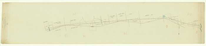
Tarrant County Sketch File 31

Print $20.00
- Digital $50.00
Tarrant County Sketch File 31
Size: 27.2 x 39.3 inches
10380
Dallas County Sketch File 19

Print $20.00
- Digital $50.00
Dallas County Sketch File 19
Size: 17.1 x 17.9 inches
11287
Dallas County Sketch File 19 1/2

Print $4.00
- Digital $50.00
Dallas County Sketch File 19 1/2
Size: 9.9 x 8.2 inches
20439
Johnson County Sketch File 1

Print $48.00
- Digital $50.00
Johnson County Sketch File 1
Size: 8.0 x 6.9 inches
28427
Parker County Sketch File 9

Print $4.00
- Digital $50.00
Parker County Sketch File 9
Size: 8.1 x 10.0 inches
33538
Tarrant County Sketch File 3

Print $4.00
- Digital $50.00
Tarrant County Sketch File 3
Size: 11.8 x 8.2 inches
37676
Tarrant County Sketch File 19

Print $4.00
- Digital $50.00
Tarrant County Sketch File 19
Size: 9.7 x 8.1 inches
37721
Tarrant County Sketch File 21

Print $4.00
- Digital $50.00
Tarrant County Sketch File 21
Size: 12.5 x 8.4 inches
37725
Tarrant County Sketch File 23

Print $4.00
- Digital $50.00
Tarrant County Sketch File 23
Size: 6.1 x 8.2 inches
37733
Tarrant County Sketch File 27

Print $4.00
- Digital $50.00
Tarrant County Sketch File 27
Size: 8.0 x 9.6 inches
37741
Tarrant County Boundary File 1

Print $20.00
- Digital $50.00
Tarrant County Boundary File 1
Size: 9.2 x 34.6 inches
59110
Tarrant County Boundary File 2

Print $6.00
- Digital $50.00
Tarrant County Boundary File 2
Size: 14.4 x 9.0 inches
59111
Tarrant County Boundary File 2a

Print $62.00
- Digital $50.00
Tarrant County Boundary File 2a
Size: 9.0 x 4.8 inches
59114
Tarrant County Boundary File 3

Print $30.00
- Digital $50.00
Tarrant County Boundary File 3
Size: 11.4 x 8.8 inches
59136
Tarrant County Boundary File 4 and 4a

Print $6.00
- Digital $50.00
Tarrant County Boundary File 4 and 4a
Size: 11.5 x 9.0 inches
59151
Tarrant County Boundary File 4 and 4a

Print $14.00
- Digital $50.00
Tarrant County Boundary File 4 and 4a
Size: 11.5 x 8.9 inches
59154
Tarrant County Boundary File 5

Print $104.00
- Digital $50.00
Tarrant County Boundary File 5
Size: 11.4 x 8.8 inches
59161
Tarrant County Boundary File 82

Print $22.00
- Digital $50.00
Tarrant County Boundary File 82
Size: 8.9 x 7.0 inches
59173
Map showing lands acquired for reservoir purposes in connection with Lake Worth and the boundary of territory annexed to the City of Fort Worth, Texas

Print $40.00
- Digital $50.00
Map showing lands acquired for reservoir purposes in connection with Lake Worth and the boundary of territory annexed to the City of Fort Worth, Texas
Size: 46.4 x 58.9 inches
62209
Map showing lands acquired for reservoir purposes in connection with Lake Worth and the boundary of territory annexed to the City of Fort Worth, Texas

Print $40.00
- Digital $50.00
Map showing lands acquired for reservoir purposes in connection with Lake Worth and the boundary of territory annexed to the City of Fort Worth, Texas
Size: 46.6 x 59.6 inches
62210
Map of Located Land of Gulf, Colorado & Santa Fe Ry. Co. through Denton

Print $40.00
- Digital $50.00
Map of Located Land of Gulf, Colorado & Santa Fe Ry. Co. through Denton
Size: 55.5 x 25.8 inches
64341
[Location, Chicago & Rock Island Railroad Through Tarrant County]
Print $40.00
- Digital $50.00
[Location, Chicago & Rock Island Railroad Through Tarrant County]
Size: 25.9 x 115.5 inches
64343
Map of the Texas & Pacific Railway from Fort Worth to El Paso

Print $40.00
- Digital $50.00
Map of the Texas & Pacific Railway from Fort Worth to El Paso
Size: 24.0 x 76.5 inches
64511
Map of the Recognised Line, M. El. P. & P. RR. from Texas & Arkansas State Line to Milam & Bexar Land District Line

Print $40.00
- Digital $50.00
Map of the Recognised Line, M. El. P. & P. RR. from Texas & Arkansas State Line to Milam & Bexar Land District Line
Size: 15.3 x 89.4 inches
64638
Tarrant County Rolled Sketch 2

Print $40.00
- Digital $50.00
Tarrant County Rolled Sketch 2
Size: 91.5 x 13.4 inches
78246
Tarrant County Rolled Sketch 3

Print $20.00
- Digital $50.00
Tarrant County Rolled Sketch 3
Size: 23.3 x 28.6 inches
7910
Tarrant County Rolled Sketch 4

Print $20.00
- Digital $50.00
Tarrant County Rolled Sketch 4
Size: 27.0 x 18.9 inches
7911


Arlington Street Map & Guide

Digital $50.00
Arlington Street Map & Guide
Size: 35.5 x 23.2 inches
94436
Tarrant County Sketch File 31
Print $20.00
- Digital $50.00
Tarrant County Sketch File 31
-
Size
27.2 x 39.3 inches
-
Map/Doc
10380
Dallas County Sketch File 19
Print $20.00
- Digital $50.00
Dallas County Sketch File 19
-
Size
17.1 x 17.9 inches
-
Map/Doc
11287
Dallas County Sketch File 19 1/2
Print $4.00
- Digital $50.00
Dallas County Sketch File 19 1/2
-
Size
9.9 x 8.2 inches
-
Map/Doc
20439
Johnson County Sketch File 1
Print $48.00
- Digital $50.00
Johnson County Sketch File 1
-
Size
8.0 x 6.9 inches
-
Map/Doc
28427
Parker County Sketch File 9
Print $4.00
- Digital $50.00
Parker County Sketch File 9
-
Size
8.1 x 10.0 inches
-
Map/Doc
33538
Tarrant County Sketch File 3
Print $4.00
- Digital $50.00
Tarrant County Sketch File 3
-
Size
11.8 x 8.2 inches
-
Map/Doc
37676
Tarrant County Sketch File 19
Print $4.00
- Digital $50.00
Tarrant County Sketch File 19
-
Size
9.7 x 8.1 inches
-
Map/Doc
37721
Tarrant County Sketch File 21
Print $4.00
- Digital $50.00
Tarrant County Sketch File 21
-
Size
12.5 x 8.4 inches
-
Map/Doc
37725
Tarrant County Sketch File 23
Print $4.00
- Digital $50.00
Tarrant County Sketch File 23
-
Size
6.1 x 8.2 inches
-
Map/Doc
37733
Tarrant County Sketch File 27
Print $4.00
- Digital $50.00
Tarrant County Sketch File 27
-
Size
8.0 x 9.6 inches
-
Map/Doc
37741
Tarrant County Boundary File 1
Print $20.00
- Digital $50.00
Tarrant County Boundary File 1
-
Size
9.2 x 34.6 inches
-
Map/Doc
59110
Tarrant County Boundary File 2
Print $6.00
- Digital $50.00
Tarrant County Boundary File 2
-
Size
14.4 x 9.0 inches
-
Map/Doc
59111
Tarrant County Boundary File 2a
Print $62.00
- Digital $50.00
Tarrant County Boundary File 2a
-
Size
9.0 x 4.8 inches
-
Map/Doc
59114
Tarrant County Boundary File 3
Print $30.00
- Digital $50.00
Tarrant County Boundary File 3
-
Size
11.4 x 8.8 inches
-
Map/Doc
59136
Tarrant County Boundary File 4 and 4a
Print $6.00
- Digital $50.00
Tarrant County Boundary File 4 and 4a
-
Size
11.5 x 9.0 inches
-
Map/Doc
59151
Tarrant County Boundary File 4 and 4a
Print $14.00
- Digital $50.00
Tarrant County Boundary File 4 and 4a
-
Size
11.5 x 8.9 inches
-
Map/Doc
59154
Tarrant County Boundary File 5
Print $104.00
- Digital $50.00
Tarrant County Boundary File 5
-
Size
11.4 x 8.8 inches
-
Map/Doc
59161
Tarrant County Boundary File 82
Print $22.00
- Digital $50.00
Tarrant County Boundary File 82
-
Size
8.9 x 7.0 inches
-
Map/Doc
59173
Map showing lands acquired for reservoir purposes in connection with Lake Worth and the boundary of territory annexed to the City of Fort Worth, Texas
Print $40.00
- Digital $50.00
Map showing lands acquired for reservoir purposes in connection with Lake Worth and the boundary of territory annexed to the City of Fort Worth, Texas
-
Size
46.4 x 58.9 inches
-
Map/Doc
62209
Map showing lands acquired for reservoir purposes in connection with Lake Worth and the boundary of territory annexed to the City of Fort Worth, Texas
Print $40.00
- Digital $50.00
Map showing lands acquired for reservoir purposes in connection with Lake Worth and the boundary of territory annexed to the City of Fort Worth, Texas
-
Size
46.6 x 59.6 inches
-
Map/Doc
62210
Map of Located Land of Gulf, Colorado & Santa Fe Ry. Co. through Denton
Print $40.00
- Digital $50.00
Map of Located Land of Gulf, Colorado & Santa Fe Ry. Co. through Denton
-
Size
55.5 x 25.8 inches
-
Map/Doc
64341
[Location, Chicago & Rock Island Railroad Through Tarrant County]
Print $40.00
- Digital $50.00
[Location, Chicago & Rock Island Railroad Through Tarrant County]
-
Size
25.9 x 115.5 inches
-
Map/Doc
64343
Map of the Texas & Pacific Railway from Fort Worth to El Paso
Print $40.00
- Digital $50.00
Map of the Texas & Pacific Railway from Fort Worth to El Paso
-
Size
24.0 x 76.5 inches
-
Map/Doc
64511
Map of the Recognised Line, M. El. P. & P. RR. from Texas & Arkansas State Line to Milam & Bexar Land District Line
Print $40.00
- Digital $50.00
Map of the Recognised Line, M. El. P. & P. RR. from Texas & Arkansas State Line to Milam & Bexar Land District Line
-
Size
15.3 x 89.4 inches
-
Map/Doc
64638
Tarrant County Rolled Sketch 2
Print $40.00
- Digital $50.00
Tarrant County Rolled Sketch 2
-
Size
91.5 x 13.4 inches
-
Map/Doc
78246
Tarrant County Rolled Sketch 3
Print $20.00
- Digital $50.00
Tarrant County Rolled Sketch 3
-
Size
23.3 x 28.6 inches
-
Map/Doc
7910
Tarrant County Rolled Sketch 4
Print $20.00
- Digital $50.00
Tarrant County Rolled Sketch 4
-
Size
27.0 x 18.9 inches
-
Map/Doc
7911
Arlington Street Map & Guide
Digital $50.00
Arlington Street Map & Guide
-
Size
35.5 x 23.2 inches
-
Map/Doc
94436