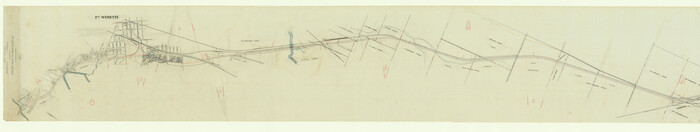
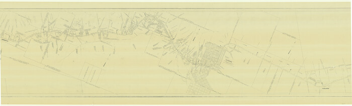
[Map of Chicago, Rock Island & Texas Railway through Tarrant County, Texas]
Print $40.00
- Digital $50.00
[Map of Chicago, Rock Island & Texas Railway through Tarrant County, Texas]
1893
Size: 22.9 x 122.0 inches
64412
[Map of Chicago, Rock Island & Texas Railway through Tarrant County, Texas]
Print $40.00
- Digital $50.00
[Map of Chicago, Rock Island & Texas Railway through Tarrant County, Texas]
1893
Size: 22.3 x 121.8 inches
64413
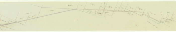
[Location, Chicago & Rock Island Railroad Through Tarrant County]
Print $40.00
- Digital $50.00
[Location, Chicago & Rock Island Railroad Through Tarrant County]
Size: 25.9 x 115.5 inches
64343
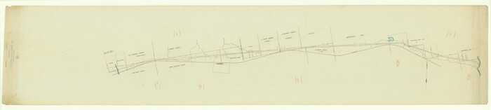
[G. C. & S. F. Ry. Northern-Division, Alignment and Right of Way Map, Weatherford Branch, Johnson and Hood Counties, Texas]
Print $40.00
- Digital $50.00
[G. C. & S. F. Ry. Northern-Division, Alignment and Right of Way Map, Weatherford Branch, Johnson and Hood Counties, Texas]
1935
Size: 37.4 x 120.9 inches
64648
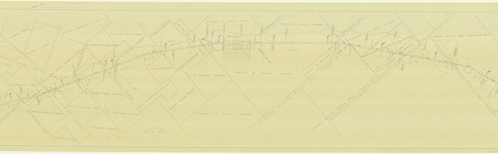
[G. C. & S. F. Ry. Alinement (sic) and Right of Way Map of Dallas Branch, Johnson County, Texas]
Print $40.00
- Digital $50.00
[G. C. & S. F. Ry. Alinement (sic) and Right of Way Map of Dallas Branch, Johnson County, Texas]
1926
Size: 37.6 x 124.3 inches
64651
Wise County Working Sketch 28

Print $40.00
- Digital $50.00
Wise County Working Sketch 28
1996
Size: 37.5 x 48.8 inches
72642
Wise County Working Sketch 22

Print $20.00
- Digital $50.00
Wise County Working Sketch 22
1980
Size: 28.1 x 27.8 inches
72636
Wise County Sketch File F

Print $20.00
- Digital $50.00
Wise County Sketch File F
1857
Size: 16.2 x 29.2 inches
12704
Wise County Sketch File 34

Print $6.00
- Digital $50.00
Wise County Sketch File 34
1856
Size: 6.3 x 9.6 inches
40592
Trinity River, Wire Bridge Sheet/Denton Creek

Print $6.00
- Digital $50.00
Trinity River, Wire Bridge Sheet/Denton Creek
1938
Size: 30.4 x 29.7 inches
65244
Trinity River, Grapevine Sheet/Denton Creek

Print $6.00
- Digital $50.00
Trinity River, Grapevine Sheet/Denton Creek
1938
Size: 22.2 x 34.7 inches
65243
Tarrant County, Texas

Print $20.00
- Digital $50.00
Tarrant County, Texas
1870
Size: 24.1 x 19.1 inches
758
Tarrant County Working Sketch Graphic Index

Print $20.00
- Digital $50.00
Tarrant County Working Sketch Graphic Index
1942
Size: 44.0 x 35.8 inches
76708
Tarrant County Working Sketch 9

Print $20.00
- Digital $50.00
Tarrant County Working Sketch 9
1986
Size: 38.1 x 42.1 inches
62426
Tarrant County Working Sketch 8

Print $20.00
- Digital $50.00
Tarrant County Working Sketch 8
1982
Size: 33.2 x 19.7 inches
62425
Tarrant County Working Sketch 7

Print $40.00
- Digital $50.00
Tarrant County Working Sketch 7
1981
Size: 18.9 x 54.3 inches
62424
Tarrant County Working Sketch 6

Print $20.00
- Digital $50.00
Tarrant County Working Sketch 6
1979
Size: 29.3 x 18.7 inches
62423
Tarrant County Working Sketch 5

Print $20.00
- Digital $50.00
Tarrant County Working Sketch 5
1980
Size: 27.7 x 27.3 inches
62422
Tarrant County Working Sketch 4

Print $20.00
- Digital $50.00
Tarrant County Working Sketch 4
1952
Size: 20.6 x 19.7 inches
62421
Tarrant County Working Sketch 3

Print $20.00
- Digital $50.00
Tarrant County Working Sketch 3
1948
Size: 26.3 x 24.9 inches
62420
Tarrant County Working Sketch 27

Print $20.00
- Digital $50.00
Tarrant County Working Sketch 27
2010
Size: 19.4 x 35.9 inches
89261
Tarrant County Working Sketch 26

Print $20.00
- Digital $50.00
Tarrant County Working Sketch 26
2004
Size: 27.1 x 43.9 inches
83586
Tarrant County Working Sketch 25

Print $20.00
- Digital $50.00
Tarrant County Working Sketch 25
2004
Size: 27.3 x 38.0 inches
83585
Tarrant County Working Sketch 24

Print $20.00
- Digital $50.00
Tarrant County Working Sketch 24
2003
Size: 26.0 x 34.9 inches
78642
Tarrant County Working Sketch 23

Print $20.00
- Digital $50.00
Tarrant County Working Sketch 23
2001
Size: 15.9 x 15.6 inches
62440
Tarrant County Working Sketch 22

Print $20.00
- Digital $50.00
Tarrant County Working Sketch 22
2001
Size: 27.5 x 23.0 inches
62439
Tarrant County Working Sketch 21

Print $20.00
- Digital $50.00
Tarrant County Working Sketch 21
1999
Size: 17.4 x 22.8 inches
62438
Tarrant County Working Sketch 20

Print $20.00
- Digital $50.00
Tarrant County Working Sketch 20
1999
Size: 15.4 x 16.8 inches
62437
Tarrant County Working Sketch 2

Print $20.00
- Digital $50.00
Tarrant County Working Sketch 2
1940
Size: 21.3 x 19.5 inches
62419
Tarrant County Working Sketch 19

Print $20.00
- Digital $50.00
Tarrant County Working Sketch 19
1999
Size: 11.8 x 18.1 inches
62436
[Map of Chicago, Rock Island & Texas Railway through Tarrant County, Texas]
Print $40.00
- Digital $50.00
[Map of Chicago, Rock Island & Texas Railway through Tarrant County, Texas]
1893
-
Size
22.9 x 122.0 inches
-
Map/Doc
64412
-
Creation Date
1893
[Map of Chicago, Rock Island & Texas Railway through Tarrant County, Texas]
Print $40.00
- Digital $50.00
[Map of Chicago, Rock Island & Texas Railway through Tarrant County, Texas]
1893
-
Size
22.3 x 121.8 inches
-
Map/Doc
64413
-
Creation Date
1893
[Location, Chicago & Rock Island Railroad Through Tarrant County]
Print $40.00
- Digital $50.00
[Location, Chicago & Rock Island Railroad Through Tarrant County]
-
Size
25.9 x 115.5 inches
-
Map/Doc
64343
[G. C. & S. F. Ry. Northern-Division, Alignment and Right of Way Map, Weatherford Branch, Johnson and Hood Counties, Texas]
Print $40.00
- Digital $50.00
[G. C. & S. F. Ry. Northern-Division, Alignment and Right of Way Map, Weatherford Branch, Johnson and Hood Counties, Texas]
1935
-
Size
37.4 x 120.9 inches
-
Map/Doc
64648
-
Creation Date
1935
[G. C. & S. F. Ry. Alinement (sic) and Right of Way Map of Dallas Branch, Johnson County, Texas]
Print $40.00
- Digital $50.00
[G. C. & S. F. Ry. Alinement (sic) and Right of Way Map of Dallas Branch, Johnson County, Texas]
1926
-
Size
37.6 x 124.3 inches
-
Map/Doc
64651
-
Creation Date
1926
Wise County Working Sketch 28
Print $40.00
- Digital $50.00
Wise County Working Sketch 28
1996
-
Size
37.5 x 48.8 inches
-
Map/Doc
72642
-
Creation Date
1996
Wise County Working Sketch 22
Print $20.00
- Digital $50.00
Wise County Working Sketch 22
1980
-
Size
28.1 x 27.8 inches
-
Map/Doc
72636
-
Creation Date
1980
Wise County Sketch File F
Print $20.00
- Digital $50.00
Wise County Sketch File F
1857
-
Size
16.2 x 29.2 inches
-
Map/Doc
12704
-
Creation Date
1857
Wise County Sketch File 34
Print $6.00
- Digital $50.00
Wise County Sketch File 34
1856
-
Size
6.3 x 9.6 inches
-
Map/Doc
40592
-
Creation Date
1856
Trinity River, Wire Bridge Sheet/Denton Creek
Print $6.00
- Digital $50.00
Trinity River, Wire Bridge Sheet/Denton Creek
1938
-
Size
30.4 x 29.7 inches
-
Map/Doc
65244
-
Creation Date
1938
Trinity River, Grapevine Sheet/Denton Creek
Print $6.00
- Digital $50.00
Trinity River, Grapevine Sheet/Denton Creek
1938
-
Size
22.2 x 34.7 inches
-
Map/Doc
65243
-
Creation Date
1938
Tarrant County, Texas
Print $20.00
- Digital $50.00
Tarrant County, Texas
1870
-
Size
24.1 x 19.1 inches
-
Map/Doc
758
-
Creation Date
1870
Tarrant County Working Sketch Graphic Index
Print $20.00
- Digital $50.00
Tarrant County Working Sketch Graphic Index
1942
-
Size
44.0 x 35.8 inches
-
Map/Doc
76708
-
Creation Date
1942
Tarrant County Working Sketch 9
Print $20.00
- Digital $50.00
Tarrant County Working Sketch 9
1986
-
Size
38.1 x 42.1 inches
-
Map/Doc
62426
-
Creation Date
1986
Tarrant County Working Sketch 8
Print $20.00
- Digital $50.00
Tarrant County Working Sketch 8
1982
-
Size
33.2 x 19.7 inches
-
Map/Doc
62425
-
Creation Date
1982
Tarrant County Working Sketch 7
Print $40.00
- Digital $50.00
Tarrant County Working Sketch 7
1981
-
Size
18.9 x 54.3 inches
-
Map/Doc
62424
-
Creation Date
1981
Tarrant County Working Sketch 6
Print $20.00
- Digital $50.00
Tarrant County Working Sketch 6
1979
-
Size
29.3 x 18.7 inches
-
Map/Doc
62423
-
Creation Date
1979
Tarrant County Working Sketch 5
Print $20.00
- Digital $50.00
Tarrant County Working Sketch 5
1980
-
Size
27.7 x 27.3 inches
-
Map/Doc
62422
-
Creation Date
1980
Tarrant County Working Sketch 4
Print $20.00
- Digital $50.00
Tarrant County Working Sketch 4
1952
-
Size
20.6 x 19.7 inches
-
Map/Doc
62421
-
Creation Date
1952
Tarrant County Working Sketch 3
Print $20.00
- Digital $50.00
Tarrant County Working Sketch 3
1948
-
Size
26.3 x 24.9 inches
-
Map/Doc
62420
-
Creation Date
1948
Tarrant County Working Sketch 27
Print $20.00
- Digital $50.00
Tarrant County Working Sketch 27
2010
-
Size
19.4 x 35.9 inches
-
Map/Doc
89261
-
Creation Date
2010
Tarrant County Working Sketch 26
Print $20.00
- Digital $50.00
Tarrant County Working Sketch 26
2004
-
Size
27.1 x 43.9 inches
-
Map/Doc
83586
-
Creation Date
2004
Tarrant County Working Sketch 25
Print $20.00
- Digital $50.00
Tarrant County Working Sketch 25
2004
-
Size
27.3 x 38.0 inches
-
Map/Doc
83585
-
Creation Date
2004
Tarrant County Working Sketch 24
Print $20.00
- Digital $50.00
Tarrant County Working Sketch 24
2003
-
Size
26.0 x 34.9 inches
-
Map/Doc
78642
-
Creation Date
2003
Tarrant County Working Sketch 23
Print $20.00
- Digital $50.00
Tarrant County Working Sketch 23
2001
-
Size
15.9 x 15.6 inches
-
Map/Doc
62440
-
Creation Date
2001
Tarrant County Working Sketch 22
Print $20.00
- Digital $50.00
Tarrant County Working Sketch 22
2001
-
Size
27.5 x 23.0 inches
-
Map/Doc
62439
-
Creation Date
2001
Tarrant County Working Sketch 21
Print $20.00
- Digital $50.00
Tarrant County Working Sketch 21
1999
-
Size
17.4 x 22.8 inches
-
Map/Doc
62438
-
Creation Date
1999
Tarrant County Working Sketch 20
Print $20.00
- Digital $50.00
Tarrant County Working Sketch 20
1999
-
Size
15.4 x 16.8 inches
-
Map/Doc
62437
-
Creation Date
1999
Tarrant County Working Sketch 2
Print $20.00
- Digital $50.00
Tarrant County Working Sketch 2
1940
-
Size
21.3 x 19.5 inches
-
Map/Doc
62419
-
Creation Date
1940
Tarrant County Working Sketch 19
Print $20.00
- Digital $50.00
Tarrant County Working Sketch 19
1999
-
Size
11.8 x 18.1 inches
-
Map/Doc
62436
-
Creation Date
1999