[Triangulation Sketch]
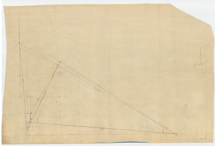
Print $40.00
- Digital $50.00
[Triangulation Sketch]
Size: 56.0 x 38.0 inches
89815
[Surveys made in Peters Colony by Thomas Leckie]
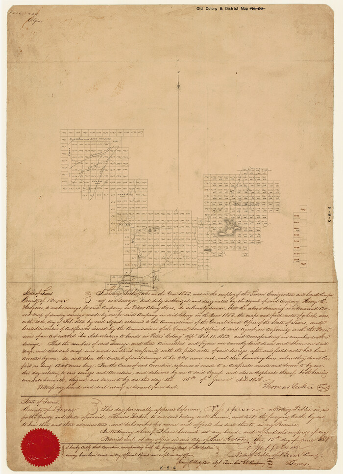
Print $20.00
- Digital $50.00
[Surveys made in Peters Colony by Thomas Leckie]
1858
Size: 22.9 x 16.6 inches
1983
[Surveys made in Peters Colony by Dennis Corwin]
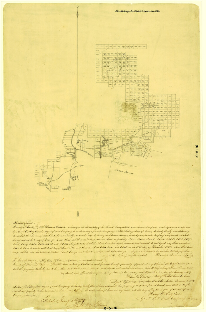
Print $20.00
- Digital $50.00
[Surveys made in Peters Colony by Dennis Corwin]
1859
Size: 24.6 x 16.2 inches
1985
[Sketch showing positions of surveys bordering on South boundary line of Archer County and North boundary line of Young County

Print $20.00
- Digital $50.00
[Sketch showing positions of surveys bordering on South boundary line of Archer County and North boundary line of Young County
1894
Size: 14.0 x 36.8 inches
90174
[Sketch of area around Geo. C. Kimball, M. G. Dickes, and S. F. Sanders surveys]
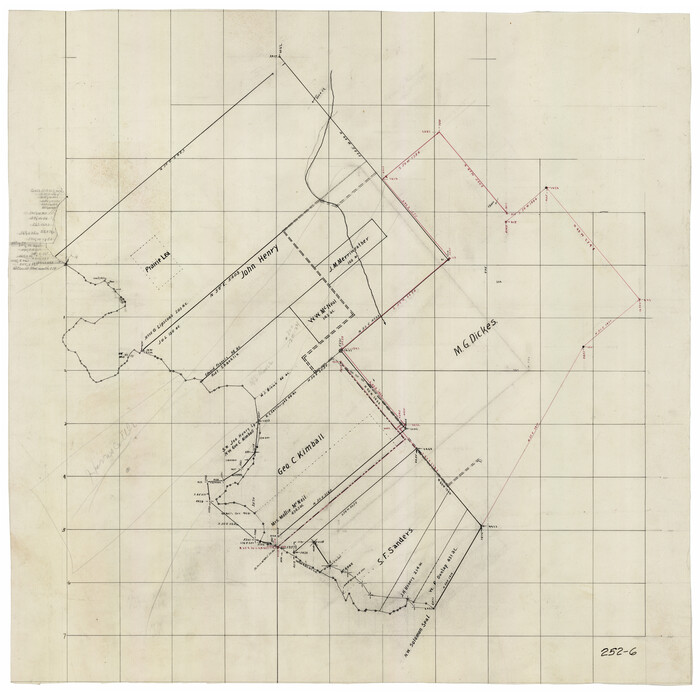
Print $20.00
- Digital $50.00
[Sketch of area around Geo. C. Kimball, M. G. Dickes, and S. F. Sanders surveys]
Size: 27.0 x 26.3 inches
92021
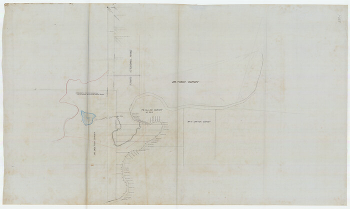
[River Meander along Jas. Tobin Survey and others]
Print $40.00
- Digital $50.00
[River Meander along Jas. Tobin Survey and others]
Size: 73.6 x 43.9 inches
89814
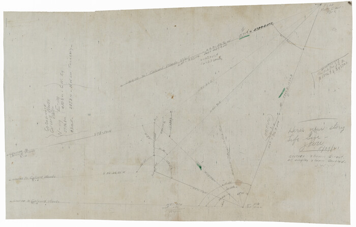
[Pencil sketch showing triangulation from Flag on Mouth of Clear Fork and Top Hill]
Print $20.00
- Digital $50.00
[Pencil sketch showing triangulation from Flag on Mouth of Clear Fork and Top Hill]
Size: 19.5 x 12.5 inches
92088
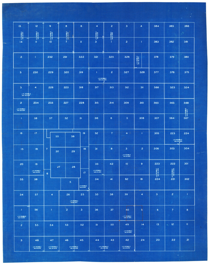
[Map Showing J. H. Kemble Sections]
Print $20.00
- Digital $50.00
[Map Showing J. H. Kemble Sections]
Size: 17.8 x 22.3 inches
92893
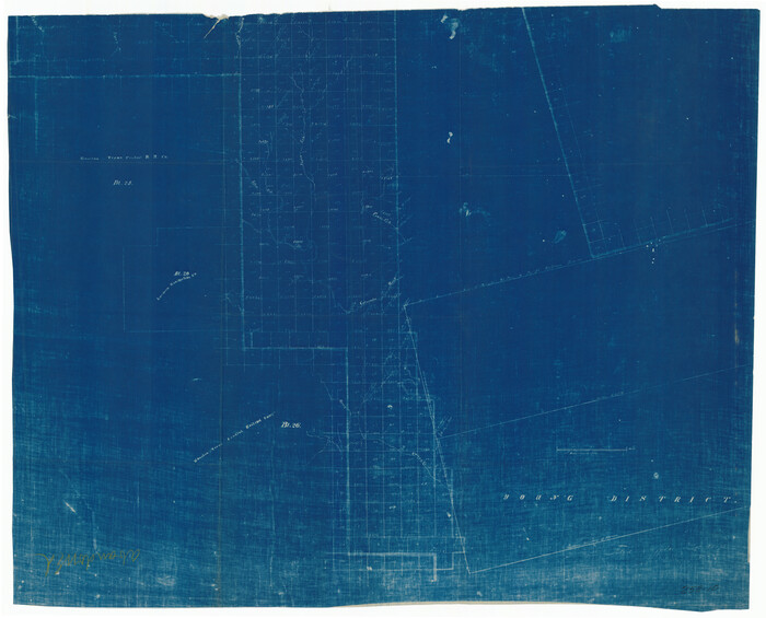
[H. & T. C. Blocks 25 and 26]
Print $20.00
- Digital $50.00
[H. & T. C. Blocks 25 and 26]
1873
Size: 42.2 x 33.9 inches
92025

Young County Working Sketch Graphic Index

Print $20.00
- Digital $50.00
Young County Working Sketch Graphic Index
1941
Size: 44.1 x 38.4 inches
76748
Young County Working Sketch 9

Print $20.00
- Digital $50.00
Young County Working Sketch 9
1921
Size: 25.9 x 36.6 inches
62032
Young County Working Sketch 8

Print $20.00
- Digital $50.00
Young County Working Sketch 8
1920
Size: 17.3 x 12.6 inches
62031
Young County Working Sketch 7

Print $20.00
- Digital $50.00
Young County Working Sketch 7
1919
Size: 24.3 x 19.8 inches
62030
Young County Working Sketch 6

Print $20.00
- Digital $50.00
Young County Working Sketch 6
1919
Size: 12.2 x 11.9 inches
62029
Young County Working Sketch 5

Print $20.00
- Digital $50.00
Young County Working Sketch 5
1919
Size: 14.3 x 7.1 inches
62028
Young County Working Sketch 4

Print $20.00
- Digital $50.00
Young County Working Sketch 4
1919
Size: 14.8 x 13.4 inches
62027
Young County Working Sketch 3

Print $20.00
- Digital $50.00
Young County Working Sketch 3
1919
Size: 13.4 x 18.9 inches
62026
Young County Working Sketch 28

Print $20.00
- Digital $50.00
Young County Working Sketch 28
1985
Size: 29.9 x 26.0 inches
62051
Young County Working Sketch 27

Print $20.00
- Digital $50.00
Young County Working Sketch 27
1982
Size: 24.3 x 32.6 inches
62050
Young County Working Sketch 26

Print $20.00
- Digital $50.00
Young County Working Sketch 26
1982
Size: 25.4 x 22.9 inches
62049
Young County Working Sketch 25

Print $20.00
- Digital $50.00
Young County Working Sketch 25
1982
Size: 12.6 x 14.4 inches
62048
Young County Working Sketch 24

Print $20.00
- Digital $50.00
Young County Working Sketch 24
1977
Size: 25.7 x 16.3 inches
62047
Young County Working Sketch 23

Print $20.00
- Digital $50.00
Young County Working Sketch 23
1965
Size: 31.3 x 22.3 inches
62046
Young County Working Sketch 22

Print $20.00
- Digital $50.00
Young County Working Sketch 22
1965
Size: 26.5 x 32.3 inches
62045
Young County Working Sketch 21

Print $20.00
- Digital $50.00
Young County Working Sketch 21
1964
Size: 42.2 x 31.2 inches
62044
Young County Working Sketch 20

Print $20.00
- Digital $50.00
Young County Working Sketch 20
1961
Size: 25.5 x 23.2 inches
62043
Young County Working Sketch 2

Print $20.00
- Digital $50.00
Young County Working Sketch 2
1918
Size: 28.1 x 33.7 inches
62025
Young County Working Sketch 19

Print $20.00
- Digital $50.00
Young County Working Sketch 19
1961
Size: 27.2 x 23.7 inches
62042
Young County Working Sketch 18

Print $20.00
- Digital $50.00
Young County Working Sketch 18
1960
Size: 23.9 x 29.2 inches
62041
[Triangulation Sketch]
Print $40.00
- Digital $50.00
[Triangulation Sketch]
-
Size
56.0 x 38.0 inches
-
Map/Doc
89815
[Surveys made in Peters Colony by Thomas Leckie]
Print $20.00
- Digital $50.00
[Surveys made in Peters Colony by Thomas Leckie]
1858
-
Size
22.9 x 16.6 inches
-
Map/Doc
1983
-
Creation Date
1858
[Surveys made in Peters Colony by Dennis Corwin]
Print $20.00
- Digital $50.00
[Surveys made in Peters Colony by Dennis Corwin]
1859
-
Size
24.6 x 16.2 inches
-
Map/Doc
1985
-
Creation Date
1859
[Sketch showing positions of surveys bordering on South boundary line of Archer County and North boundary line of Young County
Print $20.00
- Digital $50.00
[Sketch showing positions of surveys bordering on South boundary line of Archer County and North boundary line of Young County
1894
-
Size
14.0 x 36.8 inches
-
Map/Doc
90174
-
Creation Date
1894
[Sketch of area around Geo. C. Kimball, M. G. Dickes, and S. F. Sanders surveys]
Print $20.00
- Digital $50.00
[Sketch of area around Geo. C. Kimball, M. G. Dickes, and S. F. Sanders surveys]
-
Size
27.0 x 26.3 inches
-
Map/Doc
92021
[River Meander along Jas. Tobin Survey and others]
Print $40.00
- Digital $50.00
[River Meander along Jas. Tobin Survey and others]
-
Size
73.6 x 43.9 inches
-
Map/Doc
89814
[Pencil sketch showing triangulation from Flag on Mouth of Clear Fork and Top Hill]
Print $20.00
- Digital $50.00
[Pencil sketch showing triangulation from Flag on Mouth of Clear Fork and Top Hill]
-
Size
19.5 x 12.5 inches
-
Map/Doc
92088
[Map Showing J. H. Kemble Sections]
Print $20.00
- Digital $50.00
[Map Showing J. H. Kemble Sections]
-
Size
17.8 x 22.3 inches
-
Map/Doc
92893
[H. & T. C. Blocks 25 and 26]
Print $20.00
- Digital $50.00
[H. & T. C. Blocks 25 and 26]
1873
-
Size
42.2 x 33.9 inches
-
Map/Doc
92025
-
Creation Date
1873
Young County Working Sketch Graphic Index
Print $20.00
- Digital $50.00
Young County Working Sketch Graphic Index
1941
-
Size
44.1 x 38.4 inches
-
Map/Doc
76748
-
Creation Date
1941
Young County Working Sketch 9
Print $20.00
- Digital $50.00
Young County Working Sketch 9
1921
-
Size
25.9 x 36.6 inches
-
Map/Doc
62032
-
Creation Date
1921
Young County Working Sketch 8
Print $20.00
- Digital $50.00
Young County Working Sketch 8
1920
-
Size
17.3 x 12.6 inches
-
Map/Doc
62031
-
Creation Date
1920
Young County Working Sketch 7
Print $20.00
- Digital $50.00
Young County Working Sketch 7
1919
-
Size
24.3 x 19.8 inches
-
Map/Doc
62030
-
Creation Date
1919
Young County Working Sketch 6
Print $20.00
- Digital $50.00
Young County Working Sketch 6
1919
-
Size
12.2 x 11.9 inches
-
Map/Doc
62029
-
Creation Date
1919
Young County Working Sketch 5
Print $20.00
- Digital $50.00
Young County Working Sketch 5
1919
-
Size
14.3 x 7.1 inches
-
Map/Doc
62028
-
Creation Date
1919
Young County Working Sketch 4
Print $20.00
- Digital $50.00
Young County Working Sketch 4
1919
-
Size
14.8 x 13.4 inches
-
Map/Doc
62027
-
Creation Date
1919
Young County Working Sketch 3
Print $20.00
- Digital $50.00
Young County Working Sketch 3
1919
-
Size
13.4 x 18.9 inches
-
Map/Doc
62026
-
Creation Date
1919
Young County Working Sketch 28
Print $20.00
- Digital $50.00
Young County Working Sketch 28
1985
-
Size
29.9 x 26.0 inches
-
Map/Doc
62051
-
Creation Date
1985
Young County Working Sketch 27
Print $20.00
- Digital $50.00
Young County Working Sketch 27
1982
-
Size
24.3 x 32.6 inches
-
Map/Doc
62050
-
Creation Date
1982
Young County Working Sketch 26
Print $20.00
- Digital $50.00
Young County Working Sketch 26
1982
-
Size
25.4 x 22.9 inches
-
Map/Doc
62049
-
Creation Date
1982
Young County Working Sketch 25
Print $20.00
- Digital $50.00
Young County Working Sketch 25
1982
-
Size
12.6 x 14.4 inches
-
Map/Doc
62048
-
Creation Date
1982
Young County Working Sketch 24
Print $20.00
- Digital $50.00
Young County Working Sketch 24
1977
-
Size
25.7 x 16.3 inches
-
Map/Doc
62047
-
Creation Date
1977
Young County Working Sketch 23
Print $20.00
- Digital $50.00
Young County Working Sketch 23
1965
-
Size
31.3 x 22.3 inches
-
Map/Doc
62046
-
Creation Date
1965
Young County Working Sketch 22
Print $20.00
- Digital $50.00
Young County Working Sketch 22
1965
-
Size
26.5 x 32.3 inches
-
Map/Doc
62045
-
Creation Date
1965
Young County Working Sketch 21
Print $20.00
- Digital $50.00
Young County Working Sketch 21
1964
-
Size
42.2 x 31.2 inches
-
Map/Doc
62044
-
Creation Date
1964
Young County Working Sketch 20
Print $20.00
- Digital $50.00
Young County Working Sketch 20
1961
-
Size
25.5 x 23.2 inches
-
Map/Doc
62043
-
Creation Date
1961
Young County Working Sketch 2
Print $20.00
- Digital $50.00
Young County Working Sketch 2
1918
-
Size
28.1 x 33.7 inches
-
Map/Doc
62025
-
Creation Date
1918
Young County Working Sketch 19
Print $20.00
- Digital $50.00
Young County Working Sketch 19
1961
-
Size
27.2 x 23.7 inches
-
Map/Doc
62042
-
Creation Date
1961
Young County Working Sketch 18
Print $20.00
- Digital $50.00
Young County Working Sketch 18
1960
-
Size
23.9 x 29.2 inches
-
Map/Doc
62041
-
Creation Date
1960