National Map Company's New Road Survey of the United States Showing Main Highways
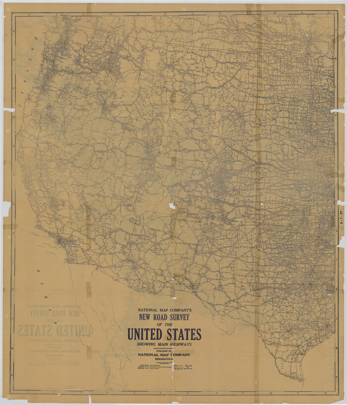

Digital $50.00
National Map Company's New Road Survey of the United States Showing Main Highways
Size: 44.5 x 38.2 inches
4659
National Map Company's New Road Survey of the United States Showing Main Highways


Print $20.00
- Digital $50.00
National Map Company's New Road Survey of the United States Showing Main Highways
Size: 44.3 x 38.2 inches
4674
Colton's Map of United States, the Canadas & c. showing the Railraods, Canals & Stage Roads with distances from place to place


Print $20.00
- Digital $50.00
Colton's Map of United States, the Canadas & c. showing the Railraods, Canals & Stage Roads with distances from place to place
Size: 28.8 x 33.0 inches
93983
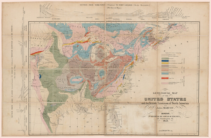
Geological Map of the United States and the British Provinces of North America

Print $20.00
- Digital $50.00
Geological Map of the United States and the British Provinces of North America
Size: 23.4 x 35.9 inches
93988
Minnesota Route the shortest and best to the Idaho Gold Mines


Print $20.00
- Digital $50.00
Minnesota Route the shortest and best to the Idaho Gold Mines
Size: 21.0 x 46.3 inches
93989
A New Map of the United States upon which are delineated its vast works of internal communication, routes across the continent &c. showing also Canada and the Island of Cuba


Print $20.00
- Digital $50.00
A New Map of the United States upon which are delineated its vast works of internal communication, routes across the continent &c. showing also Canada and the Island of Cuba
Size: 25.8 x 30.6 inches
93996
Map of the Territory of the United States from the Mississippi to the Pacific Ocean ordered by the Hon. Jeff'n Davis, Secretary of War to accompany the reports of the explorations for a railroad route


Print $40.00
- Digital $50.00
Map of the Territory of the United States from the Mississippi to the Pacific Ocean ordered by the Hon. Jeff'n Davis, Secretary of War to accompany the reports of the explorations for a railroad route
Size: 48.6 x 50.7 inches
94276
A New Map of the Whole Continent of America. Divided into North and South and West Indies, wherein are exactly decribed the United States of North America as well as the Several European Possessions according to the Preliminaries of Peace…


Print $40.00
- Digital $50.00
A New Map of the Whole Continent of America. Divided into North and South and West Indies, wherein are exactly decribed the United States of North America as well as the Several European Possessions according to the Preliminaries of Peace…
Size: 22.0 x 48.3 inches
95135
A New Map of the Whole Continent of America. Divided into North and South and West Indies, wherein are exactly decribed the United States of North America as well as the Several European Possessions according to the Preliminaries of Peace…


Print $40.00
- Digital $50.00
A New Map of the Whole Continent of America. Divided into North and South and West Indies, wherein are exactly decribed the United States of North America as well as the Several European Possessions according to the Preliminaries of Peace…
Size: 22.0 x 48.7 inches
95136
A New Map of the Whole Continent of America. Divided into North and South and West Indies, wherein are exactly decribed the United States of North America as well as the Several European Possessions according to the Preliminaries of Peace…


Print $40.00
- Digital $50.00
A New Map of the Whole Continent of America. Divided into North and South and West Indies, wherein are exactly decribed the United States of North America as well as the Several European Possessions according to the Preliminaries of Peace…
Size: 42.8 x 48.8 inches
95137
A Geological Map of the United States


Print $20.00
A Geological Map of the United States
Size: 10.2 x 15.9 inches
95281
The New Naval and Military Map of the United States


Print $40.00
The New Naval and Military Map of the United States
Size: 68.5 x 68.5 inches
95309
A Map of Mexico, Louisiana and the Missouri Territory, including also the State of Mississippi, Alabama Territory, East & West Florida, Georgia, South Carolina & part of the Island of Cuba


Print $40.00
A Map of Mexico, Louisiana and the Missouri Territory, including also the State of Mississippi, Alabama Territory, East & West Florida, Georgia, South Carolina & part of the Island of Cuba
Size: 66.9 x 64.2 inches
95312
Lay's Map of the United States


Print $40.00
- Digital $50.00
Lay's Map of the United States
Size: 55.0 x 61.7 inches
95693
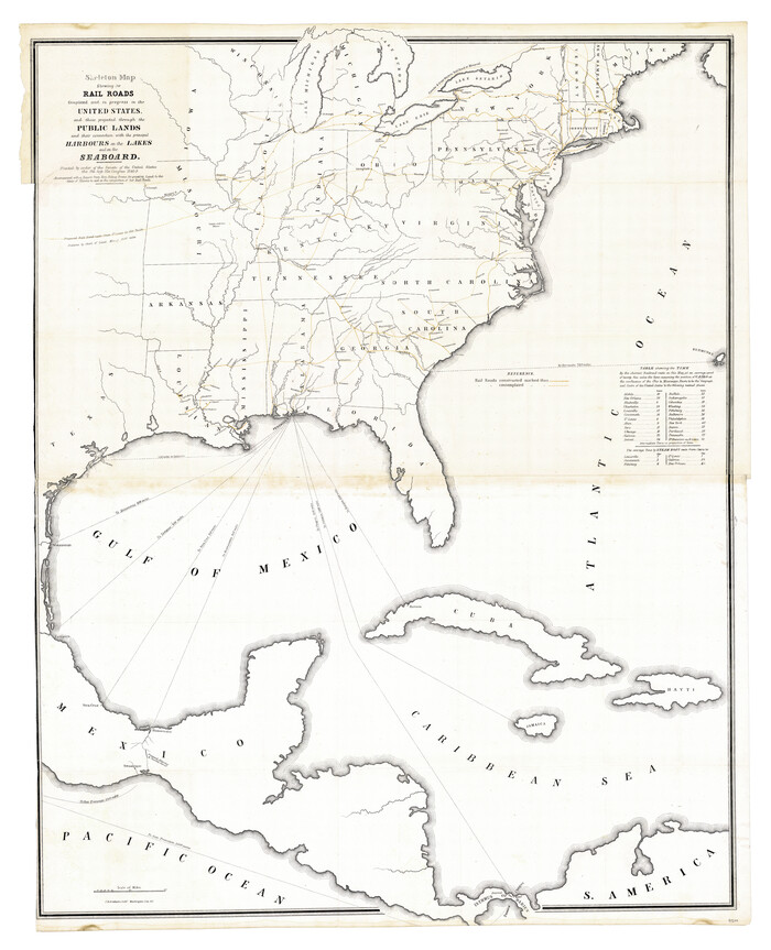
Skeleton Map Showing the Rail Roads Completed and in progress in the United States, and those projected through the Public Lands and their connection with the principal Harbours on the Lakes and on the Seaboard

Print $40.00
- Digital $50.00
Skeleton Map Showing the Rail Roads Completed and in progress in the United States, and those projected through the Public Lands and their connection with the principal Harbours on the Lakes and on the Seaboard
Size: 49.1 x 39.8 inches
95699
A Map of the United States including every county enumerated in the last census & since formed with the population of the several states, railroads, canals, & c.


A Map of the United States including every county enumerated in the last census & since formed with the population of the several states, railroads, canals, & c.
Size: 46.0 x 61.0 inches
95918
The Making of America - Northern Plains
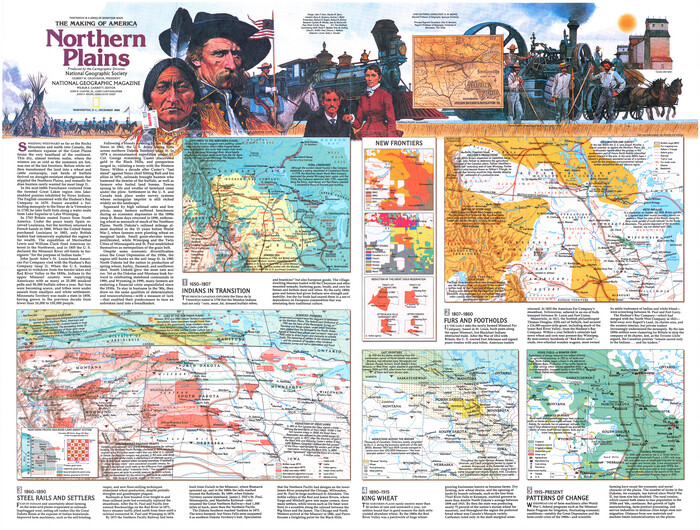

The Making of America - Northern Plains
Size: 20.7 x 27.3 inches
95943
The Land of Open Sky - Southwest U.S.A.


The Land of Open Sky - Southwest U.S.A.
Size: 20.2 x 15.6 inches
95945
The Making of America - The Southwest


The Making of America - The Southwest
Size: 20.8 x 27.5 inches
95947
Canada, United States of America, Estados Unidos Mexicanos


Print $20.00
- Digital $50.00
Canada, United States of America, Estados Unidos Mexicanos
Size: 41.9 x 36.1 inches
96512
United States Mileage Chart / United States Mileage Table / Hawaii / Alaska
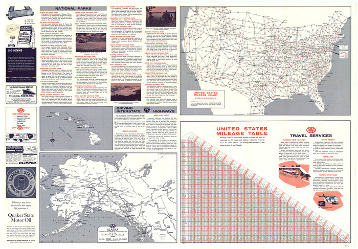

United States Mileage Chart / United States Mileage Table / Hawaii / Alaska
Size: 26.5 x 38.1 inches
96820
Partie de l'Amerique Septentrionale, qui Comprend le Canada, la Louisiane, le Labrador, le Groenland, les Etats-Unis et la Floride, &c.


Print $20.00
- Digital $50.00
Partie de l'Amerique Septentrionale, qui Comprend le Canada, la Louisiane, le Labrador, le Groenland, les Etats-Unis et la Floride, &c.
1776
Size: 31.2 x 23.4 inches
95140
A New Map of North America
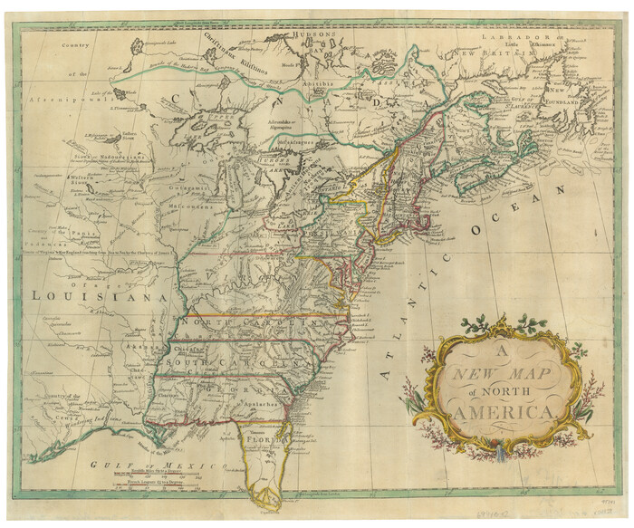

Print $20.00
- Digital $50.00
A New Map of North America
1779
Size: 18.5 x 22.2 inches
95141
Carte Generale des Treize Etats-Unis de l'Amerique Septentrionale


Print $20.00
- Digital $50.00
Carte Generale des Treize Etats-Unis de l'Amerique Septentrionale
1783
Size: 22.9 x 27.0 inches
93678
Etats-Unis de l'Amérique Septentrionale avec les Isles Royale, de Terre Neuve de St. Jean, L'Acadie &c.


Print $20.00
- Digital $50.00
Etats-Unis de l'Amérique Septentrionale avec les Isles Royale, de Terre Neuve de St. Jean, L'Acadie &c.
1785
Size: 20.9 x 28.2 inches
93679
National Map Company's New Road Survey of the United States Showing Main Highways


Digital $50.00
National Map Company's New Road Survey of the United States Showing Main Highways
-
Size
44.5 x 38.2 inches
-
Map/Doc
4659
National Map Company's New Road Survey of the United States Showing Main Highways


Print $20.00
- Digital $50.00
National Map Company's New Road Survey of the United States Showing Main Highways
-
Size
44.3 x 38.2 inches
-
Map/Doc
4674
Colton's Map of United States, the Canadas & c. showing the Railraods, Canals & Stage Roads with distances from place to place


Print $20.00
- Digital $50.00
Colton's Map of United States, the Canadas & c. showing the Railraods, Canals & Stage Roads with distances from place to place
-
Size
28.8 x 33.0 inches
-
Map/Doc
93983
Geological Map of the United States and the British Provinces of North America


Print $20.00
- Digital $50.00
Geological Map of the United States and the British Provinces of North America
-
Size
23.4 x 35.9 inches
-
Map/Doc
93988
Minnesota Route the shortest and best to the Idaho Gold Mines


Print $20.00
- Digital $50.00
Minnesota Route the shortest and best to the Idaho Gold Mines
-
Size
21.0 x 46.3 inches
-
Map/Doc
93989
A New Map of the United States upon which are delineated its vast works of internal communication, routes across the continent &c. showing also Canada and the Island of Cuba


Print $20.00
- Digital $50.00
A New Map of the United States upon which are delineated its vast works of internal communication, routes across the continent &c. showing also Canada and the Island of Cuba
-
Size
25.8 x 30.6 inches
-
Map/Doc
93996
Map of the Territory of the United States from the Mississippi to the Pacific Ocean ordered by the Hon. Jeff'n Davis, Secretary of War to accompany the reports of the explorations for a railroad route


Print $40.00
- Digital $50.00
Map of the Territory of the United States from the Mississippi to the Pacific Ocean ordered by the Hon. Jeff'n Davis, Secretary of War to accompany the reports of the explorations for a railroad route
-
Size
48.6 x 50.7 inches
-
Map/Doc
94276
A New Map of the Whole Continent of America. Divided into North and South and West Indies, wherein are exactly decribed the United States of North America as well as the Several European Possessions according to the Preliminaries of Peace…


Print $40.00
- Digital $50.00
A New Map of the Whole Continent of America. Divided into North and South and West Indies, wherein are exactly decribed the United States of North America as well as the Several European Possessions according to the Preliminaries of Peace…
-
Size
22.0 x 48.3 inches
-
Map/Doc
95135
A New Map of the Whole Continent of America. Divided into North and South and West Indies, wherein are exactly decribed the United States of North America as well as the Several European Possessions according to the Preliminaries of Peace…


Print $40.00
- Digital $50.00
A New Map of the Whole Continent of America. Divided into North and South and West Indies, wherein are exactly decribed the United States of North America as well as the Several European Possessions according to the Preliminaries of Peace…
-
Size
22.0 x 48.7 inches
-
Map/Doc
95136
A New Map of the Whole Continent of America. Divided into North and South and West Indies, wherein are exactly decribed the United States of North America as well as the Several European Possessions according to the Preliminaries of Peace…


Print $40.00
- Digital $50.00
A New Map of the Whole Continent of America. Divided into North and South and West Indies, wherein are exactly decribed the United States of North America as well as the Several European Possessions according to the Preliminaries of Peace…
-
Size
42.8 x 48.8 inches
-
Map/Doc
95137
A Geological Map of the United States


Print $20.00
A Geological Map of the United States
-
Size
10.2 x 15.9 inches
-
Map/Doc
95281
The New Naval and Military Map of the United States


Print $40.00
The New Naval and Military Map of the United States
-
Size
68.5 x 68.5 inches
-
Map/Doc
95309
A Map of Mexico, Louisiana and the Missouri Territory, including also the State of Mississippi, Alabama Territory, East & West Florida, Georgia, South Carolina & part of the Island of Cuba


Print $40.00
A Map of Mexico, Louisiana and the Missouri Territory, including also the State of Mississippi, Alabama Territory, East & West Florida, Georgia, South Carolina & part of the Island of Cuba
-
Size
66.9 x 64.2 inches
-
Map/Doc
95312
Lay's Map of the United States


Print $40.00
- Digital $50.00
Lay's Map of the United States
-
Size
55.0 x 61.7 inches
-
Map/Doc
95693
Skeleton Map Showing the Rail Roads Completed and in progress in the United States, and those projected through the Public Lands and their connection with the principal Harbours on the Lakes and on the Seaboard


Print $40.00
- Digital $50.00
Skeleton Map Showing the Rail Roads Completed and in progress in the United States, and those projected through the Public Lands and their connection with the principal Harbours on the Lakes and on the Seaboard
-
Size
49.1 x 39.8 inches
-
Map/Doc
95699
A Map of the United States including every county enumerated in the last census & since formed with the population of the several states, railroads, canals, & c.


A Map of the United States including every county enumerated in the last census & since formed with the population of the several states, railroads, canals, & c.
-
Size
46.0 x 61.0 inches
-
Map/Doc
95918
The Making of America - Northern Plains


The Making of America - Northern Plains
-
Size
20.7 x 27.3 inches
-
Map/Doc
95943
The Land of Open Sky - Southwest U.S.A.


The Land of Open Sky - Southwest U.S.A.
-
Size
20.2 x 15.6 inches
-
Map/Doc
95945
The Making of America - The Southwest


The Making of America - The Southwest
-
Size
20.8 x 27.5 inches
-
Map/Doc
95947
Canada, United States of America, Estados Unidos Mexicanos


Print $20.00
- Digital $50.00
Canada, United States of America, Estados Unidos Mexicanos
-
Size
41.9 x 36.1 inches
-
Map/Doc
96512
United States Mileage Chart / United States Mileage Table / Hawaii / Alaska


United States Mileage Chart / United States Mileage Table / Hawaii / Alaska
-
Size
26.5 x 38.1 inches
-
Map/Doc
96820
Partie de l'Amerique Septentrionale, qui Comprend le Canada, la Louisiane, le Labrador, le Groenland, les Etats-Unis et la Floride, &c.


Print $20.00
- Digital $50.00
Partie de l'Amerique Septentrionale, qui Comprend le Canada, la Louisiane, le Labrador, le Groenland, les Etats-Unis et la Floride, &c.
1776
-
Size
31.2 x 23.4 inches
-
Map/Doc
95140
-
Creation Date
1776
A New Map of North America


Print $20.00
- Digital $50.00
A New Map of North America
1779
-
Size
18.5 x 22.2 inches
-
Map/Doc
95141
-
Creation Date
1779
Carte Generale des Treize Etats-Unis de l'Amerique Septentrionale


Print $20.00
- Digital $50.00
Carte Generale des Treize Etats-Unis de l'Amerique Septentrionale
1783
-
Size
22.9 x 27.0 inches
-
Map/Doc
93678
-
Creation Date
1783
Etats-Unis de l'Amérique Septentrionale avec les Isles Royale, de Terre Neuve de St. Jean, L'Acadie &c.


Print $20.00
- Digital $50.00
Etats-Unis de l'Amérique Septentrionale avec les Isles Royale, de Terre Neuve de St. Jean, L'Acadie &c.
1785
-
Size
20.9 x 28.2 inches
-
Map/Doc
93679
-
Creation Date
1785
