United States Population Distribution by County and Territory, per the U.S. Census of 1870

United States Population Distribution by County and Territory, per the U.S. Census of 1870
2025
Size: 8.5 x 11.0 inches
97479
United States Population Distribution by County and Territory, per the U.S. Census of 1890

United States Population Distribution by County and Territory, per the U.S. Census of 1890
2025
Size: 8.5 x 11.0 inches
97480
United States Population Distribution by County and Territory, per the U.S. Census of 1900

United States Population Distribution by County and Territory, per the U.S. Census of 1900
2025
Size: 8.5 x 11.0 inches
97481
Disputed Territory Between Mexico and the United States

Disputed Territory Between Mexico and the United States
2024
Size: 10.7 x 7.9 inches
97251
United States Population Distribution by County and Territory, per the U.S. Census of 1880

United States Population Distribution by County and Territory, per the U.S. Census of 1880
2024
Size: 8.5 x 11.0 inches
97284

Disputed Territory Between Mexico and the United States

Disputed Territory Between Mexico and the United States
2023
Size: 11.0 x 8.5 inches
97129
Explorations of the Louisiana Purchase

Explorations of the Louisiana Purchase
2023
Size: 8.5 x 11.0 inches
97183
Map Showing the Distribution of the Slave Population of the Southern States of the United States

Map Showing the Distribution of the Slave Population of the Southern States of the United States
2022
Size: 8.5 x 11.0 inches
96677
Big Inch and Little Big Inch Pipelines

Big Inch and Little Big Inch Pipelines
2022
Size: 8.5 x 11.0 inches
97089
American Civil War Political Loyalties

American Civil War Political Loyalties
2022
Size: 8.5 x 11.0 inches
97091
Yellow Fever Deaths in the United States

Yellow Fever Deaths in the United States
2022
Size: 8.5 x 11.0 inches
97093
The Dust Bowl: Severe Drought During the Depression

The Dust Bowl: Severe Drought During the Depression
2022
Size: 8.5 x 11.0 inches
97095
Magnetic Declination in the United States - Epoch 1980

Print $20.00
- Digital $50.00
Magnetic Declination in the United States - Epoch 1980
1980
Size: 41.3 x 33.2 inches
92367
Magnetic Declination in the United States - Epoch 1980

Print $20.00
- Digital $50.00
Magnetic Declination in the United States - Epoch 1980
1980
Size: 41.4 x 33.3 inches
92368
Points of Interest & Road Map of Scenicland, U.S.A. and United States [Verso]

Points of Interest & Road Map of Scenicland, U.S.A. and United States [Verso]
1966
Size: 22.5 x 35.0 inches
94193
Points of Interest & Road Map of Scenicland, U.S.A. and United States [Recto]
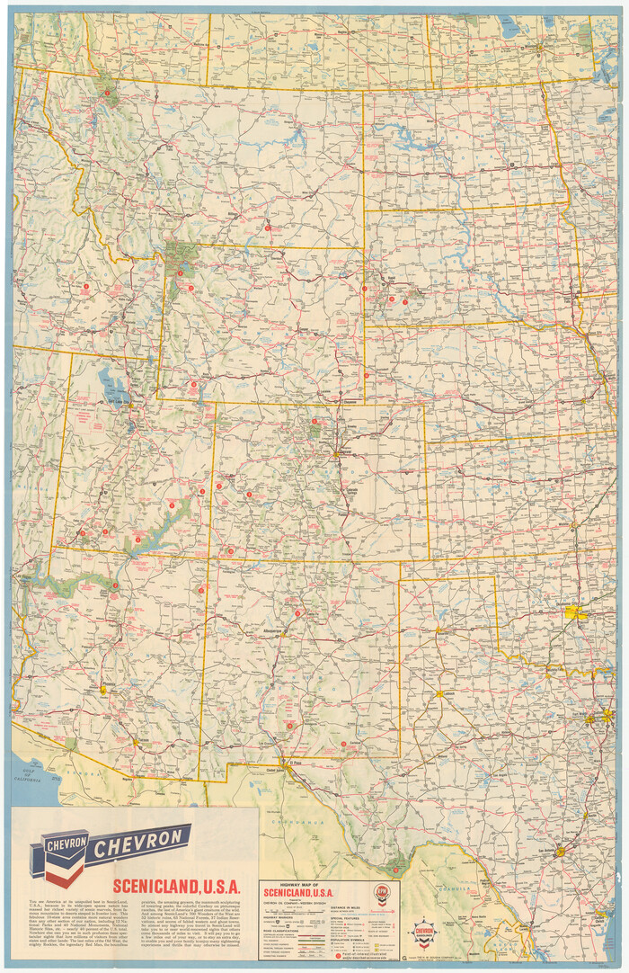
Points of Interest & Road Map of Scenicland, U.S.A. and United States [Recto]
1966
Size: 34.7 x 22.4 inches
94192

Northeastern United States Including the Great Lakes Region

Northeastern United States Including the Great Lakes Region
1959
Size: 25.6 x 19.3 inches
92395
National Parks, Monuments and Shrines of the United States and Canada

National Parks, Monuments and Shrines of the United States and Canada
1958
Size: 25.7 x 19.7 inches
92377
National Parks, Monuments and Shrines of the United States and Canada

National Parks, Monuments and Shrines of the United States and Canada
1958
Size: 25.5 x 19.5 inches
92378
United States Population Distribution by County and Territory, per the U.S. Census of 1870
United States Population Distribution by County and Territory, per the U.S. Census of 1870
2025
-
Size
8.5 x 11.0 inches
-
Map/Doc
97479
-
Creation Date
2025
United States Population Distribution by County and Territory, per the U.S. Census of 1890
United States Population Distribution by County and Territory, per the U.S. Census of 1890
2025
-
Size
8.5 x 11.0 inches
-
Map/Doc
97480
-
Creation Date
2025
United States Population Distribution by County and Territory, per the U.S. Census of 1900
United States Population Distribution by County and Territory, per the U.S. Census of 1900
2025
-
Size
8.5 x 11.0 inches
-
Map/Doc
97481
-
Creation Date
2025
Disputed Territory Between Mexico and the United States
Disputed Territory Between Mexico and the United States
2024
-
Size
10.7 x 7.9 inches
-
Map/Doc
97251
-
Creation Date
2024
United States Population Distribution by County and Territory, per the U.S. Census of 1880
United States Population Distribution by County and Territory, per the U.S. Census of 1880
2024
-
Size
8.5 x 11.0 inches
-
Map/Doc
97284
-
Creation Date
2024
Missouri Compromise of 1820

Missouri Compromise of 1820
2024
-
Size
8.5 x 11.0 inches
-
Map/Doc
97357
-
Creation Date
2024
Kansas-Nebraska Act

Kansas-Nebraska Act
2024
-
Size
8.5 x 11.0 inches
-
Map/Doc
97359
-
Creation Date
2024
Disputed Territory Between Mexico and the United States
Disputed Territory Between Mexico and the United States
2023
-
Size
11.0 x 8.5 inches
-
Map/Doc
97129
-
Creation Date
2023
The Louisiana Purchase

The Louisiana Purchase
2023
-
Size
8.5 x 11.0 inches
-
Map/Doc
97182
-
Creation Date
2023
Explorations of the Louisiana Purchase
Explorations of the Louisiana Purchase
2023
-
Size
8.5 x 11.0 inches
-
Map/Doc
97183
-
Creation Date
2023
Map Showing the Distribution of the Slave Population of the Southern States of the United States
Map Showing the Distribution of the Slave Population of the Southern States of the United States
2022
-
Size
8.5 x 11.0 inches
-
Map/Doc
96677
-
Creation Date
2022
Big Inch and Little Big Inch Pipelines
Big Inch and Little Big Inch Pipelines
2022
-
Size
8.5 x 11.0 inches
-
Map/Doc
97089
-
Creation Date
2022
American Civil War Political Loyalties
American Civil War Political Loyalties
2022
-
Size
8.5 x 11.0 inches
-
Map/Doc
97091
-
Creation Date
2022
Yellow Fever Deaths in the United States
Yellow Fever Deaths in the United States
2022
-
Size
8.5 x 11.0 inches
-
Map/Doc
97093
-
Creation Date
2022
The Dust Bowl: Severe Drought During the Depression
The Dust Bowl: Severe Drought During the Depression
2022
-
Size
8.5 x 11.0 inches
-
Map/Doc
97095
-
Creation Date
2022
America's Federal Lands

America's Federal Lands
1982
-
Size
29.7 x 43.2 inches
-
Map/Doc
94291
-
Creation Date
1982
Magnetic Declination in the United States - Epoch 1980
Print $20.00
- Digital $50.00
Magnetic Declination in the United States - Epoch 1980
1980
-
Size
41.3 x 33.2 inches
-
Map/Doc
92367
-
Creation Date
1980
Magnetic Declination in the United States - Epoch 1980
Print $20.00
- Digital $50.00
Magnetic Declination in the United States - Epoch 1980
1980
-
Size
41.4 x 33.3 inches
-
Map/Doc
92368
-
Creation Date
1980
Points of Interest & Road Map of Scenicland, U.S.A. and United States [Verso]
Points of Interest & Road Map of Scenicland, U.S.A. and United States [Verso]
1966
-
Size
22.5 x 35.0 inches
-
Map/Doc
94193
-
Creation Date
1966
Points of Interest & Road Map of Scenicland, U.S.A. and United States [Recto]
Points of Interest & Road Map of Scenicland, U.S.A. and United States [Recto]
1966
-
Size
34.7 x 22.4 inches
-
Map/Doc
94192
-
Creation Date
1966
United States

Print $40.00
- Digital $50.00
United States
1961
-
Size
55.0 x 81.2 inches
-
Map/Doc
75922
-
Creation Date
1961
South Central United States

South Central United States
1961
-
Size
25.6 x 19.7 inches
-
Map/Doc
92370
-
Creation Date
1961
Northwestern United States

Northwestern United States
1960
-
Size
25.5 x 19.4 inches
-
Map/Doc
92387
-
Creation Date
1960
Northeastern United States Including the Great Lakes Region
Northeastern United States Including the Great Lakes Region
1959
-
Size
25.6 x 19.3 inches
-
Map/Doc
92395
-
Creation Date
1959
Southeastern United States

Southeastern United States
1958
-
Size
19.8 x 25.7 inches
-
Map/Doc
92369
-
Creation Date
1958
National Parks, Monuments and Shrines of the United States and Canada
National Parks, Monuments and Shrines of the United States and Canada
1958
-
Size
25.7 x 19.7 inches
-
Map/Doc
92377
-
Creation Date
1958
National Parks, Monuments and Shrines of the United States and Canada
National Parks, Monuments and Shrines of the United States and Canada
1958
-
Size
25.5 x 19.5 inches
-
Map/Doc
92378
-
Creation Date
1958
North Central United States

North Central United States
1958
-
Size
20.1 x 25.6 inches
-
Map/Doc
92386
-
Creation Date
1958