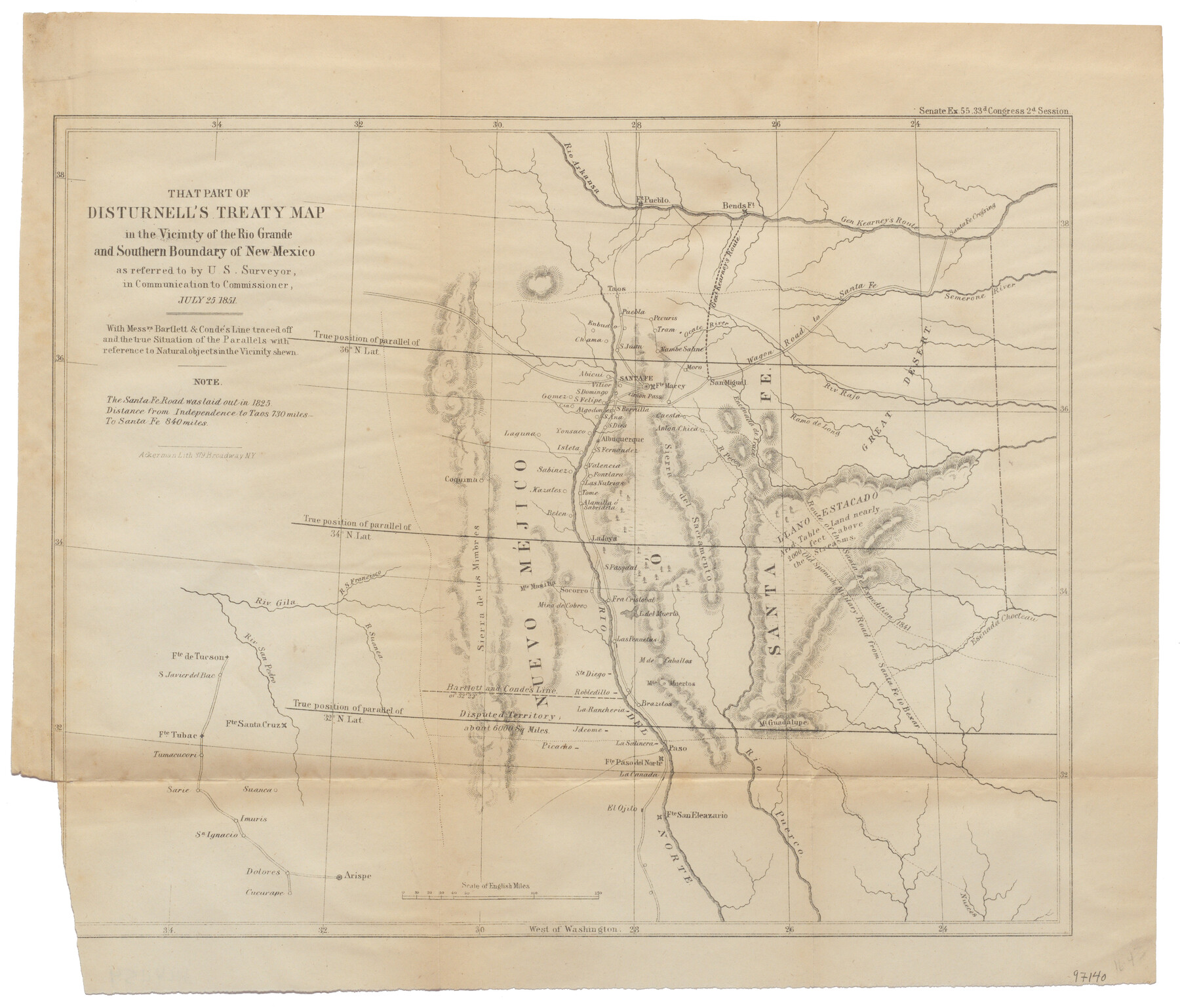
That part of Disturnell's Treaty Map in the Vicinity of the Rio Grande and Southern Boundary of New Mexico
-
Map/Doc
97140
-
Collection
General Map Collection
-
Object Dates
7/25/1851 (Creation Date)
-
Height x Width
10.7 x 12.5 inches
27.2 x 31.8 cm
-
Medium
paper, etching/engraving/lithograph
Part of: General Map Collection
Madison County Rolled Sketch 1

Print $20.00
- Digital $50.00
Madison County Rolled Sketch 1
1966
Size 36.7 x 46.0 inches
Map/Doc 9485
Mitchell County Rolled Sketch 3

Print $40.00
- Digital $50.00
Mitchell County Rolled Sketch 3
1940
Size 39.6 x 49.0 inches
Map/Doc 9524
Leon County Working Sketch 24

Print $4.00
- Digital $50.00
Leon County Working Sketch 24
1967
Size 23.3 x 29.0 inches
Map/Doc 70423
King County Sketch File 7

Print $72.00
- Digital $50.00
King County Sketch File 7
1901
Size 11.1 x 8.5 inches
Map/Doc 29030
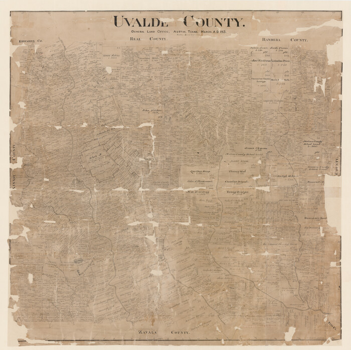
Uvalde County
Print $20.00
- Digital $50.00
Uvalde County
1915
Size 46.0 x 46.0 inches
Map/Doc 16910

Newton County Working Sketch 31

Print $20.00
- Digital $50.00
Newton County Working Sketch 31
Size 34.3 x 43.6 inches
Map/Doc 71277

Flight Mission No. CGI-3N, Frame 147, Cameron County

Print $20.00
- Digital $50.00
Flight Mission No. CGI-3N, Frame 147, Cameron County
1954
Size 18.8 x 22.4 inches
Map/Doc 84620
Hudspeth County Rolled Sketch 17

Print $40.00
- Digital $50.00
Hudspeth County Rolled Sketch 17
1886
Size 22.3 x 118.5 inches
Map/Doc 9203
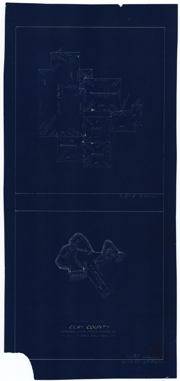
Clay County Working Sketch 3
Print $20.00
- Digital $50.00
Clay County Working Sketch 3
1923
Size 19.7 x 9.3 inches
Map/Doc 68026
[Aerial photograph showing R. H. Welder Ranch, San Patricio County, Texas]
![61407, [Aerial photograph showing R. H. Welder Ranch, San Patricio County, Texas], General Map Collection](https://historictexasmaps.com/wmedia_w700/maps/61407.tif.jpg)
Print $20.00
- Digital $50.00
[Aerial photograph showing R. H. Welder Ranch, San Patricio County, Texas]
Size 23.0 x 39.5 inches
Map/Doc 61407
You may also like
Palo Pinto County Sketch File 7

Print $4.00
- Digital $50.00
Palo Pinto County Sketch File 7
1870
Size 13.0 x 8.2 inches
Map/Doc 33398
Anderson County Working Sketch 9

Print $20.00
- Digital $50.00
Anderson County Working Sketch 9
1929
Size 30.7 x 22.1 inches
Map/Doc 67008
Fannin County Boundary File 3

Print $36.00
- Digital $50.00
Fannin County Boundary File 3
Size 13.2 x 8.8 inches
Map/Doc 53295
Hardin County Boundary File 40

Print $14.00
- Digital $50.00
Hardin County Boundary File 40
Size 9.0 x 3.5 inches
Map/Doc 54409
Polk County Boundary File 2a

Print $40.00
- Digital $50.00
Polk County Boundary File 2a
Size 31.6 x 9.6 inches
Map/Doc 57928
The United States of Mexico

Print $20.00
- Digital $50.00
The United States of Mexico
1832
Size 15.4 x 12.8 inches
Map/Doc 93952
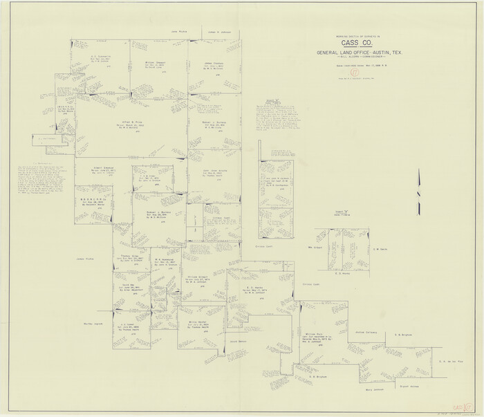
Cass County Working Sketch 17
Print $20.00
- Digital $50.00
Cass County Working Sketch 17
1958
Size 36.8 x 42.7 inches
Map/Doc 67920
[Sketch of Surveys on San Antonio Road]
![41, [Sketch of Surveys on San Antonio Road], General Map Collection](https://historictexasmaps.com/wmedia_w700/maps/41.tif.jpg)
Print $20.00
- Digital $50.00
[Sketch of Surveys on San Antonio Road]
1840
Size 20.6 x 15.4 inches
Map/Doc 41
Young Territory

Print $20.00
- Digital $50.00
Young Territory
1873
Size 45.3 x 42.8 inches
Map/Doc 1988
Reeves County Working Sketch 13

Print $20.00
- Digital $50.00
Reeves County Working Sketch 13
Size 30.5 x 33.4 inches
Map/Doc 63456
Lubbock County Sketch File 11

Print $22.00
- Digital $50.00
Lubbock County Sketch File 11
1914
Size 11.2 x 8.8 inches
Map/Doc 30434
Mason County Boundary File 2

Print $16.00
- Digital $50.00
Mason County Boundary File 2
Size 9.1 x 8.3 inches
Map/Doc 56830