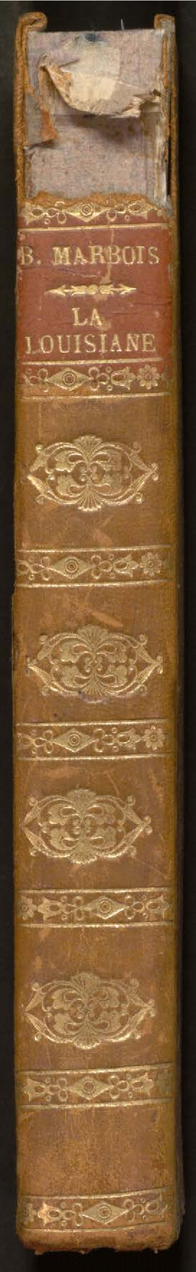
Histoire de la Louisiane et de la Cession de Cette Colonie par la France aux États-Unis de l'Amérique Septentrionale
[History of Louisiana and the Cession of this Colony by France to the United States of North America]
-
Map/Doc
97259
-
Collection
General Map Collection
-
Object Dates
1829 (Creation Date)
-
People and Organizations
François Barbé-Marbois (Author)
-
Subjects
Bound Volume North America
-
Comments
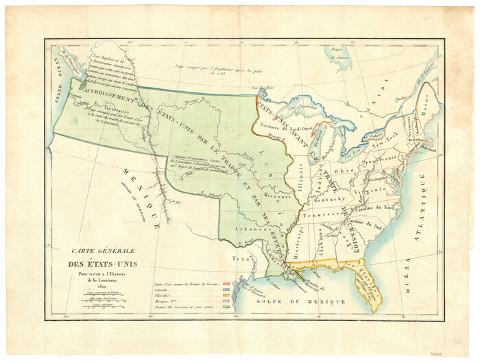
See 97260 for map that was attached inside this book.
Related maps
Carte Générale des États-Unis pour servir a l'Histoire de la Louisiane
Print $20.00
- Digital $50.00
Carte Générale des États-Unis pour servir a l'Histoire de la Louisiane
1829
Size 12.0 x 15.9 inches
Map/Doc 97260
Part of: General Map Collection
Lee County Boundary File 2

Print $25.00
- Digital $50.00
Lee County Boundary File 2
Size 14.2 x 8.6 inches
Map/Doc 56269
Mills County Rolled Sketch 6

Print $20.00
- Digital $50.00
Mills County Rolled Sketch 6
2007
Size 24.4 x 36.6 inches
Map/Doc 88738
Zapata County Sketch File 17

Print $32.00
- Digital $50.00
Zapata County Sketch File 17
1959
Size 14.4 x 8.9 inches
Map/Doc 40960
McCulloch County Sketch File 14

Print $8.00
- Digital $50.00
McCulloch County Sketch File 14
1990
Size 11.2 x 8.7 inches
Map/Doc 31203

Houston County Sketch File 3

Print $6.00
- Digital $50.00
Houston County Sketch File 3
Size 13.1 x 8.2 inches
Map/Doc 26748
Stephens County Sketch File 2

Print $4.00
- Digital $50.00
Stephens County Sketch File 2
1870
Size 12.9 x 8.2 inches
Map/Doc 37013
Morris County Working Sketch Graphic Index

Print $20.00
- Digital $50.00
Morris County Working Sketch Graphic Index
1948
Size 42.8 x 20.1 inches
Map/Doc 76649
Kleberg County

Print $20.00
- Digital $50.00
Kleberg County
1913
Size 25.6 x 32.8 inches
Map/Doc 1878
Wharton County Boundary File 1b

Print $20.00
- Digital $50.00
Wharton County Boundary File 1b
Size 15.1 x 26.6 inches
Map/Doc 59855


You may also like
[Blocks K3, K4, K7, K8, K14, M7, east part of Leagues]
![90593, [Blocks K3, K4, K7, K8, K14, M7, east part of Leagues], Twichell Survey Records](https://historictexasmaps.com/wmedia_w700/maps/90593-1.tif.jpg)
Print $20.00
- Digital $50.00
[Blocks K3, K4, K7, K8, K14, M7, east part of Leagues]
Size 32.6 x 32.4 inches
Map/Doc 90593
Hockley County Working Sketch 4

Print $40.00
- Digital $50.00
Hockley County Working Sketch 4
Size 38.7 x 52.3 inches
Map/Doc 66194
McClennan [sic] County, Texas
![577, McClennan [sic] County, Texas, Maddox Collection](https://historictexasmaps.com/wmedia_w700/maps/577.tif.jpg)
Print $20.00
- Digital $50.00
McClennan [sic] County, Texas
1880
Size 23.5 x 26.7 inches
Map/Doc 577
Crockett County Rolled Sketch 40
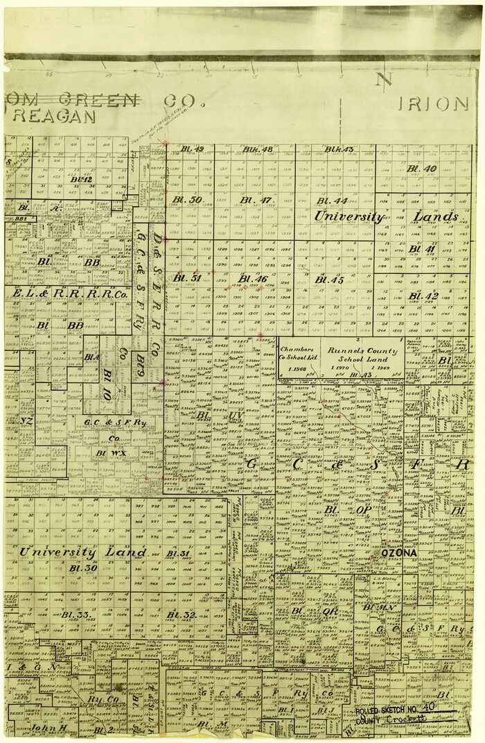
Print $20.00
- Digital $50.00
Crockett County Rolled Sketch 40
Size 21.9 x 14.3 inches
Map/Doc 5590
Intracoastal Waterway in Texas - Corpus Christi to Point Isabel including Arroyo Colorado to Mo. Pac. R.R. Bridge Near Harlingen

Print $20.00
- Digital $50.00
Intracoastal Waterway in Texas - Corpus Christi to Point Isabel including Arroyo Colorado to Mo. Pac. R.R. Bridge Near Harlingen
1933
Size 28.0 x 40.8 inches
Map/Doc 61850
Lampasas County Working Sketch 6

Print $20.00
- Digital $50.00
Lampasas County Working Sketch 6
Size 29.5 x 20.6 inches
Map/Doc 70283
Carta Etnografica

Print $20.00
- Digital $50.00
Carta Etnografica
1897
Size 26.2 x 34.1 inches
Map/Doc 96798
Old Miscellaneous File 27b

Print $10.00
- Digital $50.00
Old Miscellaneous File 27b
1880
Size 14.3 x 8.8 inches
Map/Doc 75722
Palo Pinto County Rolled Sketch 14A

Print $20.00
- Digital $50.00
Palo Pinto County Rolled Sketch 14A
1993
Size 21.8 x 28.2 inches
Map/Doc 7195
Dimmit County Sketch File 36

Print $6.00
- Digital $50.00
Dimmit County Sketch File 36
1894
Size 4.3 x 13.3 inches
Map/Doc 21158
Guadalupe County Sketch File 26

Print $4.00
- Digital $50.00
Guadalupe County Sketch File 26
1873
Size 10.2 x 8.2 inches
Map/Doc 24719
Hutchinson County Sketch File 33

Print $20.00
- Digital $50.00
Hutchinson County Sketch File 33
1926
Size 26.5 x 24.5 inches
Map/Doc 11821