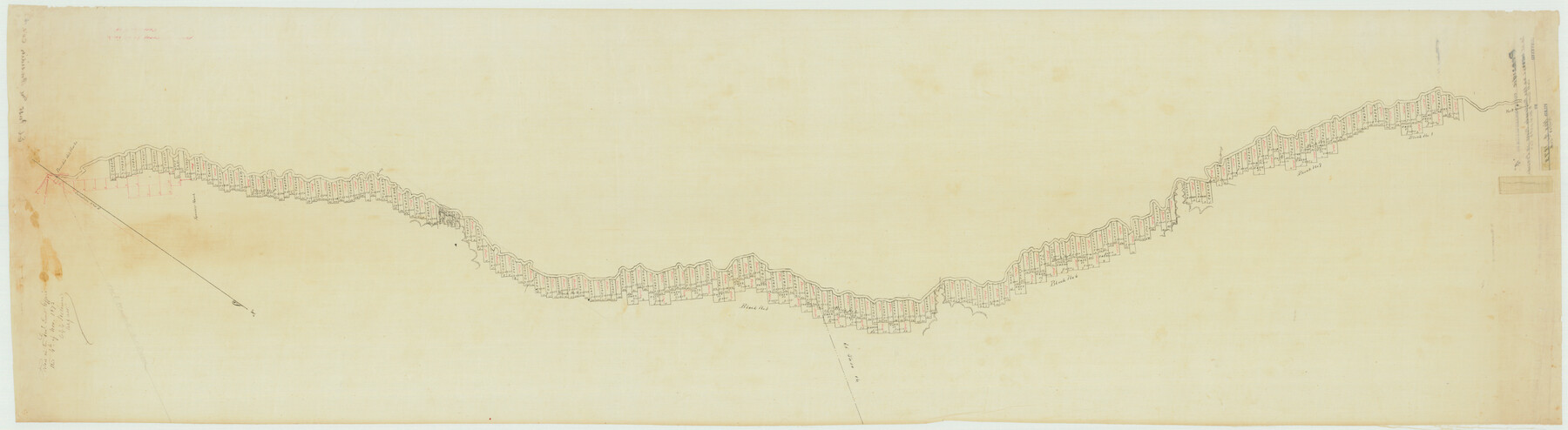
Presidio County Rolled Sketch 4
[Sketch of T. & P. Ry. Co. surveys on Rio Grande]
-
Map/Doc
10733
-
Collection
General Map Collection
-
Object Dates
1873/11/4 (File Date)
-
Counties
Presidio
-
Subjects
Surveying Rolled Sketch
-
Height x Width
19.1 x 69.8 inches
48.5 x 177.3 cm
-
Medium
linen, manuscript
Part of: General Map Collection
Comanche County Working Sketch 14

Print $20.00
- Digital $50.00
Comanche County Working Sketch 14
1960
Size 17.9 x 23.9 inches
Map/Doc 68148
Andrews County

Print $40.00
- Digital $50.00
Andrews County
1951
Size 42.7 x 54.4 inches
Map/Doc 73067
Flight Mission No. DAG-17K, Frame 127, Matagorda County

Print $20.00
- Digital $50.00
Flight Mission No. DAG-17K, Frame 127, Matagorda County
1952
Size 18.6 x 18.7 inches
Map/Doc 86347

[Surveys made in Peters Colony by Thomas Leckie]
![1983, [Surveys made in Peters Colony by Thomas Leckie], General Map Collection](https://historictexasmaps.com/wmedia_w700/maps/1983.tif.jpg)
Print $20.00
- Digital $50.00
[Surveys made in Peters Colony by Thomas Leckie]
1858
Size 22.9 x 16.6 inches
Map/Doc 1983

Archer County Working Sketch 9

Print $20.00
- Digital $50.00
Archer County Working Sketch 9
1924
Size 22.2 x 29.8 inches
Map/Doc 67149
Orange County Working Sketch 15

Print $20.00
- Digital $50.00
Orange County Working Sketch 15
1928
Size 19.3 x 24.6 inches
Map/Doc 71347
Galveston County Sketch File 56

Print $4.00
- Digital $50.00
Galveston County Sketch File 56
1892
Size 11.2 x 8.8 inches
Map/Doc 23601
Galveston County NRC Article 33.136 Sketch 85

Print $42.00
- Digital $50.00
Galveston County NRC Article 33.136 Sketch 85
2015
Size 36.4 x 24.5 inches
Map/Doc 94965
Flight Mission No. DAG-17K, Frame 63, Matagorda County

Print $20.00
- Digital $50.00
Flight Mission No. DAG-17K, Frame 63, Matagorda County
1952
Size 18.6 x 22.3 inches
Map/Doc 86325
Frio County Sketch File 15

Print $6.00
- Digital $50.00
Frio County Sketch File 15
1949
Size 11.3 x 8.8 inches
Map/Doc 23145
You may also like
Gaines County Rolled Sketch 14

Print $40.00
- Digital $50.00
Gaines County Rolled Sketch 14
Size 23.8 x 325.9 inches
Map/Doc 9030
Flight Mission No. BRA-7M, Frame 36, Jefferson County

Print $20.00
- Digital $50.00
Flight Mission No. BRA-7M, Frame 36, Jefferson County
1953
Size 18.7 x 22.3 inches
Map/Doc 85487
Geodetic positions of authentic boundary mounds, established by Louisiana Geodetic Survey traverse

Print $4.00
- Digital $50.00
Geodetic positions of authentic boundary mounds, established by Louisiana Geodetic Survey traverse
Size 28.8 x 28.7 inches
Map/Doc 1734
Shackelford County Working Sketch 15

Print $20.00
- Digital $50.00
Shackelford County Working Sketch 15
2012
Size 28.4 x 20.7 inches
Map/Doc 93321
Trinity County Working Sketch 16

Print $20.00
- Digital $50.00
Trinity County Working Sketch 16
1978
Size 31.7 x 41.2 inches
Map/Doc 69465
Jeff Davis County Working Sketch 47

Print $20.00
- Digital $50.00
Jeff Davis County Working Sketch 47
2000
Size 30.1 x 40.1 inches
Map/Doc 66542
Johnson County Working Sketch 15

Print $20.00
- Digital $50.00
Johnson County Working Sketch 15
1974
Size 21.6 x 23.8 inches
Map/Doc 66628
Refugio County Rolled Sketch 6

Print $20.00
- Digital $50.00
Refugio County Rolled Sketch 6
1892
Size 29.1 x 30.6 inches
Map/Doc 7506
Padre Island National Seashore

Print $4.00
- Digital $50.00
Padre Island National Seashore
Size 16.1 x 22.4 inches
Map/Doc 60541
Sketch in Parmer County

Print $20.00
- Digital $50.00
Sketch in Parmer County
1901
Size 15.1 x 23.8 inches
Map/Doc 91644
Starr County Sketch File 36

Print $26.00
- Digital $50.00
Starr County Sketch File 36
1939
Size 14.3 x 8.7 inches
Map/Doc 36977
[Blocks Z3, S, H1 and 1 and vicinity]
![93120, [Blocks Z3, S, H1 and 1 and vicinity], Twichell Survey Records](https://historictexasmaps.com/wmedia_w700/maps/93120-1.tif.jpg)
Print $40.00
- Digital $50.00
[Blocks Z3, S, H1 and 1 and vicinity]
Size 54.0 x 32.2 inches
Map/Doc 93120