![64406, [Galveston, Harrisburg & San Antonio Railway], General Map Collection](https://historictexasmaps.com/wmedia_w1800h1800/maps/64406.tif.jpg)
[Galveston, Harrisburg & San Antonio Railway]
Z-2-102
-
Map/Doc
64406
-
Collection
General Map Collection
-
Object Dates
1892 (Creation Date)
-
Counties
Val Verde
-
Subjects
Railroads
-
Height x Width
13.5 x 33.6 inches
34.3 x 85.3 cm
-
Medium
blueprint/diazo
-
Comments
Between "High Bridge" and Langtry. See counter nos. 64402 through 64403 and 64405 through 64408 for other sheets of map.
-
Features
GH&SA
Part of: General Map Collection
Current Miscellaneous File 95

Print $24.00
- Digital $50.00
Current Miscellaneous File 95
1994
Size 8.8 x 11.3 inches
Map/Doc 74270
Presidio County Rolled Sketch 131A

Print $20.00
- Digital $50.00
Presidio County Rolled Sketch 131A
1975
Size 30.5 x 24.9 inches
Map/Doc 10706
Clay County Sketch File 10

Print $4.00
- Digital $50.00
Clay County Sketch File 10
1860
Size 8.8 x 7.6 inches
Map/Doc 18406
Hardeman County Sketch File 5

Print $6.00
- Digital $50.00
Hardeman County Sketch File 5
Size 12.9 x 4.4 inches
Map/Doc 24994
Map of Gonzales County

Print $40.00
- Digital $50.00
Map of Gonzales County
1842
Size 59.5 x 50.0 inches
Map/Doc 16839
Brown County Sketch File 12b

Print $4.00
- Digital $50.00
Brown County Sketch File 12b
1870
Size 13.8 x 8.2 inches
Map/Doc 16608
Sutton County Sketch File X

Print $24.00
- Digital $50.00
Sutton County Sketch File X
1915
Size 14.3 x 8.8 inches
Map/Doc 37451
Hansford County

Print $20.00
- Digital $50.00
Hansford County
1932
Size 41.8 x 39.8 inches
Map/Doc 1847
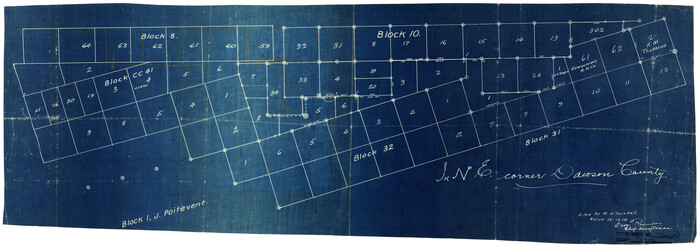
Dawson County Rolled Sketch 7
Print $20.00
- Digital $50.00
Dawson County Rolled Sketch 7
Size 14.1 x 38.1 inches
Map/Doc 5693
Map of Fannin County

Print $40.00
- Digital $50.00
Map of Fannin County
1841
Size 50.4 x 46.8 inches
Map/Doc 7821
Goliad County Working Sketch 18

Print $20.00
- Digital $50.00
Goliad County Working Sketch 18
1949
Size 31.2 x 39.4 inches
Map/Doc 63208
Sherman County Boundary File 2a

Print $10.00
- Digital $50.00
Sherman County Boundary File 2a
Size 12.9 x 8.9 inches
Map/Doc 58768
You may also like

Van Zandt County Sketch File 23

Print $4.00
- Digital $50.00
Van Zandt County Sketch File 23
1858
Size 6.8 x 8.2 inches
Map/Doc 39437
Scurry County Working Sketch 7

Print $20.00
- Digital $50.00
Scurry County Working Sketch 7
1971
Size 33.5 x 29.0 inches
Map/Doc 63836
El Paso County Boundary File 17

Print $8.00
- Digital $50.00
El Paso County Boundary File 17
Size 13.4 x 8.4 inches
Map/Doc 53192
Utility Map, Low Rent Housing Project Texas 18-1, Housing Authority of the City of Lubbock (Plan No. 3)

Print $20.00
- Digital $50.00
Utility Map, Low Rent Housing Project Texas 18-1, Housing Authority of the City of Lubbock (Plan No. 3)
1941
Size 42.5 x 27.3 inches
Map/Doc 92758
Montague County

Print $20.00
- Digital $50.00
Montague County
1924
Size 46.9 x 33.7 inches
Map/Doc 73243
Greater Texas - the Lower Coast Country and the Lower Rio Grande Valley

Greater Texas - the Lower Coast Country and the Lower Rio Grande Valley
1910
Map/Doc 96726

El Paso County Rolled Sketch 66

Print $20.00
- Digital $50.00
El Paso County Rolled Sketch 66
2014
Size 35.1 x 41.2 inches
Map/Doc 93712
Principal Watersheds of Texas

Print $20.00
Principal Watersheds of Texas
1935
Size 34.8 x 45.1 inches
Map/Doc 76306
Real County Working Sketch 1

Print $20.00
- Digital $50.00
Real County Working Sketch 1
Size 16.5 x 18.8 inches
Map/Doc 71893
Kerr County Working Sketch 25

Print $20.00
- Digital $50.00
Kerr County Working Sketch 25
Size 21.5 x 28.5 inches
Map/Doc 70056