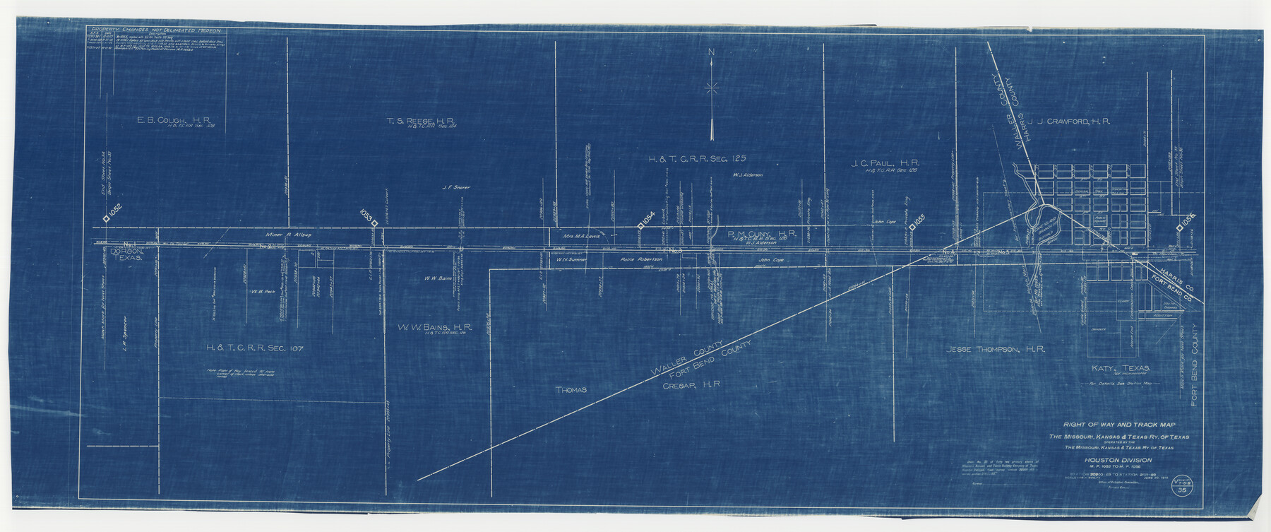
Right of Way and Track Map, the Missouri, Kansas & Texas Ry. Of Texas operated by the Missouri, Kansas & Texas Ry. Of Texas, Houston Division
M.P. 1052 to M.P. 1056, Station 20900+69 to Station 21111+89
Z-2-176
-
Map/Doc
64785
-
Collection
General Map Collection
-
Object Dates
1918/6/30 (Creation Date)
1945/9/24 (File Date)
-
Counties
Waller Harris Fort Bend
-
Subjects
Railroads
-
Height x Width
26.0 x 62.1 inches
66.0 x 157.7 cm
-
Medium
blueprint/diazo
-
Scale
1" = 400 feet
-
Comments
See counter nos. 64565 through 64567 and 64786 for other sheets of the map.
-
Features
MK&T
Katy
Cane Island Branch of Buffalo Bayou
Dorson
[Railroad line] to Houston
[Railroad line] to Taylor
Part of: General Map Collection
Galveston County NRC Article 33.136 Sketch 6

Print $20.00
- Digital $50.00
Galveston County NRC Article 33.136 Sketch 6
2001
Size 23.1 x 33.9 inches
Map/Doc 61588
Map of section no. 10 of a survey of Padre Island made for the Office of the Attorney General of the State of Texas

Print $40.00
- Digital $50.00
Map of section no. 10 of a survey of Padre Island made for the Office of the Attorney General of the State of Texas
1941
Size 57.2 x 40.6 inches
Map/Doc 2266
Blanco County Working Sketch 19

Print $20.00
- Digital $50.00
Blanco County Working Sketch 19
1960
Size 24.4 x 29.2 inches
Map/Doc 67379
Coleman County Sketch File 47

Print $12.00
- Digital $50.00
Coleman County Sketch File 47
1897
Size 14.1 x 8.6 inches
Map/Doc 18793
Hays County Sketch File 1

Print $2.00
- Digital $50.00
Hays County Sketch File 1
1856
Size 12.6 x 8.3 inches
Map/Doc 26199
La Salle County Sketch File A

Print $30.00
- Digital $50.00
La Salle County Sketch File A
1880
Size 8.1 x 12.5 inches
Map/Doc 29532
Hunt County Sketch File 1

Print $4.00
- Digital $50.00
Hunt County Sketch File 1
1853
Size 7.6 x 5.1 inches
Map/Doc 27081
Flight Mission No. DCL-5C, Frame 78, Kenedy County

Print $20.00
- Digital $50.00
Flight Mission No. DCL-5C, Frame 78, Kenedy County
1943
Size 18.7 x 22.5 inches
Map/Doc 85861
[Plat of Location and Right of Way from El Paso, Tex. To New Mexico Line, Rio Grande and El Paso R. R.]
![64084, [Plat of Location and Right of Way from El Paso, Tex. To New Mexico Line, Rio Grande and El Paso R. R.], General Map Collection](https://historictexasmaps.com/wmedia_w700/maps/64084.tif.jpg)
Print $20.00
- Digital $50.00
[Plat of Location and Right of Way from El Paso, Tex. To New Mexico Line, Rio Grande and El Paso R. R.]
Size 22.7 x 46.8 inches
Map/Doc 64084
Robertson County Rolled Sketch 1A

Print $20.00
- Digital $50.00
Robertson County Rolled Sketch 1A
1966
Size 45.3 x 28.1 inches
Map/Doc 9863
Crane County Sketch File 3a

Print $20.00
- Digital $50.00
Crane County Sketch File 3a
Size 20.8 x 13.0 inches
Map/Doc 11205
Culberson County Working Sketch 42

Print $40.00
- Digital $50.00
Culberson County Working Sketch 42
1970
Size 49.1 x 44.0 inches
Map/Doc 68496
You may also like
Harris County NRC Article 33.136 Sketch 5

Print $20.00
- Digital $50.00
Harris County NRC Article 33.136 Sketch 5
2002
Size 22.2 x 34.1 inches
Map/Doc 77047
North America corrected from the observations communicated to the Royal Society at London and the Royal Academy at Paris

Print $20.00
- Digital $50.00
North America corrected from the observations communicated to the Royal Society at London and the Royal Academy at Paris
1710
Size 38.9 x 26.9 inches
Map/Doc 93820
Current Miscellaneous File 112

Print $138.00
- Digital $50.00
Current Miscellaneous File 112
Size 11.3 x 8.7 inches
Map/Doc 74718
Real County Working Sketch 10

Print $20.00
- Digital $50.00
Real County Working Sketch 10
1929
Size 23.0 x 15.4 inches
Map/Doc 71902
Grayson County Working Sketch 6

Print $20.00
- Digital $50.00
Grayson County Working Sketch 6
1940
Size 28.6 x 40.5 inches
Map/Doc 63245
Nueces County Rolled Sketch 100

Print $20.00
- Digital $50.00
Nueces County Rolled Sketch 100
Size 21.3 x 32.7 inches
Map/Doc 10697
La Salle County Rolled Sketch 22

Print $20.00
- Digital $50.00
La Salle County Rolled Sketch 22
1955
Size 31.0 x 30.3 inches
Map/Doc 6585
Flight Mission No. DAG-28K, Frame 33, Matagorda County

Print $20.00
- Digital $50.00
Flight Mission No. DAG-28K, Frame 33, Matagorda County
1953
Size 16.2 x 16.0 inches
Map/Doc 86601
Galveston County NRC Article 33.136 Sketch 10

Print $48.00
- Digital $50.00
Galveston County NRC Article 33.136 Sketch 10
2000
Size 29.8 x 41.9 inches
Map/Doc 61592
Map of the City of Dallas, Texas, compiled from the records of Dallas Co., and latest surveys of the City Engineer

Map of the City of Dallas, Texas, compiled from the records of Dallas Co., and latest surveys of the City Engineer
1878
Size 22.9 x 31.1 inches
Map/Doc 76174
Val Verde County Rolled Sketch 30

Print $20.00
- Digital $50.00
Val Verde County Rolled Sketch 30
1884
Size 43.8 x 26.4 inches
Map/Doc 8111
Coke County Working Sketch 11

Print $20.00
- Digital $50.00
Coke County Working Sketch 11
1945
Size 40.9 x 40.2 inches
Map/Doc 68048