![75776, [Blocks CD, OP and GH in Crockett, Schleicher & Sutton Counties, Texas], Maddox Collection](https://historictexasmaps.com/wmedia_w1800h1800/maps/75776.tif.jpg)
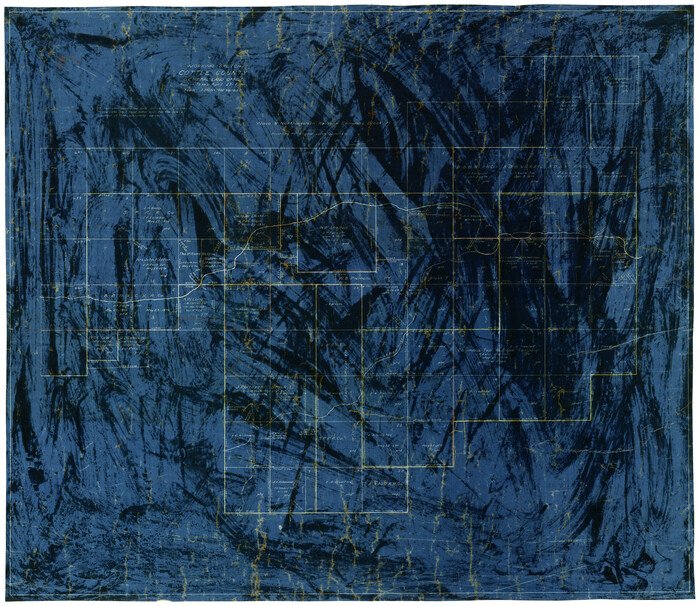
[Blocks CD, OP and GH in Crockett, Schleicher & Sutton Counties, Texas]
-
Map/Doc
75776
-
Collection
Maddox Collection
-
Counties
Crockett Sutton Schleicher
-
Height x Width
22.5 x 27.5 inches
57.2 x 69.9 cm
-
Medium
linen, manuscript
Part of: Maddox Collection
Map of Upshur County, Texas

Print $20.00
- Digital $50.00
Map of Upshur County, Texas
1879
Size 21.5 x 17.5 inches
Map/Doc 763
[Sketch Showing Surveys in Schleicher, Menard & Concho Counties, Texas]
![75782, [Sketch Showing Surveys in Schleicher, Menard & Concho Counties, Texas], Maddox Collection](https://historictexasmaps.com/wmedia_w700/maps/75782.tif.jpg)
Print $20.00
- Digital $50.00
[Sketch Showing Surveys in Schleicher, Menard & Concho Counties, Texas]
Size 16.1 x 28.9 inches
Map/Doc 75782
[Surveying Sketch of Houston and Texas Central R. R. Co., Gunter & Munson, Houston & Great Northern R. R. Co., International & Great Northern R. R. Company, et al]
![75763, [Surveying Sketch of Houston and Texas Central R. R. Co., Gunter & Munson, Houston & Great Northern R. R. Co., International & Great Northern R. R. Company, et al], Maddox Collection](https://historictexasmaps.com/wmedia_w700/maps/75763.tif.jpg)
Print $20.00
- Digital $50.00
[Surveying Sketch of Houston and Texas Central R. R. Co., Gunter & Munson, Houston & Great Northern R. R. Co., International & Great Northern R. R. Company, et al]
Size 23.1 x 28.3 inches
Map/Doc 75763
Map of Runnels County, Texas

Print $20.00
- Digital $50.00
Map of Runnels County, Texas
1879
Size 28.7 x 22.5 inches
Map/Doc 604
Working Sketch in Dickens & King Cos.

Print $20.00
- Digital $50.00
Working Sketch in Dickens & King Cos.
Size 24.4 x 20.4 inches
Map/Doc 10770
Nueces County, Texas

Print $20.00
- Digital $50.00
Nueces County, Texas
1879
Size 29.3 x 40.0 inches
Map/Doc 590
Working Sketch, Cottle County
Print $20.00
- Digital $50.00
Working Sketch, Cottle County
1916
Size 26.0 x 28.9 inches
Map/Doc 4435
Foard County, Texas

Print $20.00
- Digital $50.00
Foard County, Texas
1891
Size 20.6 x 24.5 inches
Map/Doc 4338
Mason County, Texas

Print $20.00
- Digital $50.00
Mason County, Texas
1896
Size 34.6 x 32.8 inches
Map/Doc 392
Sketch of Block B, GH & H RR & Blk C, CT RR Co, with surrounding & conflicting surveys in Knox & Baylor Counties

Print $20.00
- Digital $50.00
Sketch of Block B, GH & H RR & Blk C, CT RR Co, with surrounding & conflicting surveys in Knox & Baylor Counties
Size 24.9 x 17.9 inches
Map/Doc 75784
Map of Callahan County, Texas

Print $20.00
- Digital $50.00
Map of Callahan County, Texas
1879
Size 24.6 x 19.6 inches
Map/Doc 4337
Map of Duval County, Texas

Print $20.00
- Digital $50.00
Map of Duval County, Texas
1880
Size 31.4 x 21.8 inches
Map/Doc 5030
You may also like
Brazos River, Brazos River Sheet 4

Print $6.00
- Digital $50.00
Brazos River, Brazos River Sheet 4
1926
Size 19.7 x 32.0 inches
Map/Doc 65297
Panola County Working Sketch 36

Print $40.00
- Digital $50.00
Panola County Working Sketch 36
1984
Map/Doc 71445
Greater San Antonio & Surrounding Area

Greater San Antonio & Surrounding Area
Size 36.1 x 46.0 inches
Map/Doc 96869
Haskell County Rolled Sketch 17

Print $20.00
- Digital $50.00
Haskell County Rolled Sketch 17
2007
Size 30.0 x 36.0 inches
Map/Doc 88819
Flight Mission No. DIX-7P, Frame 13, Aransas County

Print $20.00
- Digital $50.00
Flight Mission No. DIX-7P, Frame 13, Aransas County
1956
Size 4.0 x 5.0 inches
Map/Doc 83865
Cottle County Rolled Sketch 12

Print $20.00
- Digital $50.00
Cottle County Rolled Sketch 12
1963
Size 34.2 x 25.7 inches
Map/Doc 5549
Robertson County Sketch File 10

Print $22.00
Robertson County Sketch File 10
1846
Size 12.8 x 8.4 inches
Map/Doc 35392
El Paso County Sketch File 19

Print $30.00
- Digital $50.00
El Paso County Sketch File 19
1905
Size 13.3 x 8.7 inches
Map/Doc 22009
Angelina County Sketch File 11

Print $10.00
- Digital $50.00
Angelina County Sketch File 11
1859
Size 12.4 x 8.3 inches
Map/Doc 12937
Flight Mission No. CGI-1N, Frame 184, Cameron County

Print $20.00
- Digital $50.00
Flight Mission No. CGI-1N, Frame 184, Cameron County
1955
Size 18.5 x 22.2 inches
Map/Doc 84519

Runnels County Rolled Sketch 43

Print $20.00
- Digital $50.00
Runnels County Rolled Sketch 43
Size 28.3 x 45.8 inches
Map/Doc 7531