![75763, [Surveying Sketch of Houston and Texas Central R. R. Co., Gunter & Munson, Houston & Great Northern R. R. Co., International & Great Northern R. R. Company, et al], Maddox Collection](https://historictexasmaps.com/wmedia_w1800h1800/maps/75763.tif.jpg)
[Surveying Sketch of Houston and Texas Central R. R. Co., Gunter & Munson, Houston & Great Northern R. R. Co., International & Great Northern R. R. Company, et al]
-
Map/Doc
75763
-
Collection
Maddox Collection
-
Counties
Hemphill Roberts
-
Height x Width
23.1 x 28.3 inches
58.7 x 71.9 cm
-
Medium
paper, manuscript
Part of: Maddox Collection
[Tex Mex & CCSDRG&G Railroad Blocks in Starr and Hidalgo Counties, Texas]
![4452, [Tex Mex & CCSDRG&G Railroad Blocks in Starr and Hidalgo Counties, Texas], Maddox Collection](https://historictexasmaps.com/wmedia_w700/maps/4452-1.tif.jpg)
Print $20.00
- Digital $50.00
[Tex Mex & CCSDRG&G Railroad Blocks in Starr and Hidalgo Counties, Texas]
1906
Size 28.7 x 24.2 inches
Map/Doc 4452
Map of South Brady Ranch, Concho County, Texas

Print $3.00
- Digital $50.00
Map of South Brady Ranch, Concho County, Texas
1880
Size 12.9 x 10.5 inches
Map/Doc 424
Map of the Pitchfork Ranch

Print $20.00
- Digital $50.00
Map of the Pitchfork Ranch
1915
Size 40.2 x 36.5 inches
Map/Doc 4490
[McK. & Williams No. 601 and surrounding surveys, Travis County]
![10782, [McK. & Williams No. 601 and surrounding surveys, Travis County], Maddox Collection](https://historictexasmaps.com/wmedia_w700/maps/10782-1.tif.jpg)
Print $20.00
- Digital $50.00
[McK. & Williams No. 601 and surrounding surveys, Travis County]
Size 18.3 x 12.3 inches
Map/Doc 10782
Cass County, Texas

Print $20.00
- Digital $50.00
Cass County, Texas
1879
Size 18.4 x 20.8 inches
Map/Doc 652
Map of Swisher Addition

Print $20.00
- Digital $50.00
Map of Swisher Addition
1910
Size 18.0 x 13.1 inches
Map/Doc 83425
Revised Sectional Map No. 6 showing land surveys in parts of Presidio and Brewster Counties, Texas

Print $20.00
- Digital $50.00
Revised Sectional Map No. 6 showing land surveys in parts of Presidio and Brewster Counties, Texas
Size 24.2 x 23.0 inches
Map/Doc 4475
Baylor County, Texas

Print $20.00
- Digital $50.00
Baylor County, Texas
Size 21.7 x 18.9 inches
Map/Doc 525
Plat of Surveys in Hidalgo Co.

Print $20.00
- Digital $50.00
Plat of Surveys in Hidalgo Co.
Size 18.2 x 9.3 inches
Map/Doc 405
Map of Llano County, Texas

Print $20.00
- Digital $50.00
Map of Llano County, Texas
1879
Size 24.6 x 22.9 inches
Map/Doc 568
[Map Showing Surveys in Dimmit & La Salle Counties, Texas]
![75792, [Map Showing Surveys in Dimmit & La Salle Counties, Texas], Maddox Collection](https://historictexasmaps.com/wmedia_w700/maps/75792.tif.jpg)
Print $20.00
- Digital $50.00
[Map Showing Surveys in Dimmit & La Salle Counties, Texas]
1882
Size 32.6 x 28.7 inches
Map/Doc 75792
Map of the Western Part of Travis County, Texas
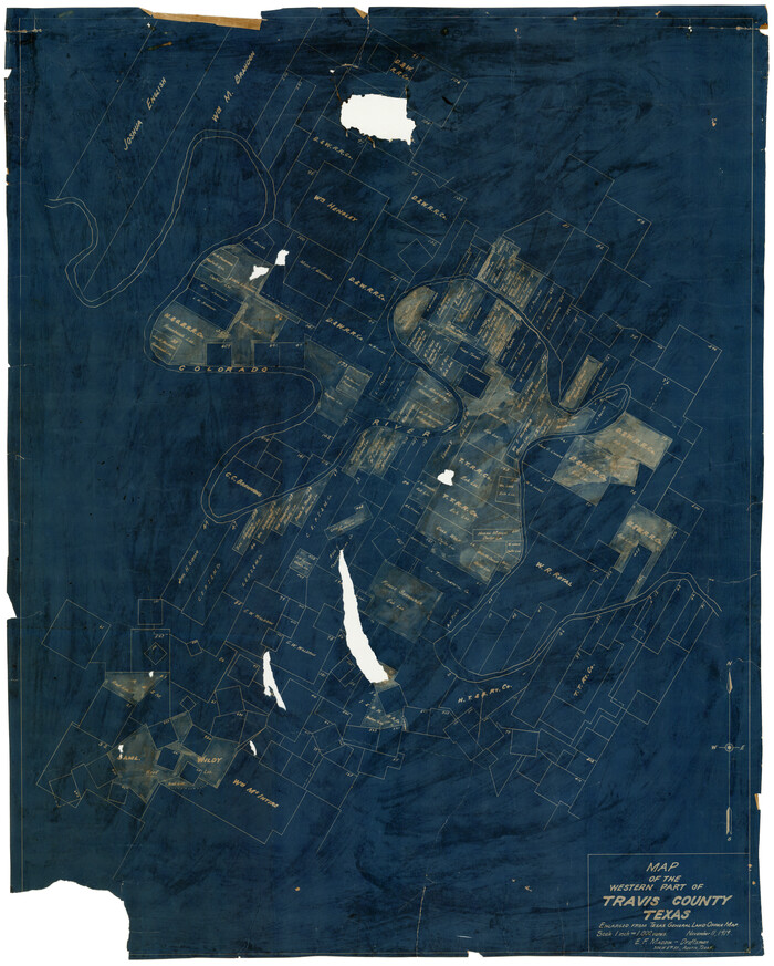
Print $20.00
- Digital $50.00
Map of the Western Part of Travis County, Texas
1919
Size 36.2 x 29.9 inches
Map/Doc 10754
You may also like
Jack County Working Sketch 19

Print $20.00
- Digital $50.00
Jack County Working Sketch 19
1989
Size 21.5 x 29.4 inches
Map/Doc 66445
Kleberg County Rolled Sketch 10-21

Print $20.00
- Digital $50.00
Kleberg County Rolled Sketch 10-21
1952
Size 37.5 x 32.9 inches
Map/Doc 9403

Pecos County Rolled Sketch 126

Print $20.00
- Digital $50.00
Pecos County Rolled Sketch 126
1948
Size 42.5 x 38.4 inches
Map/Doc 9724
Nueces County Sketch File 70

Print $8.00
- Digital $50.00
Nueces County Sketch File 70
Size 11.2 x 8.6 inches
Map/Doc 33007
Map of New Brunswick and Nova Scotia / Map of Newfoundland / Map of the West Indies, Guatimala and part of Mexico to illustrate Olney's school geography

Print $20.00
- Digital $50.00
Map of New Brunswick and Nova Scotia / Map of Newfoundland / Map of the West Indies, Guatimala and part of Mexico to illustrate Olney's school geography
1844
Size 9.5 x 12.1 inches
Map/Doc 93544
Borden County Boundary File 4

Print $2.00
- Digital $50.00
Borden County Boundary File 4
Size 13.3 x 8.3 inches
Map/Doc 50636
Fractional Township No. 9 South Range No. 25 East of the Indian Meridian, Indian Territory

Print $20.00
- Digital $50.00
Fractional Township No. 9 South Range No. 25 East of the Indian Meridian, Indian Territory
1898
Size 19.2 x 24.3 inches
Map/Doc 75243
Atascosa County Rolled Sketch 16

Print $20.00
- Digital $50.00
Atascosa County Rolled Sketch 16
1952
Size 22.7 x 38.3 inches
Map/Doc 5096
Brazoria County Sketch File 14

Print $8.00
- Digital $50.00
Brazoria County Sketch File 14
1892
Size 13.9 x 8.7 inches
Map/Doc 14973
Potter County Working Sketch 9

Print $40.00
- Digital $50.00
Potter County Working Sketch 9
1966
Size 46.4 x 48.6 inches
Map/Doc 71669
Young County Rolled Sketch 13

Print $20.00
- Digital $50.00
Young County Rolled Sketch 13
1966
Size 24.8 x 16.9 inches
Map/Doc 8301