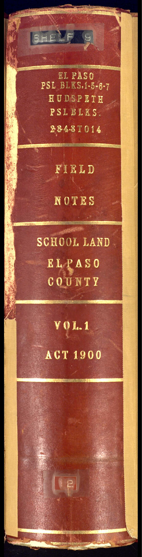
PSL Field Notes for Blocks 1, 5, 6, and 7 in El Paso County and Blocks 2, 3, 4, 8, 9, 10, 11, 12, 13, and 14 in Hudspeth County
-
Map/Doc
81653
-
Collection
General Map Collection
-
People and Organizations
Charles Rogan (GLO Commissioner)
A.H. Parker (Surveyor/Engineer)
W.L. Rider (Surveyor/Engineer)
-
Counties
El Paso Hudspeth
-
Subjects
Bound Volume Public School Land
-
Medium
paper, bound volume
-
Comments
See the following surveying items related to this PSL field note volume: Hudspeth County Rolled Sketch 23; Hudspeth County Sketch Files 1, 2, 7, 9, 10, 12, and 36.
See 97176 for an index to the Public School Land field note volumes.
Related maps
Hudspeth County Sketch File 1

Print $8.00
- Digital $50.00
Hudspeth County Sketch File 1
1900
Size 11.3 x 8.8 inches
Map/Doc 26880
Hudspeth County Sketch File 2

Print $10.00
- Digital $50.00
Hudspeth County Sketch File 2
1900
Size 13.4 x 8.6 inches
Map/Doc 26884
Hudspeth County Sketch File 7

Print $6.00
- Digital $50.00
Hudspeth County Sketch File 7
1900
Size 14.2 x 8.7 inches
Map/Doc 26892
Hudspeth County Sketch File 9

Print $8.00
- Digital $50.00
Hudspeth County Sketch File 9
1900
Size 11.3 x 8.8 inches
Map/Doc 26895
Hudspeth County Sketch File 10

Print $4.00
- Digital $50.00
Hudspeth County Sketch File 10
1900
Size 11.2 x 8.8 inches
Map/Doc 26899
Hudspeth County Sketch File 12

Print $10.00
- Digital $50.00
Hudspeth County Sketch File 12
1901
Size 14.2 x 8.7 inches
Map/Doc 26924
Hudspeth County Sketch File 36

Print $12.00
- Digital $50.00
Hudspeth County Sketch File 36
1901
Size 10.5 x 8.2 inches
Map/Doc 27003
Hudspeth County Rolled Sketch 23

Print $40.00
- Digital $50.00
Hudspeth County Rolled Sketch 23
Size 43.7 x 70.3 inches
Map/Doc 9207
Public School Land Field Note Volume Index

Public School Land Field Note Volume Index
2023
Size 8.5 x 11.0 inches
Map/Doc 97176
Part of: General Map Collection
Hamilton County Boundary File 1a

Print $40.00
- Digital $50.00
Hamilton County Boundary File 1a
Size 36.1 x 8.6 inches
Map/Doc 54193
Calhoun County Rolled Sketch 30

Print $20.00
- Digital $50.00
Calhoun County Rolled Sketch 30
1974
Size 18.5 x 27.5 inches
Map/Doc 5488
San Saba County

Print $20.00
- Digital $50.00
San Saba County
1987
Size 41.3 x 42.2 inches
Map/Doc 77417
Jefferson County

Print $20.00
- Digital $50.00
Jefferson County
1882
Size 22.8 x 20.0 inches
Map/Doc 3730
Roberts County Working Sketch 21

Print $20.00
- Digital $50.00
Roberts County Working Sketch 21
1979
Size 35.7 x 45.6 inches
Map/Doc 63547
Nueces County Rolled Sketch 90

Print $129.00
Nueces County Rolled Sketch 90
1983
Size 24.8 x 37.1 inches
Map/Doc 7008
Flight Mission No. BRE-2P, Frame 65, Nueces County

Print $20.00
- Digital $50.00
Flight Mission No. BRE-2P, Frame 65, Nueces County
1956
Size 18.4 x 22.3 inches
Map/Doc 86760
Flight Mission No. DIX-6P, Frame 201, Aransas County

Print $20.00
- Digital $50.00
Flight Mission No. DIX-6P, Frame 201, Aransas County
1956
Size 18.9 x 22.8 inches
Map/Doc 83863
[Right of Way & Track Map, The Texas & Pacific Ry. Co. Main Line]
![64681, [Right of Way & Track Map, The Texas & Pacific Ry. Co. Main Line], General Map Collection](https://historictexasmaps.com/wmedia_w700/maps/64681.tif.jpg)
Print $20.00
- Digital $50.00
[Right of Way & Track Map, The Texas & Pacific Ry. Co. Main Line]
Size 11.0 x 19.0 inches
Map/Doc 64681
Ellis County Sketch File 1

Print $6.00
- Digital $50.00
Ellis County Sketch File 1
1849
Size 6.5 x 7.9 inches
Map/Doc 21824
Padre Island National Seashore, Texas - Dependent Resurvey

Print $4.00
- Digital $50.00
Padre Island National Seashore, Texas - Dependent Resurvey
2001
Size 18.5 x 24.2 inches
Map/Doc 60547
Wood County Sketch File 1

Print $4.00
- Digital $50.00
Wood County Sketch File 1
Size 12.7 x 7.9 inches
Map/Doc 40629
You may also like
Guadalupe County Sketch File 7c

Print $22.00
- Digital $50.00
Guadalupe County Sketch File 7c
Size 12.7 x 15.5 inches
Map/Doc 24672
Northern Part of Laguna Madre

Print $20.00
- Digital $50.00
Northern Part of Laguna Madre
1982
Size 44.2 x 35.0 inches
Map/Doc 73530
Kleberg County Sketch File 2

Print $5.00
- Digital $50.00
Kleberg County Sketch File 2
1934
Size 11.1 x 8.8 inches
Map/Doc 29210
Johnson County Sketch File 8

Print $6.00
- Digital $50.00
Johnson County Sketch File 8
1859
Size 8.0 x 9.7 inches
Map/Doc 28440
Map of San Patricio District

Print $40.00
- Digital $50.00
Map of San Patricio District
1870
Size 43.8 x 51.4 inches
Map/Doc 1987
Lubbock County Rolled Sketch 7

Print $20.00
- Digital $50.00
Lubbock County Rolled Sketch 7
1944
Size 25.8 x 32.9 inches
Map/Doc 6643
[Block 36, Township 5N, and Block M]
![90631, [Block 36, Township 5N, and Block M], Twichell Survey Records](https://historictexasmaps.com/wmedia_w700/maps/90631-1.tif.jpg)
Print $20.00
- Digital $50.00
[Block 36, Township 5N, and Block M]
Size 16.6 x 20.8 inches
Map/Doc 90631
Newton County Working Sketch 10

Print $20.00
- Digital $50.00
Newton County Working Sketch 10
1941
Size 17.1 x 21.6 inches
Map/Doc 71256
Map of Llano County Showing Geology, Mineral Localities, Topography, etc.

Print $20.00
Map of Llano County Showing Geology, Mineral Localities, Topography, etc.
1875
Size 16.5 x 21.3 inches
Map/Doc 88969
Calhoun County Sketch File 8

Print $12.00
- Digital $50.00
Calhoun County Sketch File 8
1948
Size 14.2 x 9.0 inches
Map/Doc 35930
Crosby County Sketch File 31

Print $20.00
- Digital $50.00
Crosby County Sketch File 31
Size 35.0 x 14.0 inches
Map/Doc 11257
Marion County Rolled Sketch 4

Print $40.00
- Digital $50.00
Marion County Rolled Sketch 4
1951
Size 43.1 x 58.0 inches
Map/Doc 9491