El Paso County Rolled Sketch JE
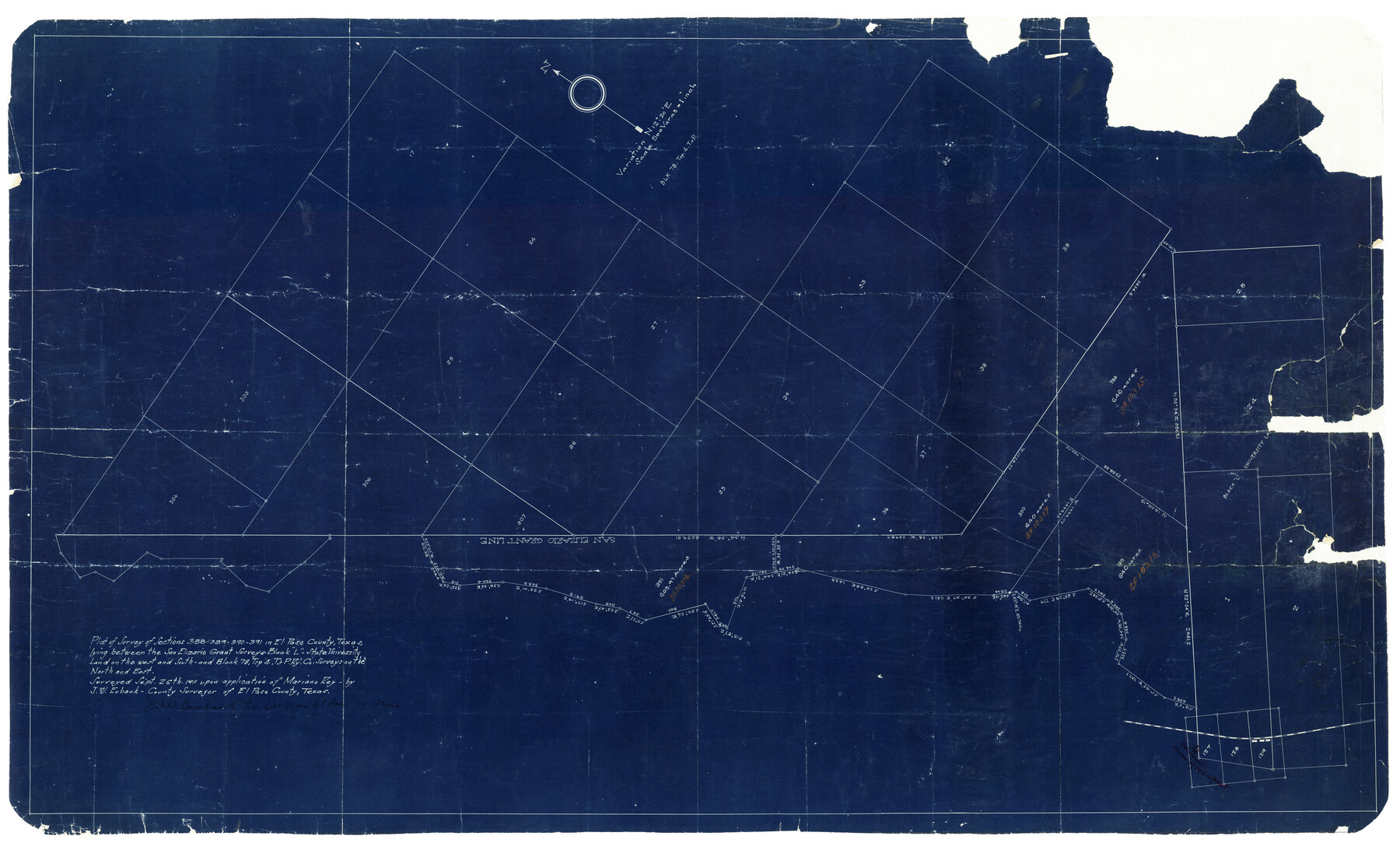
Plat of survey of sections 388-389-390-391 in El Paso County, Texas, lying between the San Elizario Grant survey & Block L - State University Land on the west and south - and Block 78, Tsp 4, T. & P. Ry. Co. surveys on the north and east
-
Map/Doc
8860
-
Collection
General Map Collection
-
Object Dates
9/26/1911 (Creation Date)
-
People and Organizations
J.W. Eubank (Surveyor/Engineer)
-
Counties
El Paso
-
Subjects
Cadastral Surveying Rolled Sketch
-
Height x Width
47.0 x 30.2 inches
119.4 x 76.7 cm
-
Medium
blueprint/diazo
-
Scale
1" = 500 varas
Part of: General Map Collection
Chambers County Sketch File 21
![10331, Chambers County Sketch File 21, General Map Collection](https://historictexasmaps.com/wmedia_w700/pdf_converted_jpg/qi_pdf_thumbnail_7027.jpg)
Print $20.00
- Digital $50.00
Chambers County Sketch File 21
Size 29.3 x 32.8 inches
Map/Doc 10331
Hidalgo County Rolled Sketch 14
![9169, Hidalgo County Rolled Sketch 14, General Map Collection](https://historictexasmaps.com/wmedia_w700/maps/9169.tif.jpg)
Print $40.00
- Digital $50.00
Hidalgo County Rolled Sketch 14
1963
Size 68.5 x 40.7 inches
Map/Doc 9169
Duval County Rolled Sketch Pressly No. 2A
![5771, Duval County Rolled Sketch Pressly No. 2A, General Map Collection](https://historictexasmaps.com/wmedia_w700/maps/5771.tif.jpg)
Print $20.00
- Digital $50.00
Duval County Rolled Sketch Pressly No. 2A
1935
Size 22.3 x 34.4 inches
Map/Doc 5771
[Surveys along Bray's Bayou]
![157, [Surveys along Bray's Bayou], General Map Collection](https://historictexasmaps.com/wmedia_w700/maps/157.tif.jpg)
Print $2.00
- Digital $50.00
[Surveys along Bray's Bayou]
Size 7.6 x 4.9 inches
Map/Doc 157
Parker County Sketch File 42
![33589, Parker County Sketch File 42, General Map Collection](https://historictexasmaps.com/wmedia_w700/pdf_converted_jpg/qi_pdf_thumbnail_13533.jpg)
Print $114.00
- Digital $50.00
Parker County Sketch File 42
1877
Size 14.4 x 12.0 inches
Map/Doc 33589
Van Zandt County Working Sketch 11
![72261, Van Zandt County Working Sketch 11, General Map Collection](https://historictexasmaps.com/wmedia_w700/maps/72261.tif.jpg)
Print $3.00
- Digital $50.00
Van Zandt County Working Sketch 11
Size 15.2 x 9.3 inches
Map/Doc 72261
San Saba County Boundary File 77a
![58591, San Saba County Boundary File 77a, General Map Collection](https://historictexasmaps.com/wmedia_w700/pdf_converted_jpg/qi_pdf_thumbnail_16778.jpg)
Print $51.00
- Digital $50.00
San Saba County Boundary File 77a
Size 17.3 x 10.8 inches
Map/Doc 58591
The History of Texas; or the Emigrant's, Farmer's, and Politician's Guide to the Character, Climate, Soil and Productions of that Country: Geographically Arranged from Personal Observation and Experience
![94038, The History of Texas; or the Emigrant's, Farmer's, and Politician's Guide to the Character, Climate, Soil and Productions of that Country: Geographically Arranged from Personal Observation and Experience, General Map Collection](https://historictexasmaps.com/wmedia_w700/pdf_converted_jpg/qi_pdf_thumbnail_38692.jpg)
The History of Texas; or the Emigrant's, Farmer's, and Politician's Guide to the Character, Climate, Soil and Productions of that Country: Geographically Arranged from Personal Observation and Experience
1836
Size 7.6 x 9.1 inches
Map/Doc 94038
Travis County Sketch File 70
![38453, Travis County Sketch File 70, General Map Collection](https://historictexasmaps.com/wmedia_w700/pdf_converted_jpg/qi_pdf_thumbnail_14607.jpg)
Print $26.00
- Digital $50.00
Travis County Sketch File 70
1961
Size 14.4 x 8.8 inches
Map/Doc 38453
Shelby County Sketch File 22
![36643, Shelby County Sketch File 22, General Map Collection](https://historictexasmaps.com/wmedia_w700/pdf_converted_jpg/qi_pdf_thumbnail_14205.jpg)
Print $6.00
- Digital $50.00
Shelby County Sketch File 22
Size 15.4 x 10.2 inches
Map/Doc 36643
Blanco County Rolled Sketch 20
![87343, Blanco County Rolled Sketch 20, General Map Collection](https://historictexasmaps.com/wmedia_w700/pdf_converted_jpg/qi_pdf_thumbnail_34271.jpg)
Print $36.00
- Digital $50.00
Blanco County Rolled Sketch 20
Size 30.7 x 17.0 inches
Map/Doc 87343
You may also like
San Jacinto County Sketch File 22
![35734, San Jacinto County Sketch File 22, General Map Collection](https://historictexasmaps.com/wmedia_w700/pdf_converted_jpg/qi_pdf_thumbnail_14038.jpg)
Print $136.00
San Jacinto County Sketch File 22
1935
Size 11.3 x 8.7 inches
Map/Doc 35734
Real County Working Sketch 62
![71954, Real County Working Sketch 62, General Map Collection](https://historictexasmaps.com/wmedia_w700/maps/71954.tif.jpg)
Print $4.00
- Digital $50.00
Real County Working Sketch 62
Size 26.4 x 23.2 inches
Map/Doc 71954
Map of surveys 191 & 192 T. C. R.R. Co. in Travis County, Texas
![75555, Map of surveys 191 & 192 T. C. R.R. Co. in Travis County, Texas, Maddox Collection](https://historictexasmaps.com/wmedia_w700/maps/75555.tif.jpg)
Print $20.00
- Digital $50.00
Map of surveys 191 & 192 T. C. R.R. Co. in Travis County, Texas
1915
Size 20.7 x 12.9 inches
Map/Doc 75555
English Field Notes of the Spanish Archives - Books R & MC
![96552, English Field Notes of the Spanish Archives - Books R & MC, Historical Volumes](https://historictexasmaps.com/wmedia_w700/pdf_converted_jpg/qi_pdf_thumbnail_40547.jpg)
English Field Notes of the Spanish Archives - Books R & MC
1835
Map/Doc 96552
Bastrop County
![692, Bastrop County, Maddox Collection](https://historictexasmaps.com/wmedia_w700/maps/692.tif.jpg)
Print $20.00
- Digital $50.00
Bastrop County
1879
Size 27.1 x 26.1 inches
Map/Doc 692
Matagorda County Working Sketch 33
![70891, Matagorda County Working Sketch 33, General Map Collection](https://historictexasmaps.com/wmedia_w700/maps/70891.tif.jpg)
Print $20.00
- Digital $50.00
Matagorda County Working Sketch 33
Size 32.0 x 42.5 inches
Map/Doc 70891
Blanco County Working Sketch 24
![67384, Blanco County Working Sketch 24, General Map Collection](https://historictexasmaps.com/wmedia_w700/maps/67384.tif.jpg)
Print $20.00
- Digital $50.00
Blanco County Working Sketch 24
1963
Size 30.2 x 31.2 inches
Map/Doc 67384
Map of Taylor, Bastrop & Houston Railway through Colorado County, Texas
![64289, Map of Taylor, Bastrop & Houston Railway through Colorado County, Texas, General Map Collection](https://historictexasmaps.com/wmedia_w700/maps/64289.tif.jpg)
Print $20.00
- Digital $50.00
Map of Taylor, Bastrop & Houston Railway through Colorado County, Texas
1888
Size 12.7 x 20.0 inches
Map/Doc 64289
Lavaca County Working Sketch 4
![70357, Lavaca County Working Sketch 4, General Map Collection](https://historictexasmaps.com/wmedia_w700/maps/70357.tif.jpg)
Print $20.00
- Digital $50.00
Lavaca County Working Sketch 4
Size 27.7 x 42.4 inches
Map/Doc 70357
Borden County Rolled Sketch 12
![8451, Borden County Rolled Sketch 12, General Map Collection](https://historictexasmaps.com/wmedia_w700/maps/8451.tif.jpg)
Print $40.00
- Digital $50.00
Borden County Rolled Sketch 12
1964
Size 48.1 x 31.6 inches
Map/Doc 8451
Lands of C. W. Post in Garza and Lynn Counties, Texas, and Surrounding Lands
![92645, Lands of C. W. Post in Garza and Lynn Counties, Texas, and Surrounding Lands, Twichell Survey Records](https://historictexasmaps.com/wmedia_w700/maps/92645.tif.jpg)
Print $20.00
- Digital $50.00
Lands of C. W. Post in Garza and Lynn Counties, Texas, and Surrounding Lands
Size 15.8 x 18.0 inches
Map/Doc 92645
Refugio County
![3984, Refugio County, General Map Collection](https://historictexasmaps.com/wmedia_w700/maps/3984.tif.jpg)
Print $20.00
- Digital $50.00
Refugio County
1883
Size 20.1 x 28.9 inches
Map/Doc 3984