Fisher County Sketch File 1

Print $20.00
- Digital $50.00
Fisher County Sketch File 1
Size: 43.5 x 18.3 inches
10448
Fisher County Sketch File 5

Print $20.00
- Digital $50.00
Fisher County Sketch File 5
1887
Size: 35.3 x 47.6 inches
10449
Fisher County Sketch File A2

Print $20.00
- Digital $50.00
Fisher County Sketch File A2
1901
Size: 35.8 x 31.0 inches
10450
Jones County Sketch File 11a

Print $40.00
- Digital $50.00
Jones County Sketch File 11a
Size: 37.5 x 49.5 inches
10510
Nolan County Sketch File 1b

Print $20.00
- Digital $50.00
Nolan County Sketch File 1b
1875
Size: 37.6 x 46.7 inches
10555
Nolan County Sketch File 2

Print $40.00
- Digital $50.00
Nolan County Sketch File 2
Size: 49.5 x 41.6 inches
10556
Fisher County Rolled Sketch 5

Print $20.00
- Digital $50.00
Fisher County Rolled Sketch 5
1961
Size: 40.3 x 32.5 inches
10659
Fisher County Sketch File 6a

Print $20.00
- Digital $50.00
Fisher County Sketch File 6a
Size: 21.3 x 18.1 inches
11476
Fisher County Sketch File 10

Print $20.00
- Digital $50.00
Fisher County Sketch File 10
Size: 9.7 x 37.0 inches
11477
Fisher County Sketch File 11

Print $20.00
- Digital $50.00
Fisher County Sketch File 11
Size: 22.8 x 20.4 inches
11478
Fisher County Sketch File 13

Print $20.00
- Digital $50.00
Fisher County Sketch File 13
Size: 18.3 x 17.7 inches
11480
Fisher County Sketch File 19

Print $20.00
- Digital $50.00
Fisher County Sketch File 19
Size: 18.8 x 15.7 inches
11481
Fisher County Sketch File A

Print $20.00
- Digital $50.00
Fisher County Sketch File A
1901
Size: 33.1 x 22.8 inches
11482
Jones County Sketch File 1

Print $20.00
- Digital $50.00
Jones County Sketch File 1
1857
Size: 17.8 x 30.3 inches
11894
Jones County Sketch File 2

Print $20.00
- Digital $50.00
Jones County Sketch File 2
1857
Size: 16.8 x 21.1 inches
11895
Jones County Sketch File 5a

Print $20.00
- Digital $50.00
Jones County Sketch File 5a
1857
Size: 18.4 x 23.5 inches
11896
Jones County Sketch File 16

Print $20.00
- Digital $50.00
Jones County Sketch File 16
1945
Size: 23.7 x 19.0 inches
11901
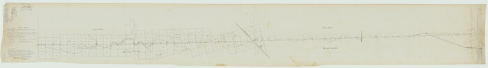
[Plat No. 1, Connecting line from SW corner of Jones Co. to SE corner of Borden Co.]
Print $40.00
- Digital $50.00
[Plat No. 1, Connecting line from SW corner of Jones Co. to SE corner of Borden Co.]
1908
Size: 18.1 x 128.8 inches
1698
Fisher County Sketch File 2

Print $2.00
- Digital $50.00
Fisher County Sketch File 2
1885
Size: 12.4 x 7.5 inches
22548
Fisher County Sketch File 3

Print $56.00
- Digital $50.00
Fisher County Sketch File 3
1886
Size: 8.9 x 5.8 inches
22549
Fisher County Sketch File 4

Print $33.00
- Digital $50.00
Fisher County Sketch File 4
Size: 11.4 x 9.2 inches
22557
Fisher County Sketch File 6

Print $6.00
- Digital $50.00
Fisher County Sketch File 6
Size: 9.7 x 15.9 inches
22563
Fisher County Sketch File 7

Print $4.00
- Digital $50.00
Fisher County Sketch File 7
1893
Size: 14.6 x 9.1 inches
22565
Fisher County Sketch File 8

Print $16.00
- Digital $50.00
Fisher County Sketch File 8
1898
Size: 14.7 x 9.1 inches
22567
Fisher County Sketch File 9

Print $4.00
- Digital $50.00
Fisher County Sketch File 9
1893
Size: 11.1 x 8.5 inches
22575
Fisher County Sketch File 12

Print $22.00
- Digital $50.00
Fisher County Sketch File 12
1893
Size: 9.0 x 7.0 inches
22577
Fisher County Sketch File 15a

Print $10.00
- Digital $50.00
Fisher County Sketch File 15a
1901
Size: 7.6 x 9.0 inches
22578
Fisher County Sketch File 1
Print $20.00
- Digital $50.00
Fisher County Sketch File 1
-
Size
43.5 x 18.3 inches
-
Map/Doc
10448
Fisher County Sketch File 5
Print $20.00
- Digital $50.00
Fisher County Sketch File 5
1887
-
Size
35.3 x 47.6 inches
-
Map/Doc
10449
-
Creation Date
1887
Fisher County Sketch File A2
Print $20.00
- Digital $50.00
Fisher County Sketch File A2
1901
-
Size
35.8 x 31.0 inches
-
Map/Doc
10450
-
Creation Date
1901
Jones County Sketch File 11a
Print $40.00
- Digital $50.00
Jones County Sketch File 11a
-
Size
37.5 x 49.5 inches
-
Map/Doc
10510
Nolan County Sketch File 1b
Print $20.00
- Digital $50.00
Nolan County Sketch File 1b
1875
-
Size
37.6 x 46.7 inches
-
Map/Doc
10555
-
Creation Date
1875
Nolan County Sketch File 2
Print $40.00
- Digital $50.00
Nolan County Sketch File 2
-
Size
49.5 x 41.6 inches
-
Map/Doc
10556
Fisher County Rolled Sketch 5
Print $20.00
- Digital $50.00
Fisher County Rolled Sketch 5
1961
-
Size
40.3 x 32.5 inches
-
Map/Doc
10659
-
Creation Date
1961
Fisher County Sketch File 6a
Print $20.00
- Digital $50.00
Fisher County Sketch File 6a
-
Size
21.3 x 18.1 inches
-
Map/Doc
11476
Fisher County Sketch File 10
Print $20.00
- Digital $50.00
Fisher County Sketch File 10
-
Size
9.7 x 37.0 inches
-
Map/Doc
11477
Fisher County Sketch File 11
Print $20.00
- Digital $50.00
Fisher County Sketch File 11
-
Size
22.8 x 20.4 inches
-
Map/Doc
11478
Fisher County Sketch File 13
Print $20.00
- Digital $50.00
Fisher County Sketch File 13
-
Size
18.3 x 17.7 inches
-
Map/Doc
11480
Fisher County Sketch File 19
Print $20.00
- Digital $50.00
Fisher County Sketch File 19
-
Size
18.8 x 15.7 inches
-
Map/Doc
11481
Fisher County Sketch File A
Print $20.00
- Digital $50.00
Fisher County Sketch File A
1901
-
Size
33.1 x 22.8 inches
-
Map/Doc
11482
-
Creation Date
1901
Jones County Sketch File 1
Print $20.00
- Digital $50.00
Jones County Sketch File 1
1857
-
Size
17.8 x 30.3 inches
-
Map/Doc
11894
-
Creation Date
1857
Jones County Sketch File 2
Print $20.00
- Digital $50.00
Jones County Sketch File 2
1857
-
Size
16.8 x 21.1 inches
-
Map/Doc
11895
-
Creation Date
1857
Jones County Sketch File 5a
Print $20.00
- Digital $50.00
Jones County Sketch File 5a
1857
-
Size
18.4 x 23.5 inches
-
Map/Doc
11896
-
Creation Date
1857
Jones County Sketch File 16
Print $20.00
- Digital $50.00
Jones County Sketch File 16
1945
-
Size
23.7 x 19.0 inches
-
Map/Doc
11901
-
Creation Date
1945
Fisher County

Print $20.00
- Digital $50.00
Fisher County
1921
-
Size
45.2 x 41.0 inches
-
Map/Doc
16829
-
Creation Date
1921
[Plat No. 1, Connecting line from SW corner of Jones Co. to SE corner of Borden Co.]
Print $40.00
- Digital $50.00
[Plat No. 1, Connecting line from SW corner of Jones Co. to SE corner of Borden Co.]
1908
-
Size
18.1 x 128.8 inches
-
Map/Doc
1698
-
Creation Date
1908
Fisher County

Print $40.00
- Digital $50.00
Fisher County
1944
-
Size
48.2 x 42.4 inches
-
Map/Doc
1826
-
Creation Date
1944
Young Territory

Print $20.00
- Digital $50.00
Young Territory
1873
-
Size
45.3 x 42.8 inches
-
Map/Doc
1988
-
Creation Date
1873
Fisher County Sketch File 2
Print $2.00
- Digital $50.00
Fisher County Sketch File 2
1885
-
Size
12.4 x 7.5 inches
-
Map/Doc
22548
-
Creation Date
1885
Fisher County Sketch File 3
Print $56.00
- Digital $50.00
Fisher County Sketch File 3
1886
-
Size
8.9 x 5.8 inches
-
Map/Doc
22549
-
Creation Date
1886
Fisher County Sketch File 4
Print $33.00
- Digital $50.00
Fisher County Sketch File 4
-
Size
11.4 x 9.2 inches
-
Map/Doc
22557
Fisher County Sketch File 6
Print $6.00
- Digital $50.00
Fisher County Sketch File 6
-
Size
9.7 x 15.9 inches
-
Map/Doc
22563
Fisher County Sketch File 7
Print $4.00
- Digital $50.00
Fisher County Sketch File 7
1893
-
Size
14.6 x 9.1 inches
-
Map/Doc
22565
-
Creation Date
1893
Fisher County Sketch File 8
Print $16.00
- Digital $50.00
Fisher County Sketch File 8
1898
-
Size
14.7 x 9.1 inches
-
Map/Doc
22567
-
Creation Date
1898
Fisher County Sketch File 9
Print $4.00
- Digital $50.00
Fisher County Sketch File 9
1893
-
Size
11.1 x 8.5 inches
-
Map/Doc
22575
-
Creation Date
1893
Fisher County Sketch File 12
Print $22.00
- Digital $50.00
Fisher County Sketch File 12
1893
-
Size
9.0 x 7.0 inches
-
Map/Doc
22577
-
Creation Date
1893
Fisher County Sketch File 15a
Print $10.00
- Digital $50.00
Fisher County Sketch File 15a
1901
-
Size
7.6 x 9.0 inches
-
Map/Doc
22578
-
Creation Date
1901