[T. & P. Block U and H. & T. C. Block 1]
Print $20.00
- Digital $50.00
[T. & P. Block U and H. & T. C. Block 1]
Size: 20.5 x 16.7 inches
91871
[Surveying sketch of Jones County showing Micaela Fiagoso survey]
Print $20.00
- Digital $50.00
[Surveying sketch of Jones County showing Micaela Fiagoso survey]
Size: 19.5 x 16.8 inches
387
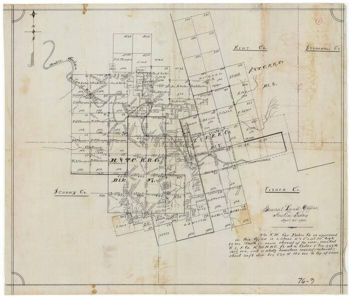
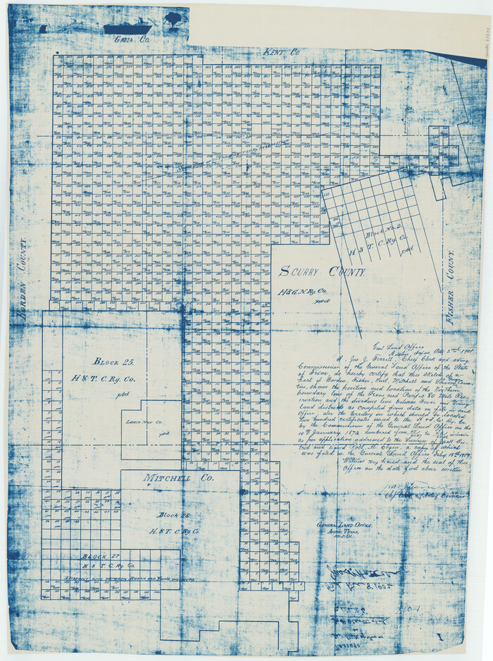
[Sketch showing Northwest corner of Fisher County, Northeast corner of Scurry County and South part of Kent County]
Print $20.00
- Digital $50.00
[Sketch showing Northwest corner of Fisher County, Northeast corner of Scurry County and South part of Kent County]
1900
Size: 17.7 x 15.0 inches
90917
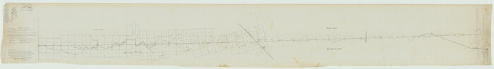
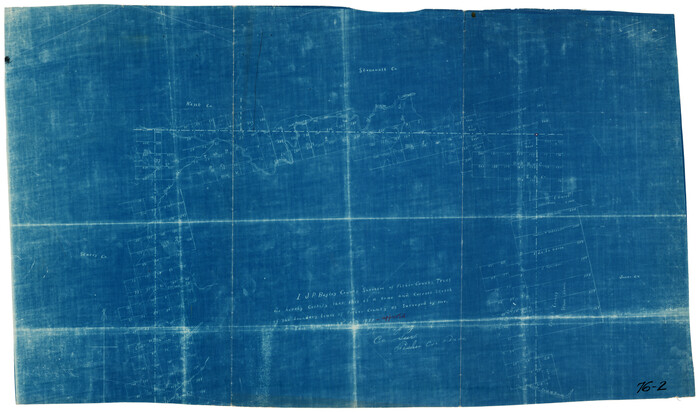
[Plat No. 1, Connecting line from SW corner of Jones Co. to SE corner of Borden Co.]
Print $40.00
- Digital $50.00
[Plat No. 1, Connecting line from SW corner of Jones Co. to SE corner of Borden Co.]
1908
Size: 18.1 x 128.8 inches
1698
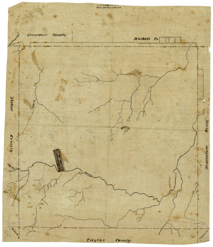
[North 3/4 of County]
Print $20.00
- Digital $50.00
[North 3/4 of County]
1887
Size: 26.0 x 15.4 inches
90840
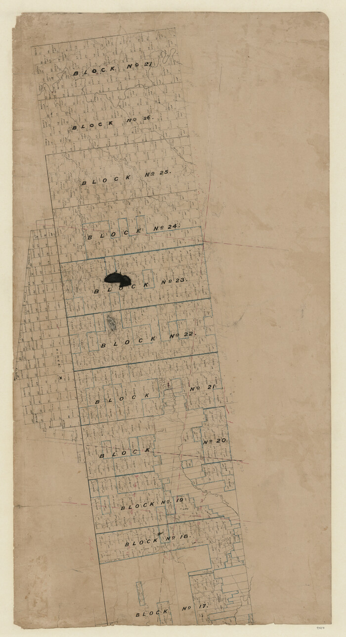
[Map of Texas and Pacific Blocks from Brazos River westward through Palo Pinto, Stephens, Shackelford, Jones, Callahan, Taylor, Fisher, Nolan and Mitchell Counties]
Print $20.00
- Digital $50.00
[Map of Texas and Pacific Blocks from Brazos River westward through Palo Pinto, Stephens, Shackelford, Jones, Callahan, Taylor, Fisher, Nolan and Mitchell Counties]
Size: 35.0 x 19.3 inches
93457
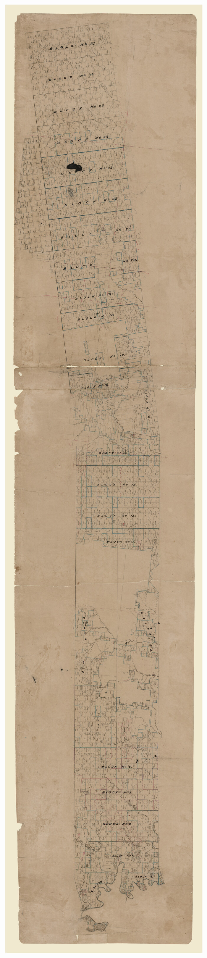
[Map of Texas and Pacific Blocks from Brazos River westward through Palo Pinto, Stephens, Shackelford, Jones, Callahan, Taylor, Fisher, Nolan and Mitchell Counties]
Print $40.00
- Digital $50.00
[Map of Texas and Pacific Blocks from Brazos River westward through Palo Pinto, Stephens, Shackelford, Jones, Callahan, Taylor, Fisher, Nolan and Mitchell Counties]
Size: 87.1 x 18.8 inches
93460
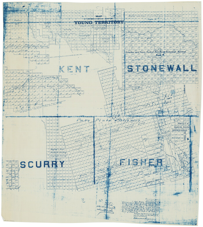
[Map of Block 97, Borden and Scurry Co (Exhibit A); Map of Southeastern part of Young Territory; Map of part of of Borden, Fisher, Kent, Mitchell, Scurry and Garza Cos. Showing the north boundary line of the T&P 80 mile reservation]
Print $20.00
- Digital $50.00
[Map of Block 97, Borden and Scurry Co (Exhibit A); Map of Southeastern part of Young Territory; Map of part of of Borden, Fisher, Kent, Mitchell, Scurry and Garza Cos. Showing the north boundary line of the T&P 80 mile reservation]
1873
Size: 33.4 x 29.6 inches
65692
[Map of Block 97, Borden and Scurry Co (Exhibit A); Map of Southeastern part of Young Territory; Map of part of of Borden, Fisher, Kent, Mitchell, Scurry and Garza Cos. Showing the north boundary line of the T&P 80 mile reservation]
Print $20.00
- Digital $50.00
[Map of Block 97, Borden and Scurry Co (Exhibit A); Map of Southeastern part of Young Territory; Map of part of of Borden, Fisher, Kent, Mitchell, Scurry and Garza Cos. Showing the north boundary line of the T&P 80 mile reservation]
1901
Size: 31.2 x 23.3 inches
65693
[H. T. & B. Block 1 and area to the west]
Print $20.00
- Digital $50.00
[H. T. & B. Block 1 and area to the west]
Size: 33.5 x 36.6 inches
90923
[Ector County Line Descriptions]

Print $20.00
- Digital $50.00
[Ector County Line Descriptions]
Size: 37.2 x 44.2 inches
92636
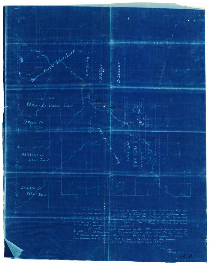
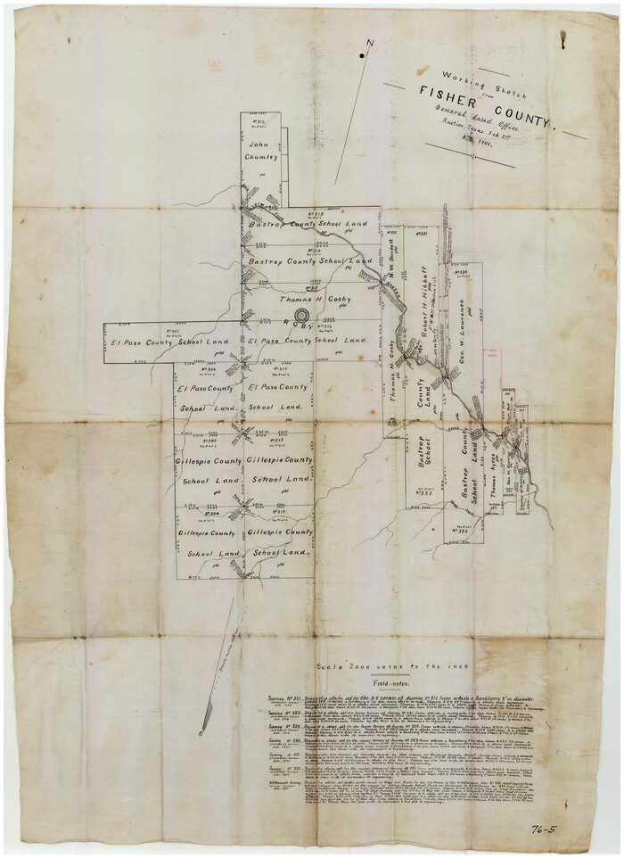
[Bastrop County, El Paso County, and Gillespie County School Land Leagues and surveys to the East]
Print $20.00
- Digital $50.00
[Bastrop County, El Paso County, and Gillespie County School Land Leagues and surveys to the East]
1886
Size: 15.9 x 20.1 inches
90868
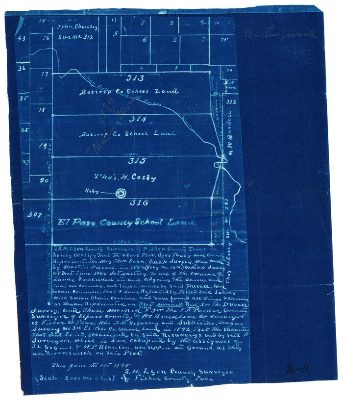
[Bastrop County School Land Leagues 313 and 314, Thos. H. Cosby League 315 and El Paso County School Land League 316 and surrounding surveys]
Print $3.00
- Digital $50.00
[Bastrop County School Land Leagues 313 and 314, Thos. H. Cosby League 315 and El Paso County School Land League 316 and surrounding surveys]
1898
Size: 10.5 x 12.6 inches
90819
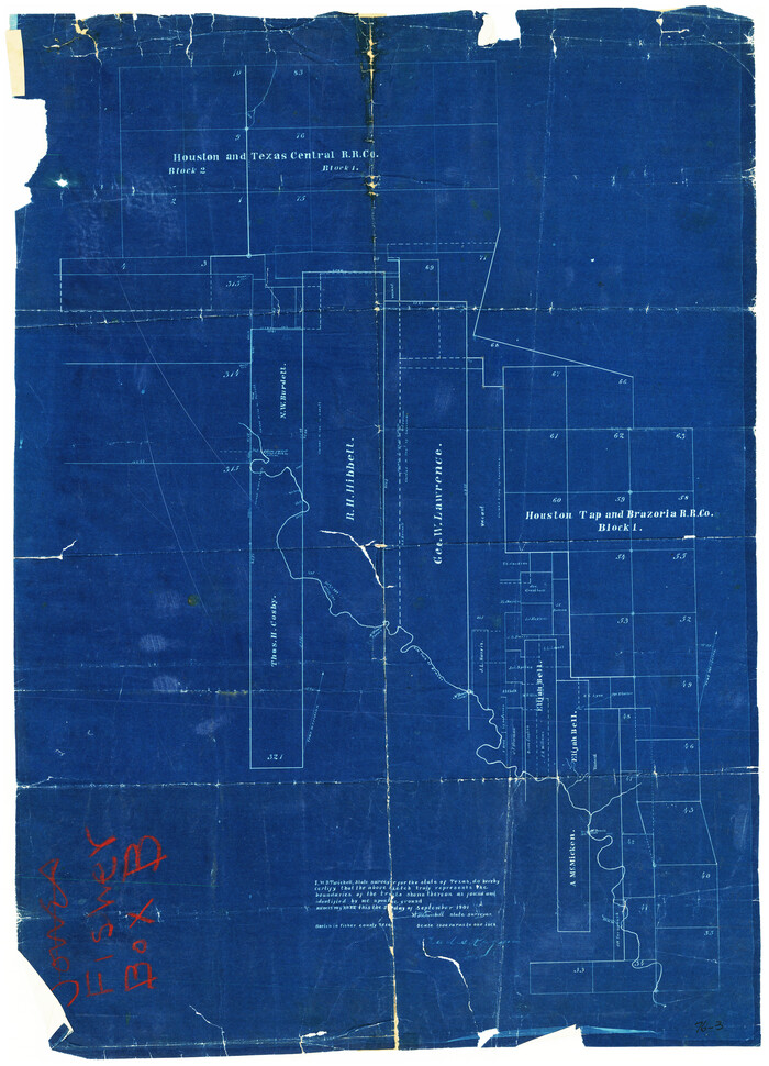
[Area around R. H. Hibbett and Geo. W. Lawrence surveys on Elm Fork of the Brazos River]
Print $20.00
- Digital $50.00
[Area around R. H. Hibbett and Geo. W. Lawrence surveys on Elm Fork of the Brazos River]
1901
Size: 23.6 x 32.4 inches
90861
[Area around Gillespie County, Bastrop County and El Paso County School Land Leagues]
Print $20.00
- Digital $50.00
[Area around Gillespie County, Bastrop County and El Paso County School Land Leagues]
1886
Size: 25.7 x 29.8 inches
90866
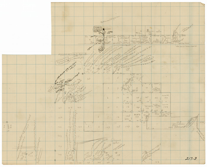
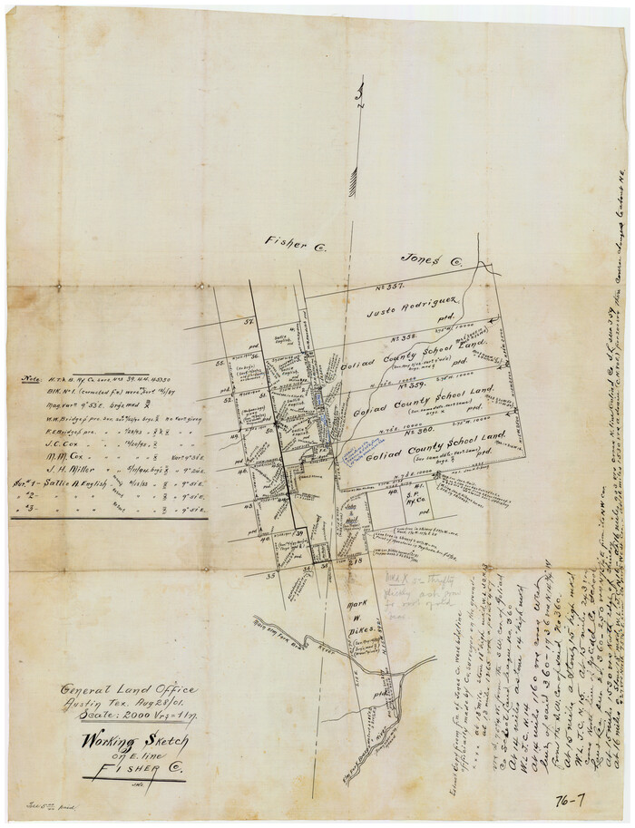
Working Sketch on East Line of Fisher County [from Main Elm Fork of Brazos River along county line to Justo Rodriguez Survey 357]
Print $20.00
- Digital $50.00
Working Sketch on East Line of Fisher County [from Main Elm Fork of Brazos River along county line to Justo Rodriguez Survey 357]
1901
Size: 17.2 x 22.4 inches
90918
Working Sketch from Fisher County [around Roby]
Print $20.00
- Digital $50.00
Working Sketch from Fisher County [around Roby]
1901
Size: 22.7 x 31.1 inches
90911
Stonewall County Sketch File 5

Print $40.00
- Digital $50.00
Stonewall County Sketch File 5
Size: 14.9 x 14.4 inches
37206
Scurry County Rolled Sketch 2

Print $20.00
- Digital $50.00
Scurry County Rolled Sketch 2
Size: 44.0 x 44.9 inches
9911
Reconnaissance Map, Roby Sheet

Print $20.00
- Digital $50.00
Reconnaissance Map, Roby Sheet
1893
Size: 17.0 x 20.8 inches
90869
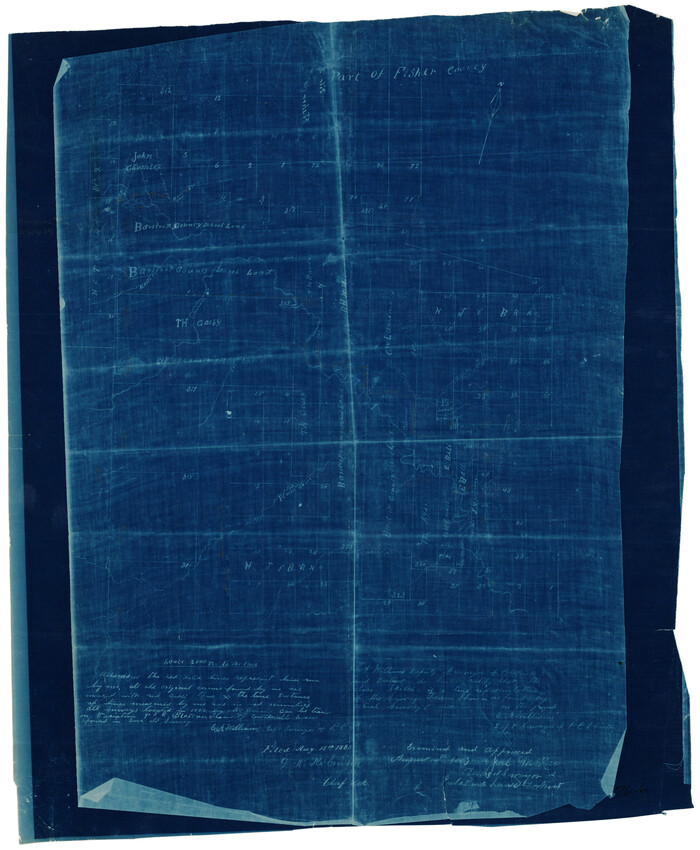
Part of Fisher County [around Bastrop County School Land Leagues 313 and 314, Thos. H. Cosby League 315 and El Paso County School Land League 316]
Print $20.00
- Digital $50.00
Part of Fisher County [around Bastrop County School Land Leagues 313 and 314, Thos. H. Cosby League 315 and El Paso County School Land League 316]
1883
Size: 20.0 x 24.7 inches
90820
Nolan County Sketch File 2

Print $40.00
- Digital $50.00
Nolan County Sketch File 2
Size: 49.5 x 41.6 inches
10556
Nolan County Sketch File 1b

Print $20.00
- Digital $50.00
Nolan County Sketch File 1b
1875
Size: 37.6 x 46.7 inches
10555
Map of the Texas & Pacific Railway from Fort Worth to El Paso

Print $40.00
- Digital $50.00
Map of the Texas & Pacific Railway from Fort Worth to El Paso
Size: 24.0 x 76.5 inches
64511
Map of Rotan Fisher County, Texas

Print $20.00
- Digital $50.00
Map of Rotan Fisher County, Texas
1926
Size: 32.2 x 36.5 inches
93231
Map of Northern Boundary Line of Texas and Pacific 80 Mile Reservation

Print $20.00
- Digital $50.00
Map of Northern Boundary Line of Texas and Pacific 80 Mile Reservation
1902
Size: 16.8 x 16.7 inches
65694
Kent County Working Sketch 18

Print $20.00
- Digital $50.00
Kent County Working Sketch 18
1974
Size: 33.5 x 31.5 inches
70025
Kent County Working Sketch 15

Print $40.00
- Digital $50.00
Kent County Working Sketch 15
1971
Size: 32.3 x 48.3 inches
70022
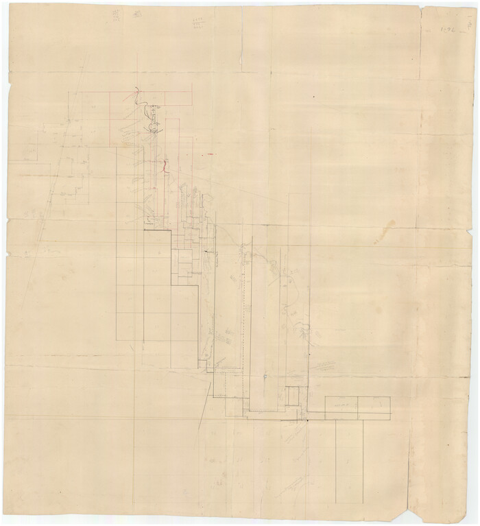
Jones County Sketch File 5a

Print $20.00
- Digital $50.00
Jones County Sketch File 5a
1857
Size: 18.4 x 23.5 inches
11896
[T. & P. Block U and H. & T. C. Block 1]
Print $20.00
- Digital $50.00
[T. & P. Block U and H. & T. C. Block 1]
-
Size
20.5 x 16.7 inches
-
Map/Doc
91871
[Surveying sketch of Jones County showing Micaela Fiagoso survey]
Print $20.00
- Digital $50.00
[Surveying sketch of Jones County showing Micaela Fiagoso survey]
-
Size
19.5 x 16.8 inches
-
Map/Doc
387
[Sketch showing Northwest corner of Fisher County, Northeast corner of Scurry County and South part of Kent County]
Print $20.00
- Digital $50.00
[Sketch showing Northwest corner of Fisher County, Northeast corner of Scurry County and South part of Kent County]
1900
-
Size
17.7 x 15.0 inches
-
Map/Doc
90917
-
Creation Date
1900
[Plat No. 1, Connecting line from SW corner of Jones Co. to SE corner of Borden Co.]
Print $40.00
- Digital $50.00
[Plat No. 1, Connecting line from SW corner of Jones Co. to SE corner of Borden Co.]
1908
-
Size
18.1 x 128.8 inches
-
Map/Doc
1698
-
Creation Date
1908
[North 3/4 of County]
Print $20.00
- Digital $50.00
[North 3/4 of County]
1887
-
Size
26.0 x 15.4 inches
-
Map/Doc
90840
-
Creation Date
1887
[Map of Texas and Pacific Blocks from Brazos River westward through Palo Pinto, Stephens, Shackelford, Jones, Callahan, Taylor, Fisher, Nolan and Mitchell Counties]
Print $20.00
- Digital $50.00
[Map of Texas and Pacific Blocks from Brazos River westward through Palo Pinto, Stephens, Shackelford, Jones, Callahan, Taylor, Fisher, Nolan and Mitchell Counties]
-
Size
35.0 x 19.3 inches
-
Map/Doc
93457
[Map of Texas and Pacific Blocks from Brazos River westward through Palo Pinto, Stephens, Shackelford, Jones, Callahan, Taylor, Fisher, Nolan and Mitchell Counties]
Print $40.00
- Digital $50.00
[Map of Texas and Pacific Blocks from Brazos River westward through Palo Pinto, Stephens, Shackelford, Jones, Callahan, Taylor, Fisher, Nolan and Mitchell Counties]
-
Size
87.1 x 18.8 inches
-
Map/Doc
93460
[Map of Block 97, Borden and Scurry Co (Exhibit A); Map of Southeastern part of Young Territory; Map of part of of Borden, Fisher, Kent, Mitchell, Scurry and Garza Cos. Showing the north boundary line of the T&P 80 mile reservation]
Print $20.00
- Digital $50.00
[Map of Block 97, Borden and Scurry Co (Exhibit A); Map of Southeastern part of Young Territory; Map of part of of Borden, Fisher, Kent, Mitchell, Scurry and Garza Cos. Showing the north boundary line of the T&P 80 mile reservation]
1873
-
Size
33.4 x 29.6 inches
-
Map/Doc
65692
-
Creation Date
1873
[Map of Block 97, Borden and Scurry Co (Exhibit A); Map of Southeastern part of Young Territory; Map of part of of Borden, Fisher, Kent, Mitchell, Scurry and Garza Cos. Showing the north boundary line of the T&P 80 mile reservation]
Print $20.00
- Digital $50.00
[Map of Block 97, Borden and Scurry Co (Exhibit A); Map of Southeastern part of Young Territory; Map of part of of Borden, Fisher, Kent, Mitchell, Scurry and Garza Cos. Showing the north boundary line of the T&P 80 mile reservation]
1901
-
Size
31.2 x 23.3 inches
-
Map/Doc
65693
-
Creation Date
1901
[H. T. & B. Block 1 and area to the west]
Print $20.00
- Digital $50.00
[H. T. & B. Block 1 and area to the west]
-
Size
33.5 x 36.6 inches
-
Map/Doc
90923
[Ector County Line Descriptions]
Print $20.00
- Digital $50.00
[Ector County Line Descriptions]
-
Size
37.2 x 44.2 inches
-
Map/Doc
92636
[Bastrop County, El Paso County, and Gillespie County School Land Leagues and surveys to the East]
Print $20.00
- Digital $50.00
[Bastrop County, El Paso County, and Gillespie County School Land Leagues and surveys to the East]
1886
-
Size
15.9 x 20.1 inches
-
Map/Doc
90868
-
Creation Date
1886
[Bastrop County School Land Leagues 313 and 314, Thos. H. Cosby League 315 and El Paso County School Land League 316 and surrounding surveys]
Print $3.00
- Digital $50.00
[Bastrop County School Land Leagues 313 and 314, Thos. H. Cosby League 315 and El Paso County School Land League 316 and surrounding surveys]
1898
-
Size
10.5 x 12.6 inches
-
Map/Doc
90819
-
Creation Date
1898
[Area around R. H. Hibbett and Geo. W. Lawrence surveys on Elm Fork of the Brazos River]
Print $20.00
- Digital $50.00
[Area around R. H. Hibbett and Geo. W. Lawrence surveys on Elm Fork of the Brazos River]
1901
-
Size
23.6 x 32.4 inches
-
Map/Doc
90861
-
Creation Date
1901
[Area around Gillespie County, Bastrop County and El Paso County School Land Leagues]
Print $20.00
- Digital $50.00
[Area around Gillespie County, Bastrop County and El Paso County School Land Leagues]
1886
-
Size
25.7 x 29.8 inches
-
Map/Doc
90866
-
Creation Date
1886
Young Territory

Print $20.00
- Digital $50.00
Young Territory
1873
-
Size
45.3 x 42.8 inches
-
Map/Doc
1988
-
Creation Date
1873
Working Sketch on East Line of Fisher County [from Main Elm Fork of Brazos River along county line to Justo Rodriguez Survey 357]
Print $20.00
- Digital $50.00
Working Sketch on East Line of Fisher County [from Main Elm Fork of Brazos River along county line to Justo Rodriguez Survey 357]
1901
-
Size
17.2 x 22.4 inches
-
Map/Doc
90918
-
Creation Date
1901
Working Sketch from Fisher County [around Roby]
Print $20.00
- Digital $50.00
Working Sketch from Fisher County [around Roby]
1901
-
Size
22.7 x 31.1 inches
-
Map/Doc
90911
-
Creation Date
1901
Stonewall County Sketch File 5
Print $40.00
- Digital $50.00
Stonewall County Sketch File 5
-
Size
14.9 x 14.4 inches
-
Map/Doc
37206
Scurry County Rolled Sketch 2
Print $20.00
- Digital $50.00
Scurry County Rolled Sketch 2
-
Size
44.0 x 44.9 inches
-
Map/Doc
9911
Reconnaissance Map, Roby Sheet
Print $20.00
- Digital $50.00
Reconnaissance Map, Roby Sheet
1893
-
Size
17.0 x 20.8 inches
-
Map/Doc
90869
-
Creation Date
1893
Part of Fisher County [around Bastrop County School Land Leagues 313 and 314, Thos. H. Cosby League 315 and El Paso County School Land League 316]
Print $20.00
- Digital $50.00
Part of Fisher County [around Bastrop County School Land Leagues 313 and 314, Thos. H. Cosby League 315 and El Paso County School Land League 316]
1883
-
Size
20.0 x 24.7 inches
-
Map/Doc
90820
-
Creation Date
1883
Nolan County Sketch File 2
Print $40.00
- Digital $50.00
Nolan County Sketch File 2
-
Size
49.5 x 41.6 inches
-
Map/Doc
10556
Nolan County Sketch File 1b
Print $20.00
- Digital $50.00
Nolan County Sketch File 1b
1875
-
Size
37.6 x 46.7 inches
-
Map/Doc
10555
-
Creation Date
1875
Map of the Texas & Pacific Railway from Fort Worth to El Paso
Print $40.00
- Digital $50.00
Map of the Texas & Pacific Railway from Fort Worth to El Paso
-
Size
24.0 x 76.5 inches
-
Map/Doc
64511
Map of Rotan Fisher County, Texas
Print $20.00
- Digital $50.00
Map of Rotan Fisher County, Texas
1926
-
Size
32.2 x 36.5 inches
-
Map/Doc
93231
-
Creation Date
1926
Map of Northern Boundary Line of Texas and Pacific 80 Mile Reservation
Print $20.00
- Digital $50.00
Map of Northern Boundary Line of Texas and Pacific 80 Mile Reservation
1902
-
Size
16.8 x 16.7 inches
-
Map/Doc
65694
-
Creation Date
1902
Kent County Working Sketch 18
Print $20.00
- Digital $50.00
Kent County Working Sketch 18
1974
-
Size
33.5 x 31.5 inches
-
Map/Doc
70025
-
Creation Date
1974
Kent County Working Sketch 15
Print $40.00
- Digital $50.00
Kent County Working Sketch 15
1971
-
Size
32.3 x 48.3 inches
-
Map/Doc
70022
-
Creation Date
1971
Jones County Sketch File 5a
Print $20.00
- Digital $50.00
Jones County Sketch File 5a
1857
-
Size
18.4 x 23.5 inches
-
Map/Doc
11896
-
Creation Date
1857