Jones County Sketch File 10a

Print $40.00
- Digital $50.00
Jones County Sketch File 10a
1875
Size: 40.0 x 50.6 inches
10509
Shackelford County Sketch File 4

Print $40.00
- Digital $50.00
Shackelford County Sketch File 4
Size: 38.5 x 53.7 inches
10600
Stephens County Sketch File 16

Print $40.00
- Digital $50.00
Stephens County Sketch File 16
Size: 38.2 x 72.1 inches
10608
Callahan County Sketch File 14

Print $40.00
- Digital $50.00
Callahan County Sketch File 14
1938
Size: 20.5 x 26.1 inches
11042
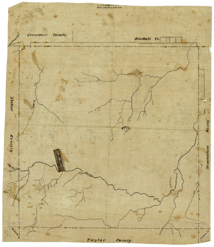
Haskell County Sketch File 4

Print $20.00
- Digital $50.00
Haskell County Sketch File 4
Size: 17.7 x 18.6 inches
11739
Haskell County Sketch File 21

Print $20.00
- Digital $50.00
Haskell County Sketch File 21
1935
Size: 30.2 x 20.3 inches
11744
Jones County Sketch File 1

Print $20.00
- Digital $50.00
Jones County Sketch File 1
1857
Size: 17.8 x 30.3 inches
11894
Jones County Sketch File 2

Print $20.00
- Digital $50.00
Jones County Sketch File 2
1857
Size: 16.8 x 21.1 inches
11895
Jones County Sketch File 5a

Print $20.00
- Digital $50.00
Jones County Sketch File 5a
1857
Size: 18.4 x 23.5 inches
11896
Shackelford County Sketch File 7

Print $20.00
- Digital $50.00
Shackelford County Sketch File 7
1912
Size: 27.2 x 13.5 inches
12314
Shackelford County Sketch File 9

Print $20.00
- Digital $50.00
Shackelford County Sketch File 9
1918
Size: 24.3 x 15.5 inches
12315
Shackelford County Sketch File 10

Print $20.00
- Digital $50.00
Shackelford County Sketch File 10
1918
Size: 31.4 x 19.9 inches
12316
Shackelford County Sketch File 11

Print $20.00
- Digital $50.00
Shackelford County Sketch File 11
1914
Size: 16.8 x 17.0 inches
12317
Shackelford County

Print $20.00
- Digital $50.00
Shackelford County
1920
Size: 44.6 x 37.1 inches
16813
A Map of that part of Young District south of old Fannin District line

Print $20.00
- Digital $50.00
A Map of that part of Young District south of old Fannin District line
1861
Size: 24.9 x 38.0 inches
1979
Map of University Land in Shackelford and Callahan Counties

Print $20.00
- Digital $50.00
Map of University Land in Shackelford and Callahan Counties
1905
Size: 33.4 x 25.3 inches
2435
Map of Asylum Lands

Print $20.00
- Digital $50.00
Map of Asylum Lands
1857
Size: 28.4 x 18.5 inches
2459
Guadalupe County Sketch File 1a

Print $4.00
- Digital $50.00
Guadalupe County Sketch File 1a
1859
Size: 12.6 x 7.9 inches
24646
Map of Asylum & University lands situated on the waters of Hubbards Creek

Print $20.00
- Digital $50.00
Map of Asylum & University lands situated on the waters of Hubbards Creek
1857
Size: 21.2 x 28.5 inches
2491
Haskell County Sketch File 16

Print $32.00
- Digital $50.00
Haskell County Sketch File 16
1894
Size: 11.2 x 8.8 inches
26163
Callahan County Sketch File 6a

Print $24.00
- Digital $50.00
Callahan County Sketch File 6a
Size: 8.0 x 6.8 inches
35860
Shackelford County Sketch File 1

Print $4.00
- Digital $50.00
Shackelford County Sketch File 1
1877
Size: 12.8 x 8.0 inches
36570
Shackelford County Sketch File 2

Print $4.00
- Digital $50.00
Shackelford County Sketch File 2
1870
Size: 9.3 x 9.0 inches
36572
Shackelford County Sketch File 3

Print $8.00
- Digital $50.00
Shackelford County Sketch File 3
1852
Size: 8.2 x 7.3 inches
36574
Shackelford County Sketch File 5

Print $4.00
- Digital $50.00
Shackelford County Sketch File 5
1885
Size: 12.3 x 7.6 inches
36578
Shackelford County Sketch File 12

Print $26.00
- Digital $50.00
Shackelford County Sketch File 12
1949
Size: 14.4 x 8.8 inches
36580
Shackelford County Sketch File 13

Print $22.00
- Digital $50.00
Shackelford County Sketch File 13
1875
Size: 12.8 x 15.8 inches
36583
Shackelford County Sketch File 14

Print $28.00
- Digital $50.00
Shackelford County Sketch File 14
1874
Size: 14.4 x 8.8 inches
36585
[Surveying sketch of Jones County showing Micaela Fiagoso survey]
Print $20.00
- Digital $50.00
[Surveying sketch of Jones County showing Micaela Fiagoso survey]
Size: 19.5 x 16.8 inches
387
Map of Shackelford County

Print $20.00
- Digital $50.00
Map of Shackelford County
1878
Size: 25.0 x 20.2 inches
4025
Jones County Sketch File 10a
Print $40.00
- Digital $50.00
Jones County Sketch File 10a
1875
-
Size
40.0 x 50.6 inches
-
Map/Doc
10509
-
Creation Date
1875
Shackelford County Sketch File 4
Print $40.00
- Digital $50.00
Shackelford County Sketch File 4
-
Size
38.5 x 53.7 inches
-
Map/Doc
10600
Stephens County Sketch File 16
Print $40.00
- Digital $50.00
Stephens County Sketch File 16
-
Size
38.2 x 72.1 inches
-
Map/Doc
10608
Callahan County Sketch File 14
Print $40.00
- Digital $50.00
Callahan County Sketch File 14
1938
-
Size
20.5 x 26.1 inches
-
Map/Doc
11042
-
Creation Date
1938
Haskell County Sketch File 4
Print $20.00
- Digital $50.00
Haskell County Sketch File 4
-
Size
17.7 x 18.6 inches
-
Map/Doc
11739
Haskell County Sketch File 21
Print $20.00
- Digital $50.00
Haskell County Sketch File 21
1935
-
Size
30.2 x 20.3 inches
-
Map/Doc
11744
-
Creation Date
1935
Jones County Sketch File 1
Print $20.00
- Digital $50.00
Jones County Sketch File 1
1857
-
Size
17.8 x 30.3 inches
-
Map/Doc
11894
-
Creation Date
1857
Jones County Sketch File 2
Print $20.00
- Digital $50.00
Jones County Sketch File 2
1857
-
Size
16.8 x 21.1 inches
-
Map/Doc
11895
-
Creation Date
1857
Jones County Sketch File 5a
Print $20.00
- Digital $50.00
Jones County Sketch File 5a
1857
-
Size
18.4 x 23.5 inches
-
Map/Doc
11896
-
Creation Date
1857
Shackelford County Sketch File 7
Print $20.00
- Digital $50.00
Shackelford County Sketch File 7
1912
-
Size
27.2 x 13.5 inches
-
Map/Doc
12314
-
Creation Date
1912
Shackelford County Sketch File 9
Print $20.00
- Digital $50.00
Shackelford County Sketch File 9
1918
-
Size
24.3 x 15.5 inches
-
Map/Doc
12315
-
Creation Date
1918
Shackelford County Sketch File 10
Print $20.00
- Digital $50.00
Shackelford County Sketch File 10
1918
-
Size
31.4 x 19.9 inches
-
Map/Doc
12316
-
Creation Date
1918
Shackelford County Sketch File 11
Print $20.00
- Digital $50.00
Shackelford County Sketch File 11
1914
-
Size
16.8 x 17.0 inches
-
Map/Doc
12317
-
Creation Date
1914
Shackelford County
Print $20.00
- Digital $50.00
Shackelford County
1920
-
Size
44.6 x 37.1 inches
-
Map/Doc
16813
-
Creation Date
1920
A Map of that part of Young District south of old Fannin District line
Print $20.00
- Digital $50.00
A Map of that part of Young District south of old Fannin District line
1861
-
Size
24.9 x 38.0 inches
-
Map/Doc
1979
-
Creation Date
1861
Map of University Land in Shackelford and Callahan Counties
Print $20.00
- Digital $50.00
Map of University Land in Shackelford and Callahan Counties
1905
-
Size
33.4 x 25.3 inches
-
Map/Doc
2435
-
Creation Date
1905
Map of Asylum Lands
Print $20.00
- Digital $50.00
Map of Asylum Lands
1857
-
Size
28.4 x 18.5 inches
-
Map/Doc
2459
-
Creation Date
1857
Guadalupe County Sketch File 1a
Print $4.00
- Digital $50.00
Guadalupe County Sketch File 1a
1859
-
Size
12.6 x 7.9 inches
-
Map/Doc
24646
-
Creation Date
1859
Map of Asylum & University lands situated on the waters of Hubbards Creek
Print $20.00
- Digital $50.00
Map of Asylum & University lands situated on the waters of Hubbards Creek
1857
-
Size
21.2 x 28.5 inches
-
Map/Doc
2491
-
Creation Date
1857
Haskell County Sketch File 16
Print $32.00
- Digital $50.00
Haskell County Sketch File 16
1894
-
Size
11.2 x 8.8 inches
-
Map/Doc
26163
-
Creation Date
1894
Callahan County Sketch File 6a
Print $24.00
- Digital $50.00
Callahan County Sketch File 6a
-
Size
8.0 x 6.8 inches
-
Map/Doc
35860
Shackelford County Sketch File 1
Print $4.00
- Digital $50.00
Shackelford County Sketch File 1
1877
-
Size
12.8 x 8.0 inches
-
Map/Doc
36570
-
Creation Date
1877
Shackelford County Sketch File 2
Print $4.00
- Digital $50.00
Shackelford County Sketch File 2
1870
-
Size
9.3 x 9.0 inches
-
Map/Doc
36572
-
Creation Date
1870
Shackelford County Sketch File 3
Print $8.00
- Digital $50.00
Shackelford County Sketch File 3
1852
-
Size
8.2 x 7.3 inches
-
Map/Doc
36574
-
Creation Date
1852
Shackelford County Sketch File 5
Print $4.00
- Digital $50.00
Shackelford County Sketch File 5
1885
-
Size
12.3 x 7.6 inches
-
Map/Doc
36578
-
Creation Date
1885
Shackelford County Sketch File 12
Print $26.00
- Digital $50.00
Shackelford County Sketch File 12
1949
-
Size
14.4 x 8.8 inches
-
Map/Doc
36580
-
Creation Date
1949
Shackelford County Sketch File 13
Print $22.00
- Digital $50.00
Shackelford County Sketch File 13
1875
-
Size
12.8 x 15.8 inches
-
Map/Doc
36583
-
Creation Date
1875
Shackelford County Sketch File 14
Print $28.00
- Digital $50.00
Shackelford County Sketch File 14
1874
-
Size
14.4 x 8.8 inches
-
Map/Doc
36585
-
Creation Date
1874
[Surveying sketch of Jones County showing Micaela Fiagoso survey]
Print $20.00
- Digital $50.00
[Surveying sketch of Jones County showing Micaela Fiagoso survey]
-
Size
19.5 x 16.8 inches
-
Map/Doc
387
Map of Shackelford County
Print $20.00
- Digital $50.00
Map of Shackelford County
1878
-
Size
25.0 x 20.2 inches
-
Map/Doc
4025
-
Creation Date
1878