
Paul McCombs Field Book on 80 Mile Reservation west of the Pecos
1883

Map of Texas and Pacific Ry. Company's Surveys in the 80 Mile Reserve
1885
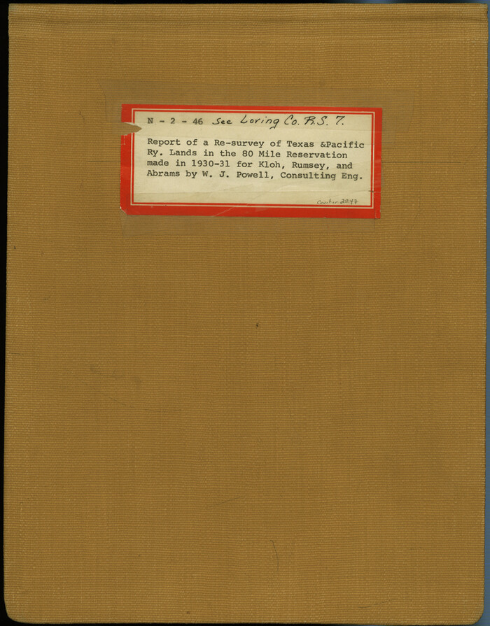
Report of a resurvey of Texas & Pacific Ry. Lands in the 80 mile reservation made in 1930-31 for Kloh, Rumsey, and Abrams by W. J. Powell, Consulting Eng.
1931

Kuechler's Corners, Texas & Pacific Ry. Co. 80 Mile Reserve
1934
![2249, [Letters to and from Maj. W. J. Powell regarding surveys of Texas and Pacific Ry. Lands west of the Pecos. Blks 53-55, Township 1 & 2 map within], General Map Collection](https://historictexasmaps.com/wmedia_w700/pdf_converted_jpg/qi_pdf_thumbnail_1039.jpg)
[Letters to and from Maj. W. J. Powell regarding surveys of Texas and Pacific Ry. Lands west of the Pecos. Blks 53-55, Township 1 & 2 map within]
1934

1882 Map of the Texas & Pacific R-Y Reserve
1888
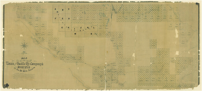
Map of Texas and Pacific Ry. Company's Surveys in the 80 Mile Reserve
1885

Sectional Map No. 3 of the lands and of the line of the Texas & Pacific Ry. Co. in Reeves and parts of Tom Green, Pecos, Presidio & El Paso Cos.
1885

T&P Ry. from Texarkana to Atlanta
1910
The State of Texas vs. Chas. J. Canda, et al, T. & P. Ry. Co., No. 10351
1893

Jacob Kuechler's Field Notes (Field Book), Texas & Pacific Ry. Co. 80 Mile Reserve
1879
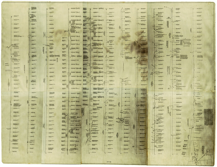
[Center Line of the Texas and Pacific Railroad Company 16 Mile Reserve]
1876

Map of Texas and Pacific Ry. Company's Surveys in the 80 Mile Reserve
1885

"The Texas and Pacific Railway Company Reservation and Land Grant"
1962

Map of the Texas & Pacific Ry. Reserve West of the Pecos River
1879

Map of the Texas & Pacific Ry. Reserve West of the Pecos River
1879

Map of the Texas & Pacific Ry. Reserve West of the Pecos River
1879
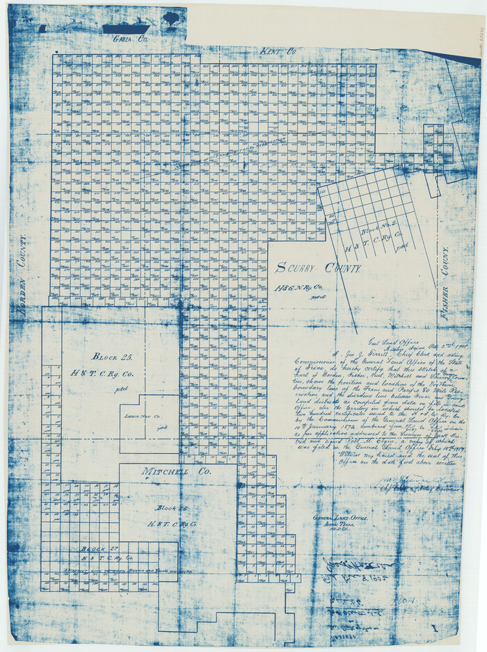
[Map of Block 97, Borden and Scurry Co (Exhibit A); Map of Southeastern part of Young Territory; Map of part of of Borden, Fisher, Kent, Mitchell, Scurry and Garza Cos. Showing the north boundary line of the T&P 80 mile reservation]
1901

Map of Northern Boundary Line of Texas and Pacific 80 Mile Reservation
1902

Statement of Facts - State of Texas vs. F. B. Olcott, Cause 17090, 12/18/1902
1902

[Index map of T. & P. Ry. Company’s 80-mile Trans-Pecos Reserve’s perpetuated corners - South Part]

Current Miscellaneous File 11
1930

Current Miscellaneous File 29

Map of the Texas and Pacific Railway and Connections
1897
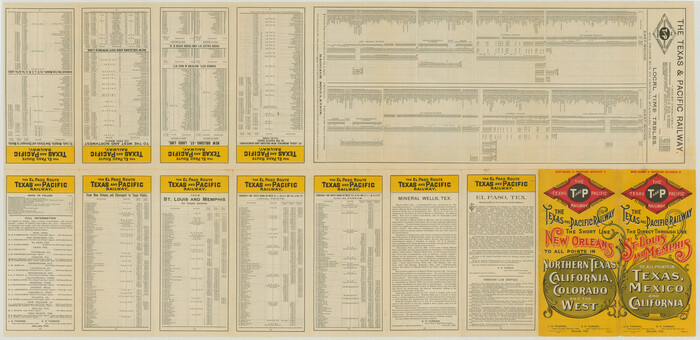
Map of the Texas and Pacific Railway and Connections
1897
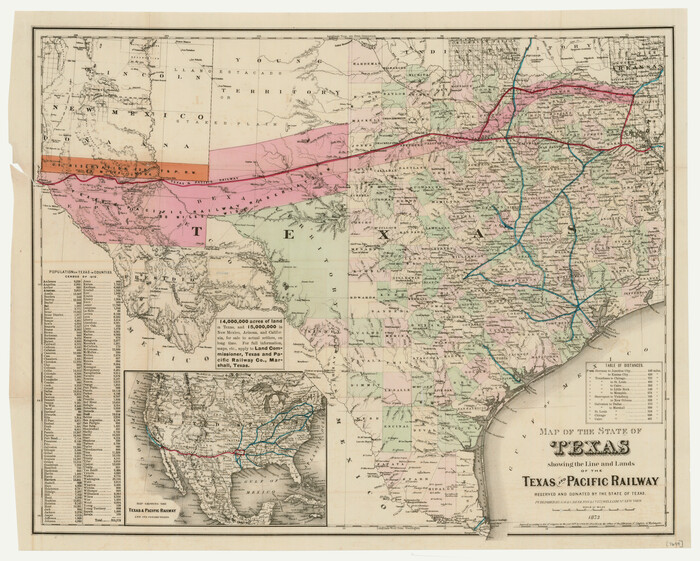
Map of the State of Texas showing the Line and Lands of the Texas and Pacific Railway Reserved and Donated by the State of Texas
1873

Andrews County Rolled Sketch 42

Map of the Texas and Pacific Railway and Connections
1897

Map of Texas and Pacific Ry. Company's Surveys in the 80 Mile Reserve
1885

Map of Texas and Pacific Ry. Company's Surveys in the 80 Mile Reserve
1885

Paul McCombs Field Book on 80 Mile Reservation west of the Pecos
1883
-
Size
7.8 x 6.0 inches
-
Map/Doc
2238
-
Creation Date
1883

Map of Texas and Pacific Ry. Company's Surveys in the 80 Mile Reserve
1885
-
Map/Doc
2241
-
Creation Date
1885

Report of a resurvey of Texas & Pacific Ry. Lands in the 80 mile reservation made in 1930-31 for Kloh, Rumsey, and Abrams by W. J. Powell, Consulting Eng.
1931
-
Size
11.3 x 8.8 inches
-
Map/Doc
2247
-
Creation Date
1931

Kuechler's Corners, Texas & Pacific Ry. Co. 80 Mile Reserve
1934
-
Size
11.0 x 8.5 inches
-
Map/Doc
2248
-
Creation Date
1934
![2249, [Letters to and from Maj. W. J. Powell regarding surveys of Texas and Pacific Ry. Lands west of the Pecos. Blks 53-55, Township 1 & 2 map within], General Map Collection](https://historictexasmaps.com/wmedia_w700/pdf_converted_jpg/qi_pdf_thumbnail_1039.jpg)
[Letters to and from Maj. W. J. Powell regarding surveys of Texas and Pacific Ry. Lands west of the Pecos. Blks 53-55, Township 1 & 2 map within]
1934
-
Size
10.2 x 15.4 inches
-
Map/Doc
2249
-
Creation Date
1934

1882 Map of the Texas & Pacific R-Y Reserve
1888
-
Size
95.6 x 42.5 inches
-
Map/Doc
2299
-
Creation Date
1888

Map of Texas and Pacific Ry. Company's Surveys in the 80 Mile Reserve
1885
-
Size
41.5 x 91.8 inches
-
Map/Doc
2300
-
Creation Date
1885

Sectional Map No. 3 of the lands and of the line of the Texas & Pacific Ry. Co. in Reeves and parts of Tom Green, Pecos, Presidio & El Paso Cos.
1885
-
Size
22.3 x 17.4 inches
-
Map/Doc
2303
-
Creation Date
1885

T&P Ry. from Texarkana to Atlanta
1910
-
Size
19.8 x 77.4 inches
-
Map/Doc
2327
-
Creation Date
1910

The State of Texas vs. Chas. J. Canda, et al, T. & P. Ry. Co., No. 10351
1893
-
Size
10.0 x 17.0 inches
-
Map/Doc
3048
-
Creation Date
1893

Jacob Kuechler's Field Notes (Field Book), Texas & Pacific Ry. Co. 80 Mile Reserve
1879
-
Size
7.9 x 5.4 inches
-
Map/Doc
3050
-
Creation Date
1879
![3125, [Center Line of the Texas and Pacific Railroad Company 16 Mile Reserve], General Map Collection](https://historictexasmaps.com/wmedia_w700/maps/3125-1.tif.jpg)
[Center Line of the Texas and Pacific Railroad Company 16 Mile Reserve]
1876
-
Size
43.1 x 55.6 inches
-
Map/Doc
3125
-
Creation Date
1876

Map of Texas and Pacific Ry. Company's Surveys in the 80 Mile Reserve
1885
-
Size
41.5 x 91.8 inches
-
Map/Doc
60313
-
Creation Date
1885

"The Texas and Pacific Railway Company Reservation and Land Grant"
1962
-
Size
9.3 x 6.5 inches
-
Map/Doc
62213
-
Creation Date
1962

Map of the Texas & Pacific Ry. Reserve West of the Pecos River
1879
-
Size
41.1 x 29.8 inches
-
Map/Doc
65332
-
Creation Date
1879

Map of the Texas & Pacific Ry. Reserve West of the Pecos River
1879
-
Size
40.8 x 30.2 inches
-
Map/Doc
65333
-
Creation Date
1879

Map of the Texas & Pacific Ry. Reserve West of the Pecos River
1879
-
Size
41.2 x 29.9 inches
-
Map/Doc
65334
-
Creation Date
1879
![65693, [Map of Block 97, Borden and Scurry Co (Exhibit A); Map of Southeastern part of Young Territory; Map of part of of Borden, Fisher, Kent, Mitchell, Scurry and Garza Cos. Showing the north boundary line of the T&P 80 mile reservation], General Map Collection](https://historictexasmaps.com/wmedia_w700/maps/65693.tif.jpg)
[Map of Block 97, Borden and Scurry Co (Exhibit A); Map of Southeastern part of Young Territory; Map of part of of Borden, Fisher, Kent, Mitchell, Scurry and Garza Cos. Showing the north boundary line of the T&P 80 mile reservation]
1901
-
Size
31.2 x 23.3 inches
-
Map/Doc
65693
-
Creation Date
1901

Map of Northern Boundary Line of Texas and Pacific 80 Mile Reservation
1902
-
Size
16.8 x 16.7 inches
-
Map/Doc
65694
-
Creation Date
1902

Statement of Facts - State of Texas vs. F. B. Olcott, Cause 17090, 12/18/1902
1902
-
Size
14.3 x 8.9 inches
-
Map/Doc
65724
-
Creation Date
1902
![69766, [Index map of T. & P. Ry. Company’s 80-mile Trans-Pecos Reserve’s perpetuated corners - South Part], General Map Collection](https://historictexasmaps.com/wmedia_w700/maps/69766.tif.jpg)
[Index map of T. & P. Ry. Company’s 80-mile Trans-Pecos Reserve’s perpetuated corners - South Part]
-
Size
23.1 x 90.1 inches
-
Map/Doc
69766

Current Miscellaneous File 11
1930
-
Size
11.2 x 8.7 inches
-
Map/Doc
73778
-
Creation Date
1930

Current Miscellaneous File 29
-
Size
11.2 x 8.8 inches
-
Map/Doc
73920

Map of the Texas and Pacific Railway and Connections
1897
-
Size
17.7 x 36.1 inches
-
Map/Doc
76298
-
Creation Date
1897

Map of the Texas and Pacific Railway and Connections
1897
-
Size
17.6 x 36.3 inches
-
Map/Doc
76299
-
Creation Date
1897

Map of the State of Texas showing the Line and Lands of the Texas and Pacific Railway Reserved and Donated by the State of Texas
1873
-
Size
20.2 x 25.1 inches
-
Map/Doc
76317
-
Creation Date
1873

Andrews County Rolled Sketch 42
-
Size
27.3 x 36.0 inches
-
Map/Doc
77182

Map of the Texas and Pacific Railway and Connections
1897
-
Size
19.3 x 24.4 inches
-
Map/Doc
79328
-
Creation Date
1897

Map of Texas and Pacific Ry. Company's Surveys in the 80 Mile Reserve
1885
-
Size
44.0 x 51.6 inches
-
Map/Doc
83557
-
Creation Date
1885

Map of Texas and Pacific Ry. Company's Surveys in the 80 Mile Reserve
1885
-
Size
44.0 x 46.6 inches
-
Map/Doc
83558
-
Creation Date
1885