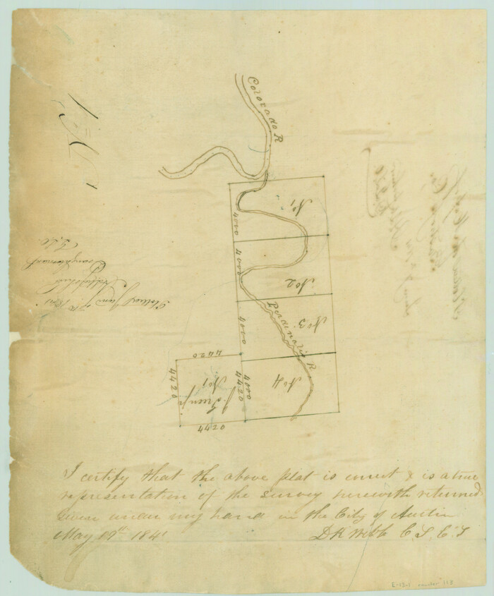
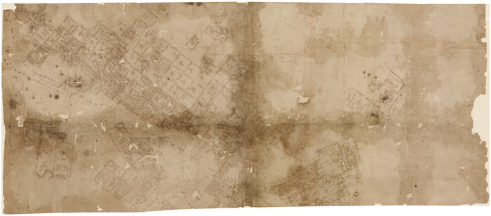
[Surveys in the Travis District along the Colorado and Pedernales Rivers]
Print $2.00
- Digital $50.00
[Surveys in the Travis District along the Colorado and Pedernales Rivers]
1841
Size: 9.9 x 8.2 inches
113
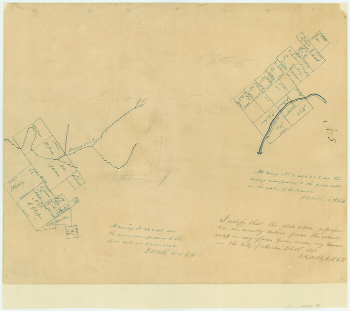
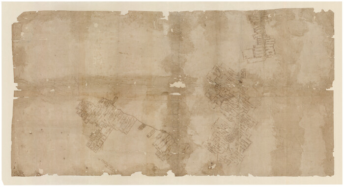
[Surveys in the Travis District along Onion Creek and the Pedernales River]
Print $20.00
- Digital $50.00
[Surveys in the Travis District along Onion Creek and the Pedernales River]
1841
Size: 14.0 x 15.8 inches
40
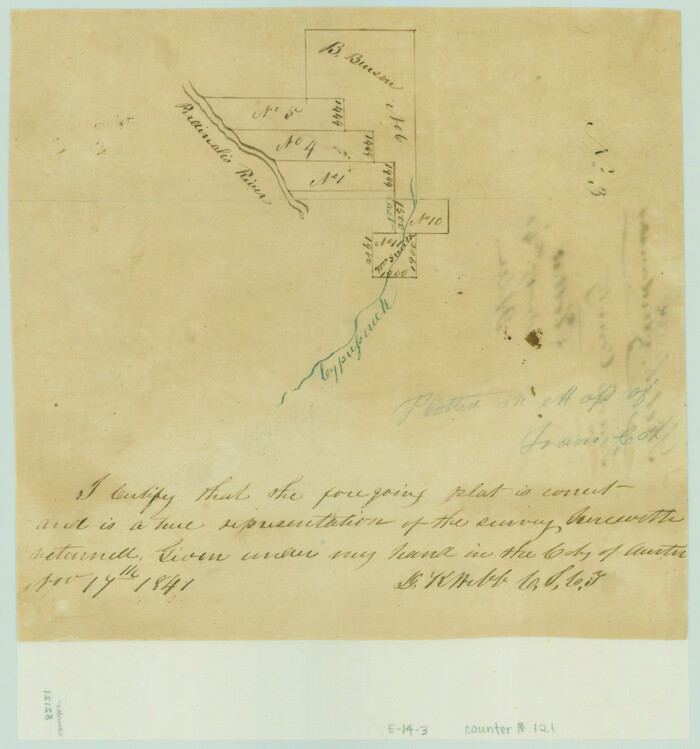
[Surveys along the Pedernales River and Cypress Creek]
Print $2.00
- Digital $50.00
[Surveys along the Pedernales River and Cypress Creek]
1841
Size: 8.3 x 7.7 inches
121
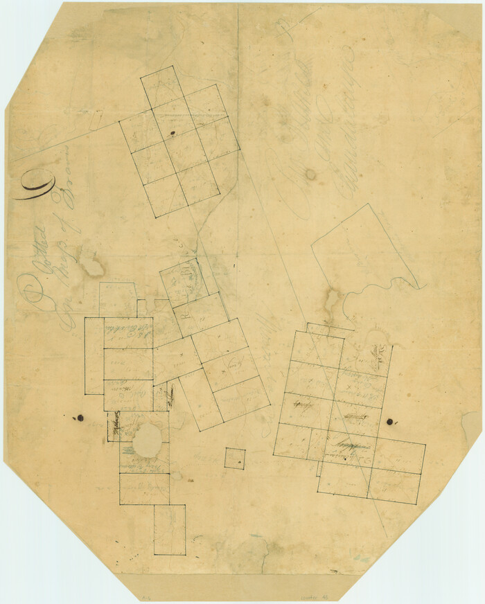
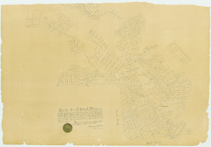
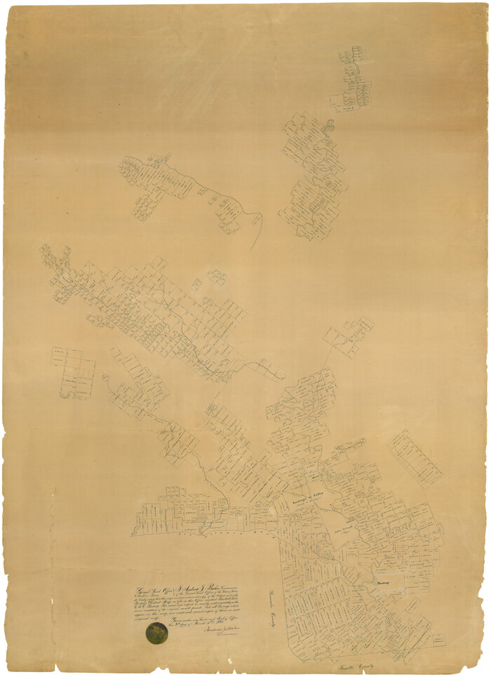
[Surveys along the Guadalupe River and Blanco Creek]
Print $20.00
- Digital $50.00
[Surveys along the Guadalupe River and Blanco Creek]
Size: 19.5 x 15.7 inches
45
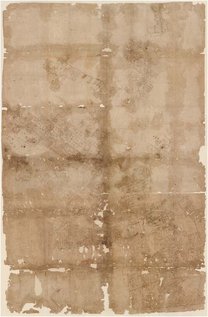
[Bastrop District]
Print $40.00
- Digital $50.00
[Bastrop District]
1838
Size: 67.3 x 44.2 inches
16941
[Bastrop District]
Print $40.00
- Digital $50.00
[Bastrop District]
1895
Size: 36.5 x 52.0 inches
3131
[Bastrop District]
Print $40.00
- Digital $50.00
[Bastrop District]
1895
Size: 37.4 x 51.9 inches
83005
[Bastrop District]
Print $40.00
- Digital $50.00
[Bastrop District]
1895
Size: 71.8 x 52.3 inches
83006
[Bastrop District]
Print $20.00
- Digital $50.00
[Bastrop District]
1838
Size: 25.1 x 46.1 inches
83517
[Bastrop District]
Print $20.00
- Digital $50.00
[Bastrop District]
1838
Size: 19.5 x 44.2 inches
83518
[Bastrop District]
Print $20.00
- Digital $50.00
[Bastrop District]
1838
Size: 26.5 x 44.2 inches
83519
Water-Shed of the Colorado River

Print $40.00
- Digital $50.00
Water-Shed of the Colorado River
1925
Size: 37.1 x 79.8 inches
65261
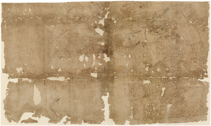
Travis County Working Sketch 67

Print $20.00
- Digital $50.00
Travis County Working Sketch 67
2017
Size: 24.6 x 36.6 inches
94123
Travis County Working Sketch 66

Print $20.00
- Digital $50.00
Travis County Working Sketch 66
2017
Size: 24.5 x 36.6 inches
94122
Travis County Rolled Sketch 23

Print $20.00
- Digital $50.00
Travis County Rolled Sketch 23
1941
Size: 30.5 x 37.7 inches
8024
Surveyor's Watercourse Report 1

Print $34.00
Surveyor's Watercourse Report 1
2025
Size: 11.0 x 8.5 inches
97511
Road Guide of Central Texas, Colorado River, Highland Lakes and Hill Country

Print $20.00
- Digital $50.00
Road Guide of Central Texas, Colorado River, Highland Lakes and Hill Country
1947
Size: 18.0 x 21.7 inches
60293
Map of Blanco County, Texas

Print $20.00
- Digital $50.00
Map of Blanco County, Texas
1880
Size: 28.5 x 20.1 inches
406
Map of Blanco County

Print $20.00
- Digital $50.00
Map of Blanco County
1862
Size: 28.1 x 18.7 inches
3303
Map of Blanco County

Print $20.00
- Digital $50.00
Map of Blanco County
1871
Size: 22.1 x 17.2 inches
3304
Map of Blanco County

Print $20.00
- Digital $50.00
Map of Blanco County
1878
Size: 19.0 x 28.0 inches
3305
Map of Blanco County

Print $20.00
- Digital $50.00
Map of Blanco County
1880
Size: 23.9 x 18.2 inches
3306
Kendall County Working Sketch 9

Print $40.00
- Digital $50.00
Kendall County Working Sketch 9
1953
Size: 52.8 x 37.2 inches
66681
Kendall County Working Sketch 25

Print $40.00
- Digital $50.00
Kendall County Working Sketch 25
1978
Size: 39.4 x 56.8 inches
66697
Kendall County Rolled Sketch 3

Print $9.00
- Digital $50.00
Kendall County Rolled Sketch 3
1858
Size: 10.0 x 15.3 inches
46424
[Surveys in the Travis District along the Colorado and Pedernales Rivers]
Print $2.00
- Digital $50.00
[Surveys in the Travis District along the Colorado and Pedernales Rivers]
1841
-
Size
9.9 x 8.2 inches
-
Map/Doc
113
-
Creation Date
1841
[Surveys in the Travis District along Onion Creek and the Pedernales River]
Print $20.00
- Digital $50.00
[Surveys in the Travis District along Onion Creek and the Pedernales River]
1841
-
Size
14.0 x 15.8 inches
-
Map/Doc
40
-
Creation Date
1841
[Surveys along the Pedernales River and Cypress Creek]
Print $2.00
- Digital $50.00
[Surveys along the Pedernales River and Cypress Creek]
1841
-
Size
8.3 x 7.7 inches
-
Map/Doc
121
-
Creation Date
1841
[Surveys along the Guadalupe River and Blanco Creek]
Print $20.00
- Digital $50.00
[Surveys along the Guadalupe River and Blanco Creek]
-
Size
19.5 x 15.7 inches
-
Map/Doc
45
[Blanco County]
![3307, [Blanco County], General Map Collection](https://historictexasmaps.com/wmedia_w700/maps/3307-2.tif.jpg)
Print $20.00
- Digital $50.00
[Blanco County]
1872
-
Size
19.1 x 16.0 inches
-
Map/Doc
3307
-
Creation Date
1872
[Bastrop District]
Print $40.00
- Digital $50.00
[Bastrop District]
1838
-
Size
67.3 x 44.2 inches
-
Map/Doc
16941
-
Creation Date
1838
[Bastrop District]
Print $40.00
- Digital $50.00
[Bastrop District]
1895
-
Size
36.5 x 52.0 inches
-
Map/Doc
3131
-
Creation Date
1895
[Bastrop District]
Print $40.00
- Digital $50.00
[Bastrop District]
1895
-
Size
37.4 x 51.9 inches
-
Map/Doc
83005
-
Creation Date
1895
[Bastrop District]
Print $40.00
- Digital $50.00
[Bastrop District]
1895
-
Size
71.8 x 52.3 inches
-
Map/Doc
83006
-
Creation Date
1895
[Bastrop District]
Print $20.00
- Digital $50.00
[Bastrop District]
1838
-
Size
25.1 x 46.1 inches
-
Map/Doc
83517
-
Creation Date
1838
[Bastrop District]
Print $20.00
- Digital $50.00
[Bastrop District]
1838
-
Size
19.5 x 44.2 inches
-
Map/Doc
83518
-
Creation Date
1838
[Bastrop District]
Print $20.00
- Digital $50.00
[Bastrop District]
1838
-
Size
26.5 x 44.2 inches
-
Map/Doc
83519
-
Creation Date
1838
Water-Shed of the Colorado River
Print $40.00
- Digital $50.00
Water-Shed of the Colorado River
1925
-
Size
37.1 x 79.8 inches
-
Map/Doc
65261
-
Creation Date
1925
Travis County Working Sketch 67
Print $20.00
- Digital $50.00
Travis County Working Sketch 67
2017
-
Size
24.6 x 36.6 inches
-
Map/Doc
94123
-
Creation Date
2017
Travis County Working Sketch 66
Print $20.00
- Digital $50.00
Travis County Working Sketch 66
2017
-
Size
24.5 x 36.6 inches
-
Map/Doc
94122
-
Creation Date
2017
Travis County Rolled Sketch 23
Print $20.00
- Digital $50.00
Travis County Rolled Sketch 23
1941
-
Size
30.5 x 37.7 inches
-
Map/Doc
8024
-
Creation Date
1941
Texas Hill Country Trail Region

Texas Hill Country Trail Region
2017
-
Size
18.2 x 24.3 inches
-
Map/Doc
96871
-
Creation Date
2017
Texas Hill Country Trail Region

Texas Hill Country Trail Region
-
Size
18.1 x 24.2 inches
-
Map/Doc
96872
Surveyor's Watercourse Report 1
Print $34.00
Surveyor's Watercourse Report 1
2025
-
Size
11.0 x 8.5 inches
-
Map/Doc
97511
-
Creation Date
2025
Road Guide of Central Texas, Colorado River, Highland Lakes and Hill Country
Print $20.00
- Digital $50.00
Road Guide of Central Texas, Colorado River, Highland Lakes and Hill Country
1947
-
Size
18.0 x 21.7 inches
-
Map/Doc
60293
-
Creation Date
1947
Map of Blanco County, Texas
Print $20.00
- Digital $50.00
Map of Blanco County, Texas
1880
-
Size
28.5 x 20.1 inches
-
Map/Doc
406
-
Creation Date
1880
Map of Blanco County
Print $20.00
- Digital $50.00
Map of Blanco County
1862
-
Size
28.1 x 18.7 inches
-
Map/Doc
3303
-
Creation Date
1862
Map of Blanco County
Print $20.00
- Digital $50.00
Map of Blanco County
1871
-
Size
22.1 x 17.2 inches
-
Map/Doc
3304
-
Creation Date
1871
Map of Blanco County
Print $20.00
- Digital $50.00
Map of Blanco County
1878
-
Size
19.0 x 28.0 inches
-
Map/Doc
3305
-
Creation Date
1878
Map of Blanco County
Print $20.00
- Digital $50.00
Map of Blanco County
1880
-
Size
23.9 x 18.2 inches
-
Map/Doc
3306
-
Creation Date
1880
Map of Blanco

Print $20.00
- Digital $50.00
Map of Blanco
1950
-
Size
28.4 x 20.8 inches
-
Map/Doc
4822
-
Creation Date
1950
Kendall County Working Sketch 9
Print $40.00
- Digital $50.00
Kendall County Working Sketch 9
1953
-
Size
52.8 x 37.2 inches
-
Map/Doc
66681
-
Creation Date
1953
Kendall County Working Sketch 25
Print $40.00
- Digital $50.00
Kendall County Working Sketch 25
1978
-
Size
39.4 x 56.8 inches
-
Map/Doc
66697
-
Creation Date
1978
Kendall County Rolled Sketch 3
Print $9.00
- Digital $50.00
Kendall County Rolled Sketch 3
1858
-
Size
10.0 x 15.3 inches
-
Map/Doc
46424
-
Creation Date
1858
Johnson City

Print $40.00
- Digital $50.00
Johnson City
1890
-
Size
14.1 x 17.2 inches
-
Map/Doc
14648
-
Creation Date
1890