[Sketch showing B. S. & F. Blks B1 and B2 and surrounding Blocks]
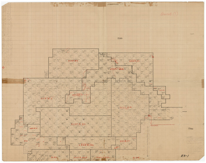
Print $20.00
- Digital $50.00
[Sketch showing B. S. & F. Blks B1 and B2 and surrounding Blocks]
Size: 23.3 x 18.3 inches
90137
[B. S. & F. Blk. M10, D. & S. E. RR. Co. Secs. 138 thru 149]
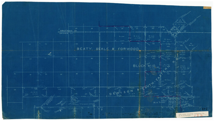
Print $20.00
- Digital $50.00
[B. S. & F. Blk. M10, D. & S. E. RR. Co. Secs. 138 thru 149]
Size: 26.4 x 15.5 inches
90133
Water-Shed of the Pease River Drainage Area

Print $6.00
- Digital $50.00
Water-Shed of the Pease River Drainage Area
Size: 14.9 x 31.0 inches
65102
Swisher County Working Sketch 5

Print $20.00
- Digital $50.00
Swisher County Working Sketch 5
1973
Size: 16.0 x 26.5 inches
62416
Swisher County Sketch File 5

Print $8.00
- Digital $50.00
Swisher County Sketch File 5
1876
Size: 14.3 x 8.8 inches
37618
Swisher County Sketch File 2a

Print $96.00
- Digital $50.00
Swisher County Sketch File 2a
1891
Size: 14.3 x 8.7 inches
37578
Swisher County Sketch File 1b

Print $8.00
- Digital $50.00
Swisher County Sketch File 1b
1884
Size: 12.8 x 8.2 inches
37570
Plat Showing the Construction of Texas & Pacific Ry. Co. Blocks 3 & 4 As Located by G. A. Lider

Print $40.00
- Digital $50.00
Plat Showing the Construction of Texas & Pacific Ry. Co. Blocks 3 & 4 As Located by G. A. Lider
1913
Size: 51.4 x 36.3 inches
89931
Motley County Sketch File B4 (N)

Print $20.00
- Digital $50.00
Motley County Sketch File B4 (N)
1900
Size: 23.5 x 25.8 inches
42151
Motley County Sketch File B (S)

Print $40.00
- Digital $50.00
Motley County Sketch File B (S)
Size: 14.2 x 12.4 inches
32157
Motley County Sketch File 7 (N)

Print $20.00
- Digital $50.00
Motley County Sketch File 7 (N)
1901
Size: 16.0 x 19.8 inches
42140
Motley County Sketch File 6 (N)

Print $20.00
- Digital $50.00
Motley County Sketch File 6 (N)
1900
Size: 14.0 x 8.6 inches
32004
Motley County Sketch File 2 (N)

Print $22.00
- Digital $50.00
Motley County Sketch File 2 (N)
Size: 8.3 x 14.8 inches
31996
Motley County Sketch File 10 (N)

Print $20.00
- Digital $50.00
Motley County Sketch File 10 (N)
1900
Size: 14.0 x 8.5 inches
32026
Map of Silverton, County Seat of Briscoe County, Texas

Print $20.00
- Digital $50.00
Map of Silverton, County Seat of Briscoe County, Texas
1891
Size: 24.3 x 19.8 inches
4832
Map of Briscoe County, Texas

Print $20.00
- Digital $50.00
Map of Briscoe County, Texas
1879
Size: 22.6 x 18.0 inches
614
Map of Briscoe County

Print $20.00
- Digital $50.00
Map of Briscoe County
1885
Size: 24.4 x 20.1 inches
3334
Map of Briscoe County

Print $20.00
- Digital $50.00
Map of Briscoe County
1901
Size: 42.0 x 35.0 inches
4758
Map of Briscoe County

Print $20.00
- Digital $50.00
Map of Briscoe County
1901
Size: 41.4 x 38.0 inches
4893
Hall County Working Sketch 4

Print $20.00
- Digital $50.00
Hall County Working Sketch 4
1923
Size: 29.0 x 19.7 inches
63332
Hall County Working Sketch 2

Print $40.00
- Digital $50.00
Hall County Working Sketch 2
1907
Size: 40.9 x 48.4 inches
63330
Hall County Sketch File B2

Print $20.00
- Digital $50.00
Hall County Sketch File B2
1904
Size: 21.7 x 35.1 inches
11613
Hall County Sketch File B1

Print $20.00
- Digital $50.00
Hall County Sketch File B1
1904
Size: 23.4 x 25.4 inches
11612
Hall County Sketch File B and B1

Print $14.00
- Digital $50.00
Hall County Sketch File B and B1
Size: 9.2 x 8.5 inches
24780
Hall County Sketch File 6

Print $20.00
- Digital $50.00
Hall County Sketch File 6
1885
Size: 28.2 x 37.9 inches
10473
Hall County Sketch File 14

Print $20.00
- Digital $50.00
Hall County Sketch File 14
1882
Size: 20.9 x 32.9 inches
11607
Hall County Sketch File 10

Print $20.00
- Digital $50.00
Hall County Sketch File 10
1884
Size: 19.6 x 22.1 inches
11605
Hale County Sketch File 26

Print $40.00
- Digital $50.00
Hale County Sketch File 26
1911
Size: 20.7 x 54.4 inches
10471
General Highway Map, Briscoe County, Texas

Print $20.00
General Highway Map, Briscoe County, Texas
1940
Size: 18.5 x 24.9 inches
79029
[Sketch showing B. S. & F. Blks B1 and B2 and surrounding Blocks]
Print $20.00
- Digital $50.00
[Sketch showing B. S. & F. Blks B1 and B2 and surrounding Blocks]
-
Size
23.3 x 18.3 inches
-
Map/Doc
90137
[Jack District]
![1993, [Jack District], General Map Collection](https://historictexasmaps.com/wmedia_w700/maps/1993-1.tif.jpg)
Print $40.00
- Digital $50.00
[Jack District]
1878
-
Size
42.1 x 64.5 inches
-
Map/Doc
1993
-
Creation Date
1878
[B. S. & F. Blk. M10, D. & S. E. RR. Co. Secs. 138 thru 149]
Print $20.00
- Digital $50.00
[B. S. & F. Blk. M10, D. & S. E. RR. Co. Secs. 138 thru 149]
-
Size
26.4 x 15.5 inches
-
Map/Doc
90133
Water-Shed of the Pease River Drainage Area
Print $6.00
- Digital $50.00
Water-Shed of the Pease River Drainage Area
-
Size
14.9 x 31.0 inches
-
Map/Doc
65102
Swisher County Working Sketch 5
Print $20.00
- Digital $50.00
Swisher County Working Sketch 5
1973
-
Size
16.0 x 26.5 inches
-
Map/Doc
62416
-
Creation Date
1973
Swisher County Sketch File 5
Print $8.00
- Digital $50.00
Swisher County Sketch File 5
1876
-
Size
14.3 x 8.8 inches
-
Map/Doc
37618
-
Creation Date
1876
Swisher County Sketch File 2a
Print $96.00
- Digital $50.00
Swisher County Sketch File 2a
1891
-
Size
14.3 x 8.7 inches
-
Map/Doc
37578
-
Creation Date
1891
Swisher County Sketch File 1b
Print $8.00
- Digital $50.00
Swisher County Sketch File 1b
1884
-
Size
12.8 x 8.2 inches
-
Map/Doc
37570
-
Creation Date
1884
Plat Showing the Construction of Texas & Pacific Ry. Co. Blocks 3 & 4 As Located by G. A. Lider
Print $40.00
- Digital $50.00
Plat Showing the Construction of Texas & Pacific Ry. Co. Blocks 3 & 4 As Located by G. A. Lider
1913
-
Size
51.4 x 36.3 inches
-
Map/Doc
89931
-
Creation Date
1913
Motley County Sketch File B4 (N)
Print $20.00
- Digital $50.00
Motley County Sketch File B4 (N)
1900
-
Size
23.5 x 25.8 inches
-
Map/Doc
42151
-
Creation Date
1900
Motley County Sketch File B (S)
Print $40.00
- Digital $50.00
Motley County Sketch File B (S)
-
Size
14.2 x 12.4 inches
-
Map/Doc
32157
Motley County Sketch File 7 (N)
Print $20.00
- Digital $50.00
Motley County Sketch File 7 (N)
1901
-
Size
16.0 x 19.8 inches
-
Map/Doc
42140
-
Creation Date
1901
Motley County Sketch File 6 (N)
Print $20.00
- Digital $50.00
Motley County Sketch File 6 (N)
1900
-
Size
14.0 x 8.6 inches
-
Map/Doc
32004
-
Creation Date
1900
Motley County Sketch File 2 (N)
Print $22.00
- Digital $50.00
Motley County Sketch File 2 (N)
-
Size
8.3 x 14.8 inches
-
Map/Doc
31996
Motley County Sketch File 10 (N)
Print $20.00
- Digital $50.00
Motley County Sketch File 10 (N)
1900
-
Size
14.0 x 8.5 inches
-
Map/Doc
32026
-
Creation Date
1900
Map of Silverton, County Seat of Briscoe County, Texas
Print $20.00
- Digital $50.00
Map of Silverton, County Seat of Briscoe County, Texas
1891
-
Size
24.3 x 19.8 inches
-
Map/Doc
4832
-
Creation Date
1891
Map of Briscoe County, Texas
Print $20.00
- Digital $50.00
Map of Briscoe County, Texas
1879
-
Size
22.6 x 18.0 inches
-
Map/Doc
614
-
Creation Date
1879
Map of Briscoe County
Print $20.00
- Digital $50.00
Map of Briscoe County
1885
-
Size
24.4 x 20.1 inches
-
Map/Doc
3334
-
Creation Date
1885
Map of Briscoe County
Print $20.00
- Digital $50.00
Map of Briscoe County
1901
-
Size
42.0 x 35.0 inches
-
Map/Doc
4758
-
Creation Date
1901
Map of Briscoe County
Print $20.00
- Digital $50.00
Map of Briscoe County
1901
-
Size
41.4 x 38.0 inches
-
Map/Doc
4893
-
Creation Date
1901
Hall County Working Sketch 4
Print $20.00
- Digital $50.00
Hall County Working Sketch 4
1923
-
Size
29.0 x 19.7 inches
-
Map/Doc
63332
-
Creation Date
1923
Hall County Working Sketch 2
Print $40.00
- Digital $50.00
Hall County Working Sketch 2
1907
-
Size
40.9 x 48.4 inches
-
Map/Doc
63330
-
Creation Date
1907
Hall County Sketch File B2
Print $20.00
- Digital $50.00
Hall County Sketch File B2
1904
-
Size
21.7 x 35.1 inches
-
Map/Doc
11613
-
Creation Date
1904
Hall County Sketch File B1
Print $20.00
- Digital $50.00
Hall County Sketch File B1
1904
-
Size
23.4 x 25.4 inches
-
Map/Doc
11612
-
Creation Date
1904
Hall County Sketch File B and B1
Print $14.00
- Digital $50.00
Hall County Sketch File B and B1
-
Size
9.2 x 8.5 inches
-
Map/Doc
24780
Hall County Sketch File 6
Print $20.00
- Digital $50.00
Hall County Sketch File 6
1885
-
Size
28.2 x 37.9 inches
-
Map/Doc
10473
-
Creation Date
1885
Hall County Sketch File 14
Print $20.00
- Digital $50.00
Hall County Sketch File 14
1882
-
Size
20.9 x 32.9 inches
-
Map/Doc
11607
-
Creation Date
1882
Hall County Sketch File 10
Print $20.00
- Digital $50.00
Hall County Sketch File 10
1884
-
Size
19.6 x 22.1 inches
-
Map/Doc
11605
-
Creation Date
1884
Hale County Sketch File 26
Print $40.00
- Digital $50.00
Hale County Sketch File 26
1911
-
Size
20.7 x 54.4 inches
-
Map/Doc
10471
-
Creation Date
1911
General Highway Map, Briscoe County, Texas
Print $20.00
General Highway Map, Briscoe County, Texas
1940
-
Size
18.5 x 24.9 inches
-
Map/Doc
79029
-
Creation Date
1940