Travis County Working Sketch 67

Print $20.00
- Digital $50.00
Travis County Working Sketch 67
2017
Size: 24.6 x 36.6 inches
94123
Travis County Working Sketch 66

Print $20.00
- Digital $50.00
Travis County Working Sketch 66
2017
Size: 24.5 x 36.6 inches
94122
Hays County Working Sketch 23

Print $20.00
- Digital $50.00
Hays County Working Sketch 23
2011
Size: 30.5 x 29.2 inches
90090
Hays County State Real Property Sketch 2

Print $20.00
- Digital $50.00
Hays County State Real Property Sketch 2
2006
Size: 24.3 x 34.4 inches
88619
Hays County State Real Property Sketch 1

Print $20.00
- Digital $50.00
Hays County State Real Property Sketch 1
2005
Size: 31.1 x 42.2 inches
83423
Hays County State Real Property Sketch 3

Print $20.00
- Digital $50.00
Hays County State Real Property Sketch 3
2003
Size: 24.0 x 37.2 inches
96638
Hays County Rolled Sketch 32

Print $20.00
- Digital $50.00
Hays County Rolled Sketch 32
2003
Size: 15.6 x 20.0 inches
78489
Hays County Rolled Sketch 31

Print $20.00
- Digital $50.00
Hays County Rolled Sketch 31
2001
Size: 24.0 x 34.7 inches
76421
Hays County Working Sketch 22

Print $20.00
- Digital $50.00
Hays County Working Sketch 22
2000
Size: 47.1 x 36.9 inches
76051
Blanco County Sketch File 51

Print $8.00
- Digital $50.00
Blanco County Sketch File 51
1998
Size: 11.1 x 8.5 inches
14697
Comal County Working Sketch 15

Print $20.00
- Digital $50.00
Comal County Working Sketch 15
1994
Size: 44.6 x 31.0 inches
68181
Travis County Working Sketch 60

Print $20.00
- Digital $50.00
Travis County Working Sketch 60
1992
Size: 21.8 x 20.9 inches
69444
Blanco County Working Sketch 42

Print $20.00
- Digital $50.00
Blanco County Working Sketch 42
1986
Size: 35.1 x 30.7 inches
67402
Hays County Working Sketch 21

Print $40.00
- Digital $50.00
Hays County Working Sketch 21
1980
Size: 42.7 x 65.6 inches
66095
Hays County Working Sketch 20

Print $40.00
- Digital $50.00
Hays County Working Sketch 20
1980
Size: 42.9 x 65.6 inches
66094
Hays County Working Sketch 19

Print $20.00
- Digital $50.00
Hays County Working Sketch 19
1980
Size: 30.1 x 26.0 inches
66093
Hays County Working Sketch 18

Print $20.00
- Digital $50.00
Hays County Working Sketch 18
1978
Size: 33.4 x 32.0 inches
66092
Hays County Working Sketch 17

Print $20.00
- Digital $50.00
Hays County Working Sketch 17
1971
Size: 28.6 x 30.0 inches
66091
Hays County Working Sketch 16

Print $20.00
- Digital $50.00
Hays County Working Sketch 16
1970
Size: 34.3 x 38.0 inches
66090
Hays County Rolled Sketch 30

Print $20.00
- Digital $50.00
Hays County Rolled Sketch 30
1966
Size: 33.1 x 36.6 inches
9150
Hays County Working Sketch 15

Print $40.00
- Digital $50.00
Hays County Working Sketch 15
1965
Size: 39.8 x 51.6 inches
66089
Travis County Working Sketch 53

Print $40.00
- Digital $50.00
Travis County Working Sketch 53
1964
Size: 42.7 x 53.0 inches
69437
Hays County Working Sketch 14

Print $20.00
- Digital $50.00
Hays County Working Sketch 14
1964
Size: 23.7 x 19.7 inches
66088
General Highway Map, Hays County, Texas

Print $20.00
General Highway Map, Hays County, Texas
1961
Size: 18.1 x 24.7 inches
79513
General Highway Map. Detail of Cities and Towns in Hays County, Texas [San Marcos and vicinity]
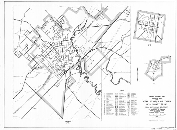
Print $20.00
General Highway Map. Detail of Cities and Towns in Hays County, Texas [San Marcos and vicinity]
1961
Size: 17.9 x 24.5 inches
79514
Guadalupe County Sketch File 22

Print $20.00
- Digital $50.00
Guadalupe County Sketch File 22
1957
Size: 16.2 x 16.5 inches
11591
Hays County Rolled Sketch 29

Print $20.00
- Digital $50.00
Hays County Rolled Sketch 29
1954
Size: 26.1 x 28.0 inches
6184
Hays County Rolled Sketch 28

Print $20.00
- Digital $50.00
Hays County Rolled Sketch 28
1954
Size: 20.2 x 37.5 inches
6183
Hays County Sketch File 34

Print $15.00
- Digital $50.00
Hays County Sketch File 34
1954
Size: 14.3 x 8.9 inches
26270
Travis County Working Sketch 67
Print $20.00
- Digital $50.00
Travis County Working Sketch 67
2017
-
Size
24.6 x 36.6 inches
-
Map/Doc
94123
-
Creation Date
2017
Travis County Working Sketch 66
Print $20.00
- Digital $50.00
Travis County Working Sketch 66
2017
-
Size
24.5 x 36.6 inches
-
Map/Doc
94122
-
Creation Date
2017
Texas Hill Country Trail Region

Texas Hill Country Trail Region
2017
-
Size
18.2 x 24.3 inches
-
Map/Doc
96871
-
Creation Date
2017
Hays County Working Sketch 23
Print $20.00
- Digital $50.00
Hays County Working Sketch 23
2011
-
Size
30.5 x 29.2 inches
-
Map/Doc
90090
-
Creation Date
2011
Hays County State Real Property Sketch 2
Print $20.00
- Digital $50.00
Hays County State Real Property Sketch 2
2006
-
Size
24.3 x 34.4 inches
-
Map/Doc
88619
-
Creation Date
2006
Hays County State Real Property Sketch 1
Print $20.00
- Digital $50.00
Hays County State Real Property Sketch 1
2005
-
Size
31.1 x 42.2 inches
-
Map/Doc
83423
-
Creation Date
2005
Hays County State Real Property Sketch 3
Print $20.00
- Digital $50.00
Hays County State Real Property Sketch 3
2003
-
Size
24.0 x 37.2 inches
-
Map/Doc
96638
-
Creation Date
2003
Hays County Rolled Sketch 32
Print $20.00
- Digital $50.00
Hays County Rolled Sketch 32
2003
-
Size
15.6 x 20.0 inches
-
Map/Doc
78489
-
Creation Date
2003
Hays County Rolled Sketch 31
Print $20.00
- Digital $50.00
Hays County Rolled Sketch 31
2001
-
Size
24.0 x 34.7 inches
-
Map/Doc
76421
-
Creation Date
2001
Hays County Working Sketch 22
Print $20.00
- Digital $50.00
Hays County Working Sketch 22
2000
-
Size
47.1 x 36.9 inches
-
Map/Doc
76051
-
Creation Date
2000
Blanco County Sketch File 51
Print $8.00
- Digital $50.00
Blanco County Sketch File 51
1998
-
Size
11.1 x 8.5 inches
-
Map/Doc
14697
-
Creation Date
1998
Comal County Working Sketch 15
Print $20.00
- Digital $50.00
Comal County Working Sketch 15
1994
-
Size
44.6 x 31.0 inches
-
Map/Doc
68181
-
Creation Date
1994
Travis County Working Sketch 60
Print $20.00
- Digital $50.00
Travis County Working Sketch 60
1992
-
Size
21.8 x 20.9 inches
-
Map/Doc
69444
-
Creation Date
1992
Blanco County Working Sketch 42
Print $20.00
- Digital $50.00
Blanco County Working Sketch 42
1986
-
Size
35.1 x 30.7 inches
-
Map/Doc
67402
-
Creation Date
1986
Hays County Working Sketch 21
Print $40.00
- Digital $50.00
Hays County Working Sketch 21
1980
-
Size
42.7 x 65.6 inches
-
Map/Doc
66095
-
Creation Date
1980
Hays County Working Sketch 20
Print $40.00
- Digital $50.00
Hays County Working Sketch 20
1980
-
Size
42.9 x 65.6 inches
-
Map/Doc
66094
-
Creation Date
1980
Hays County Working Sketch 19
Print $20.00
- Digital $50.00
Hays County Working Sketch 19
1980
-
Size
30.1 x 26.0 inches
-
Map/Doc
66093
-
Creation Date
1980
Hays County Working Sketch 18
Print $20.00
- Digital $50.00
Hays County Working Sketch 18
1978
-
Size
33.4 x 32.0 inches
-
Map/Doc
66092
-
Creation Date
1978
Hays County Working Sketch 17
Print $20.00
- Digital $50.00
Hays County Working Sketch 17
1971
-
Size
28.6 x 30.0 inches
-
Map/Doc
66091
-
Creation Date
1971
Hays County Working Sketch 16
Print $20.00
- Digital $50.00
Hays County Working Sketch 16
1970
-
Size
34.3 x 38.0 inches
-
Map/Doc
66090
-
Creation Date
1970
Hays County Rolled Sketch 30
Print $20.00
- Digital $50.00
Hays County Rolled Sketch 30
1966
-
Size
33.1 x 36.6 inches
-
Map/Doc
9150
-
Creation Date
1966
Hays County Working Sketch 15
Print $40.00
- Digital $50.00
Hays County Working Sketch 15
1965
-
Size
39.8 x 51.6 inches
-
Map/Doc
66089
-
Creation Date
1965
Travis County Working Sketch 53
Print $40.00
- Digital $50.00
Travis County Working Sketch 53
1964
-
Size
42.7 x 53.0 inches
-
Map/Doc
69437
-
Creation Date
1964
Hays County Working Sketch 14
Print $20.00
- Digital $50.00
Hays County Working Sketch 14
1964
-
Size
23.7 x 19.7 inches
-
Map/Doc
66088
-
Creation Date
1964
General Highway Map, Hays County, Texas
Print $20.00
General Highway Map, Hays County, Texas
1961
-
Size
18.1 x 24.7 inches
-
Map/Doc
79513
-
Creation Date
1961
General Highway Map. Detail of Cities and Towns in Hays County, Texas [San Marcos and vicinity]
Print $20.00
General Highway Map. Detail of Cities and Towns in Hays County, Texas [San Marcos and vicinity]
1961
-
Size
17.9 x 24.5 inches
-
Map/Doc
79514
-
Creation Date
1961
Guadalupe County Sketch File 22
Print $20.00
- Digital $50.00
Guadalupe County Sketch File 22
1957
-
Size
16.2 x 16.5 inches
-
Map/Doc
11591
-
Creation Date
1957
Hays County Rolled Sketch 29
Print $20.00
- Digital $50.00
Hays County Rolled Sketch 29
1954
-
Size
26.1 x 28.0 inches
-
Map/Doc
6184
-
Creation Date
1954
Hays County Rolled Sketch 28
Print $20.00
- Digital $50.00
Hays County Rolled Sketch 28
1954
-
Size
20.2 x 37.5 inches
-
Map/Doc
6183
-
Creation Date
1954
Hays County Sketch File 34
Print $15.00
- Digital $50.00
Hays County Sketch File 34
1954
-
Size
14.3 x 8.9 inches
-
Map/Doc
26270
-
Creation Date
1954