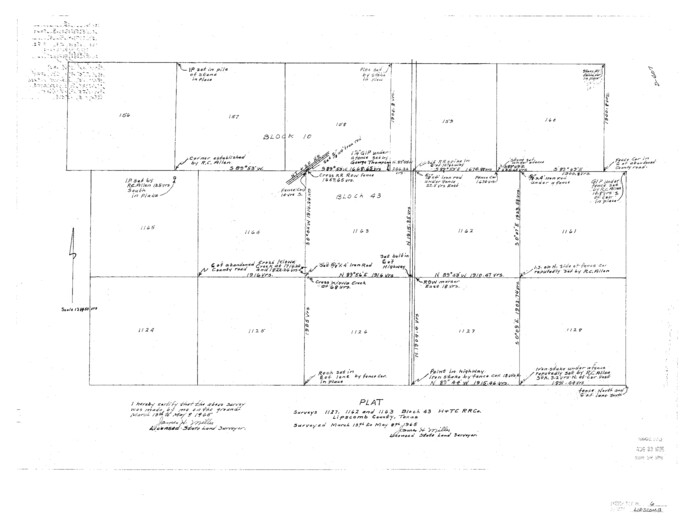
Lipscomb County Sketch File 6

Print $20.00
- Digital $50.00
Lipscomb County Sketch File 6
1965
Size: 19.4 x 26.1 inches
12005
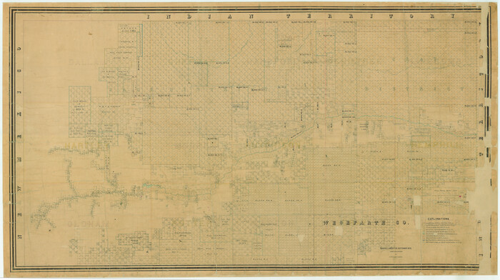
[Young Territory]

Print $40.00
- Digital $50.00
[Young Territory]
1875
Size: 49.0 x 87.4 inches
16784
[Texas Panhandle North Boundary Line]


Print $20.00
- Digital $50.00
[Texas Panhandle North Boundary Line]
1898
Size: 11.9 x 46.1 inches
1737
Texas Panhandle North Boundary Line


Print $40.00
- Digital $50.00
Texas Panhandle North Boundary Line
1898
Size: 13.4 x 125.2 inches
1738
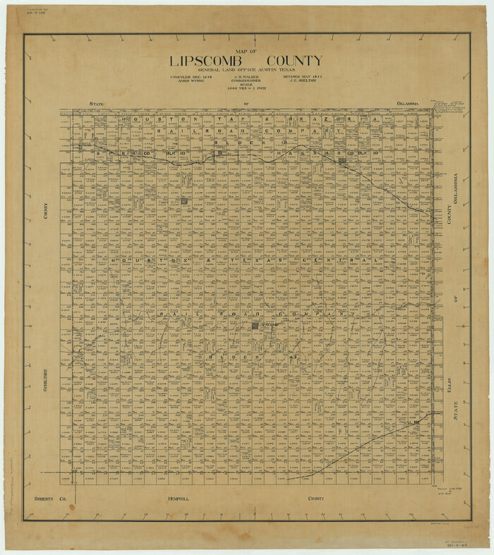
Map of Lipscomb County

Print $20.00
- Digital $50.00
Map of Lipscomb County
1899
Size: 45.1 x 39.6 inches
1883
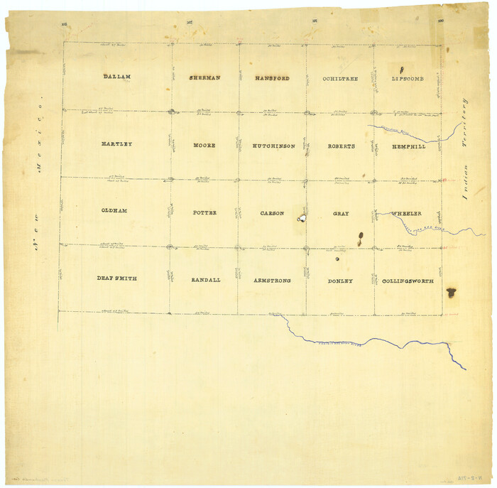
[Map Showing Panhandle Counties in Texas]

Print $20.00
- Digital $50.00
[Map Showing Panhandle Counties in Texas]
1876
Size: 27.3 x 27.9 inches
2087
Hemphill County Sketch File 9


Print $26.00
- Digital $50.00
Hemphill County Sketch File 9
1955
Size: 11.0 x 8.8 inches
26312
Hutchinson County Sketch File 23


Print $22.00
- Digital $50.00
Hutchinson County Sketch File 23
1913
Size: 11.2 x 8.8 inches
27245
Lipscomb County Sketch File 2
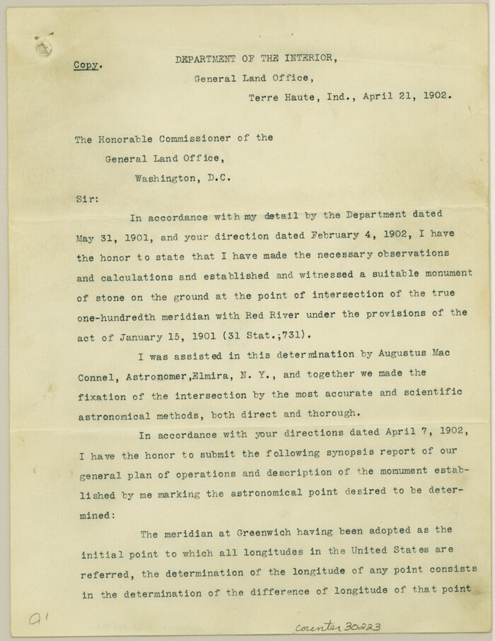

Print $20.00
- Digital $50.00
Lipscomb County Sketch File 2
1902
Size: 10.7 x 8.2 inches
30223
Lipscomb County Sketch File 4


Print $56.00
- Digital $50.00
Lipscomb County Sketch File 4
1910
Size: 11.2 x 8.7 inches
30233
Ochiltree County Sketch File 2


Print $38.00
- Digital $50.00
Ochiltree County Sketch File 2
1903
Size: 11.3 x 8.6 inches
33168
Ochiltree County Sketch File 5


Print $4.00
- Digital $50.00
Ochiltree County Sketch File 5
Size: 14.5 x 8.9 inches
33184
Ochiltree County Sketch File 8


Print $16.00
- Digital $50.00
Ochiltree County Sketch File 8
1933
Size: 11.2 x 8.7 inches
33186
Ochiltree County Sketch File 6


Print $20.00
- Digital $50.00
Ochiltree County Sketch File 6
1930
Size: 9.5 x 32.7 inches
42203
Ochiltree County Sketch File 7


Print $20.00
- Digital $50.00
Ochiltree County Sketch File 7
Size: 14.5 x 26.1 inches
42204
Lipscomb County Rolled Sketch 6


Print $20.00
- Digital $50.00
Lipscomb County Rolled Sketch 6
1941
Size: 44.8 x 21.8 inches
42260
[Sketch of surveys north of Canadian River, Hemphill County, Texas]
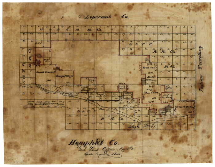

Print $3.00
- Digital $50.00
[Sketch of surveys north of Canadian River, Hemphill County, Texas]
1882
Size: 10.5 x 13.5 inches
484
Lipscomb County, Texas
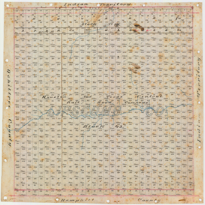

Print $20.00
- Digital $50.00
Lipscomb County, Texas
1880
Size: 16.5 x 18.2 inches
489
Map of Lipscomb County
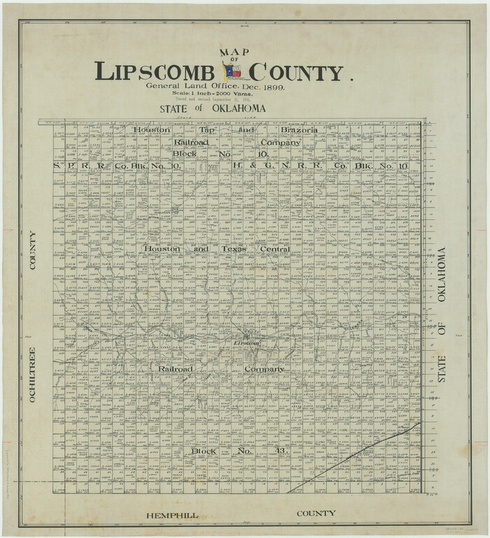

Print $20.00
- Digital $50.00
Map of Lipscomb County
1899
Size: 43.1 x 39.2 inches
5017
Lipscomb County Boundary File 1
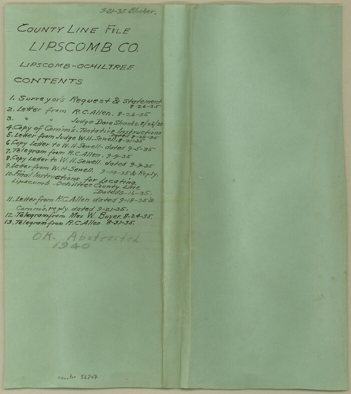

Print $16.00
- Digital $50.00
Lipscomb County Boundary File 1
Size: 9.0 x 8.0 inches
56307
Lipscomb County Boundary File 2
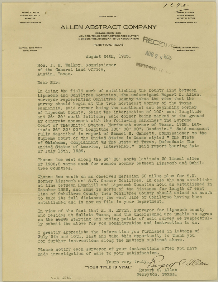

Print $6.00
- Digital $50.00
Lipscomb County Boundary File 2
Size: 11.1 x 8.6 inches
56315
Lipscomb County Boundary File 3


Print $4.00
- Digital $50.00
Lipscomb County Boundary File 3
Size: 8.2 x 6.5 inches
56318
Lipscomb County Boundary File 4
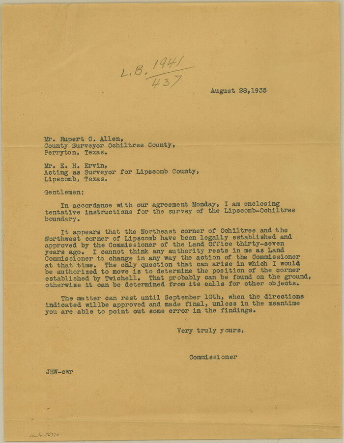

Print $14.00
- Digital $50.00
Lipscomb County Boundary File 4
Size: 11.1 x 8.6 inches
56320
Lipscomb County Boundary File 5


Print $4.00
- Digital $50.00
Lipscomb County Boundary File 5
Size: 5.5 x 8.6 inches
56327
Lipscomb County Boundary File 6


Print $4.00
- Digital $50.00
Lipscomb County Boundary File 6
Size: 11.1 x 8.6 inches
56329
Lipscomb County Boundary File 7
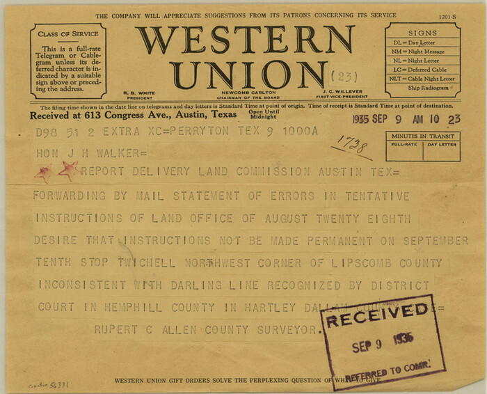

Print $4.00
- Digital $50.00
Lipscomb County Boundary File 7
Size: 6.6 x 8.1 inches
56331
Lipscomb County Boundary File 8
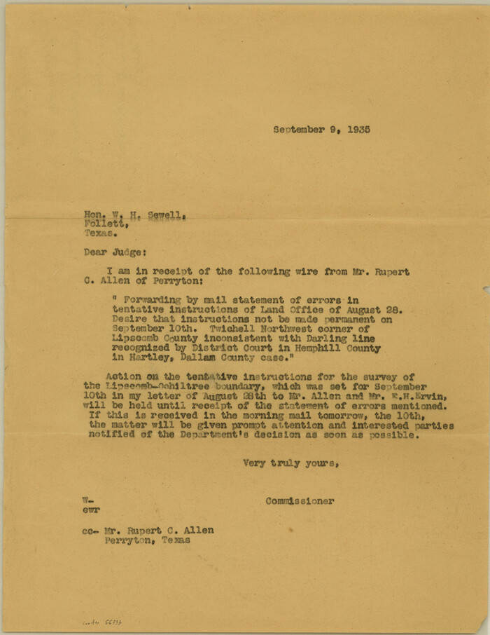

Print $4.00
- Digital $50.00
Lipscomb County Boundary File 8
Size: 11.1 x 8.6 inches
56333
Lipscomb County Sketch File 6


Print $20.00
- Digital $50.00
Lipscomb County Sketch File 6
1965
-
Size
19.4 x 26.1 inches
-
Map/Doc
12005
-
Creation Date
1965
[Young Territory]
![16784, [Young Territory], General Map Collection](https://historictexasmaps.com/wmedia_w700/maps/16784.tif.jpg)
![16784, [Young Territory], General Map Collection](https://historictexasmaps.com/wmedia_w700/maps/16784.tif.jpg)
Print $40.00
- Digital $50.00
[Young Territory]
1875
-
Size
49.0 x 87.4 inches
-
Map/Doc
16784
-
Creation Date
1875
[Texas Panhandle North Boundary Line]


Print $20.00
- Digital $50.00
[Texas Panhandle North Boundary Line]
1898
-
Size
11.9 x 46.1 inches
-
Map/Doc
1737
-
Creation Date
1898
Texas Panhandle North Boundary Line


Print $40.00
- Digital $50.00
Texas Panhandle North Boundary Line
1898
-
Size
13.4 x 125.2 inches
-
Map/Doc
1738
-
Creation Date
1898
Map of Lipscomb County


Print $20.00
- Digital $50.00
Map of Lipscomb County
1899
-
Size
45.1 x 39.6 inches
-
Map/Doc
1883
-
Creation Date
1899
[Map Showing Panhandle Counties in Texas]
![2087, [Map Showing Panhandle Counties in Texas], General Map Collection](https://historictexasmaps.com/wmedia_w700/maps/2087.tif.jpg)
![2087, [Map Showing Panhandle Counties in Texas], General Map Collection](https://historictexasmaps.com/wmedia_w700/maps/2087.tif.jpg)
Print $20.00
- Digital $50.00
[Map Showing Panhandle Counties in Texas]
1876
-
Size
27.3 x 27.9 inches
-
Map/Doc
2087
-
Creation Date
1876
Hemphill County Sketch File 9


Print $26.00
- Digital $50.00
Hemphill County Sketch File 9
1955
-
Size
11.0 x 8.8 inches
-
Map/Doc
26312
-
Creation Date
1955
Hutchinson County Sketch File 23


Print $22.00
- Digital $50.00
Hutchinson County Sketch File 23
1913
-
Size
11.2 x 8.8 inches
-
Map/Doc
27245
-
Creation Date
1913
Lipscomb County Sketch File 2


Print $20.00
- Digital $50.00
Lipscomb County Sketch File 2
1902
-
Size
10.7 x 8.2 inches
-
Map/Doc
30223
-
Creation Date
1902
Lipscomb County Sketch File 4


Print $56.00
- Digital $50.00
Lipscomb County Sketch File 4
1910
-
Size
11.2 x 8.7 inches
-
Map/Doc
30233
-
Creation Date
1910
Ochiltree County Sketch File 2


Print $38.00
- Digital $50.00
Ochiltree County Sketch File 2
1903
-
Size
11.3 x 8.6 inches
-
Map/Doc
33168
-
Creation Date
1903
Ochiltree County Sketch File 5


Print $4.00
- Digital $50.00
Ochiltree County Sketch File 5
-
Size
14.5 x 8.9 inches
-
Map/Doc
33184
Ochiltree County Sketch File 8


Print $16.00
- Digital $50.00
Ochiltree County Sketch File 8
1933
-
Size
11.2 x 8.7 inches
-
Map/Doc
33186
-
Creation Date
1933
Lipscomb County
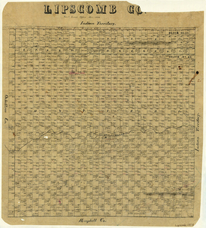

Print $20.00
- Digital $50.00
Lipscomb County
1878
-
Size
18.1 x 16.4 inches
-
Map/Doc
3816
-
Creation Date
1878
Lipscomb County


Print $20.00
- Digital $50.00
Lipscomb County
1889
-
Size
23.5 x 18.5 inches
-
Map/Doc
3817
-
Creation Date
1889
Ochiltree County Sketch File 6


Print $20.00
- Digital $50.00
Ochiltree County Sketch File 6
1930
-
Size
9.5 x 32.7 inches
-
Map/Doc
42203
-
Creation Date
1930
Ochiltree County Sketch File 7


Print $20.00
- Digital $50.00
Ochiltree County Sketch File 7
-
Size
14.5 x 26.1 inches
-
Map/Doc
42204
Lipscomb County Rolled Sketch 6


Print $20.00
- Digital $50.00
Lipscomb County Rolled Sketch 6
1941
-
Size
44.8 x 21.8 inches
-
Map/Doc
42260
-
Creation Date
1941
[Sketch of surveys north of Canadian River, Hemphill County, Texas]
![484, [Sketch of surveys north of Canadian River, Hemphill County, Texas], Maddox Collection](https://historictexasmaps.com/wmedia_w700/maps/00484-1.tif.jpg)
![484, [Sketch of surveys north of Canadian River, Hemphill County, Texas], Maddox Collection](https://historictexasmaps.com/wmedia_w700/maps/00484-1.tif.jpg)
Print $3.00
- Digital $50.00
[Sketch of surveys north of Canadian River, Hemphill County, Texas]
1882
-
Size
10.5 x 13.5 inches
-
Map/Doc
484
-
Creation Date
1882
Lipscomb County, Texas


Print $20.00
- Digital $50.00
Lipscomb County, Texas
1880
-
Size
16.5 x 18.2 inches
-
Map/Doc
489
-
Creation Date
1880
Map of Lipscomb County


Print $20.00
- Digital $50.00
Map of Lipscomb County
1899
-
Size
43.1 x 39.2 inches
-
Map/Doc
5017
-
Creation Date
1899
Lipscomb County Boundary File 1


Print $16.00
- Digital $50.00
Lipscomb County Boundary File 1
-
Size
9.0 x 8.0 inches
-
Map/Doc
56307
Lipscomb County Boundary File 2


Print $6.00
- Digital $50.00
Lipscomb County Boundary File 2
-
Size
11.1 x 8.6 inches
-
Map/Doc
56315
Lipscomb County Boundary File 3


Print $4.00
- Digital $50.00
Lipscomb County Boundary File 3
-
Size
8.2 x 6.5 inches
-
Map/Doc
56318
Lipscomb County Boundary File 4


Print $14.00
- Digital $50.00
Lipscomb County Boundary File 4
-
Size
11.1 x 8.6 inches
-
Map/Doc
56320
Lipscomb County Boundary File 5


Print $4.00
- Digital $50.00
Lipscomb County Boundary File 5
-
Size
5.5 x 8.6 inches
-
Map/Doc
56327
Lipscomb County Boundary File 6


Print $4.00
- Digital $50.00
Lipscomb County Boundary File 6
-
Size
11.1 x 8.6 inches
-
Map/Doc
56329
Lipscomb County Boundary File 7


Print $4.00
- Digital $50.00
Lipscomb County Boundary File 7
-
Size
6.6 x 8.1 inches
-
Map/Doc
56331
Lipscomb County Boundary File 8


Print $4.00
- Digital $50.00
Lipscomb County Boundary File 8
-
Size
11.1 x 8.6 inches
-
Map/Doc
56333
