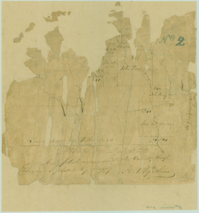
[Valdez and Martinez grants in the Goliad District]
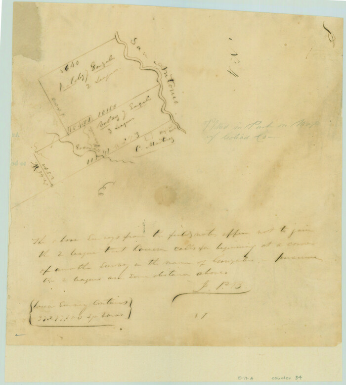
Print $3.00
- Digital $50.00
[Valdez and Martinez grants in the Goliad District]
1842
Size: 10.6 x 9.5 inches
54
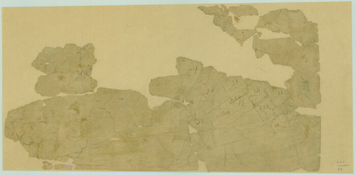
[Surveys on Cibolo Creek]
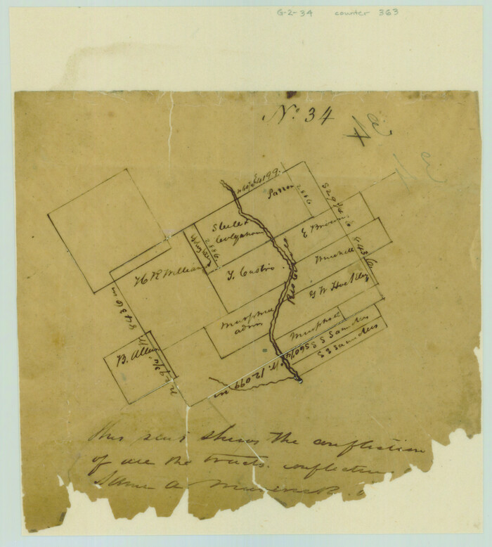
Print $2.00
- Digital $50.00
[Surveys on Cibolo Creek]
Size: 7.4 x 6.7 inches
363
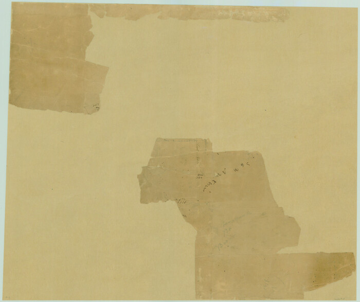
[Surveys near Calaveras Creek]
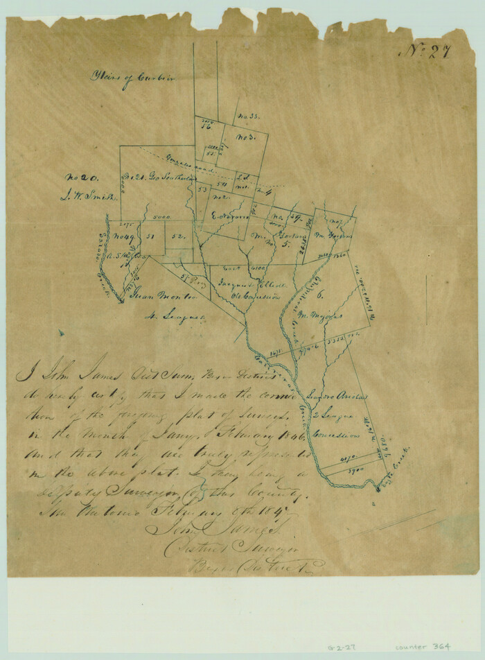
Print $2.00
- Digital $50.00
[Surveys near Calaveras Creek]
1846
Size: 10.9 x 8.0 inches
364
[Surveys in the Bexar District along the Colorado River]
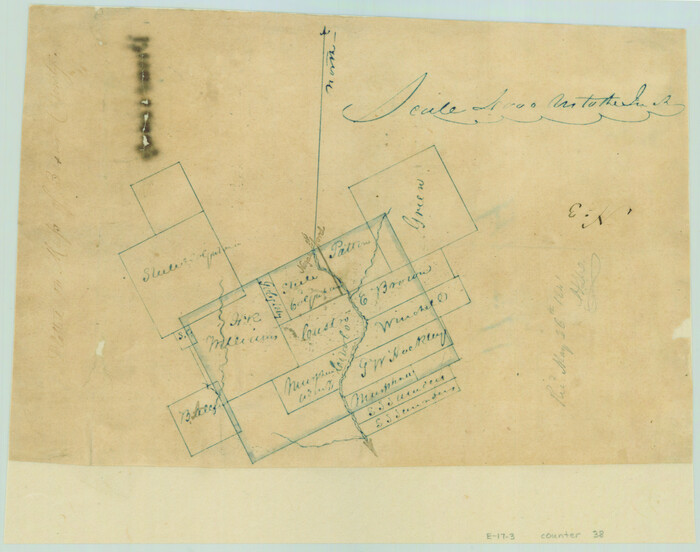
Print $2.00
- Digital $50.00
[Surveys in the Bexar District along the Colorado River]
1841
Size: 7.2 x 9.1 inches
38
[Surveys in the Bexar District along Borrego Creek prepared by the Deputy Surveyor]
Print $2.00
- Digital $50.00
[Surveys in the Bexar District along Borrego Creek prepared by the Deputy Surveyor]
1847
Size: 7.7 x 7.2 inches
96
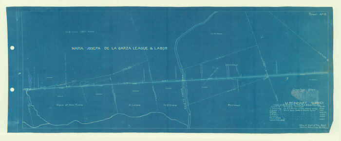
[Surveys in Guadalupe and Wilson Counties]
Print $2.00
- Digital $50.00
[Surveys in Guadalupe and Wilson Counties]
Size: 6.0 x 12.2 inches
59
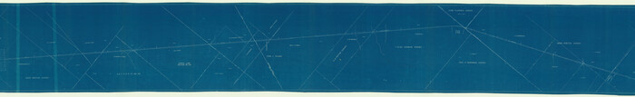
[Surveys along the San Antonio and Cibolo Rivers]
Print $20.00
- Digital $50.00
[Surveys along the San Antonio and Cibolo Rivers]
Size: 16.9 x 20.2 inches
69
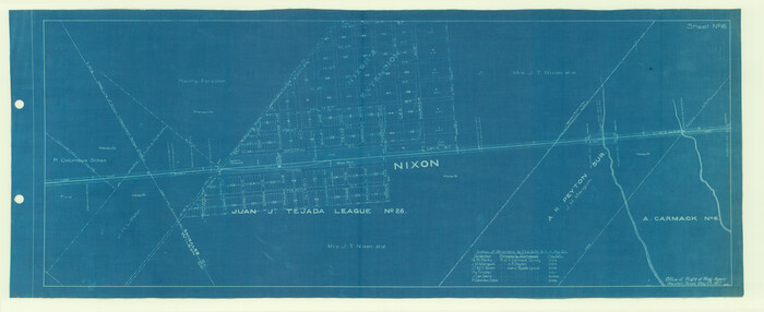
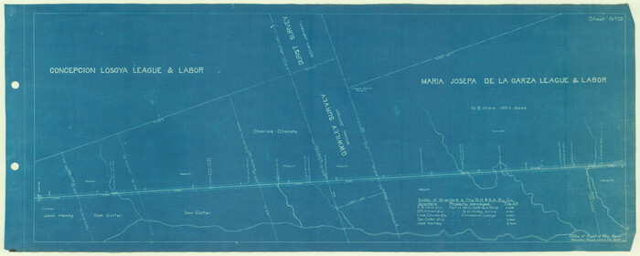
[Map of the Stockdale-Cuero Extension G.H. & S.A. Ry.]
Print $40.00
- Digital $50.00
[Map of the Stockdale-Cuero Extension G.H. & S.A. Ry.]
1905
Size: 19.6 x 128.0 inches
64095
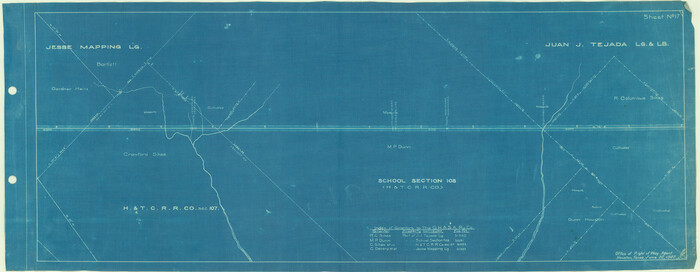
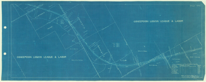
[Galveston, Harrisburg & San Antonio Railroad from Cuero to Stockdale]
Print $20.00
- Digital $50.00
[Galveston, Harrisburg & San Antonio Railroad from Cuero to Stockdale]
1907
Size: 13.9 x 34.1 inches
64198
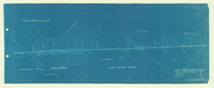
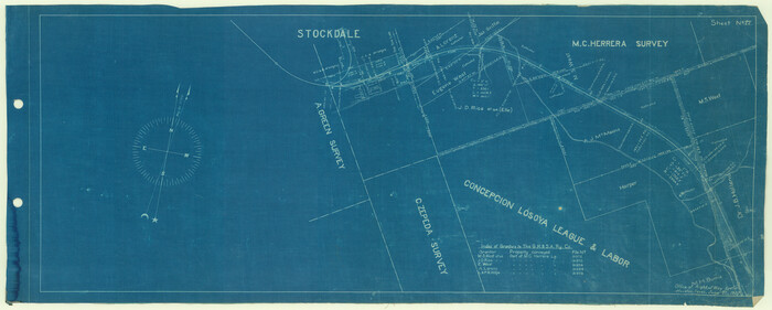
[Galveston, Harrisburg & San Antonio Railroad from Cuero to Stockdale]
Print $20.00
- Digital $50.00
[Galveston, Harrisburg & San Antonio Railroad from Cuero to Stockdale]
1907
Size: 12.9 x 33.2 inches
64199
[Galveston, Harrisburg & San Antonio Railroad from Cuero to Stockdale]
Print $20.00
- Digital $50.00
[Galveston, Harrisburg & San Antonio Railroad from Cuero to Stockdale]
1907
Size: 14.0 x 34.1 inches
64200
[Galveston, Harrisburg & San Antonio Railroad from Cuero to Stockdale]
Print $20.00
- Digital $50.00
[Galveston, Harrisburg & San Antonio Railroad from Cuero to Stockdale]
1907
Size: 14.3 x 34.3 inches
64201
[Galveston, Harrisburg & San Antonio Railroad from Cuero to Stockdale]
Print $20.00
- Digital $50.00
[Galveston, Harrisburg & San Antonio Railroad from Cuero to Stockdale]
1907
Size: 13.3 x 33.1 inches
64202
[Galveston, Harrisburg & San Antonio Railroad from Cuero to Stockdale]
Print $20.00
- Digital $50.00
[Galveston, Harrisburg & San Antonio Railroad from Cuero to Stockdale]
1907
Size: 13.2 x 33.1 inches
64203
[Galveston, Harrisburg & San Antonio Railroad from Cuero to Stockdale]
Print $20.00
- Digital $50.00
[Galveston, Harrisburg & San Antonio Railroad from Cuero to Stockdale]
1907
Size: 13.3 x 33.1 inches
64204
Wilson County Working Sketch Graphic Index

Print $20.00
- Digital $50.00
Wilson County Working Sketch Graphic Index
1921
Size: 39.5 x 47.7 inches
76743
Wilson County Working Sketch 9

Print $20.00
- Digital $50.00
Wilson County Working Sketch 9
1979
Size: 31.6 x 33.0 inches
72589
Wilson County Working Sketch 8

Print $20.00
- Digital $50.00
Wilson County Working Sketch 8
1975
Size: 36.5 x 31.9 inches
72588
Wilson County Working Sketch 7

Print $20.00
- Digital $50.00
Wilson County Working Sketch 7
1965
Size: 23.7 x 30.2 inches
72587
Wilson County Working Sketch 6

Print $20.00
- Digital $50.00
Wilson County Working Sketch 6
1955
Size: 39.4 x 32.3 inches
72586
Wilson County Working Sketch 5

Print $20.00
- Digital $50.00
Wilson County Working Sketch 5
1954
Size: 32.4 x 33.9 inches
72585
Wilson County Working Sketch 4

Print $20.00
- Digital $50.00
Wilson County Working Sketch 4
1953
Size: 30.8 x 28.5 inches
72584
Wilson County Working Sketch 3

Print $20.00
- Digital $50.00
Wilson County Working Sketch 3
1952
Size: 33.6 x 33.2 inches
72583
Wilson County Working Sketch 2

Print $20.00
- Digital $50.00
Wilson County Working Sketch 2
1950
Size: 42.0 x 42.8 inches
72582
Wilson County Working Sketch 14

Print $20.00
- Digital $50.00
Wilson County Working Sketch 14
1987
Size: 31.9 x 36.2 inches
72594
Wilson County Working Sketch 13

Print $40.00
- Digital $50.00
Wilson County Working Sketch 13
1985
Size: 23.9 x 53.5 inches
72593
Wilson County Working Sketch 12

Print $20.00
- Digital $50.00
Wilson County Working Sketch 12
1981
Size: 19.5 x 12.9 inches
72592
Wilson County Working Sketch 11

Print $20.00
- Digital $50.00
Wilson County Working Sketch 11
1980
Size: 14.4 x 13.1 inches
72591
Wilson County Working Sketch 10

Print $20.00
- Digital $50.00
Wilson County Working Sketch 10
1980
Size: 16.6 x 11.7 inches
72590
Wilson County Working Sketch 1

Print $2.00
- Digital $50.00
Wilson County Working Sketch 1
Size: 7.1 x 13.1 inches
72581
[Valdez and Martinez grants in the Goliad District]
Print $3.00
- Digital $50.00
[Valdez and Martinez grants in the Goliad District]
1842
-
Size
10.6 x 9.5 inches
-
Map/Doc
54
-
Creation Date
1842
[Surveys on Cibolo Creek]
Print $2.00
- Digital $50.00
[Surveys on Cibolo Creek]
-
Size
7.4 x 6.7 inches
-
Map/Doc
363
[Surveys near Calaveras Creek]
Print $2.00
- Digital $50.00
[Surveys near Calaveras Creek]
1846
-
Size
10.9 x 8.0 inches
-
Map/Doc
364
-
Creation Date
1846
[Surveys in the Bexar District along the Colorado River]
Print $2.00
- Digital $50.00
[Surveys in the Bexar District along the Colorado River]
1841
-
Size
7.2 x 9.1 inches
-
Map/Doc
38
-
Creation Date
1841
[Surveys in the Bexar District along Borrego Creek prepared by the Deputy Surveyor]
Print $2.00
- Digital $50.00
[Surveys in the Bexar District along Borrego Creek prepared by the Deputy Surveyor]
1847
-
Size
7.7 x 7.2 inches
-
Map/Doc
96
-
Creation Date
1847
[Surveys in Guadalupe and Wilson Counties]
Print $2.00
- Digital $50.00
[Surveys in Guadalupe and Wilson Counties]
-
Size
6.0 x 12.2 inches
-
Map/Doc
59
[Surveys along the San Antonio and Cibolo Rivers]
Print $20.00
- Digital $50.00
[Surveys along the San Antonio and Cibolo Rivers]
-
Size
16.9 x 20.2 inches
-
Map/Doc
69
[Map of the Stockdale-Cuero Extension G.H. & S.A. Ry.]
Print $40.00
- Digital $50.00
[Map of the Stockdale-Cuero Extension G.H. & S.A. Ry.]
1905
-
Size
19.6 x 128.0 inches
-
Map/Doc
64095
-
Creation Date
1905
[Galveston, Harrisburg & San Antonio Railroad from Cuero to Stockdale]
Print $20.00
- Digital $50.00
[Galveston, Harrisburg & San Antonio Railroad from Cuero to Stockdale]
1907
-
Size
13.9 x 34.1 inches
-
Map/Doc
64198
-
Creation Date
1907
[Galveston, Harrisburg & San Antonio Railroad from Cuero to Stockdale]
Print $20.00
- Digital $50.00
[Galveston, Harrisburg & San Antonio Railroad from Cuero to Stockdale]
1907
-
Size
12.9 x 33.2 inches
-
Map/Doc
64199
-
Creation Date
1907
[Galveston, Harrisburg & San Antonio Railroad from Cuero to Stockdale]
Print $20.00
- Digital $50.00
[Galveston, Harrisburg & San Antonio Railroad from Cuero to Stockdale]
1907
-
Size
14.0 x 34.1 inches
-
Map/Doc
64200
-
Creation Date
1907
[Galveston, Harrisburg & San Antonio Railroad from Cuero to Stockdale]
Print $20.00
- Digital $50.00
[Galveston, Harrisburg & San Antonio Railroad from Cuero to Stockdale]
1907
-
Size
14.3 x 34.3 inches
-
Map/Doc
64201
-
Creation Date
1907
[Galveston, Harrisburg & San Antonio Railroad from Cuero to Stockdale]
Print $20.00
- Digital $50.00
[Galveston, Harrisburg & San Antonio Railroad from Cuero to Stockdale]
1907
-
Size
13.3 x 33.1 inches
-
Map/Doc
64202
-
Creation Date
1907
[Galveston, Harrisburg & San Antonio Railroad from Cuero to Stockdale]
Print $20.00
- Digital $50.00
[Galveston, Harrisburg & San Antonio Railroad from Cuero to Stockdale]
1907
-
Size
13.2 x 33.1 inches
-
Map/Doc
64203
-
Creation Date
1907
[Galveston, Harrisburg & San Antonio Railroad from Cuero to Stockdale]
Print $20.00
- Digital $50.00
[Galveston, Harrisburg & San Antonio Railroad from Cuero to Stockdale]
1907
-
Size
13.3 x 33.1 inches
-
Map/Doc
64204
-
Creation Date
1907
Wilson County Working Sketch Graphic Index
Print $20.00
- Digital $50.00
Wilson County Working Sketch Graphic Index
1921
-
Size
39.5 x 47.7 inches
-
Map/Doc
76743
-
Creation Date
1921
Wilson County Working Sketch 9
Print $20.00
- Digital $50.00
Wilson County Working Sketch 9
1979
-
Size
31.6 x 33.0 inches
-
Map/Doc
72589
-
Creation Date
1979
Wilson County Working Sketch 8
Print $20.00
- Digital $50.00
Wilson County Working Sketch 8
1975
-
Size
36.5 x 31.9 inches
-
Map/Doc
72588
-
Creation Date
1975
Wilson County Working Sketch 7
Print $20.00
- Digital $50.00
Wilson County Working Sketch 7
1965
-
Size
23.7 x 30.2 inches
-
Map/Doc
72587
-
Creation Date
1965
Wilson County Working Sketch 6
Print $20.00
- Digital $50.00
Wilson County Working Sketch 6
1955
-
Size
39.4 x 32.3 inches
-
Map/Doc
72586
-
Creation Date
1955
Wilson County Working Sketch 5
Print $20.00
- Digital $50.00
Wilson County Working Sketch 5
1954
-
Size
32.4 x 33.9 inches
-
Map/Doc
72585
-
Creation Date
1954
Wilson County Working Sketch 4
Print $20.00
- Digital $50.00
Wilson County Working Sketch 4
1953
-
Size
30.8 x 28.5 inches
-
Map/Doc
72584
-
Creation Date
1953
Wilson County Working Sketch 3
Print $20.00
- Digital $50.00
Wilson County Working Sketch 3
1952
-
Size
33.6 x 33.2 inches
-
Map/Doc
72583
-
Creation Date
1952
Wilson County Working Sketch 2
Print $20.00
- Digital $50.00
Wilson County Working Sketch 2
1950
-
Size
42.0 x 42.8 inches
-
Map/Doc
72582
-
Creation Date
1950
Wilson County Working Sketch 14
Print $20.00
- Digital $50.00
Wilson County Working Sketch 14
1987
-
Size
31.9 x 36.2 inches
-
Map/Doc
72594
-
Creation Date
1987
Wilson County Working Sketch 13
Print $40.00
- Digital $50.00
Wilson County Working Sketch 13
1985
-
Size
23.9 x 53.5 inches
-
Map/Doc
72593
-
Creation Date
1985
Wilson County Working Sketch 12
Print $20.00
- Digital $50.00
Wilson County Working Sketch 12
1981
-
Size
19.5 x 12.9 inches
-
Map/Doc
72592
-
Creation Date
1981
Wilson County Working Sketch 11
Print $20.00
- Digital $50.00
Wilson County Working Sketch 11
1980
-
Size
14.4 x 13.1 inches
-
Map/Doc
72591
-
Creation Date
1980
Wilson County Working Sketch 10
Print $20.00
- Digital $50.00
Wilson County Working Sketch 10
1980
-
Size
16.6 x 11.7 inches
-
Map/Doc
72590
-
Creation Date
1980
Wilson County Working Sketch 1
Print $2.00
- Digital $50.00
Wilson County Working Sketch 1
-
Size
7.1 x 13.1 inches
-
Map/Doc
72581