Harris County Sketch File 33a

Print $20.00
- Digital $50.00
Harris County Sketch File 33a
Size: 34.1 x 30.0 inches
10478
Atascosa County Sketch File 2a

Print $40.00
- Digital $50.00
Atascosa County Sketch File 2a
Size: 25.1 x 15.3 inches
10858
Guadalupe County Sketch File 7

Print $20.00
- Digital $50.00
Guadalupe County Sketch File 7
Size: 15.6 x 19.5 inches
11590
Gonzales County Sketch File 4

Print $4.00
- Digital $50.00
Gonzales County Sketch File 4
Size: 12.6 x 8.0 inches
24373
Guadalupe County Sketch File 3

Print $4.00
- Digital $50.00
Guadalupe County Sketch File 3
Size: 8.0 x 12.6 inches
24650
Guadalupe County Sketch File 7b

Print $4.00
- Digital $50.00
Guadalupe County Sketch File 7b
Size: 7.3 x 10.9 inches
24670
Guadalupe County Sketch File 7c

Print $22.00
- Digital $50.00
Guadalupe County Sketch File 7c
Size: 12.7 x 15.5 inches
24672
[Surveys on Cibolo Creek]
Print $2.00
- Digital $50.00
[Surveys on Cibolo Creek]
Size: 7.4 x 6.7 inches
363
Wilson County Sketch File 3b

Print $22.00
- Digital $50.00
Wilson County Sketch File 3b
Size: 7.8 x 11.9 inches
40402
Wilson County Sketch File 10

Print $4.00
- Digital $50.00
Wilson County Sketch File 10
Size: 6.7 x 6.2 inches
40417
Wilson County Sketch File 11

Print $27.00
- Digital $50.00
Wilson County Sketch File 11
Size: 19.5 x 23.6 inches
40419
[Surveys in Guadalupe and Wilson Counties]
Print $2.00
- Digital $50.00
[Surveys in Guadalupe and Wilson Counties]
Size: 6.0 x 12.2 inches
59
Wilson County Boundary File 1

Print $58.00
- Digital $50.00
Wilson County Boundary File 1
Size: 9.6 x 4.5 inches
60058
Wilson County Boundary File 2

Print $10.00
- Digital $50.00
Wilson County Boundary File 2
Size: 12.3 x 8.3 inches
60078
Wilson County Boundary File 3

Print $26.00
- Digital $50.00
Wilson County Boundary File 3
Size: 14.3 x 8.7 inches
60083
Wilson County Boundary File 4

Print $26.00
- Digital $50.00
Wilson County Boundary File 4
Size: 8.9 x 7.8 inches
60096
Wilson County Boundary File 5

Print $20.00
- Digital $50.00
Wilson County Boundary File 5
Size: 14.4 x 8.7 inches
60109
Wilson County Boundary File 5a

Print $20.00
- Digital $50.00
Wilson County Boundary File 5a
Size: 12.0 x 28.0 inches
60118
Wilson County Boundary File 9

Print $42.00
- Digital $50.00
Wilson County Boundary File 9
Size: 14.3 x 8.9 inches
60119
Map Showing Showing San Antonio & Aransas Pass Railway from San Antonio to Wilson County Line

Print $40.00
- Digital $50.00
Map Showing Showing San Antonio & Aransas Pass Railway from San Antonio to Wilson County Line
Size: 25.8 x 101.6 inches
64283
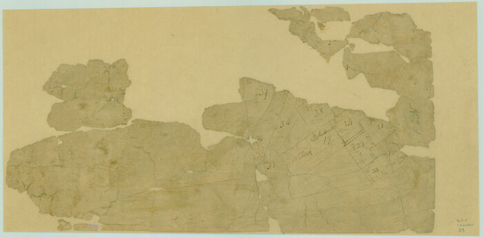
[Surveys along the San Antonio and Cibolo Rivers]
Print $20.00
- Digital $50.00
[Surveys along the San Antonio and Cibolo Rivers]
Size: 16.9 x 20.2 inches
69
Wilson County Working Sketch 1

Print $2.00
- Digital $50.00
Wilson County Working Sketch 1
Size: 7.1 x 13.1 inches
72581
Wilson County Rolled Sketch 4

Print $20.00
- Digital $50.00
Wilson County Rolled Sketch 4
Size: 27.1 x 29.6 inches
8370
Green Memorial Park

Print $20.00
- Digital $50.00
Green Memorial Park
Size: 41.4 x 20.9 inches
92937
Map of Wilson County

Print $20.00
- Digital $50.00
Map of Wilson County
1840
Size: 24.4 x 21.0 inches
4154
Wilson County Sketch File 12

Print $8.00
- Digital $50.00
Wilson County Sketch File 12
1841
Size: 14.1 x 8.6 inches
40425
[Surveys in the Bexar District along the Colorado River]
Print $2.00
- Digital $50.00
[Surveys in the Bexar District along the Colorado River]
1841
Size: 7.2 x 9.1 inches
38
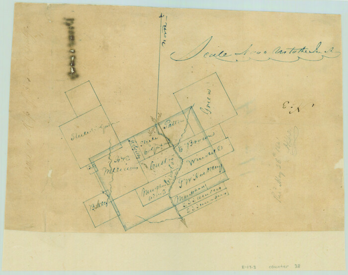
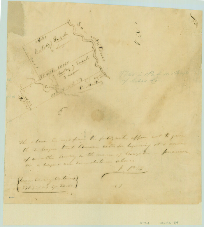
[Valdez and Martinez grants in the Goliad District]
Print $3.00
- Digital $50.00
[Valdez and Martinez grants in the Goliad District]
1842
Size: 10.6 x 9.5 inches
54
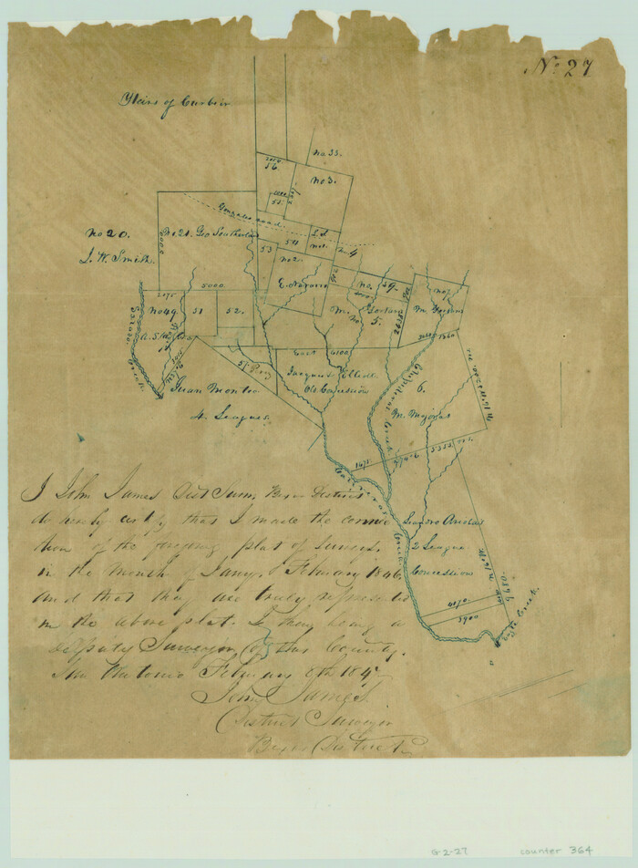
[Surveys near Calaveras Creek]
Print $2.00
- Digital $50.00
[Surveys near Calaveras Creek]
1846
Size: 10.9 x 8.0 inches
364
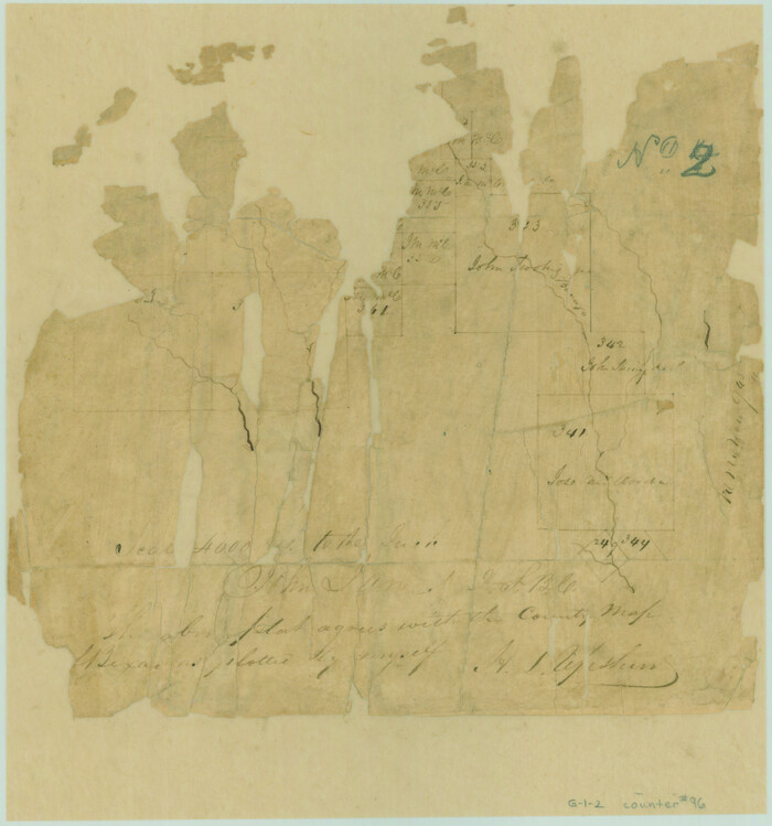
[Surveys in the Bexar District along Borrego Creek prepared by the Deputy Surveyor]
Print $2.00
- Digital $50.00
[Surveys in the Bexar District along Borrego Creek prepared by the Deputy Surveyor]
1847
Size: 7.7 x 7.2 inches
96
Harris County Sketch File 33a
Print $20.00
- Digital $50.00
Harris County Sketch File 33a
-
Size
34.1 x 30.0 inches
-
Map/Doc
10478
Atascosa County Sketch File 2a
Print $40.00
- Digital $50.00
Atascosa County Sketch File 2a
-
Size
25.1 x 15.3 inches
-
Map/Doc
10858
Guadalupe County Sketch File 7
Print $20.00
- Digital $50.00
Guadalupe County Sketch File 7
-
Size
15.6 x 19.5 inches
-
Map/Doc
11590
Gonzales County Sketch File 4
Print $4.00
- Digital $50.00
Gonzales County Sketch File 4
-
Size
12.6 x 8.0 inches
-
Map/Doc
24373
Guadalupe County Sketch File 3
Print $4.00
- Digital $50.00
Guadalupe County Sketch File 3
-
Size
8.0 x 12.6 inches
-
Map/Doc
24650
Guadalupe County Sketch File 7b
Print $4.00
- Digital $50.00
Guadalupe County Sketch File 7b
-
Size
7.3 x 10.9 inches
-
Map/Doc
24670
Guadalupe County Sketch File 7c
Print $22.00
- Digital $50.00
Guadalupe County Sketch File 7c
-
Size
12.7 x 15.5 inches
-
Map/Doc
24672
[Surveys on Cibolo Creek]
Print $2.00
- Digital $50.00
[Surveys on Cibolo Creek]
-
Size
7.4 x 6.7 inches
-
Map/Doc
363
Wilson County Sketch File 3b
Print $22.00
- Digital $50.00
Wilson County Sketch File 3b
-
Size
7.8 x 11.9 inches
-
Map/Doc
40402
Wilson County Sketch File 10
Print $4.00
- Digital $50.00
Wilson County Sketch File 10
-
Size
6.7 x 6.2 inches
-
Map/Doc
40417
Wilson County Sketch File 11
Print $27.00
- Digital $50.00
Wilson County Sketch File 11
-
Size
19.5 x 23.6 inches
-
Map/Doc
40419
[Surveys in Guadalupe and Wilson Counties]
Print $2.00
- Digital $50.00
[Surveys in Guadalupe and Wilson Counties]
-
Size
6.0 x 12.2 inches
-
Map/Doc
59
Wilson County Boundary File 1
Print $58.00
- Digital $50.00
Wilson County Boundary File 1
-
Size
9.6 x 4.5 inches
-
Map/Doc
60058
Wilson County Boundary File 2
Print $10.00
- Digital $50.00
Wilson County Boundary File 2
-
Size
12.3 x 8.3 inches
-
Map/Doc
60078
Wilson County Boundary File 3
Print $26.00
- Digital $50.00
Wilson County Boundary File 3
-
Size
14.3 x 8.7 inches
-
Map/Doc
60083
Wilson County Boundary File 4
Print $26.00
- Digital $50.00
Wilson County Boundary File 4
-
Size
8.9 x 7.8 inches
-
Map/Doc
60096
Wilson County Boundary File 5
Print $20.00
- Digital $50.00
Wilson County Boundary File 5
-
Size
14.4 x 8.7 inches
-
Map/Doc
60109
Wilson County Boundary File 5a
Print $20.00
- Digital $50.00
Wilson County Boundary File 5a
-
Size
12.0 x 28.0 inches
-
Map/Doc
60118
Wilson County Boundary File 9
Print $42.00
- Digital $50.00
Wilson County Boundary File 9
-
Size
14.3 x 8.9 inches
-
Map/Doc
60119
Map Showing Showing San Antonio & Aransas Pass Railway from San Antonio to Wilson County Line
Print $40.00
- Digital $50.00
Map Showing Showing San Antonio & Aransas Pass Railway from San Antonio to Wilson County Line
-
Size
25.8 x 101.6 inches
-
Map/Doc
64283
[Surveys along the San Antonio and Cibolo Rivers]
Print $20.00
- Digital $50.00
[Surveys along the San Antonio and Cibolo Rivers]
-
Size
16.9 x 20.2 inches
-
Map/Doc
69
Wilson County Working Sketch 1
Print $2.00
- Digital $50.00
Wilson County Working Sketch 1
-
Size
7.1 x 13.1 inches
-
Map/Doc
72581
Wilson County Rolled Sketch 4
Print $20.00
- Digital $50.00
Wilson County Rolled Sketch 4
-
Size
27.1 x 29.6 inches
-
Map/Doc
8370
Green Memorial Park
Print $20.00
- Digital $50.00
Green Memorial Park
-
Size
41.4 x 20.9 inches
-
Map/Doc
92937
Map of Wilson County
Print $20.00
- Digital $50.00
Map of Wilson County
1840
-
Size
24.4 x 21.0 inches
-
Map/Doc
4154
-
Creation Date
1840
Wilson County Sketch File 12
Print $8.00
- Digital $50.00
Wilson County Sketch File 12
1841
-
Size
14.1 x 8.6 inches
-
Map/Doc
40425
-
Creation Date
1841
[Surveys in the Bexar District along the Colorado River]
Print $2.00
- Digital $50.00
[Surveys in the Bexar District along the Colorado River]
1841
-
Size
7.2 x 9.1 inches
-
Map/Doc
38
-
Creation Date
1841
[Valdez and Martinez grants in the Goliad District]
Print $3.00
- Digital $50.00
[Valdez and Martinez grants in the Goliad District]
1842
-
Size
10.6 x 9.5 inches
-
Map/Doc
54
-
Creation Date
1842
[Surveys near Calaveras Creek]
Print $2.00
- Digital $50.00
[Surveys near Calaveras Creek]
1846
-
Size
10.9 x 8.0 inches
-
Map/Doc
364
-
Creation Date
1846
[Surveys in the Bexar District along Borrego Creek prepared by the Deputy Surveyor]
Print $2.00
- Digital $50.00
[Surveys in the Bexar District along Borrego Creek prepared by the Deputy Surveyor]
1847
-
Size
7.7 x 7.2 inches
-
Map/Doc
96
-
Creation Date
1847