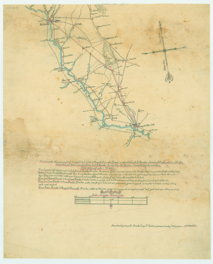
Best Route for Movements of Troops from Laredo to Ringold [sic] Barracks, Texas
Print $20.00
Best Route for Movements of Troops from Laredo to Ringold [sic] Barracks, Texas
1865
Size: 18.9 x 15.3 inches
79299
General Highway Map, Zapata County, Texas

Print $20.00
General Highway Map, Zapata County, Texas
1940
Size: 18.4 x 24.8 inches
79287
General Highway Map, Zapata County, Texas

Print $20.00
General Highway Map, Zapata County, Texas
1940
Size: 18.3 x 24.9 inches
79288
General Highway Map, Zapata County, Texas

Print $20.00
General Highway Map, Zapata County, Texas
1961
Size: 18.2 x 24.8 inches
79721
General Highway Map, Zapata County, Texas

Print $20.00
General Highway Map, Zapata County, Texas
1961
Size: 18.0 x 24.7 inches
79722
Jim Hogg County Rolled Sketch 3

Print $20.00
- Digital $50.00
Jim Hogg County Rolled Sketch 3
1912
Size: 28.2 x 20.2 inches
6439
Jim Hogg County Rolled Sketch 4

Print $20.00
- Digital $50.00
Jim Hogg County Rolled Sketch 4
Size: 17.0 x 30.5 inches
6440
Land grants from the state of Tamaulipas in the trans-Nueces

Land grants from the state of Tamaulipas in the trans-Nueces
2009
Size: 11.0 x 8.5 inches
94040
Map of San Patricio District

Print $40.00
- Digital $50.00
Map of San Patricio District
1870
Size: 43.8 x 51.4 inches
1987
Map of Zapata County

Print $40.00
- Digital $50.00
Map of Zapata County
1901
Size: 55.1 x 47.7 inches
16937
Map of Zapata County

Print $20.00
- Digital $50.00
Map of Zapata County
1863
Size: 35.0 x 28.0 inches
4175
Map of Zapata County

Print $20.00
- Digital $50.00
Map of Zapata County
1879
Size: 27.4 x 25.6 inches
4176
Map of Zapata County

Print $20.00
- Digital $50.00
Map of Zapata County
1880
Size: 27.1 x 25.7 inches
4177
Map of Zapata County

Print $40.00
- Digital $50.00
Map of Zapata County
1901
Size: 49.1 x 42.4 inches
63144
Map of the Rio Grande Frontier, Texas, East of Fort McIntosh and South of the Mex. National RR.

Print $20.00
- Digital $50.00
Map of the Rio Grande Frontier, Texas, East of Fort McIntosh and South of the Mex. National RR.
1892
Size: 26.1 x 39.8 inches
4660
Oil Development and Structural Map showing Schott, Mirando and other oil fields of the Laredo District with present and proposed development.

Print $20.00
- Digital $50.00
Oil Development and Structural Map showing Schott, Mirando and other oil fields of the Laredo District with present and proposed development.
1920
Size: 11.3 x 8.9 inches
94107
Plat showing proposed counties to be taken from Zapata, Starr & Hidalgo Counties

Print $20.00
- Digital $50.00
Plat showing proposed counties to be taken from Zapata, Starr & Hidalgo Counties
1911
Size: 24.8 x 27.0 inches
2478
Plat showing proposed counties to be taken from Zapata, Starr & Hidalgo Counties

Print $20.00
- Digital $50.00
Plat showing proposed counties to be taken from Zapata, Starr & Hidalgo Counties
1911
Size: 24.8 x 27.8 inches
2660
Soil Map - Reconnoissance Survey - South Texas Sheet

Print $20.00
- Digital $50.00
Soil Map - Reconnoissance Survey - South Texas Sheet
1909
Size: 28.6 x 37.8 inches
97267
Starr County Rolled Sketch 2

Print $40.00
- Digital $50.00
Starr County Rolled Sketch 2
1853
Size: 31.7 x 48.5 inches
9938
Starr County Sketch File 14

Print $40.00
- Digital $50.00
Starr County Sketch File 14
Size: 23.8 x 46.0 inches
4626
Starr County Sketch File 17

Print $24.00
- Digital $50.00
Starr County Sketch File 17
1880
Size: 12.8 x 8.2 inches
36874
Starr County Sketch File 18

Print $20.00
- Digital $50.00
Starr County Sketch File 18
1880
Size: 38.2 x 25.1 inches
10606
Starr County Sketch File 5

Print $40.00
- Digital $50.00
Starr County Sketch File 5
Size: 31.4 x 40.7 inches
82571
Starr County Sketch File 52

Print $4.00
- Digital $50.00
Starr County Sketch File 52
Size: 13.9 x 9.0 inches
37011
Starr County Sketch File 6

Print $20.00
- Digital $50.00
Starr County Sketch File 6
Size: 43.4 x 36.7 inches
10605
Webb County Sketch File 16

Print $20.00
- Digital $50.00
Webb County Sketch File 16
Size: 37.1 x 24.5 inches
12635
Webb County Sketch File 3a

Print $40.00
- Digital $50.00
Webb County Sketch File 3a
1855
Size: 32.1 x 20.8 inches
12613
Webb County Working Sketch 11

Print $20.00
- Digital $50.00
Webb County Working Sketch 11
1921
Size: 17.8 x 16.3 inches
72376
Best Route for Movements of Troops from Laredo to Ringold [sic] Barracks, Texas
Print $20.00
Best Route for Movements of Troops from Laredo to Ringold [sic] Barracks, Texas
1865
-
Size
18.9 x 15.3 inches
-
Map/Doc
79299
-
Creation Date
1865
General Highway Map, Zapata County, Texas
Print $20.00
General Highway Map, Zapata County, Texas
1940
-
Size
18.4 x 24.8 inches
-
Map/Doc
79287
-
Creation Date
1940
General Highway Map, Zapata County, Texas
Print $20.00
General Highway Map, Zapata County, Texas
1940
-
Size
18.3 x 24.9 inches
-
Map/Doc
79288
-
Creation Date
1940
General Highway Map, Zapata County, Texas
Print $20.00
General Highway Map, Zapata County, Texas
1961
-
Size
18.2 x 24.8 inches
-
Map/Doc
79721
-
Creation Date
1961
General Highway Map, Zapata County, Texas
Print $20.00
General Highway Map, Zapata County, Texas
1961
-
Size
18.0 x 24.7 inches
-
Map/Doc
79722
-
Creation Date
1961
Jim Hogg County Rolled Sketch 3
Print $20.00
- Digital $50.00
Jim Hogg County Rolled Sketch 3
1912
-
Size
28.2 x 20.2 inches
-
Map/Doc
6439
-
Creation Date
1912
Jim Hogg County Rolled Sketch 4
Print $20.00
- Digital $50.00
Jim Hogg County Rolled Sketch 4
-
Size
17.0 x 30.5 inches
-
Map/Doc
6440
Land grants from the state of Tamaulipas in the trans-Nueces
Land grants from the state of Tamaulipas in the trans-Nueces
2009
-
Size
11.0 x 8.5 inches
-
Map/Doc
94040
-
Creation Date
2009
Map of San Patricio District
Print $40.00
- Digital $50.00
Map of San Patricio District
1870
-
Size
43.8 x 51.4 inches
-
Map/Doc
1987
-
Creation Date
1870
Map of Zapata County
Print $40.00
- Digital $50.00
Map of Zapata County
1901
-
Size
55.1 x 47.7 inches
-
Map/Doc
16937
-
Creation Date
1901
Map of Zapata County
Print $20.00
- Digital $50.00
Map of Zapata County
1863
-
Size
35.0 x 28.0 inches
-
Map/Doc
4175
-
Creation Date
1863
Map of Zapata County
Print $20.00
- Digital $50.00
Map of Zapata County
1879
-
Size
27.4 x 25.6 inches
-
Map/Doc
4176
-
Creation Date
1879
Map of Zapata County
Print $20.00
- Digital $50.00
Map of Zapata County
1880
-
Size
27.1 x 25.7 inches
-
Map/Doc
4177
-
Creation Date
1880
Map of Zapata County
Print $40.00
- Digital $50.00
Map of Zapata County
1901
-
Size
49.1 x 42.4 inches
-
Map/Doc
63144
-
Creation Date
1901
Map of the Rio Grande Frontier, Texas, East of Fort McIntosh and South of the Mex. National RR.
Print $20.00
- Digital $50.00
Map of the Rio Grande Frontier, Texas, East of Fort McIntosh and South of the Mex. National RR.
1892
-
Size
26.1 x 39.8 inches
-
Map/Doc
4660
-
Creation Date
1892
Oil Development and Structural Map showing Schott, Mirando and other oil fields of the Laredo District with present and proposed development.
Print $20.00
- Digital $50.00
Oil Development and Structural Map showing Schott, Mirando and other oil fields of the Laredo District with present and proposed development.
1920
-
Size
11.3 x 8.9 inches
-
Map/Doc
94107
-
Creation Date
1920
Plat showing proposed counties to be taken from Zapata, Starr & Hidalgo Counties
Print $20.00
- Digital $50.00
Plat showing proposed counties to be taken from Zapata, Starr & Hidalgo Counties
1911
-
Size
24.8 x 27.0 inches
-
Map/Doc
2478
-
Creation Date
1911
Plat showing proposed counties to be taken from Zapata, Starr & Hidalgo Counties
Print $20.00
- Digital $50.00
Plat showing proposed counties to be taken from Zapata, Starr & Hidalgo Counties
1911
-
Size
24.8 x 27.8 inches
-
Map/Doc
2660
-
Creation Date
1911
Soil Map - Reconnoissance Survey - South Texas Sheet
Print $20.00
- Digital $50.00
Soil Map - Reconnoissance Survey - South Texas Sheet
1909
-
Size
28.6 x 37.8 inches
-
Map/Doc
97267
-
Creation Date
1909
Starr County Rolled Sketch 2
Print $40.00
- Digital $50.00
Starr County Rolled Sketch 2
1853
-
Size
31.7 x 48.5 inches
-
Map/Doc
9938
-
Creation Date
1853
Starr County Sketch File 14
Print $40.00
- Digital $50.00
Starr County Sketch File 14
-
Size
23.8 x 46.0 inches
-
Map/Doc
4626
Starr County Sketch File 17
Print $24.00
- Digital $50.00
Starr County Sketch File 17
1880
-
Size
12.8 x 8.2 inches
-
Map/Doc
36874
-
Creation Date
1880
Starr County Sketch File 18
Print $20.00
- Digital $50.00
Starr County Sketch File 18
1880
-
Size
38.2 x 25.1 inches
-
Map/Doc
10606
-
Creation Date
1880
Starr County Sketch File 5
Print $40.00
- Digital $50.00
Starr County Sketch File 5
-
Size
31.4 x 40.7 inches
-
Map/Doc
82571
Starr County Sketch File 52
Print $4.00
- Digital $50.00
Starr County Sketch File 52
-
Size
13.9 x 9.0 inches
-
Map/Doc
37011
Starr County Sketch File 6
Print $20.00
- Digital $50.00
Starr County Sketch File 6
-
Size
43.4 x 36.7 inches
-
Map/Doc
10605
Webb County Sketch File 16
Print $20.00
- Digital $50.00
Webb County Sketch File 16
-
Size
37.1 x 24.5 inches
-
Map/Doc
12635
Webb County Sketch File 3a
Print $40.00
- Digital $50.00
Webb County Sketch File 3a
1855
-
Size
32.1 x 20.8 inches
-
Map/Doc
12613
-
Creation Date
1855
Webb County Working Sketch 11
Print $20.00
- Digital $50.00
Webb County Working Sketch 11
1921
-
Size
17.8 x 16.3 inches
-
Map/Doc
72376
-
Creation Date
1921
Zapata County

Print $40.00
- Digital $50.00
Zapata County
1901
-
Size
53.1 x 38.0 inches
-
Map/Doc
63143
-
Creation Date
1901