de Leon Empresario Colony. April 30, 1829

Print $20.00
de Leon Empresario Colony. April 30, 1829
2020
Size: 18.5 x 21.7 inches
95990
de Leon Empresario Colony. April 15, 1824

Print $20.00
de Leon Empresario Colony. April 15, 1824
2020
Size: 18.5 x 21.7 inches
95988
de Leon Empresario Colony. Absorbed by DeWitt Colony. April 15, 1825

Print $20.00
de Leon Empresario Colony. Absorbed by DeWitt Colony. April 15, 1825
2020
Size: 18.5 x 21.7 inches
95989
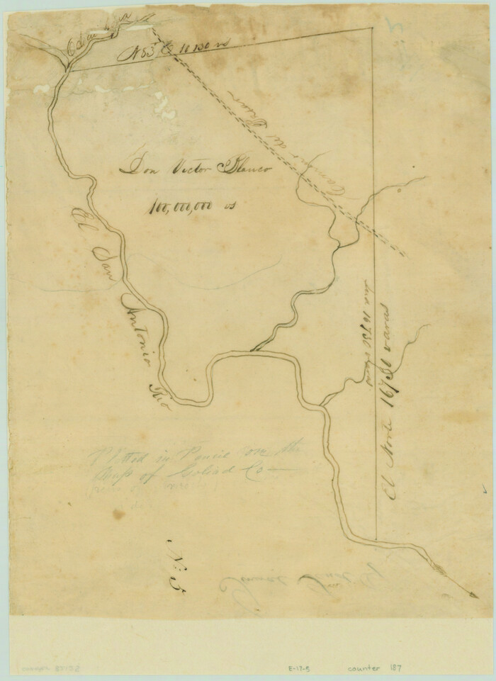
[Victor Blanco's survey along the San Antonio River]
Print $2.00
- Digital $50.00
[Victor Blanco's survey along the San Antonio River]
Size: 11.2 x 8.2 inches
187
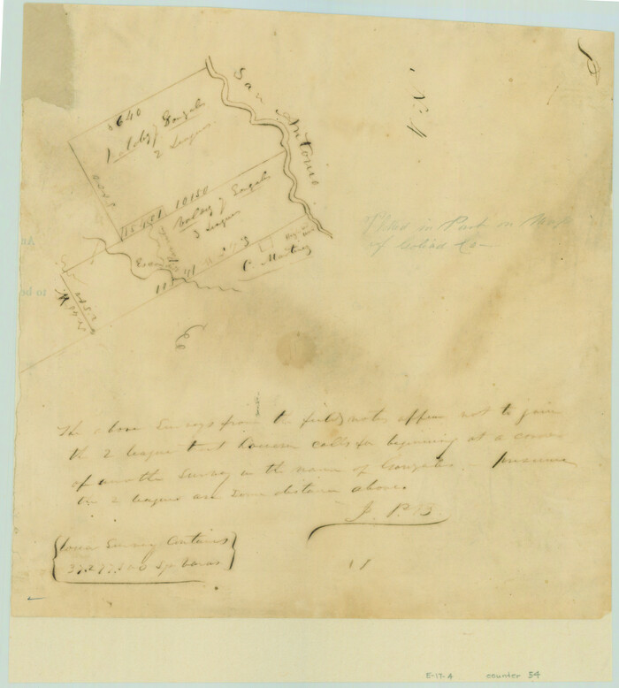
[Valdez and Martinez grants in the Goliad District]
Print $3.00
- Digital $50.00
[Valdez and Martinez grants in the Goliad District]
1842
Size: 10.6 x 9.5 inches
54
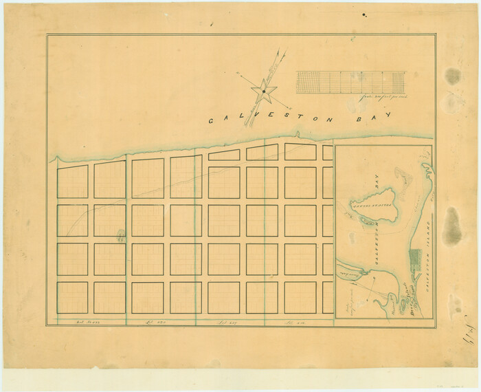
[Town lots on Galveston Island]
Print $20.00
- Digital $50.00
[Town lots on Galveston Island]
1839
Size: 18.8 x 23.0 inches
11
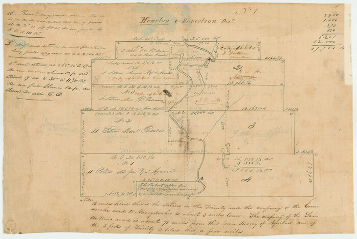
[Titles along the Trinity River]
Print $3.00
- Digital $50.00
[Titles along the Trinity River]
Size: 10.6 x 15.8 inches
175
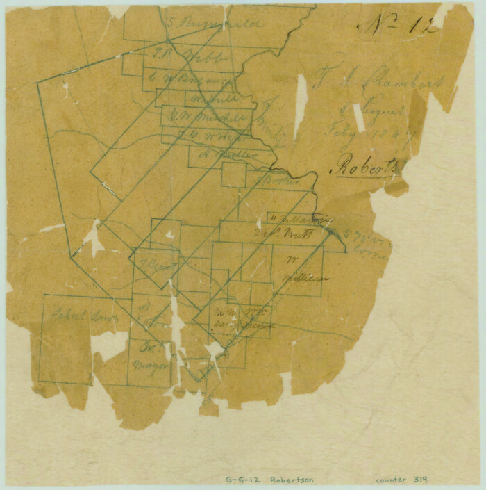
[T. J. Chambers' grant]
Print $2.00
- Digital $50.00
[T. J. Chambers' grant]
1847
Size: 7.1 x 7.1 inches
319
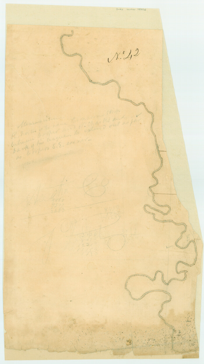
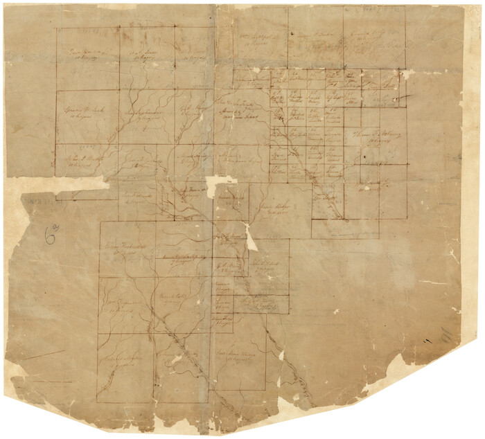
[Surveys possibly in Austin County]
Print $3.00
- Digital $50.00
[Surveys possibly in Austin County]
Size: 17.0 x 9.6 inches
78356
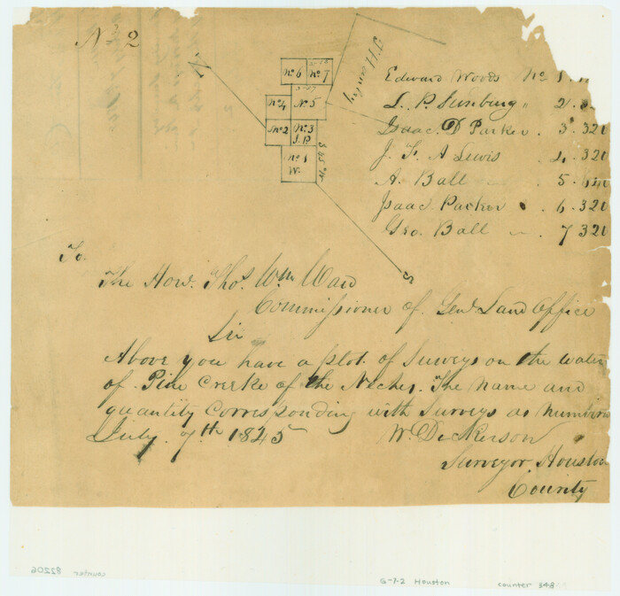
[Surveys on the waters of Pine Creeke of the Neches]
Print $2.00
- Digital $50.00
[Surveys on the waters of Pine Creeke of the Neches]
1845
Size: 7.9 x 8.2 inches
348
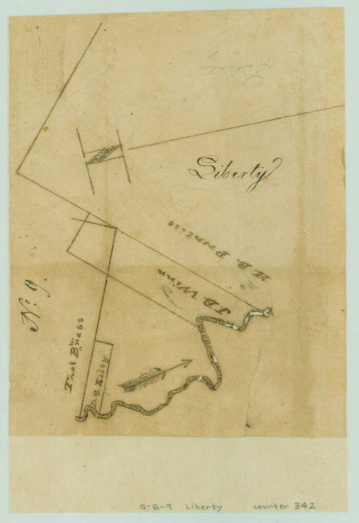
[Surveys on the Trinity River]
Print $2.00
- Digital $50.00
[Surveys on the Trinity River]
Size: 6.6 x 4.6 inches
342
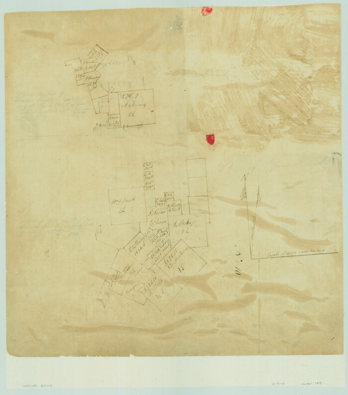
[Surveys on the San Marcos River]
Print $20.00
- Digital $50.00
[Surveys on the San Marcos River]
Size: 14.1 x 12.4 inches
149
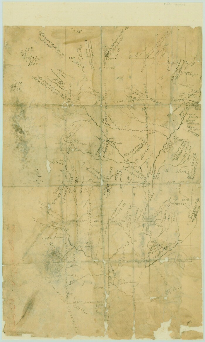
[Surveys on the Sabine River, Sulphur Fork of the Red River, and the Bois d'Arc River for Johnson, Williams, and Peebles' contract and G. W. Smyth, commissioner]
Print $20.00
- Digital $50.00
[Surveys on the Sabine River, Sulphur Fork of the Red River, and the Bois d'Arc River for Johnson, Williams, and Peebles' contract and G. W. Smyth, commissioner]
1835
Size: 23.6 x 25.9 inches
44
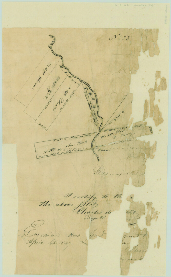
[Surveys on the Rio Frio]
Print $2.00
- Digital $50.00
[Surveys on the Rio Frio]
1847
Size: 11.8 x 7.3 inches
267
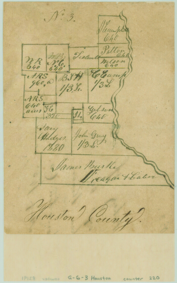
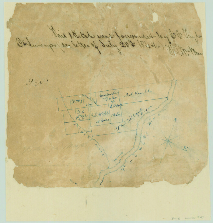
[Surveys on the Neches River]
Print $2.00
- Digital $50.00
[Surveys on the Neches River]
1845
Size: 6.0 x 3.8 inches
220
[Surveys on Trespalacios Bay]
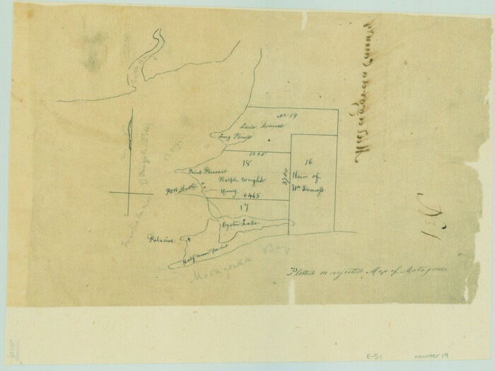
Print $2.00
- Digital $50.00
[Surveys on Trespalacios Bay]
Size: 7.2 x 9.6 inches
19
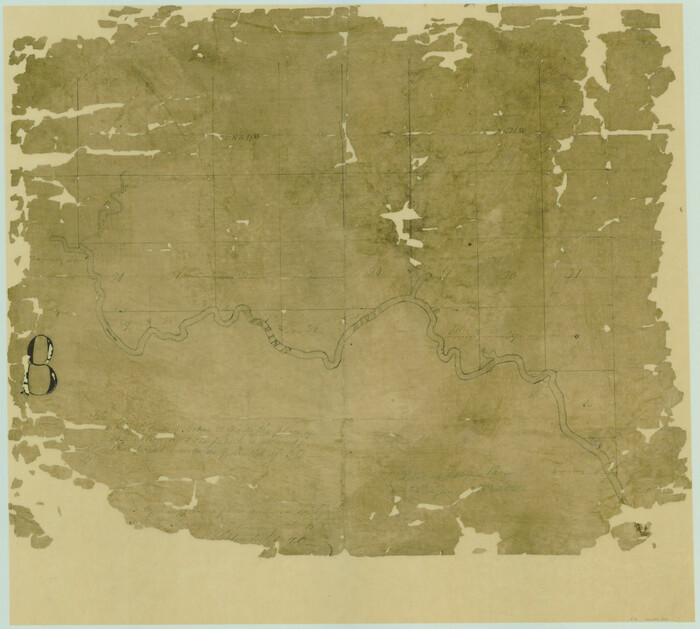
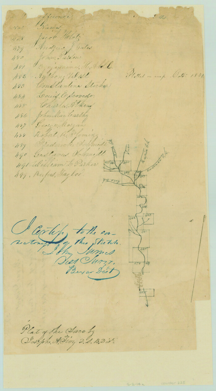
[Surveys on San Antonio River and Aransas Bay area]
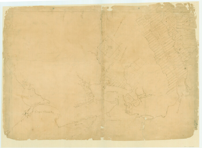
Print $20.00
- Digital $50.00
[Surveys on San Antonio River and Aransas Bay area]
1840
Size: 24.1 x 33.0 inches
141
[Surveys on Galveston and East Bay]
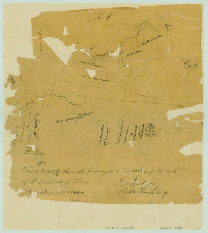
Print $2.00
- Digital $50.00
[Surveys on Galveston and East Bay]
1846
Size: 8.8 x 7.9 inches
248
[Surveys on Cibolo Creek]
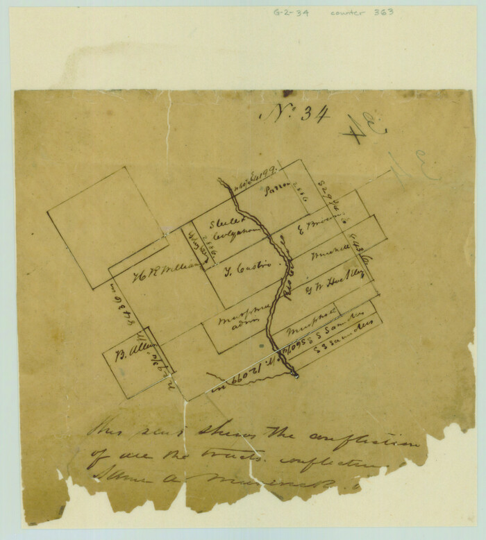
Print $2.00
- Digital $50.00
[Surveys on Cibolo Creek]
Size: 7.4 x 6.7 inches
363
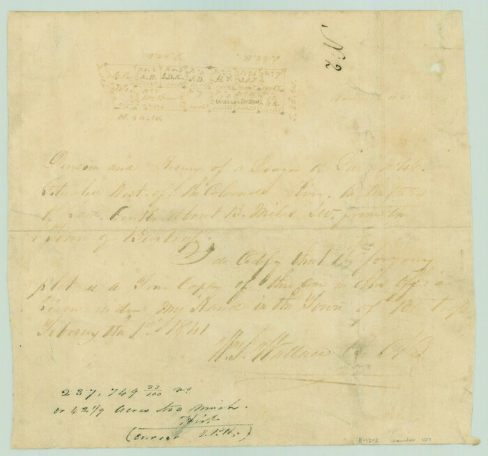
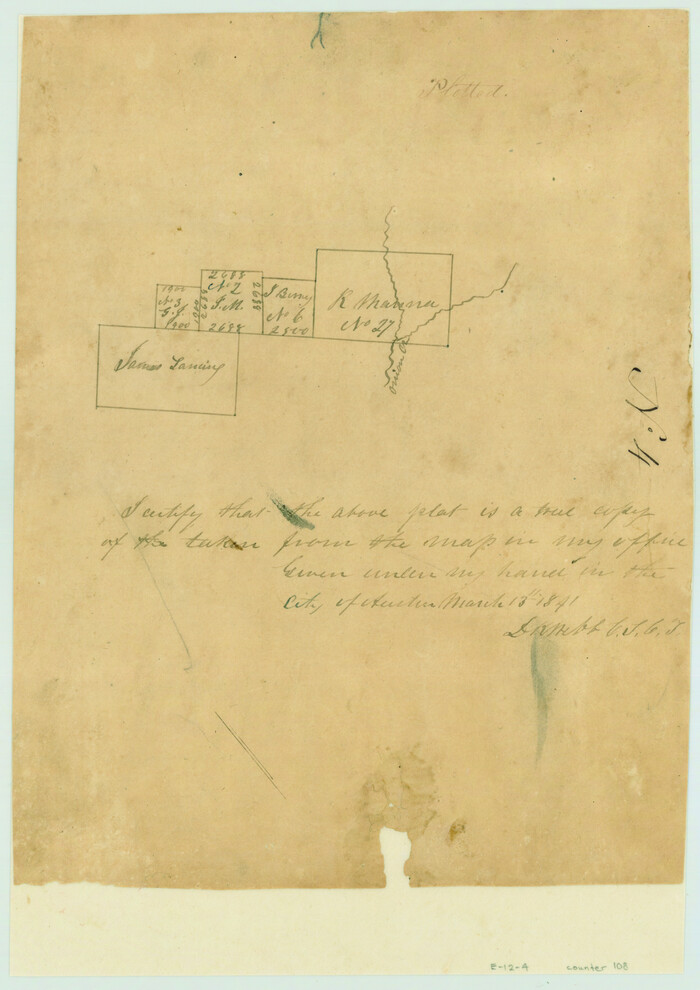
[Surveys near the city of Bastrop]
Print $2.00
- Digital $50.00
[Surveys near the city of Bastrop]
1841
Size: 6.5 x 7.0 inches
107
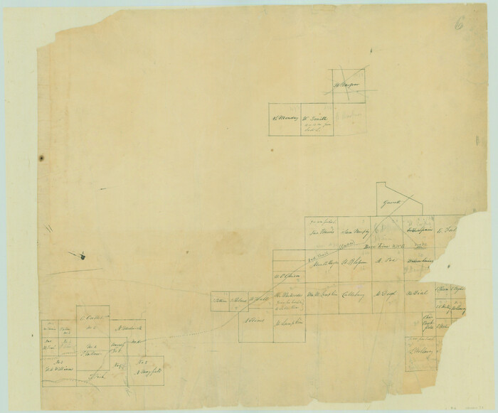
[Surveys near the Sabine River]
Print $20.00
- Digital $50.00
[Surveys near the Sabine River]
1840
Size: 18.8 x 20.9 inches
302
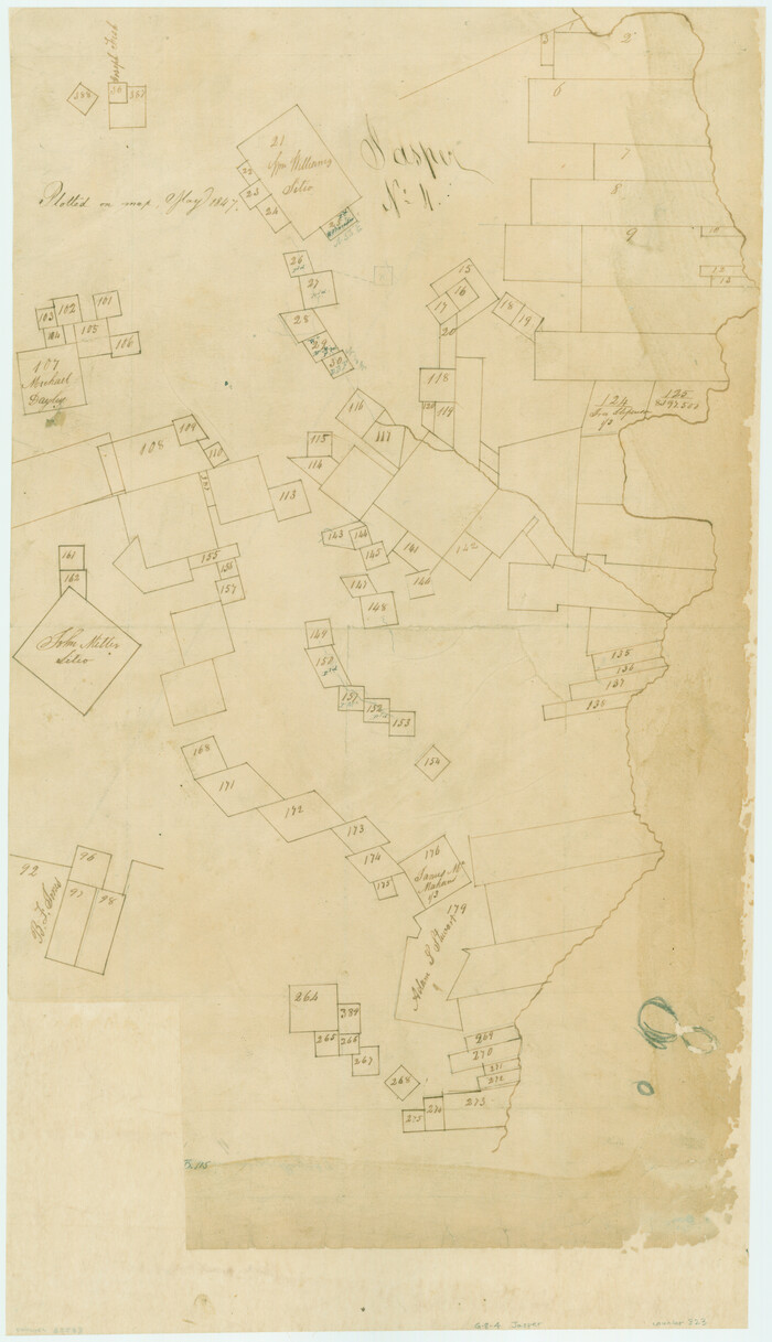
[Surveys near the Sabine River in the Jasper District]
Print $20.00
- Digital $50.00
[Surveys near the Sabine River in the Jasper District]
1847
Size: 18.1 x 10.4 inches
323
[Surveys near the Neches River]
Print $3.00
- Digital $50.00
[Surveys near the Neches River]
Size: 17.2 x 10.3 inches
8
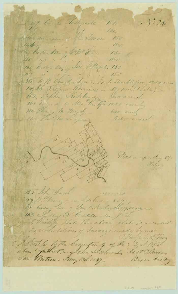
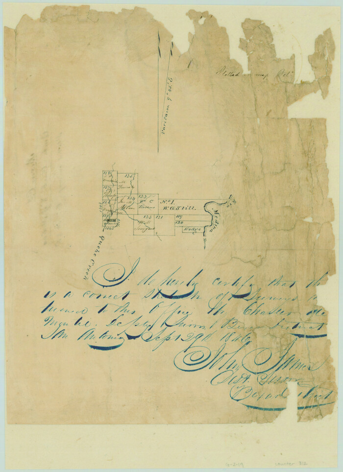
[Surveys near the Medina River, Bexar District]
Print $2.00
- Digital $50.00
[Surveys near the Medina River, Bexar District]
1847
Size: 13.1 x 8.0 inches
230
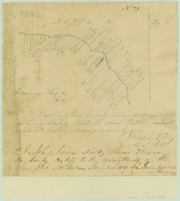
[Surveys near the Guadalupe River]
Print $2.00
- Digital $50.00
[Surveys near the Guadalupe River]
1847
Size: 8.8 x 7.9 inches
288
[Surveys near Seco Creek]
Print $2.00
- Digital $50.00
[Surveys near Seco Creek]
1846
Size: 13.1 x 7.3 inches
225
[Surveys near Quihi Creek]
Print $2.00
- Digital $50.00
[Surveys near Quihi Creek]
1846
Size: 11.0 x 8.0 inches
312
[Surveys near Onion Creek]
Print $2.00
- Digital $50.00
[Surveys near Onion Creek]
1841
Size: 11.0 x 7.8 inches
108
[Surveys near Lake Soda made under G.W. Smyth, Commissioner]
Print $20.00
- Digital $50.00
[Surveys near Lake Soda made under G.W. Smyth, Commissioner]
1835
Size: 16.0 x 19.3 inches
73
[Surveys near Keechi Creek and the Trinity River]
Print $2.00
- Digital $50.00
[Surveys near Keechi Creek and the Trinity River]
1841
Size: 8.6 x 8.2 inches
47
de Leon Empresario Colony. April 30, 1829
Print $20.00
de Leon Empresario Colony. April 30, 1829
2020
-
Size
18.5 x 21.7 inches
-
Map/Doc
95990
-
Creation Date
2020
de Leon Empresario Colony. April 15, 1824
Print $20.00
de Leon Empresario Colony. April 15, 1824
2020
-
Size
18.5 x 21.7 inches
-
Map/Doc
95988
-
Creation Date
2020
de Leon Empresario Colony. Absorbed by DeWitt Colony. April 15, 1825
Print $20.00
de Leon Empresario Colony. Absorbed by DeWitt Colony. April 15, 1825
2020
-
Size
18.5 x 21.7 inches
-
Map/Doc
95989
-
Creation Date
2020
[Victor Blanco's survey along the San Antonio River]
Print $2.00
- Digital $50.00
[Victor Blanco's survey along the San Antonio River]
-
Size
11.2 x 8.2 inches
-
Map/Doc
187
[Valdez and Martinez grants in the Goliad District]
Print $3.00
- Digital $50.00
[Valdez and Martinez grants in the Goliad District]
1842
-
Size
10.6 x 9.5 inches
-
Map/Doc
54
-
Creation Date
1842
[Town lots on Galveston Island]
Print $20.00
- Digital $50.00
[Town lots on Galveston Island]
1839
-
Size
18.8 x 23.0 inches
-
Map/Doc
11
-
Creation Date
1839
[Titles along the Trinity River]
Print $3.00
- Digital $50.00
[Titles along the Trinity River]
-
Size
10.6 x 15.8 inches
-
Map/Doc
175
[T. J. Chambers' grant]
Print $2.00
- Digital $50.00
[T. J. Chambers' grant]
1847
-
Size
7.1 x 7.1 inches
-
Map/Doc
319
-
Creation Date
1847
[Surveys possibly in Austin County]
Print $3.00
- Digital $50.00
[Surveys possibly in Austin County]
-
Size
17.0 x 9.6 inches
-
Map/Doc
78356
[Surveys on the waters of Pine Creeke of the Neches]
Print $2.00
- Digital $50.00
[Surveys on the waters of Pine Creeke of the Neches]
1845
-
Size
7.9 x 8.2 inches
-
Map/Doc
348
-
Creation Date
1845
[Surveys on the Trinity River]
Print $2.00
- Digital $50.00
[Surveys on the Trinity River]
-
Size
6.6 x 4.6 inches
-
Map/Doc
342
[Surveys on the San Marcos River]
Print $20.00
- Digital $50.00
[Surveys on the San Marcos River]
-
Size
14.1 x 12.4 inches
-
Map/Doc
149
[Surveys on the Sabine River, Sulphur Fork of the Red River, and the Bois d'Arc River for Johnson, Williams, and Peebles' contract and G. W. Smyth, commissioner]
Print $20.00
- Digital $50.00
[Surveys on the Sabine River, Sulphur Fork of the Red River, and the Bois d'Arc River for Johnson, Williams, and Peebles' contract and G. W. Smyth, commissioner]
1835
-
Size
23.6 x 25.9 inches
-
Map/Doc
44
-
Creation Date
1835
[Surveys on the Rio Frio]
Print $2.00
- Digital $50.00
[Surveys on the Rio Frio]
1847
-
Size
11.8 x 7.3 inches
-
Map/Doc
267
-
Creation Date
1847
[Surveys on the Neches River]
Print $2.00
- Digital $50.00
[Surveys on the Neches River]
1845
-
Size
6.0 x 3.8 inches
-
Map/Doc
220
-
Creation Date
1845
[Surveys on Trespalacios Bay]
Print $2.00
- Digital $50.00
[Surveys on Trespalacios Bay]
-
Size
7.2 x 9.6 inches
-
Map/Doc
19
[Surveys on San Antonio River and Aransas Bay area]
Print $20.00
- Digital $50.00
[Surveys on San Antonio River and Aransas Bay area]
1840
-
Size
24.1 x 33.0 inches
-
Map/Doc
141
-
Creation Date
1840
[Surveys on Galveston and East Bay]
Print $2.00
- Digital $50.00
[Surveys on Galveston and East Bay]
1846
-
Size
8.8 x 7.9 inches
-
Map/Doc
248
-
Creation Date
1846
[Surveys on Cibolo Creek]
Print $2.00
- Digital $50.00
[Surveys on Cibolo Creek]
-
Size
7.4 x 6.7 inches
-
Map/Doc
363
[Surveys near the city of Bastrop]
Print $2.00
- Digital $50.00
[Surveys near the city of Bastrop]
1841
-
Size
6.5 x 7.0 inches
-
Map/Doc
107
-
Creation Date
1841
[Surveys near the Sabine River]
Print $20.00
- Digital $50.00
[Surveys near the Sabine River]
1840
-
Size
18.8 x 20.9 inches
-
Map/Doc
302
-
Creation Date
1840
[Surveys near the Sabine River in the Jasper District]
Print $20.00
- Digital $50.00
[Surveys near the Sabine River in the Jasper District]
1847
-
Size
18.1 x 10.4 inches
-
Map/Doc
323
-
Creation Date
1847
[Surveys near the Neches River]
Print $3.00
- Digital $50.00
[Surveys near the Neches River]
-
Size
17.2 x 10.3 inches
-
Map/Doc
8
[Surveys near the Medina River, Bexar District]
Print $2.00
- Digital $50.00
[Surveys near the Medina River, Bexar District]
1847
-
Size
13.1 x 8.0 inches
-
Map/Doc
230
-
Creation Date
1847
[Surveys near the Guadalupe River]
Print $2.00
- Digital $50.00
[Surveys near the Guadalupe River]
1847
-
Size
8.8 x 7.9 inches
-
Map/Doc
288
-
Creation Date
1847
[Surveys near Seco Creek]
Print $2.00
- Digital $50.00
[Surveys near Seco Creek]
1846
-
Size
13.1 x 7.3 inches
-
Map/Doc
225
-
Creation Date
1846
[Surveys near Quihi Creek]
Print $2.00
- Digital $50.00
[Surveys near Quihi Creek]
1846
-
Size
11.0 x 8.0 inches
-
Map/Doc
312
-
Creation Date
1846
[Surveys near Onion Creek]
Print $2.00
- Digital $50.00
[Surveys near Onion Creek]
1841
-
Size
11.0 x 7.8 inches
-
Map/Doc
108
-
Creation Date
1841
[Surveys near Lake Soda made under G.W. Smyth, Commissioner]
Print $20.00
- Digital $50.00
[Surveys near Lake Soda made under G.W. Smyth, Commissioner]
1835
-
Size
16.0 x 19.3 inches
-
Map/Doc
73
-
Creation Date
1835
[Surveys near Keechi Creek and the Trinity River]
Print $2.00
- Digital $50.00
[Surveys near Keechi Creek and the Trinity River]
1841
-
Size
8.6 x 8.2 inches
-
Map/Doc
47
-
Creation Date
1841